

Map Nova Scotium(31)
24"x36" Gallery Poster, Nova et exacta Americae map of south america 1602 $52.95

24"x36" Gallery Poster, Nova et exacta Americae map of south america 1602
Oak Island Treasure Map c1974 18x24 Vintage Mystery Chart Historic Nova Scotia Island Illustration Pirate Lore Exploration Collector Gift Framed Display Study Library $74.99

Oak Island Treasure Map c1974 18x24 Vintage Mystery Chart Historic Nova Scotia Island Illustration Pirate Lore Exploration Collector Gift Framed Display Study Library
New, Nova Scotia Map Wall Art Print, Travel Decor
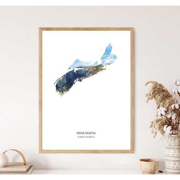
Nova Scotia Map Wall Art Print, Travel Decor
Oak Island Treasure Map c1974 11x14 Vintage Mystery Chart Historic Nova Scotia Island Illustration Pirate Lore Exploration Collector Gift Unframed Wall Decor History Buff Home Office Study $9.99

Oak Island Treasure Map c1974 11x14 Vintage Mystery Chart Historic Nova Scotia Island Illustration Pirate Lore Exploration Collector Gift Unframed Wall Decor History Buff Home Office Study
Mackinlay, A. and W. 14x12 White Modern Wood Framed Museum Art Print Titled - Mackinlays map of the Province of Nova Scotia, including the island of Cape Breton, 1862 From $29.99

Mackinlay, A. and W. 14x12 White Modern Wood Framed Museum Art Print Titled - Mackinlays map of the Province of Nova Scotia, including the island of Cape Breton, 1862
24"x36" Gallery Poster, map of Nova Scotia, and Cape Breton Island 1775 $52.95

24"x36" Gallery Poster, map of Nova Scotia, and Cape Breton Island 1775
24"x36" Gallery Poster, map of western Nova Scotia to Cape Cod 1607 p2 $52.95

24"x36" Gallery Poster, map of western Nova Scotia to Cape Cod 1607 p2
Nova Scotia Wall Art Print, Province Map Travel Decor From $18.99

Nova Scotia Wall Art Print, Province Map Travel Decor
Nova Scotia Poster, Boho Travel, Province Map Silhouette, Travel Inspired Home And Office Decor From $21.99

Nova Scotia Poster, Boho Travel, Province Map Silhouette, Travel Inspired Home And Office Decor
24"x36" Gallery Poster, map of Nova Scotia Cape Breton Island Canada 1775 $52.95

24"x36" Gallery Poster, map of Nova Scotia Cape Breton Island Canada 1775
Oak Island Treasure Map c1974 16x20 Vintage Mystery Chart Historic Nova Scotia Island Illustration Pirate Lore Exploration Collector Gift Framed Display Study Library $55.99

Oak Island Treasure Map c1974 16x20 Vintage Mystery Chart Historic Nova Scotia Island Illustration Pirate Lore Exploration Collector Gift Framed Display Study Library
Oak Island Treasure Map c1974 11x14 Vintage Mystery Chart Historic Nova Scotia Island Illustration Pirate Lore Exploration Collector Gift Framed Display Study Library $35.99

Oak Island Treasure Map c1974 11x14 Vintage Mystery Chart Historic Nova Scotia Island Illustration Pirate Lore Exploration Collector Gift Framed Display Study Library
Oak Island Treasure Map c1974 16x20 Vintage Mystery Chart Historic Nova Scotia Island Illustration Pirate Lore Exploration Collector Gift Unframed Wall Decor History Buff Home Office Study $29.99

Oak Island Treasure Map c1974 16x20 Vintage Mystery Chart Historic Nova Scotia Island Illustration Pirate Lore Exploration Collector Gift Unframed Wall Decor History Buff Home Office Study
Historic Map - New Brunswick Nova Scotia Canada - Cram 1888 - Vintage Wall Art From $36.95

Historic Map - New Brunswick Nova Scotia Canada - Cram 1888 - Vintage Wall Art
Historic Map - Cape Breton Nova Scotia - Mackinlay 1865 - Vintage Wall Art From $36.95

Historic Map - Cape Breton Nova Scotia - Mackinlay 1865 - Vintage Wall Art
Historic Map - Nova Scotia Acadia Canada - Jeffreys 1713 - Vintage Wall Art From $36.95
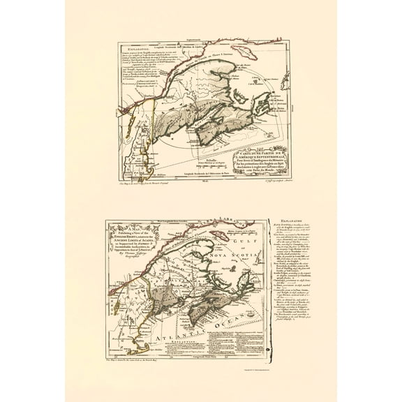
Historic Map - Nova Scotia Acadia Canada - Jeffreys 1713 - Vintage Wall Art
24"x36" Gallery Poster, 1853 Andrews Map of the Maritime Provinces, New Brunswick, Nova Scotia, Newfoundland $52.95

24"x36" Gallery Poster, 1853 Andrews Map of the Maritime Provinces, New Brunswick, Nova Scotia, Newfoundland
Nova Scotia Poster, Boho Travel, Province Of Map Silhouette, Travel Inspired Home And Office Decor

Nova Scotia Poster, Boho Travel, Province Of Map Silhouette, Travel Inspired Home And Office Decor
Oak Island Treasure Map c1974 16x20 Vintage Mystery Chart Historic Nova Scotia Island Illustration Pirate Lore Exploration Collector Gift Stretched Canvas Display Office Library $39.99

Oak Island Treasure Map c1974 16x20 Vintage Mystery Chart Historic Nova Scotia Island Illustration Pirate Lore Exploration Collector Gift Stretched Canvas Display Office Library
24"x36" Gallery Poster, 1855 Colton Map of New Brunswick, Nova Scotia, Newfoundland and Price Edward Island $52.95

24"x36" Gallery Poster, 1855 Colton Map of New Brunswick, Nova Scotia, Newfoundland and Price Edward Island
24"x36" Gallery Poster, Nova et terrarum orbis tabula world map 1664 $52.95

24"x36" Gallery Poster, Nova et terrarum orbis tabula world map 1664
Oak Island Treasure Map c1974 18x24 Vintage Mystery Chart Historic Nova Scotia Island Illustration Pirate Lore Exploration Collector Gift Unframed Wall Decor History Buff Home Office Study $34.99

Oak Island Treasure Map c1974 18x24 Vintage Mystery Chart Historic Nova Scotia Island Illustration Pirate Lore Exploration Collector Gift Unframed Wall Decor History Buff Home Office Study
Map of Newfoundland, Nova Scotia & Eastern Canada (1760) - Rigobert Bonne From $15.50

Map of Newfoundland, Nova Scotia & Eastern Canada (1760) - Rigobert Bonne
24"x36" Gallery Poster, Orbis terrarum nova world map 1690 $52.95

24"x36" Gallery Poster, Orbis terrarum nova world map 1690
Historic Map - Nova Scotia Canada - Thomson 1817 - Vintage Wall Art From $36.95

Historic Map - Nova Scotia Canada - Thomson 1817 - Vintage Wall Art
Historic Map - Nova Scotia Canada - Mitchell 1755 - Vintage Wall Art From $36.95

Historic Map - Nova Scotia Canada - Mitchell 1755 - Vintage Wall Art
Oak Island Treasure Map c1974 18x24 Vintage Mystery Chart Historic Nova Scotia Island Illustration Pirate Lore Exploration Collector Gift Stretched Canvas Display Office Library $54.99

Oak Island Treasure Map c1974 18x24 Vintage Mystery Chart Historic Nova Scotia Island Illustration Pirate Lore Exploration Collector Gift Stretched Canvas Display Office Library
Oak Island Treasure Map c1974 24x36 Vintage Mystery Chart Historic Nova Scotia Island Illustration Pirate Lore Exploration Collector Gift Unframed Wall Decor History Buff Home Office Study $39.99

Oak Island Treasure Map c1974 24x36 Vintage Mystery Chart Historic Nova Scotia Island Illustration Pirate Lore Exploration Collector Gift Unframed Wall Decor History Buff Home Office Study
24"x36" Gallery Poster, map river of Annapolis Royal in Nova Scotia 1757 $52.95

24"x36" Gallery Poster, map river of Annapolis Royal in Nova Scotia 1757
Historic Map - Nova Scotia New Brunswick Canada - Bartholomew 1892 From $36.95
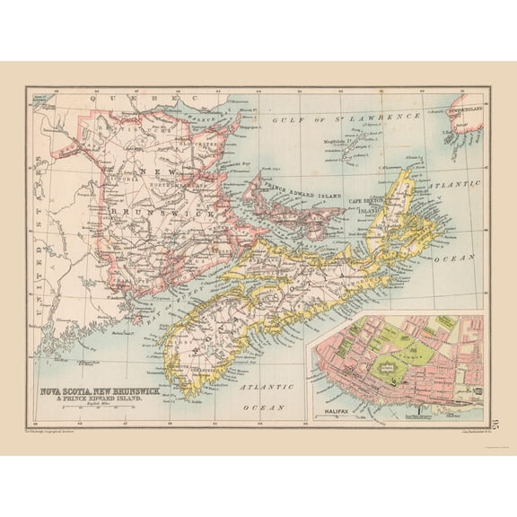
Historic Map - Nova Scotia New Brunswick Canada - Bartholomew 1892
Vintage Maps 14x11 White Modern Wood Framed Museum Art Print Titled - Telegraph stations in the United States Canada and Nova Scotia 1853 From $29.99

Vintage Maps 14x11 White Modern Wood Framed Museum Art Print Titled - Telegraph stations in the United States Canada and Nova Scotia 1853
Other options to consider(68)
HISTORIX 1879 Halifax Nova Scotia Canada Map Vintage Poster Wall Art Print, 16 x 24 Inch From $39.99

HISTORIX 1879 Halifax Nova Scotia Canada Map Vintage Poster Wall Art Print, 16 x 24 Inch
Map Showing The Tracks Of Robert Falcon Scotts Terra Nova Expedition 1910 To 1913 From South With Scott By Rear Admiral ERGR Evans Canvas Art - Ken Welsh Design Pics (14 x 15) $30.48

Map Showing The Tracks Of Robert Falcon Scotts Terra Nova Expedition 1910 To 1913 From South With Scott By Rear Admiral ERGR Evans Canvas Art - Ken Welsh Design Pics (14 x 15)
wall26 Canvas Wall Art - Early Vintage Map of The World (Nova Totius Terrarum Orbis Tabula) - Giclee Print Gallery Wrap Modern Home Art Ready to Hang - 12x18 inches From $28.59

wall26 Canvas Wall Art - Early Vintage Map of The World (Nova Totius Terrarum Orbis Tabula) - Giclee Print Gallery Wrap Modern Home Art Ready to Hang - 12x18 inches
Historic Map - Nova Scotia Newfoundland Canada - Tallis 1851 - Vintage Wall Art From $36.95

Historic Map - Nova Scotia Newfoundland Canada - Tallis 1851 - Vintage Wall Art
Map Showing The Tracks Of Robert Falcon Scotts Terra Nova Expedition 1910 To 1913 From South With Scott By Rear Admiral ERGR Evans Canvas Art - Ken Welsh Design Pics (28 x 30) $121.94

Map Showing The Tracks Of Robert Falcon Scotts Terra Nova Expedition 1910 To 1913 From South With Scott By Rear Admiral ERGR Evans Canvas Art - Ken Welsh Design Pics (28 x 30)
24"x36" Gallery Poster, Africae nova tabula map of africa 1640 $52.95

24"x36" Gallery Poster, Africae nova tabula map of africa 1640
24"x36" Gallery Poster, Nova orbis tabula world map 1694 $52.95

24"x36" Gallery Poster, Nova orbis tabula world map 1694
Historic State Map - New England to Virginia, Nova Belgica - Valk 1636 - Vintage Wall Art From $36.95

Historic State Map - New England to Virginia, Nova Belgica - Valk 1636 - Vintage Wall Art
FAQ
What makes a vintage Nova Scotia map special?
Vintage Nova Scotia maps stand out for their unique artistry and historical value. They often feature period-specific details, old place names, and decorative elements that reflect the era when they were created.
- Many include illustrations of landmarks and regional symbols.
- They can showcase historical borders and exploration routes.
- Collectors appreciate the charm and storytelling these maps offer.
Displaying a vintage map can add character to your space while giving you a window into the province's rich past.
How do I choose the right map size for my wall?
Picking the right map size depends on your wall space and how you want it to stand out. Consider measuring the area where you plan to hang the map before shopping.
- Smaller maps (like 11x14 inches) work well for desks and smaller nooks.
- Medium sizes (16x20 or 18x24 inches) are great for gallery walls or above furniture.
- Larger maps (24x36 inches) make a bold statement in living rooms or offices.
Thinking ahead about placement can help you find the perfect fit for your decor.
Can these maps be used for classroom projects?
Many Nova Scotia maps are educational tools as well as decorative pieces. They can be a great resource for classroom projects about history, geography, or exploration.
- Historic maps help visualize how borders and settlements changed over time.
- Illustrated maps can spark curiosity and discussion about regional stories.
- Maps with pirate lore or exploration themes are especially engaging for students.
Just be sure to check the level of detail to match your project's needs.
What's the difference between framed and unframed maps?
The main difference is presentation and readiness to display. Framed maps arrive with a protective border and backing, so you can hang them right away.
- Framed versions offer a polished look and protect the map from dust and damage.
- Unframed maps give you flexibility to choose your own frame or use them as posters.
- Some unframed maps may be easier to roll and store for later use.
Consider how you want to showcase your map before deciding.
How should I care for my vintage-style map print?
Taking care of your map print helps keep it looking great for years. Here are a few tips:
- Keep your map out of direct sunlight to help prevent fading.
- Dust gently with a soft, dry cloth—avoid using water or cleaners.
- If unframed, consider using acid-free mounting materials to protect the paper.
Displaying your map in a frame can also help shield it from damage and dust.
Popular in Map Nova Scotium Wall Art for Home Decor
Related Products
New York City Subway Map 1979-11x14 Unframed Art Print Poster Paper - Classic Outdoor Decor, Old Map of NYC Subway, Historical Map of New York, Classic Gift for Map Enthusiast and Cartography
 New York City Subway Map 1979-11x14 Unframed Art Print Poster Paper - Classic Outdoor Decor, Old Map of NYC Subway, Historical Map of New York, Classic Gift for Map Enthusiast and Cartography$14.99current price $14.99
Historic Map - World Winds Navigation - Petermann - Vintage Wall Art
 Historic Map - World Winds Navigation - Petermann - Vintage Wall Art$40.95current price $40.95
24x36 gallery poster, Map of the Mediterranean Sea with subdivisions, straits, islands and countries
 24x36 gallery poster, Map of the Mediterranean Sea with subdivisions, straits, islands and countries$52.95current price $52.95
Historic State Map - Montana Yellowstone National Park - Hoen 1896 - Vintage Wall Art
 Historic State Map - Montana Yellowstone National Park - Hoen 1896 - Vintage Wall Art$40.95current price $40.95
Historic Map - World America 1492 to 1499 - Bleau - Vintage Wall Art
 Historic Map - World America 1492 to 1499 - Bleau - Vintage Wall Art$40.95current price $40.95
Alaska Map Wall Art Poster - Authentic Hand Drawn Maps in Old World, Antique Style - Art Deco for Home Office Décor - Lithographic Print
 Alaska Map Wall Art Poster - Authentic Hand Drawn Maps in Old World, Antique Style - Art Deco for Home Office Décor - Lithographic Print$34.70current price $34.70
Historic Map - World - Perthes 1891 - Vintage Wall Art
 Historic Map - World - Perthes 1891 - Vintage Wall Art$45.95current price $45.95
1980 Diego Garcia Map - Vintage Diego Garcia Map - Old Diego Garcia Map - History Map of Diego Garcia Island British Indian Ocean Territory Wall Art Poster Print
 1980 Diego Garcia Map - Vintage Diego Garcia Map - Old Diego Garcia Map - History Map of Diego Garcia Island British Indian Ocean Territory Wall Art Poster Print$39.99current price $39.99
Map of South America - Vintage Colored Cartographic Map by J. Rapkin c.1851 - Master Art Print (Unframed) 9in x 12in
 Map of South America - Vintage Colored Cartographic Map by J. Rapkin c.1851 - Master Art Print (Unframed) 9in x 12in$14.98current price $14.98
Palmetto Posters 22x41 Laminated Poster: Large detailed time zones map of the world
Palmetto Posters 22x41 Laminated Poster: Large detailed time zones map of the world
Historic Map - World - Hammond 1910 - Vintage Wall Art
 Historic Map - World - Hammond 1910 - Vintage Wall Art$40.95current price $40.95
HISTORIX Vintage 1902 Eureka California Map Poster - 24x36 Inch Old Bird's Eye View of Eureka Humboldt County Map of California Poster Wall Art Print
 HISTORIX Vintage 1902 Eureka California Map Poster - 24x36 Inch Old Bird's Eye View of Eureka Humboldt County Map of California Poster Wall Art Print$84.99current price $84.99
Historic State Map - United States - Cram 1888 - Vintage Wall Art
 Historic State Map - United States - Cram 1888 - Vintage Wall Art$40.95current price $40.95
Topographical Map - Gonzales California Quad - USGS 1921 - Vintage Wall Art
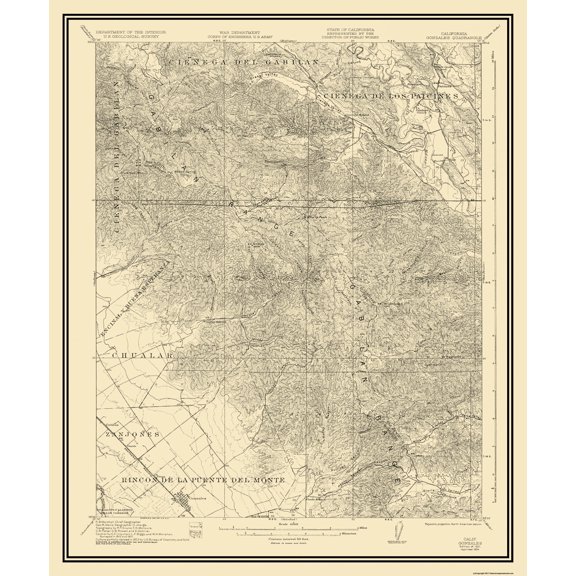 Topographical Map - Gonzales California Quad - USGS 1921 - Vintage Wall Art$40.95current price $40.95
State of Maine Wildlife Map - New England - Vintage Pictorial Map by J.G. Shelley & Louis Koster c.1950s - Master Art Print (Unframed) 9in x 12in
 State of Maine Wildlife Map - New England - Vintage Pictorial Map by J.G. Shelley & Louis Koster c.1950s - Master Art Print (Unframed) 9in x 12in$14.98current price $14.98
Historic Map - United States Central - Bartholomew 1892 - Vintage Wall Art
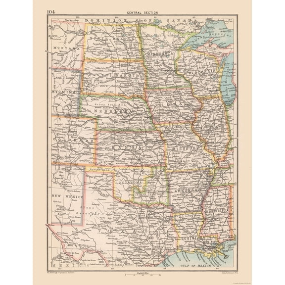 Historic Map - United States Central - Bartholomew 1892 - Vintage Wall Art$45.95current price $45.95
Historic State Map - California - Hoen 1896 - Vintage Wall Art
 Historic State Map - California - Hoen 1896 - Vintage Wall Art$40.95current price $40.95
Topographical Map - Grand Teton National Park Wyoming Sheet - USGS 1948 - Vintage Wall Art
 Topographical Map - Grand Teton National Park Wyoming Sheet - USGS 1948 - Vintage Wall Art$45.95current price $45.95