Northwest Us Map(18)
Uses item details. Price when purchased online
Topographical Map - United States Northwest - USGS 1932 - Vintage Wall Art From $36.95

2 options
Available in additional 2 optionsFrom$3695
Topographical Map - United States Northwest - USGS 1932 - Vintage Wall Art
Historic State Map - United States Northwest - Petermann 1872 - Vintage Wall Art From $36.95

2 options
Available in additional 2 optionsFrom$3695
Historic State Map - United States Northwest - Petermann 1872 - Vintage Wall Art
1880 Map of Oregon and Washington Territory - Vintage Pacific Northwest Map - Pacific Northwest Wall Art - Pacific Northwest Map Poster - Northwest US Map From $39.99

2 options
Available in additional 2 optionsFrom$3999
1880 Map of Oregon and Washington Territory - Vintage Pacific Northwest Map - Pacific Northwest Wall Art - Pacific Northwest Map Poster - Northwest US Map
Historic Map - United States Northwest - Stieler 1885 - Vintage Wall Art From $36.95

2 options
Available in additional 2 optionsFrom$3695
Historic Map - United States Northwest - Stieler 1885 - Vintage Wall Art
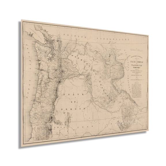
1859 State of Oregon and Washington Territory Map - Vintage Pacific Northwest Wall Art - Pacific Northwest Decor - Pacific Northwest Map Poster - Northwest US Map From $39.99
2 options
Available in additional 2 optionsFrom$3999
1859 State of Oregon and Washington Territory Map - Vintage Pacific Northwest Wall Art - Pacific Northwest Decor - Pacific Northwest Map Poster - Northwest US Map
Historic Map - North American Northwest Coast - Robinson 1798 - Vintage Wall Art From $36.95

2 options
Available in additional 2 optionsFrom$3695
Historic Map - North American Northwest Coast - Robinson 1798 - Vintage Wall Art

Historic Map - South America Northwest - Streit 1913 - Vintage Wall Art From $36.95

2 options
Available in additional 2 optionsFrom$3695
Historic Map - South America Northwest - Streit 1913 - Vintage Wall Art
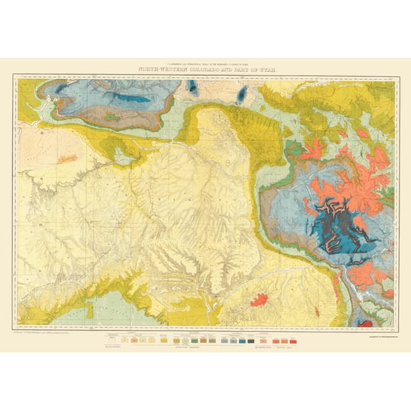
Topographical Map - Colorado Northwest Utah Economic - USGS 1881 - Vintage Wall Art From $36.95
2 options
Available in additional 2 optionsFrom$3695
Topographical Map - Colorado Northwest Utah Economic - USGS 1881 - Vintage Wall Art
Replogle Globes USA Map with Flags, 49"W x 33"H $21.99

$2199
current price $21.99Replogle Globes USA Map with Flags, 49"W x 33"H
Historic Map - North America Oregon Territory United States - Wilkes 1841 From $36.95

2 options
Available in additional 2 optionsFrom$3695
Historic Map - North America Oregon Territory United States - Wilkes 1841
United States Map Printed North America Geography Wallpaper Unframed Paper Print From $18.99

4 options
Available in additional 4 optionsFrom$1899
United States Map Printed North America Geography Wallpaper Unframed Paper Print
Historic Map - North America United States - Streit 1913 - Vintage Wall Art From $36.95

2 options
Available in additional 2 optionsFrom$3695
Historic Map - North America United States - Streit 1913 - Vintage Wall Art
Historic Map - United States North Eastern - Bartholomew 1892 - Vintage Wall Art From $36.95

2 options
Available in additional 2 optionsFrom$3695
Historic Map - United States North Eastern - Bartholomew 1892 - Vintage Wall Art
United States Map United States Flag North America Wall Art Home Decor Geography Map Gift Wallpaper From $18.99

5 options
Available in additional 5 optionsFrom$1899
United States Map United States Flag North America Wall Art Home Decor Geography Map Gift Wallpaper
Old War Map Print - North America United States Chart - Homann 1784 - Vintage Wall Art From $36.95

2 options
Available in additional 2 optionsFrom$3695
Old War Map Print - North America United States Chart - Homann 1784 - Vintage Wall Art
Map Of The Northern United States Of North America Circa.1760. From Atlas De

2 options
Available in additional 2 optionsMap Of The Northern United States Of North America Circa.1760. From Atlas De
30x50 RMC Classic Edition United States Wall Map - Laminated

30x50 RMC Classic Edition United States Wall Map - Laminated
Other options to consider(260)
National Geographic Reference Map: National Geographic Dinosaurs of North America Wall Map (22.25 X 30.5 In) (Sheet map, rolled) $15.80

$1580
current price $15.80National Geographic Reference Map: National Geographic Dinosaurs of North America Wall Map (22.25 X 30.5 In) (Sheet map, rolled)
Historic Map - Asia America Northwest Passage - Thomson 1816 - Vintage Wall Art From $36.95

2 options
Available in additional 2 optionsFrom$3695
Historic Map - Asia America Northwest Passage - Thomson 1816 - Vintage Wall Art
Historic Map - North America Mexico United States - Sanson 1650 - Vintage Wall Art From $36.95

2 options
Available in additional 2 optionsFrom$3695
Historic Map - North America Mexico United States - Sanson 1650 - Vintage Wall Art
Historic State Map - North America Lewis Clark Routes - Clark 1804 - Vintage Wall Art From $36.95

2 options
Available in additional 2 optionsFrom$3695
Historic State Map - North America Lewis Clark Routes - Clark 1804 - Vintage Wall Art
United States Map Flag North America Wall Geography Wallpaper Poster Wall Art Print From $18.99

4 options
Available in additional 4 optionsFrom$1899
United States Map Flag North America Wall Geography Wallpaper Poster Wall Art Print
Historic Map - North America New England Canada United States - Johnson 1860 From $36.95

2 options
Available in additional 2 optionsFrom$3695
Historic Map - North America New England Canada United States - Johnson 1860
Historic Map - North America Commercial Chart - Newnes 1907 - Vintage Wall Art From $36.95

2 options
Available in additional 2 optionsFrom$3695
Historic Map - North America Commercial Chart - Newnes 1907 - Vintage Wall Art
Old War Map Print - North America Northeastern Coast - Vaugondy 1755 - Vintage Wall Art From $36.95

2 options
Available in additional 2 optionsFrom$3695
Old War Map Print - North America Northeastern Coast - Vaugondy 1755 - Vintage Wall Art
Historic Map - North America Northern Mexico Texas US - Appleton 1892 From $36.95

2 options
Available in additional 2 optionsFrom$3695
Historic Map - North America Northern Mexico Texas US - Appleton 1892
Goldthwait 13x12 White Modern Wood Framed Museum Art Print Titled - 1861 Map of US and North America From $29.99

4 options
Available in additional 4 optionsFrom$2999
Goldthwait 13x12 White Modern Wood Framed Museum Art Print Titled - 1861 Map of US and North America
Art.com Map of Ohio, Northern Part. United States Art Print by Encyclopaedia Britannica, 18" x 12" From $19.00


From$1900
Art.com Map of Ohio, Northern Part. United States Art Print by Encyclopaedia Britannica, 18" x 12"
Historic Revolutionary War Map - North America Northern Department - Mortier 1780 - 23 x 25 - Vintage Wall Art

Historic Revolutionary War Map - North America Northern Department - Mortier 1780 - 23 x 25 - Vintage Wall Art
Historic Map - Canada United States Northern - Societe Royale De Loudres 1766 From $36.95

2 options
Available in additional 2 optionsFrom$3695
Historic Map - Canada United States Northern - Societe Royale De Loudres 1766
Topographical Map - Cedar Lake Washington Quad - USGS 1913 - Vintage Wall Art From $36.95

2 options
Available in additional 2 optionsFrom$3695
Topographical Map - Cedar Lake Washington Quad - USGS 1913 - Vintage Wall Art
Historic Nautical Map - Pacific Ocean Asia North America Northern Hemisphere - 1844 From $36.95

2 options
Available in additional 2 optionsFrom$3695
Historic Nautical Map - Pacific Ocean Asia North America Northern Hemisphere - 1844
Historic Map - South America Northwestern - Jansson 1630 - Vintage Wall Art From $36.95

2 options
Available in additional 2 optionsFrom$3695
Historic Map - South America Northwestern - Jansson 1630 - Vintage Wall Art
Historic Print, [View of the U.S. Capitol from Northwest], 18" x 24" From $57.00
![Historic Print, [View of the U.S. Capitol from Northwest], 18" x 24"](https://i5.walmartimages.com/seo/Historic-Print-View-of-the-U-S-Capitol-from-Northwest-18-x-24_70c00d0e-9c5d-4703-8e23-9752b63f7a61.1f98e2e6dd7a5e90456fb878885f1180.jpeg?odnHeight=576&odnWidth=576&odnBg=FFFFFF)
2 options
Available in additional 2 optionsFrom$5700
Historic Print, [View of the U.S. Capitol from Northwest], 18" x 24"
Historic Print, [View of Washington, D.C., looking northwest from southeast of the U.S. Capitol] - 2, 16" x 20"
![Historic Print, [View of Washington, D.C., looking northwest from southeast of the U.S. Capitol] - 2, 16" x 20"](https://i5.walmartimages.com/seo/Historic-Print-View-of-Washington-D-C-looking-northwest-from-southeast-of-the-U-S-Capitol-2-16-x-20_a90cacb8-db29-464f-9f12-74c24ad65681.3b8ed413d3ecaa82dd09d14e2a6a4f3d.jpeg?odnHeight=576&odnWidth=576&odnBg=FFFFFF)
Historic Print, [View of Washington, D.C., looking northwest from southeast of the U.S. Capitol] - 2, 16" x 20"
Historic Print, [View of Washington, D.C., looking northwest from southeast of the U.S. Capitol] - 3, 18" x 24" From $57.00
![Historic Print, [View of Washington, D.C., looking northwest from southeast of the U.S. Capitol] - 3, 18" x 24"](https://i5.walmartimages.com/seo/Historic-Print-View-of-Washington-D-C-looking-northwest-from-southeast-of-the-U-S-Capitol-3-18-x-24_2b8210bf-8a27-4781-adf2-e0c5d994a35a.ed2fa6ac46e95cdf2134f1c7022b744e.png?odnHeight=576&odnWidth=576&odnBg=FFFFFF)
2 options
Available in additional 2 optionsFrom$5700
Historic Print, [View of Washington, D.C., looking northwest from southeast of the U.S. Capitol] - 3, 18" x 24"
Historic Print, [View of Washington, D.C., looking northwest from southeast of the U.S. Capitol] - 4, 18" x 24"
![Historic Print, [View of Washington, D.C., looking northwest from southeast of the U.S. Capitol] - 4, 18" x 24"](https://i5.walmartimages.com/seo/Historic-Print-View-of-Washington-D-C-looking-northwest-from-southeast-of-the-U-S-Capitol-4-18-x-24_651b1b13-7da8-4660-be36-4a07c611cb35.355c4114d49e4deed855dcaf7d4668a8.png?odnHeight=576&odnWidth=576&odnBg=FFFFFF)
Historic Print, [View of Washington, D.C., looking northwest from southeast of the U.S. Capitol] - 4, 18" x 24"
Revolutionary War Map Print - New England North America - Gibson 1771 - Vintage Wall Art From $36.95

2 options
Available in additional 2 optionsFrom$3695
Revolutionary War Map Print - New England North America - Gibson 1771 - Vintage Wall Art
Historic Print, U.S. Department of the Interior, Eighteenth & C Streets Northwest, Washington, District of Columbia, DC - 103, 16" x 20"

Historic Print, U.S. Department of the Interior, Eighteenth & C Streets Northwest, Washington, District of Columbia, DC - 103, 16" x 20"
Popular in Northwest Us Map
Related Products
Historic Print, PA Apollo 1896 MAP, 16" x 20"
 Historic Print, PA Apollo 1896 MAP, 16" x 20"$57.00current price $57.00
Historic State Map - United States Canada - Harper 1847 - Vintage Wall Art
 Historic State Map - United States Canada - Harper 1847 - Vintage Wall Art$40.95current price $40.95
Art.com Letterpress USA Map Art Print by Michael Mullan, 24" x 16"
 Art.com Letterpress USA Map Art Print by Michael Mullan, 24" x 16"$24.00current price $24.00
Historic State Map - United States South Eastern - Thomson 1817 - Vintage Wall Art
 Historic State Map - United States South Eastern - Thomson 1817 - Vintage Wall Art$40.95current price $40.95
New York City Map Wall Art, Nyc Map Posters, New York Map Poster, New York Map Wall Art, New York Poster, Nyc Poster, New York City, Stretched Canvas Size 8x12
 New York City Map Wall Art, Nyc Map Posters, New York Map Poster, New York Map Wall Art, New York Poster, Nyc Poster, New York City, Stretched Canvas Size 8x12$29.99current price $29.99
Historic Map - World - Janvier 1782 - Vintage Wall Art
 Historic Map - World - Janvier 1782 - Vintage Wall Art$45.95current price $45.95
Historic Print, OH Cambridge 1899 MAP, 16" x 20"
 Historic Print, OH Cambridge 1899 MAP, 16" x 20"$57.00current price $57.00
Historic State Map - United States Time Zones - Monteith 1882 - Vintage Wall Art
 Historic State Map - United States Time Zones - Monteith 1882 - Vintage Wall Art$40.95current price $40.95
1875 Graphic Chart of San Francisco Map Print with Index to Points of Interest - Vintage Map of Bay Area Poster - San Francisco Map Poster - San Francisco Map Art
 1875 Graphic Chart of San Francisco Map Print with Index to Points of Interest - Vintage Map of Bay Area Poster - San Francisco Map Poster - San Francisco Map Art$39.99current price $39.99
Great BIG Canvas | Rolled Vision Studio Poster Print entitled Eastern States Map
 Great BIG Canvas | Rolled Vision Studio Poster Print entitled Eastern States Map$77.99current price $77.99
Great BIG Canvas | Rolled Charles McMullen Poster Print entitled City Map I
 Great BIG Canvas | Rolled Charles McMullen Poster Print entitled City Map I$74.99current price $74.99
USA National Parks, Monuments & Forests Map 24x36 Poster
 USA National Parks, Monuments & Forests Map 24x36 Poster$31.97current price $31.97
Historic State Map - New York - 1780 - Vintage Wall Art
 Historic State Map - New York - 1780 - Vintage Wall Art$40.95current price $40.95
1876 New York City Poster - NYC Map Wall Art - Vintage Map of New York City with Points of Interest - Historic Map of New York City Poster - Old NYC Map Print
 1876 New York City Poster - NYC Map Wall Art - Vintage Map of New York City with Points of Interest - Historic Map of New York City Poster - Old NYC Map Print$59.99current price $59.99