Map Routes(123)
Uses item details. Price when purchased online
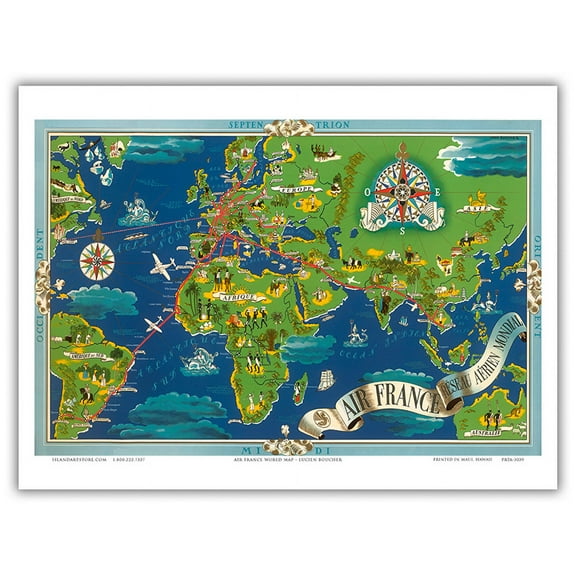
France - Fly Routes World Map - World Air Routes - Vintage Airline Travel Poster by Lucien Boucher c.1948 - 8 x 12 inch Vintage Wood Art Sign From $14.98

20 options
Available in additional 20 optionsFrom$1498
France - Fly Routes World Map - World Air Routes - Vintage Airline Travel Poster by Lucien Boucher c.1948 - 8 x 12 inch Vintage Wood Art Sign
36x48 Arkansas State Official Executive Laminated Wall Map $59.00

$5900
current price $59.0036x48 Arkansas State Official Executive Laminated Wall Map
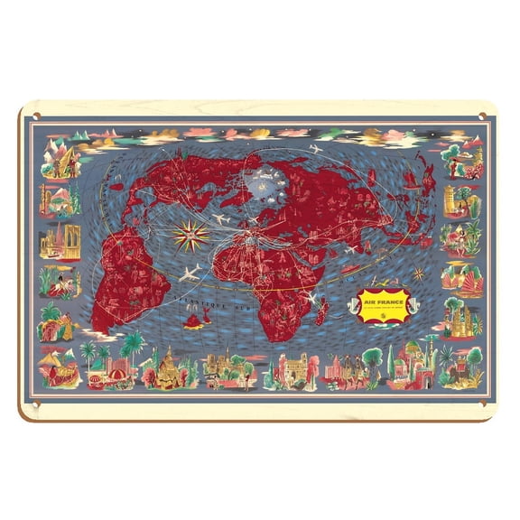
Largest Network in the World (Le Plus Grand Réseau du Monde) - Air Routes - Vintage Pictorial Map by Lucien Boucher c.1961 - 8 x 12 inch Vintage Wood Art Sign From $14.98
20 options
Available in additional 20 optionsFrom$1498
Largest Network in the World (Le Plus Grand Réseau du Monde) - Air Routes - Vintage Pictorial Map by Lucien Boucher c.1961 - 8 x 12 inch Vintage Wood Art Sign
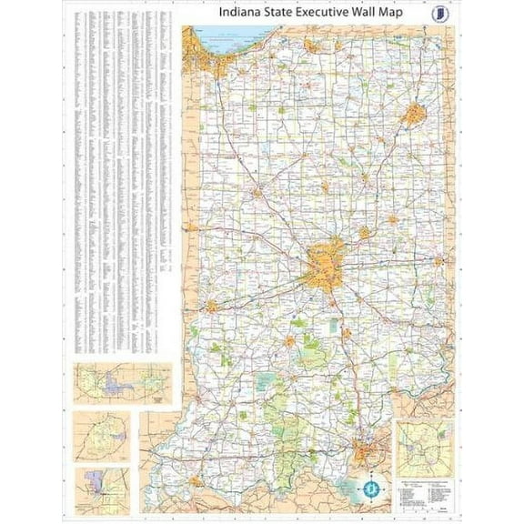
36x54 Indiana State Official Executive Laminated Wall Map $59.00
$5900
current price $59.0036x54 Indiana State Official Executive Laminated Wall Map
Réseau Aérien Mondial (Global Air Network) - Fly Routes World Map - France Planisphere - Vintage Airline Travel Poster by Lucien Boucher c.1950 - Master Art Print (Unframed) 9in x 12in From $14.98
18 options
Available in additional 18 optionsFrom$1498
Réseau Aérien Mondial (Global Air Network) - Fly Routes World Map - France Planisphere - Vintage Airline Travel Poster by Lucien Boucher c.1950 - Master Art Print (Unframed) 9in x 12in
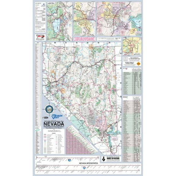
36x56 Nevada State Official Executive Laminated Wall Map $59.00
$5900
current price $59.0036x56 Nevada State Official Executive Laminated Wall Map
36x44 Louisiana State Official Executive Laminated Wall Map $59.00
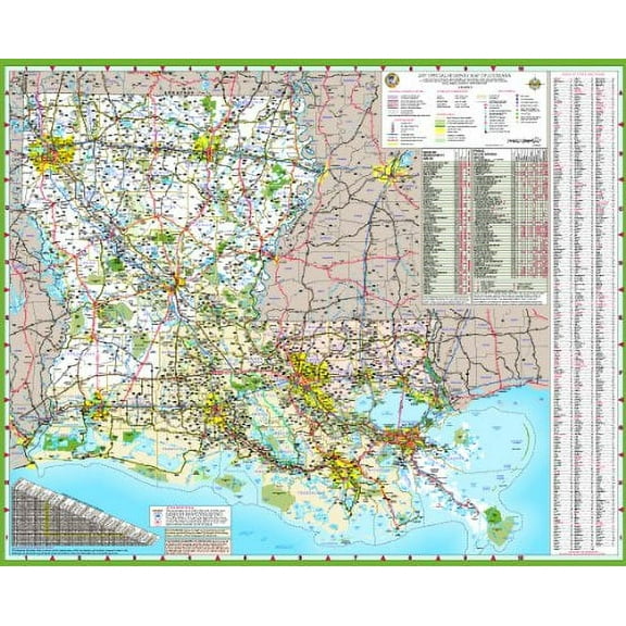
$5900
current price $59.0036x44 Louisiana State Official Executive Laminated Wall Map
Swiftmaps Florida State Laminated Wall Map 36" x 48" Poster $48.00
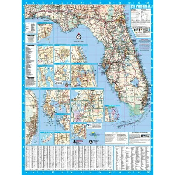
$4800
current price $48.00Swiftmaps Florida State Laminated Wall Map 36" x 48" Poster
World Map - Fly Routes World Map - Planisphere - Vintage Airline Travel Poster by Lucien Boucher c.1948 - 8 x 12 inch Vintage Wood Art Sign From $14.98

19 options
Available in additional 19 optionsFrom$1498
World Map - Fly Routes World Map - Planisphere - Vintage Airline Travel Poster by Lucien Boucher c.1948 - 8 x 12 inch Vintage Wood Art Sign
Railroad Map - Pacific Coast Steamship Company Routes - Rand McNally 1896 - WallArt From $36.95

2 options
Available in additional 2 optionsFrom$3695
Railroad Map - Pacific Coast Steamship Company Routes - Rand McNally 1896 - WallArt
48x68 Pennsylvania State Official Executive Laminated Wall Map $89.95

$8995
current price $89.9548x68 Pennsylvania State Official Executive Laminated Wall Map
36x55 Massachusetts State Official Executive Laminated Wall Map $59.00
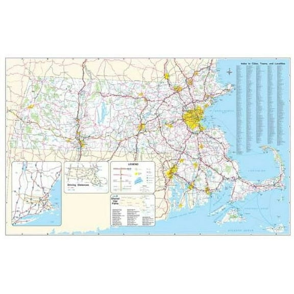
$5900
current price $59.0036x55 Massachusetts State Official Executive Laminated Wall Map
Double Hemisphere Route Map - TAI Airline - Vintage Airline Travel Poster by Luc-Marie Bayle c.1948 - Master Art Print (Unframed) 9in x 12in From $14.98

18 options
Available in additional 18 optionsFrom$1498
Double Hemisphere Route Map - TAI Airline - Vintage Airline Travel Poster by Luc-Marie Bayle c.1948 - Master Art Print (Unframed) 9in x 12in
Swiftmaps Georgia State Official Executive Laminated Wall Map, 36x48 $59.00

$5900
current price $59.00Swiftmaps Georgia State Official Executive Laminated Wall Map, 36x48
Historic State Map - North America Lewis Clark Routes - Clark 1806 - Vintage Wall Art From $36.95

2 options
Available in additional 2 optionsFrom$3695
Historic State Map - North America Lewis Clark Routes - Clark 1806 - Vintage Wall Art
Swiftmaps Florida State Laminated Wall Map 48 x 64 Poster $89.95
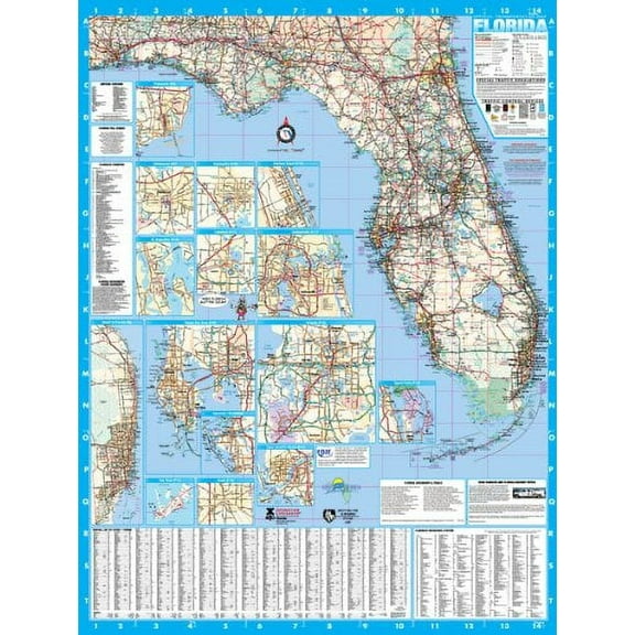
$8995
current price $89.95Swiftmaps Florida State Laminated Wall Map 48 x 64 Poster
36x54 Illinois State Official Executive Laminated Wall Map $59.00
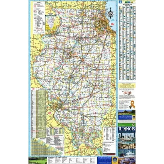
$5900
current price $59.0036x54 Illinois State Official Executive Laminated Wall Map
13 out of 5 Stars. 1 reviews
Railroad Map - Philadelphia Charleston Communication Routes - McClellan 1837 From $36.95

2 options
Available in additional 2 optionsFrom$3695
Railroad Map - Philadelphia Charleston Communication Routes - McClellan 1837
36x50 Pennsylvania State Official Executive Laminated Wall Map $59.00

$5900
current price $59.0036x50 Pennsylvania State Official Executive Laminated Wall Map
Railroad Map - Iowa Railroad Routes - McEwen 1897 - Vintage Wall Art From $36.95

2 options
Available in additional 2 optionsFrom$3695
Railroad Map - Iowa Railroad Routes - McEwen 1897 - Vintage Wall Art
48x78 Iowa State Official Executive Laminated Wall Map $89.95

$8995
current price $89.9548x78 Iowa State Official Executive Laminated Wall Map
Brivelle Vintage Railway Route Map Gray, Red and White Poster Retro travel-inspired Home or office decor Wall, 12 x 8 in From $12.95

8 options
Available in additional 8 optionsFrom$1295
Brivelle Vintage Railway Route Map Gray, Red and White Poster Retro travel-inspired Home or office decor Wall, 12 x 8 in
Swiftmaps Executive and Commercial State Wall Map, 36"x48" $59.00

$5900
current price $59.00Swiftmaps Executive and Commercial State Wall Map, 36"x48"
Trademark Art 'Map of Principal World Trade Routes, 1912' Canvas Art From $36.99

2 options
Available in additional 2 optionsFrom$3699
Trademark Art 'Map of Principal World Trade Routes, 1912' Canvas Art
Historic Map - World Map - Martines 1587 - Vintage Wall Art From $36.95

2 options
Available in additional 2 optionsFrom$3695
Historic Map - World Map - Martines 1587 - Vintage Wall Art
Historic State Map - North America Lewis Clark Routes - Clark 1804 - Vintage Wall Art From $36.95

2 options
Available in additional 2 optionsFrom$3695
Historic State Map - North America Lewis Clark Routes - Clark 1804 - Vintage Wall Art
Historic Nautical Map - Fairfax County Rural Delivery Routes - USPS 1912 - Vintage Wall Art From $36.95

2 options
Available in additional 2 optionsFrom$3695
Historic Nautical Map - Fairfax County Rural Delivery Routes - USPS 1912 - Vintage Wall Art
Brivelle Vintage Upper Midwest railroad route map Red, cream, blue and tan Poster Retro travel Home or office decor Wall, 12 x 8 in From $12.95

5 options
Available in additional 5 optionsFrom$1295
Brivelle Vintage Upper Midwest railroad route map Red, cream, blue and tan Poster Retro travel Home or office decor Wall, 12 x 8 in
Historic Highway Route 66 Custom Retro Road Trip Travel Map Graphic Wall Art, Unframed Poster From $19.99

4 options
Available in additional 4 optionsFrom$1999
Historic Highway Route 66 Custom Retro Road Trip Travel Map Graphic Wall Art, Unframed Poster
Historic Map - World Commercial Routes - Bartholomew 1892 - Vintage Wall Art From $36.95

2 options
Available in additional 2 optionsFrom$3695
Historic Map - World Commercial Routes - Bartholomew 1892 - Vintage Wall Art
36x64 New Jersey State Official Executive Laminated Wall Map $59.00

$5900
current price $59.0036x64 New Jersey State Official Executive Laminated Wall Map
Historic Map - World - Rathbun 1893 - Vintage Wall Art From $36.95

2 options
Available in additional 2 optionsFrom$3695
Historic Map - World - Rathbun 1893 - Vintage Wall Art
48x52 Minnesota State Official Executive Laminated Wall Map $89.95

$8995
current price $89.9548x52 Minnesota State Official Executive Laminated Wall Map
48x66 Georgia State Official Executive Laminated Wall Map $89.95
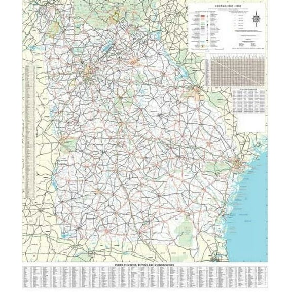
$8995
current price $89.9548x66 Georgia State Official Executive Laminated Wall Map
36x48 Colorado State Official Executive Laminated Wall Map $59.00
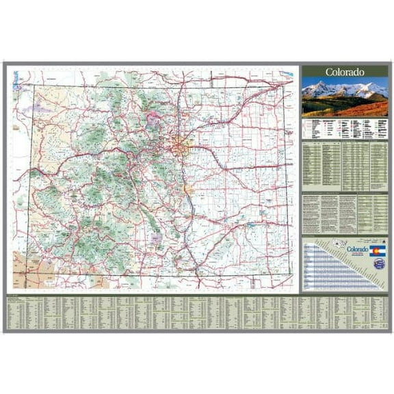
$5900
current price $59.0036x48 Colorado State Official Executive Laminated Wall Map
Trademark Art 'Map of Principal World Trade Routes, 1912' Canvas Art $27.72

$2772
current price $27.72Trademark Art 'Map of Principal World Trade Routes, 1912' Canvas Art
Historic Map - World - Hammond 1910 - Vintage Wall Art From $36.95

2 options
Available in additional 2 optionsFrom$3695
Historic Map - World - Hammond 1910 - Vintage Wall Art
Historic Map - Paris France Transportation Routes - Regnier 1853 - Vintage Wall Art From $36.95

2 options
Available in additional 2 optionsFrom$3695
Historic Map - Paris France Transportation Routes - Regnier 1853 - Vintage Wall Art
Historic Map - World - Loon - Vintage Wall Art From $36.95

2 options
Available in additional 2 optionsFrom$3695
Historic Map - World - Loon - Vintage Wall Art
Travel Map Of Europe Rail, Air, Automobile Routes. United States Lines, 1930. Framed Vintage Travel Poster From $90.00


From$9000
Travel Map Of Europe Rail, Air, Automobile Routes. United States Lines, 1930. Framed Vintage Travel Poster
Popular in Map Routes
Related Products
Historic Print, OH Cambridge 1899 MAP, 16" x 20"
 Historic Print, OH Cambridge 1899 MAP, 16" x 20"$57.00current price $57.00
Historic State Map - United States Canada - Harper 1847 - Vintage Wall Art
 Historic State Map - United States Canada - Harper 1847 - Vintage Wall Art$40.95current price $40.95
Global Gallery's 'US City Map' By Michael Mullan Stretched Canvas Wall Art
 Global Gallery's 'US City Map' By Michael Mullan Stretched Canvas Wall Art$96.53current price $96.53
Global Gallery's 'US City Map' By Michael Mullan Stretched Canvas Wall Art
 Global Gallery's 'US City Map' By Michael Mullan Stretched Canvas Wall Art$84.83current price $84.83
Historic State Map - United States Eastern - Weik 1855 - Vintage Wall Art
 Historic State Map - United States Eastern - Weik 1855 - Vintage Wall Art$40.95current price $40.95
Historic Print, NH Ashland 1883 MAP, 18" x 24"
 Historic Print, NH Ashland 1883 MAP, 18" x 24"$71.00current price $71.00
Historic Map - World - Janvier 1782 - Vintage Wall Art
 Historic Map - World - Janvier 1782 - Vintage Wall Art$45.95current price $45.95
Historic Print, IN Tell City 1870 MAP, 18" x 24"
 Historic Print, IN Tell City 1870 MAP, 18" x 24"$71.00current price $71.00
Global Gallery's 'US City Map on Wood Blue' By Michael Mullan Stretched Canvas Wall Art
 Global Gallery's 'US City Map on Wood Blue' By Michael Mullan Stretched Canvas Wall Art$122.27current price $122.27
Historic State Map - United States Time Zones - Monteith 1882 - Vintage Wall Art
 Historic State Map - United States Time Zones - Monteith 1882 - Vintage Wall Art$40.95current price $40.95
HISTORIX 1900 Wisconsin Map Poster Wall Art Print, 24 x 30 Inch
 HISTORIX 1900 Wisconsin Map Poster Wall Art Print, 24 x 30 Inch$54.99current price $54.99
48x70 United States Executive Wall Map - Laminated
 48x70 United States Executive Wall Map - Laminated$49.99current price $49.99
Great BIG Canvas | Rolled Vision Studio Poster Print entitled Eastern States Map
 Great BIG Canvas | Rolled Vision Studio Poster Print entitled Eastern States Map$77.99current price $77.99
Historic State Map - New York - 1780 - Vintage Wall Art
 Historic State Map - New York - 1780 - Vintage Wall Art$40.95current price $40.95
1875 Graphic Chart of San Francisco Map Print with Index to Points of Interest - Vintage Map of Bay Area Poster - San Francisco Map Poster - San Francisco Map Art
 1875 Graphic Chart of San Francisco Map Print with Index to Points of Interest - Vintage Map of Bay Area Poster - San Francisco Map Poster - San Francisco Map Art$39.99current price $39.99