Hero image 0 of Historic State Map - United States North Eastern Canada - Black 1867 - 31.48 x 23 - Vintage Wall Art, 0 of 5
Historic State Map - United States North Eastern Canada - Black 1867 - 31.48 x 23 - Vintage Wall Art
(No ratings yet)
Historic State Map - United States North Eastern Canada - Black 1867 - 31.48 x 23 - Vintage Wall ArtHistoric State Map United States North Eastern Canada Black 1867 31 48 x 23 Vintage Wall ArtHistoric State Map United States North Eastern Canada Black 1867 31 48 x 23 Vintage Wall Art
Material:Matte Art
Key item features
- BEAUTIFUL MAPS OF THE UNITED STATES - At Maps of the Past, we have all different types of US maps. From topographical to natural resources, we have exactly the type of US map you are looking for. Check out all of the different types of US maps that we have to offer. Easily find the one that is right for your needs.
- A UNITED STATES MAP FOR EVERY NEED - At Maps of the Past, we carry a variety of US maps. From exports and natural resources, to mines and railroads. We have maps of the US that cover any need. Check our wide selection of United States maps!
- ONLY ACCEPT THE BEST PRINT QUALITY FOR YOUR REPRODUCTIONS - There are many printers and print types available on the market, when purchasing a reproduction there is no finer quality reproduction than a reproduction using the Giclee Printing method. Giclee describes the technique or style of printing used, and it is revered as the highest quality printing because of the way it precisely sprays ink onto a surface. Trust nothing less than the best!
- GUARNANTEED TO GET EXACTLY WHAT YOU ORDERED - This map comes exactly to the specification of 23.00 x 31.48 inches/58.42 X 79.95 cm. All of our maps come rolled, wrapped, and shipped in a heavy gauge mailing tube to ensure it arrives intact.
- WHY CHOOSE MAPS OF THE PAST? - Maps of the Past is one of the single largest producers of different types of maps. They legally own the rights to the maps they sell, and provide them to you in clean, clear, and vibrant print. If you are looking for a high quality map print, then look no further than Maps of the Past!
Specs
 Size23.00 x 31.48
 MaterialMatte Art
 BrandMAPS OF THE PAST
 Age groupAdult
Current price is USD$45.95$45.95/count
Price when purchased online
- Free shipping
 Free 30-day returns
How do you want your item?
Columbus, 43215
Arrives between Apr 16 - Apr 18
|Sold and shipped by Maps of the Past
4.3 stars out of 5, based on 10 seller reviews(4.3)10 seller reviews
Free 30-day returns
About this item
Product details
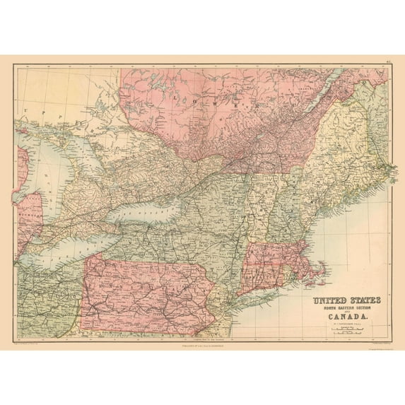
Old State Maps - North Eastern United States, Canada - Black's Atlas 1867 - This is an exquisite full-color Reproduction printed on high-quality gloss paper, art paper or canvas.
Print Size: 23.00 x 31.48 inches
58.42 X 79.95cm
The following towns are featured: Detroit, Ceawford, Toronto, Ottawa, Montreal, Bangor, Portland, New York, Quebec, Chatham.
This Map is Situated in: United States, Canada.
SKU: USNE0034
Original Maps are often difficult to find and usually have fold lines, identifying stamps or markings, tears, ragged edges, and assorted other natural signs of age that detract from their beauty. All of our maps have been professionally restored to depict their original beauty, while keeping all historical data intact.
These maps are fabulous pieces of history full of information useful to Historians, Genealogists, Cartographers, Relic Hunters, & Others. They make fascinating conversation pieces and splendid works of art for the home or office.
- BEAUTIFUL MAPS OF THE UNITED STATES - At Maps of the Past, we have all different types of US maps. From topographical to natural resources, we have exactly the type of US map you are looking for. Check out all of the different types of US maps that we have to offer. Easily find the one that is right for your needs.
- A UNITED STATES MAP FOR EVERY NEED - At Maps of the Past, we carry a variety of US maps. From exports and natural resources, to mines and railroads. We have maps of the US that cover any need. Check our wide selection of United States maps!
- ONLY ACCEPT THE BEST PRINT QUALITY FOR YOUR REPRODUCTIONS - There are many printers and print types available on the market, when purchasing a reproduction there is no finer quality reproduction than a reproduction using the Giclee Printing method. Giclee describes the technique or style of printing used, and it is revered as the highest quality printing because of the way it precisely sprays ink onto a surface. Trust nothing less than the best!
- GUARNANTEED TO GET EXACTLY WHAT YOU ORDERED - This map comes exactly to the specification of 23.00 x 31.48 inches/58.42 X 79.95 cm. All of our maps come rolled, wrapped, and shipped in a heavy gauge mailing tube to ensure it arrives intact.
- WHY CHOOSE MAPS OF THE PAST? - Maps of the Past is one of the single largest producers of different types of maps. They legally own the rights to the maps they sell, and provide them to you in clean, clear, and vibrant print. If you are looking for a high quality map print, then look no further than Maps of the Past!
info:
We aim to show you accurate product information. Manufacturers, suppliers and others provide what you see here, and we have not verified it.
Specifications
Brand
MAPS OF THE PAST
Manufacturer Part Number
USNE0034-3
Manufacturer
Maps Of The Past
Warranty
Warranty information
Please be aware that the warranty terms on items offered for sale by third party Marketplace sellers may differ from those displayed in this section (if any). To confirm warranty terms on an item offered for sale by a third party Marketplace seller, please use the 'Contact seller' feature on the third party Marketplace seller's information page and request the item's warranty terms prior to purchase.
Similar items you might like
Based on what customers bought
Best seller 24x36 United States, USA, US Premier Wall Map Paper Folded $9.90
Best seller $990current price $9.90
24x36 United States, USA, US Premier Wall Map Paper Folded
594.3 out of 5 Stars. 59 reviewsColorado State Hand-Drawn Map Poster 24x18", Vintage-Style Wall Art, Lithographic Print with Soy-Based Inks, Gift for History Buffs, Travelers, Teachers, Made in USA $37.26
 $3726current price $37.26
Colorado State Hand-Drawn Map Poster 24x18", Vintage-Style Wall Art, Lithographic Print with Soy-Based Inks, Gift for History Buffs, Travelers, Teachers, Made in USA
Historic State Map - South Carolina - Mitchell 1849 - 26.80 x 23 - Vintage Wall Art $40.95
 4 optionsAvailable in additional 4 options$4095current price $40.95
Historic State Map - South Carolina - Mitchell 1849 - 26.80 x 23 - Vintage Wall Art
Xplorer Maps MAP_UT Utah State Hand-Drawn Map $37.26
 $3726current price $37.26
Xplorer Maps MAP_UT Utah State Hand-Drawn Map
California State Hand-Drawn Map Poster 18x24", Vintage-Style Wall Art, Lithographic Print with Soy-Based Inks, Gift for History Buffs, Travelers, Teachers, Made in USA $37.26
 $3726current price $37.26
California State Hand-Drawn Map Poster 18x24", Vintage-Style Wall Art, Lithographic Print with Soy-Based Inks, Gift for History Buffs, Travelers, Teachers, Made in USA
Clearance 2025 Vintage Color Map, United States Geography Poster, Mount McKinley Location, Educational Tool for Home or Office Décor, Highly Detailed Collectible Map $6.41 Was $7.13
Clearance $641current price $6.41, Was $7.13$7.13
2025 Vintage Color Map, United States Geography Poster, Mount McKinley Location, Educational Tool for Home or Office Décor, Highly Detailed Collectible Map
Xplorer Maps New Hampshire State Hand-Drawn Map Poster - Authentic 18x24 Inch Vintage-Style Wall Art - Lithographic Print with Soy-Based Inks - Made In USA $37.26
 $3726current price $37.26
Xplorer Maps New Hampshire State Hand-Drawn Map Poster - Authentic 18x24 Inch Vintage-Style Wall Art - Lithographic Print with Soy-Based Inks - Made In USA
Xplorer Maps Pennsylvania State Hand-Drawn Map Poster - Authentic 24x18 Inch Vintage-Style Wall Art - Lithographic Print with Soy-Based Inks - Made In USA - Neutral Colors $37.26
 $3726current price $37.26
Xplorer Maps Pennsylvania State Hand-Drawn Map Poster - Authentic 24x18 Inch Vintage-Style Wall Art - Lithographic Print with Soy-Based Inks - Made In USA - Neutral Colors
Topographical Map - Clark Brothers Ranch Texas Quad - USGS 1981 - Vintage Wall Art $36.95
 4 optionsAvailable in additional 4 options$3695current price $36.95
Topographical Map - Clark Brothers Ranch Texas Quad - USGS 1981 - Vintage Wall Art
Hovmgk 2025 USA Color Map Art Print Poster, Vintage Updated USA Map with Mount McKinley, Geographical Wall Art for Home & Office, Educational Map for Geography Lovers & Collectors $12.98
 $1298current price $12.98
Hovmgk 2025 USA Color Map Art Print Poster, Vintage Updated USA Map with Mount McKinley, Geographical Wall Art for Home & Office, Educational Map for Geography Lovers & Collectors
Topographical Map - Carthage East Illinois Quad - USGS 1974 - 23 x 30.07 - Vintage Wall Art $40.95 Was $45.95
 $4095current price $40.95, Was $45.95$45.95
Topographical Map - Carthage East Illinois Quad - USGS 1974 - 23 x 30.07 - Vintage Wall Art
24x24in Nevada County Map with Cities 【Photo Paper】 $24.99
 2 optionsAvailable in additional 2 options$2499current price $24.99
24x24in Nevada County Map with Cities 【Photo Paper】
11 out of 5 Stars. 1 reviewsTopographical Map - Chances Store Texas Quad - USGS 1980 - Vintage Wall Art $36.95
 4 optionsAvailable in additional 4 options$3695current price $36.95
Topographical Map - Chances Store Texas Quad - USGS 1980 - Vintage Wall Art
Clearance Lksixu 12x18 United States Map, Classic USA Wall Map with Gulf of America and Mount McKinley, Laminated United States Scholar Map Poster Geography Learning USA Map for Home Office School $6.99 Was $14.99
Clearance $699current price $6.99, Was $14.99$14.99
Lksixu 12x18 United States Map, Classic USA Wall Map with Gulf of America and Mount McKinley, Laminated United States Scholar Map Poster Geography Learning USA Map for Home Office School
Historic State Map - New Mexico Arizona - Mitchell 1867 - 23 x 28.30 - Vintage Wall Art $40.95
 3 optionsAvailable in additional 3 options$4095current price $40.95
Historic State Map - New Mexico Arizona - Mitchell 1867 - 23 x 28.30 - Vintage Wall Art
Topographical Map - Threemile Creek Reservoir Wyoming Quad - USGS 1984 - 23 x 29.36 - Vintage Wall Art $40.95 $40.95/count
 2 optionsAvailable in additional 2 options$4095current price $40.95$40.95/count
Topographical Map - Threemile Creek Reservoir Wyoming Quad - USGS 1984 - 23 x 29.36 - Vintage Wall Art
Historic Map - Mercator Projection American Continent - Vintage Wall Art $36.95
 4 optionsAvailable in additional 4 options$3695current price $36.95
Historic Map - Mercator Projection American Continent - Vintage Wall Art
Historic State Map - Texas Mexico - Carey 1822 - Vintage Wall Art $36.95
 $3695current price $36.95
Historic State Map - Texas Mexico - Carey 1822 - Vintage Wall Art
Historic Map - British Isles Political - Cortambert 1880 - 23 x 29.74 - Vintage Wall Art $40.95 $40.95/count
 4 optionsAvailable in additional 4 options$4095current price $40.95$40.95/count
Historic Map - British Isles Political - Cortambert 1880 - 23 x 29.74 - Vintage Wall Art
Historic State Map - Nebraska Kansas - Colton 1855 - Vintage Wall Art $36.95
 4 optionsAvailable in additional 4 options$3695current price $36.95
Historic State Map - Nebraska Kansas - Colton 1855 - Vintage Wall Art
Check out these related products
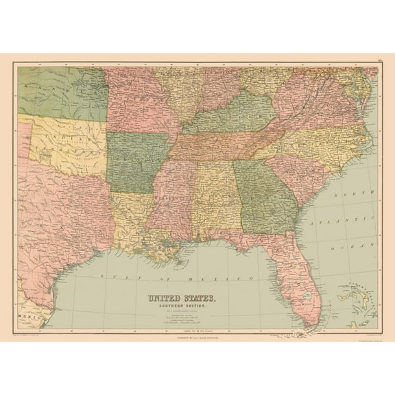
Historic State Map - United States South Eastern - Black 1867 - 31.47 x 23 - Vintage Wall Art $40.95
 3 optionsAvailable in additional 3 options$4095current price $40.95
Historic State Map - United States South Eastern - Black 1867 - 31.47 x 23 - Vintage Wall Art
Historic Map - North America United States Mexico Canada - Black 1867 $36.95
 $3695current price $36.95
Historic Map - North America United States Mexico Canada - Black 1867
Historic Map - South America - Black 1867 - Vintage Wall Art $36.95
 $3695current price $36.95
Historic Map - South America - Black 1867 - Vintage Wall Art
Historic Map - Northwest India - Black 1867 - Vintage Wall Art $36.95
 4 optionsAvailable in additional 4 options$3695current price $36.95
Historic Map - Northwest India - Black 1867 - Vintage Wall Art
Historic Map - German North Confederation - Black 1867 - Vintage Wall Art $36.95
 $3695current price $36.95
Historic Map - German North Confederation - Black 1867 - Vintage Wall Art
Historic Map - North Scotland - Black 1867 - 32.76 x 23 - Vintage Wall Art $40.95
 $4095current price $40.95
Historic Map - North Scotland - Black 1867 - 32.76 x 23 - Vintage Wall Art
Historic Map - South Scotland - Black 1867 - Vintage Wall Art $36.95
 $3695current price $36.95
Historic Map - South Scotland - Black 1867 - Vintage Wall Art
Historic Map - Europe Turkey - Black 1867 - Vintage Wall Art $36.95
 $3695current price $36.95
Historic Map - Europe Turkey - Black 1867 - Vintage Wall Art
Historic Map - Holland Belgium - Black 1867 - Vintage Wall Art $36.95
 $3695current price $36.95
Historic Map - Holland Belgium - Black 1867 - Vintage Wall Art
Historic State Map - United States General Map - Black 1867 - 29.93 x 23 - Vintage Wall Art $40.95 $40.95/count
 3 optionsAvailable in additional 3 options$4095current price $40.95$40.95/count
Historic State Map - United States General Map - Black 1867 - 29.93 x 23 - Vintage Wall Art
Historic Map - Prussia Germany - Black 1867 - Vintage Wall Art $36.95
 $3695current price $36.95
Historic Map - Prussia Germany - Black 1867 - Vintage Wall Art
Historic Map - Israel Ancient Divisions - Black 1867 - Vintage Wall Art $36.95
 $3695current price $36.95
Historic Map - Israel Ancient Divisions - Black 1867 - Vintage Wall Art
Historic Map - Russia - Black 1867 - Vintage Wall Art $36.95
 $3695current price $36.95
Historic Map - Russia - Black 1867 - Vintage Wall Art
Historic Map - South Africa - Black 1867 - Vintage Wall Art $36.95
 $3695current price $36.95
Historic Map - South Africa - Black 1867 - Vintage Wall Art
Historic Map - Ancient World - Black 1867 - Vintage Wall Art $36.95
 $3695current price $36.95
Historic Map - Ancient World - Black 1867 - Vintage Wall Art
Historic Map - Persia Afghanistan - Black 1867 - Vintage Wall Art $36.95
 4 optionsAvailable in additional 4 options$3695current price $36.95
Historic Map - Persia Afghanistan - Black 1867 - Vintage Wall Art
Historic Map - Greece - Black 1867 - Vintage Wall Art $36.95
 4 optionsAvailable in additional 4 options$3695current price $36.95
Historic Map - Greece - Black 1867 - Vintage Wall Art
Historic Map - Brazil Uruguay Paraguay Guayana - Black 1867 - Vintage Wall Art $36.95
 $3695current price $36.95
Historic Map - Brazil Uruguay Paraguay Guayana - Black 1867 - Vintage Wall Art
Historic Map - West Indies - Black 1867 - 32.59 x 23 - Vintage Wall Art $40.95
 4 optionsAvailable in additional 4 options$4095current price $40.95
Historic Map - West Indies - Black 1867 - 32.59 x 23 - Vintage Wall Art
Historic Map - New Zealand - Black 1867 - Vintage Wall Art $36.95
 $3695current price $36.95
Historic Map - New Zealand - Black 1867 - Vintage Wall Art
Customer ratings & reviews
0 ratings|0 reviews
This item does not have any reviews yet

Related pages
- Pa County Map
- State Capitol Map
- Historic Topographic Maps
- Topographic Map Elevation
- Map Of Pa Counties
- North East Map
- National Parks Posters
- World Map Wall Art
- Central America Travel Books, Maps & Guides
- Cyprus Travel Books
- Northeast United States Travel Books, Maps & Guides
- Southern United States Travel Books, Maps & Guides