
Hero image 0 of Historic County Map - Tulare County California - Thompson 1892 - Vintage Wall Art, 0 of 4
Historic County Map - Tulare County California - Thompson 1892 - Vintage Wall Art
(No ratings yet)
Historic County Map - Tulare County California - Thompson 1892 - Vintage Wall ArtHistoric County Map Tulare County California Thompson 1892 42 75 x 23 Vintage Wall ArtHistoric County Map Tulare County California Thompson 1892 Vintage Wall ArtHistoric County Map Tulare County California Thompson 1892 Vintage Wall ArtHistoric County Map Tulare County California Thompson 1892 42 75 x 23 Vintage Wall Art
Material:Matte Art
Size:42.75 x 23
Key item features
- HISTORICAL LOCAL MAPS MAKE GREAT WALL ART - Ever wonder what your country looked like during the early days of the USA? Well now you can find out! Maps of the Past provides maps from various time periods so you can track the history of your local city or town. These gorgiously detailed maps make for a great piece of art for your home or office. Own a piece of art and history today!
- LOCAL MAPS PROVIDE IMPORTANT INFORMATION - Local maps show you how the borders of a local are established and were they can be found. It also highlights rivers, mountains, and other natural element you may not know are there. Local maps can also show you transportation lanes across your local
- ONLY ACCEPT THE BEST PRINT QUALITY FOR YOUR REPRODUCTIONS - There are many printers and print types available on the market, when purchasing a reproduction there is no finer quality reproduction than a reproduction using the Giclee Printing method. Giclee describes the technique or style of printing used, and it is revered as the highest quality printing because of the way it precisely sprays ink onto a surface. Trust nothing less than the best!
- GUARANTEED TO GET EXACTLY WHAT YOU ORDERED - All of our maps come rolled, wrapped, and shipped in a heavy gauge mailing tube to ensure it arrives intact.
- WHY CHOOSE MAPS OF THE PAST? - Maps of the Past is one of the single largest producers of different types of maps. They legally own the rights to the maps they sell, and provide them to you in clean, clear, and vibrant print. If you are looking for a high quality map print, then look no further than Maps of the Past!
Specs
- ColorMulticolor
- Decor styleIndustrial
- ThemeHistorical County Maps
- FramedN
- ShapeRectangle
- Art typePhotography
Current price is USD$45.95
Price when purchased online
- Free shipping
 Free 30-day returns
How do you want your item?
Columbus, 43215
Arrives between Apr 17 - Apr 20
|Sold and shipped by Maps of the Past
4.3 stars out of 5, based on 10 seller reviews(4.3)10 seller reviews
Free 30-day returns
About this item
Product details
Old County Map - Tulare California - 1892 - This is an exquisite full-color Reproduction printed on gloss paper or art paper.
Sites and Townships Specific To This Map Are: References to: Farm Houses, Schools, Churches, Cemeteries, Blacksmith, Shops, Canals, Ditches, Orchards, Vineyards, Artesian Wells, Roads, Mount Whitney, Milestone Peak, Southern Pacific Railroad, McClures Valley, Kettleman Plains & Monache Meadows.
The following towns are featured: Dinuba, Trayer, Mineral King, Goshen, Visalia, Terradella & Springville.
This Map is Situated in: Tulare County, California.
SKU: CATU0002
Original Maps are often difficult to find and usually have fold lines, identifying stamps or markings, tears, ragged edges, and assorted other natural signs of age that detract from their beauty. All of our maps have been professionally restored to depict their original beauty, while keeping all historical data intact.
These maps are fabulous pieces of history full of information useful to Historians, Genealogists, Cartographers, Relic Hunters, & Others. They make fascinating conversation pieces and splendid works of art for the home or office.
- HISTORICAL LOCAL MAPS MAKE GREAT WALL ART - Ever wonder what your country looked like during the early days of the USA? Well now you can find out! Maps of the Past provides maps from various time periods so you can track the history of your local city or town. These gorgiously detailed maps make for a great piece of art for your home or office. Own a piece of art and history today!
- LOCAL MAPS PROVIDE IMPORTANT INFORMATION - Local maps show you how the borders of a local are established and were they can be found. It also highlights rivers, mountains, and other natural element you may not know are there. Local maps can also show you transportation lanes across your local
- ONLY ACCEPT THE BEST PRINT QUALITY FOR YOUR REPRODUCTIONS - There are many printers and print types available on the market, when purchasing a reproduction there is no finer quality reproduction than a reproduction using the Giclee Printing method. Giclee describes the technique or style of printing used, and it is revered as the highest quality printing because of the way it precisely sprays ink onto a surface. Trust nothing less than the best!
- GUARANTEED TO GET EXACTLY WHAT YOU ORDERED - All of our maps come rolled, wrapped, and shipped in a heavy gauge mailing tube to ensure it arrives intact.
- WHY CHOOSE MAPS OF THE PAST? - Maps of the Past is one of the single largest producers of different types of maps. They legally own the rights to the maps they sell, and provide them to you in clean, clear, and vibrant print. If you are looking for a high quality map print, then look no further than Maps of the Past!
info:
We aim to show you accurate product information. Manufacturers, suppliers and others provide what you see here, and we have not verified it.
Specifications
Color
Multicolor
Decor style
Industrial
Theme
Historical County Maps
Framed
N
Warranty
Warranty information
Please be aware that the warranty terms on items offered for sale by third party Marketplace sellers may differ from those displayed in this section (if any). To confirm warranty terms on an item offered for sale by a third party Marketplace seller, please use the 'Contact seller' feature on the third party Marketplace seller's information page and request the item's warranty terms prior to purchase.
Similar items you might like
Based on what customers bought
In 50+ people's carts Home Decor Collection Gold Metro Beaded Oval Framed Landscape Wall Art, Vintage-Style Décor for Living Room, Entryway, Bedroom, or Office, 14x11 $7.49
In 50+ people's carts $749current price $7.49
Home Decor Collection Gold Metro Beaded Oval Framed Landscape Wall Art, Vintage-Style Décor for Living Room, Entryway, Bedroom, or Office, 14x11
1774.4 out of 5 Stars. 177 reviewsHistoric State Map - California - 1650 - 23 x 32.68 - Vintage Wall Art $40.95 $40.95/count
 $4095current price $40.95$40.95/count
Historic State Map - California - 1650 - 23 x 32.68 - Vintage Wall Art
Historic County Map - Republic County Kansas - Everts 1887 - 23 x 27.16 - Vintage Wall Art $45.95 Was $74.95 $45.95/count
 2 optionsAvailable in additional 2 options$4595current price $45.95, Was $74.95$74.95$45.95/count
Historic County Map - Republic County Kansas - Everts 1887 - 23 x 27.16 - Vintage Wall Art
Historic County Map - Wright County Iowa - Andreas 1874 - 23 x 29.58 - Vintage Wall Art $40.95 $40.95/count
 $4095current price $40.95$40.95/count
Historic County Map - Wright County Iowa - Andreas 1874 - 23 x 29.58 - Vintage Wall Art
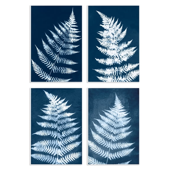
Stupell Industries Modern Fern Impressions Plants & Flowers Painting Unframed Art Print Wall Art, 10 x 15, Set of 4 $117.99
 2 optionsAvailable in additional 2 options$11799current price $117.99
Stupell Industries Modern Fern Impressions Plants & Flowers Painting Unframed Art Print Wall Art, 10 x 15, Set of 4
Historic County Map - Tarrant County Texas- General Land Office 1885 - 23 x 29.25 - Vintage Wall Art $40.95 $40.95/count
 $4095current price $40.95$40.95/count
Historic County Map - Tarrant County Texas- General Land Office 1885 - 23 x 29.25 - Vintage Wall Art
Stupell Industries Blue Seashells on Beige Animals Painting Unframed Art Print Wall Art, 11 x 14, Set of 4 $117.99
 $11799current price $117.99
Stupell Industries Blue Seashells on Beige Animals Painting Unframed Art Print Wall Art, 11 x 14, Set of 4
Historic County Map - La Porte County Indiana - Kelley 1937 - 23 x 30.16 - Vintage Wall Art $40.95
 $4095current price $40.95
Historic County Map - La Porte County Indiana - Kelley 1937 - 23 x 30.16 - Vintage Wall Art
Historic County Map - New Haven County Connecticut - Whiteford 1852 - 26.69 x 23 - Vintage Wall Art $45.95 Was $74.95
 $4595current price $45.95, Was $74.95$74.95
Historic County Map - New Haven County Connecticut - Whiteford 1852 - 26.69 x 23 - Vintage Wall Art
Historic County Map - Southern Counties California Geological - Fairbanks 1893 - 23 x 24.91 - Vintage Wall Art $45.95 Was $74.95 $45.95/count
 $4595current price $45.95, Was $74.95$74.95$45.95/count
Historic County Map - Southern Counties California Geological - Fairbanks 1893 - 23 x 24.91 - Vintage Wall Art
Stupell Industries Musical Tropical Birds Entertainment Painting Unframed Art Print Wall Art, 10 x 15, Set of 4 $117.99
 2 optionsAvailable in additional 2 options$11799current price $117.99
Stupell Industries Musical Tropical Birds Entertainment Painting Unframed Art Print Wall Art, 10 x 15, Set of 4
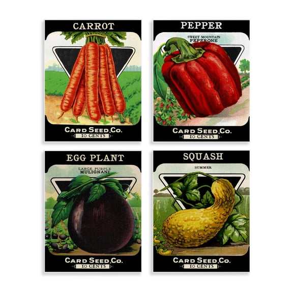
Stupell Industries Vintage Farm Garden Vegetables Food & Beverage Painting Unframed Art Print Wall Art, 11 x 14, Set of 4 $117.99
 $11799current price $117.99
Stupell Industries Vintage Farm Garden Vegetables Food & Beverage Painting Unframed Art Print Wall Art, 11 x 14, Set of 4
Historic City Map - Medford Massachusetts County - Walling 1855 - 23 x 24.39 - Vintage Wall Art $45.95 Was $74.95
 $4595current price $45.95, Was $74.95$74.95
Historic City Map - Medford Massachusetts County - Walling 1855 - 23 x 24.39 - Vintage Wall Art
Stupell Industries Minimal Shells & Anchor Nautical & Beach Painting Unframed Art Print Wall Art, 11 x 14, Set of 4 $117.99
 $11799current price $117.99
Stupell Industries Minimal Shells & Anchor Nautical & Beach Painting Unframed Art Print Wall Art, 11 x 14, Set of 4
Historic County Map - Carroll County Maryland - Martenet 1862 - 27.75 x 23 - Vintage Wall Art $45.95 Was $74.95
 $4595current price $45.95, Was $74.95$74.95
Historic County Map - Carroll County Maryland - Martenet 1862 - 27.75 x 23 - Vintage Wall Art
Historic County Map - Livingston County Michigan - Ogle 1895 - 23 x 32.29 - Vintage Wall Art $40.95
 $4095current price $40.95
Historic County Map - Livingston County Michigan - Ogle 1895 - 23 x 32.29 - Vintage Wall Art
Historic County Map - Leelanau County Michigan - Walling 1873 - 23 x 29.99 - Vintage Wall Art $40.95
 $4095current price $40.95
Historic County Map - Leelanau County Michigan - Walling 1873 - 23 x 29.99 - Vintage Wall Art
Historic County Map - Madison County Indiana - Andreas 1876 - 23 x 28.88 - Vintage Wall Art $45.95
 $4595current price $45.95
Historic County Map - Madison County Indiana - Andreas 1876 - 23 x 28.88 - Vintage Wall Art
Historic County Map - Charlevoix Antrim Counties Michigan - Walling 1873 - 23 x 29.69 - Vintage Wall Art $40.95 $40.95/count
 $4095current price $40.95$40.95/count
Historic County Map - Charlevoix Antrim Counties Michigan - Walling 1873 - 23 x 29.69 - Vintage Wall Art
Historic County Map - Orange County Indiana - Andreas 1876 - 23 x 28.31 - Vintage Wall Art $45.95
 $4595current price $45.95
Historic County Map - Orange County Indiana - Andreas 1876 - 23 x 28.31 - Vintage Wall Art
Customer ratings & reviews
0 ratings|0 reviews
This item does not have any reviews yet

Related pages
- Oregon Map By County
- Colorado Springs Map
- Map Utah Counties
- Kentucky Counties Map
- Map Wenatchee Wa
- Tallahassee Florida Map
- Central America Travel Books, Maps & Guides
- National Parks Posters
- Northeast United States Travel Books, Maps & Guides
- General South America Travel Books, Maps & Guides
- Ontario Travel Books, Maps & Guides
- Southern United States Travel Books, Maps & Guides