Petaluma Map(3)
Uses item details. Price when purchased online
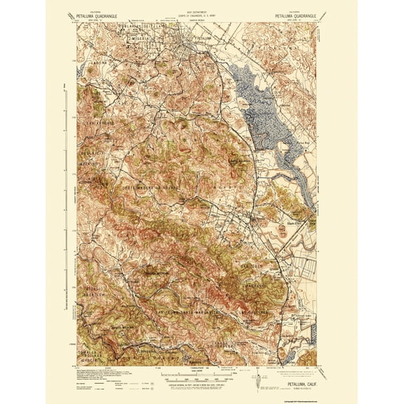
Topographical Map - Petaluma California Quad - USGS 1942 - Vintage Wall Art From $36.95
2 options
Available in additional 2 optionsFrom$3695
Topographical Map - Petaluma California Quad - USGS 1942 - Vintage Wall Art
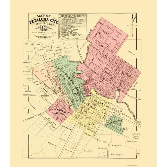
Historic City Map - Petaluma California - Thompson 1877 - Vintage Wall Art From $36.95
2 options
Available in additional 2 optionsFrom$3695
Historic City Map - Petaluma California - Thompson 1877 - Vintage Wall Art
Historic City Map - Petaluma California - Thompson 1877 - Vintage Wall Art From $36.95

2 options
Available in additional 2 optionsFrom$3695
Historic City Map - Petaluma California - Thompson 1877 - Vintage Wall Art
Other options to consider(88)
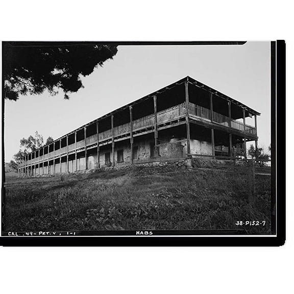
Historic Print, Vallejo Adobe, Adobe Road at Casa Grande, Petaluma vicinity, Sonoma County, CA - 4, 16" x 20"

Historic Print, Vallejo Adobe, Adobe Road at Casa Grande, Petaluma vicinity, Sonoma County, CA - 4, 16" x 20"
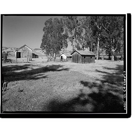
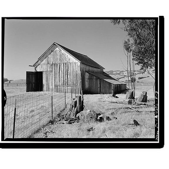
Historic Print, Schlake Ranch, 2300 East Washington Street, Petaluma, Sonoma County, CA, 18" x 24"
Historic Print, Schlake Ranch, 2300 East Washington Street, Petaluma, Sonoma County, CA, 18" x 24"
Historic Print, Vallejo Adobe, Adobe Road at Casa Grande, Petaluma vicinity, Sonoma County, CA - 4, 16" x 20" From $57.00

2 options
Available in additional 2 optionsFrom$5700
Historic Print, Vallejo Adobe, Adobe Road at Casa Grande, Petaluma vicinity, Sonoma County, CA - 4, 16" x 20"
Historic Print, Adobe, Northeast of Petaluma on Pacific Duck Farm, Petaluma vicinity, Sonoma County, CA, 16" x 20"
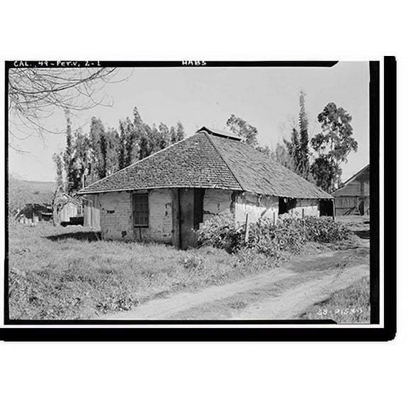
Historic Print, Adobe, Northeast of Petaluma on Pacific Duck Farm, Petaluma vicinity, Sonoma County, CA, 16" x 20"
Historic Print, Vallejo Adobe, Adobe Road at Casa Grande, Petaluma vicinity, Sonoma County, CA - 3, 18" x 24"

Historic Print, Vallejo Adobe, Adobe Road at Casa Grande, Petaluma vicinity, Sonoma County, CA - 3, 18" x 24"
Historic Print, Vallejo Adobe, Adobe Road at Casa Grande, Petaluma vicinity, Sonoma County, CA, 16" x 20" From $57.00

2 options
Available in additional 2 optionsFrom$5700
Historic Print, Vallejo Adobe, Adobe Road at Casa Grande, Petaluma vicinity, Sonoma County, CA, 16" x 20"
Historic Print, Schlake Ranch, Pumphouse, 2300 East Washington Street, Petaluma, Sonoma County, CA, 18" x 24"

Historic Print, Schlake Ranch, Pumphouse, 2300 East Washington Street, Petaluma, Sonoma County, CA, 18" x 24"
Historic Print, Vallejo Adobe, Adobe Road at Casa Grande, Petaluma vicinity, Sonoma County, CA, 16" x 20" From $57.00
2 options
Available in additional 2 optionsFrom$5700
Historic Print, Vallejo Adobe, Adobe Road at Casa Grande, Petaluma vicinity, Sonoma County, CA, 16" x 20"
Historic Print, Vallejo Adobe, Adobe Road at Casa Grande, Petaluma vicinity, Sonoma County, CA - 8, 16" x 20" From $57.00

2 options
Available in additional 2 optionsFrom$5700
Historic Print, Vallejo Adobe, Adobe Road at Casa Grande, Petaluma vicinity, Sonoma County, CA - 8, 16" x 20"
Historic Print, Vallejo Adobe, Adobe Road at Casa Grande, Petaluma vicinity, Sonoma County, CA - 10, 18" x 24"

Historic Print, Vallejo Adobe, Adobe Road at Casa Grande, Petaluma vicinity, Sonoma County, CA - 10, 18" x 24"
Historic Print, Vallejo Adobe, Adobe Road at Casa Grande, Petaluma vicinity, Sonoma County, CA - 2, 16" x 20" From $57.00

2 options
Available in additional 2 optionsFrom$5700
Historic Print, Vallejo Adobe, Adobe Road at Casa Grande, Petaluma vicinity, Sonoma County, CA - 2, 16" x 20"
Historic Print, Vallejo Adobe, Adobe Road at Casa Grande, Petaluma vicinity, Sonoma County, CA - 15, 16" x 20" From $57.00

2 options
Available in additional 2 optionsFrom$5700
Historic Print, Vallejo Adobe, Adobe Road at Casa Grande, Petaluma vicinity, Sonoma County, CA - 15, 16" x 20"
Historic Print, Vallejo Adobe, Adobe Road at Casa Grande, Petaluma vicinity, Sonoma County, CA - 2, 16" x 20" From $57.00

2 options
Available in additional 2 optionsFrom$5700
Historic Print, Vallejo Adobe, Adobe Road at Casa Grande, Petaluma vicinity, Sonoma County, CA - 2, 16" x 20"
Historic Print, Vallejo Adobe, Adobe Road at Casa Grande, Petaluma vicinity, Sonoma County, CA - 8, 18" x 24"

Historic Print, Vallejo Adobe, Adobe Road at Casa Grande, Petaluma vicinity, Sonoma County, CA - 8, 18" x 24"
Historic Print, Vallejo Adobe, Adobe Road at Casa Grande, Petaluma vicinity, Sonoma County, CA - 14, 18" x 24"

Historic Print, Vallejo Adobe, Adobe Road at Casa Grande, Petaluma vicinity, Sonoma County, CA - 14, 18" x 24"
Historic Print, Vallejo Adobe, Adobe Road at Casa Grande, Petaluma vicinity, Sonoma County, CA - 7, 16" x 20" From $57.00

2 options
Available in additional 2 optionsFrom$5700
Historic Print, Vallejo Adobe, Adobe Road at Casa Grande, Petaluma vicinity, Sonoma County, CA - 7, 16" x 20"
Historic Print, Vallejo Adobe, Adobe Road at Casa Grande, Petaluma vicinity, Sonoma County, CA - 6, 16" x 20" From $57.00

2 options
Available in additional 2 optionsFrom$5700
Historic Print, Vallejo Adobe, Adobe Road at Casa Grande, Petaluma vicinity, Sonoma County, CA - 6, 16" x 20"
Historic Print, Vallejo Adobe, Adobe Road at Casa Grande, Petaluma vicinity, Sonoma County, CA - 9, 16" x 20" From $57.00

2 options
Available in additional 2 optionsFrom$5700
Historic Print, Vallejo Adobe, Adobe Road at Casa Grande, Petaluma vicinity, Sonoma County, CA - 9, 16" x 20"
Historic Print, Vallejo Adobe, Adobe Road at Casa Grande, Petaluma vicinity, Sonoma County, CA - 5, 18" x 24"

Historic Print, Vallejo Adobe, Adobe Road at Casa Grande, Petaluma vicinity, Sonoma County, CA - 5, 18" x 24"
Historic Print, Vallejo Adobe, Adobe Road at Casa Grande, Petaluma vicinity, Sonoma County, CA - 9, 18" x 24"

Historic Print, Vallejo Adobe, Adobe Road at Casa Grande, Petaluma vicinity, Sonoma County, CA - 9, 18" x 24"
Historic Print, Schlake Ranch, New Barn, 2300 East Washington Street, Petaluma, Sonoma County, CA - 3, 16" x 20" From $57.00
2 options
Available in additional 2 optionsFrom$5700
Historic Print, Schlake Ranch, New Barn, 2300 East Washington Street, Petaluma, Sonoma County, CA - 3, 16" x 20"
Petaluma Poster - Wine Country Posters, Petaluma Art Poster, Sonoma Wine Country, California, Vineyard WCP-0001 (18x24 Art Print, Wall Decor Travel Poster) $35.00

$3500
current price $35.00Petaluma Poster - Wine Country Posters, Petaluma Art Poster, Sonoma Wine Country, California, Vineyard WCP-0001 (18x24 Art Print, Wall Decor Travel Poster)
Historic Print, Schlake Ranch, New Barn, 2300 East Washington Street, Petaluma, Sonoma County, CA, 16" x 20" From $57.00

2 options
Available in additional 2 optionsFrom$5700
Historic Print, Schlake Ranch, New Barn, 2300 East Washington Street, Petaluma, Sonoma County, CA, 16" x 20"
Historic Print, Schlake Ranch, Water Tower, 2300 East Washington Street, Petaluma, Sonoma County, CA, 18" x 24"

Historic Print, Schlake Ranch, Water Tower, 2300 East Washington Street, Petaluma, Sonoma County, CA, 18" x 24"
Historic Print, Schlake Ranch, New Barn, 2300 East Washington Street, Petaluma, Sonoma County, CA - 2, 16" x 20"

Historic Print, Schlake Ranch, New Barn, 2300 East Washington Street, Petaluma, Sonoma County, CA - 2, 16" x 20"
Historic Print, Vallejo Adobe, Adobe Road at Casa Grande, Petaluma vicinity, Sonoma County, CA - 19, 16" x 20" From $57.00

2 options
Available in additional 2 optionsFrom$5700
Historic Print, Vallejo Adobe, Adobe Road at Casa Grande, Petaluma vicinity, Sonoma County, CA - 19, 16" x 20"
Historic Print, Schlake Ranch, Poultry Complex, 2300 East Washington Street, Petaluma, Sonoma County, CA, 16" x 20" From $57.00

2 options
Available in additional 2 optionsFrom$5700
Historic Print, Schlake Ranch, Poultry Complex, 2300 East Washington Street, Petaluma, Sonoma County, CA, 16" x 20"
Historic Print, Vallejo Adobe, Adobe Road at Casa Grande, Petaluma vicinity, Sonoma County, CA - 22, 16" x 20"

Historic Print, Vallejo Adobe, Adobe Road at Casa Grande, Petaluma vicinity, Sonoma County, CA - 22, 16" x 20"
Historic Print, Vallejo Adobe, Adobe Road at Casa Grande, Petaluma vicinity, Sonoma County, CA - 10, 16" x 20"

Historic Print, Vallejo Adobe, Adobe Road at Casa Grande, Petaluma vicinity, Sonoma County, CA - 10, 16" x 20"
Historic Print, Schlake Ranch, Farmhouse, 2300 East Washington Street, Petaluma, Sonoma County, CA, 18" x 24"

Historic Print, Schlake Ranch, Farmhouse, 2300 East Washington Street, Petaluma, Sonoma County, CA, 18" x 24"
Historic Print, Vallejo Adobe, Adobe Road at Casa Grande, Petaluma vicinity, Sonoma County, CA - 5, 16" x 20" From $57.00

2 options
Available in additional 2 optionsFrom$5700
Historic Print, Vallejo Adobe, Adobe Road at Casa Grande, Petaluma vicinity, Sonoma County, CA - 5, 16" x 20"
Historic Print, Schlake Ranch, Old Barn, 2300 Washington Street, Petaluma, Sonoma County, CA, 16" x 20" From $57.00

2 options
Available in additional 2 optionsFrom$5700
Historic Print, Schlake Ranch, Old Barn, 2300 Washington Street, Petaluma, Sonoma County, CA, 16" x 20"
Historic Print, Vallejo Adobe, Adobe Road at Casa Grande, Petaluma vicinity, Sonoma County, CA - 3, 16" x 20" From $57.00

2 options
Available in additional 2 optionsFrom$5700
Historic Print, Vallejo Adobe, Adobe Road at Casa Grande, Petaluma vicinity, Sonoma County, CA - 3, 16" x 20"
Historic Print, Schlake Ranch, Old Barn, 2300 Washington Street, Petaluma, Sonoma County, CA - 3, 16" x 20" From $57.00

2 options
Available in additional 2 optionsFrom$5700
Historic Print, Schlake Ranch, Old Barn, 2300 Washington Street, Petaluma, Sonoma County, CA - 3, 16" x 20"
Historic Print, Vallejo Adobe, Adobe Road at Casa Grande, Petaluma vicinity, Sonoma County, CA - 7, 16" x 20"

Historic Print, Vallejo Adobe, Adobe Road at Casa Grande, Petaluma vicinity, Sonoma County, CA - 7, 16" x 20"
Historic Print, Vallejo Adobe, Adobe Road at Casa Grande, Petaluma vicinity, Sonoma County, CA - 13, 16" x 20"

Historic Print, Vallejo Adobe, Adobe Road at Casa Grande, Petaluma vicinity, Sonoma County, CA - 13, 16" x 20"
Historic Print, Vallejo Adobe, Adobe Road at Casa Grande, Petaluma vicinity, Sonoma County, CA - 18, 16" x 20"

Historic Print, Vallejo Adobe, Adobe Road at Casa Grande, Petaluma vicinity, Sonoma County, CA - 18, 16" x 20"
Popular in Petaluma Map
Related Products
Historic Map - Europe Baltic Sea Surroundings - Stieler 1885 - Vintage Wall Art
 Historic Map - Europe Baltic Sea Surroundings - Stieler 1885 - Vintage Wall Art$45.95current price $45.95
Historic Map - Oceania Polynesia East Pacific - Stieler 1885 - Vintage Wall Art
 Historic Map - Oceania Polynesia East Pacific - Stieler 1885 - Vintage Wall Art$40.95current price $40.95
Historic Map - Russia Baltic Sea - Radefeld 1855 - Vintage Wall Art
 Historic Map - Russia Baltic Sea - Radefeld 1855 - Vintage Wall Art$40.95current price $40.95
Vintage 1893 Map of Hawaii Wall Art Featuring the Hawaiian Islands with Historical Text and Statistical Data
 Vintage 1893 Map of Hawaii Wall Art Featuring the Hawaiian Islands with Historical Text and Statistical Data$17.51current price $17.51
Historic Map - West Midlands England - Bartholomew 1892 - Vintage Wall Art
 Historic Map - West Midlands England - Bartholomew 1892 - Vintage Wall Art$45.95current price $45.95
1893 Map of Hawaii - Vintage Map of Hawaiian Islands Wall Art - Hawaii Vintage Map Includes Text and Statistical Data - Vintage Map Hawaii - Hawaii Map Poster
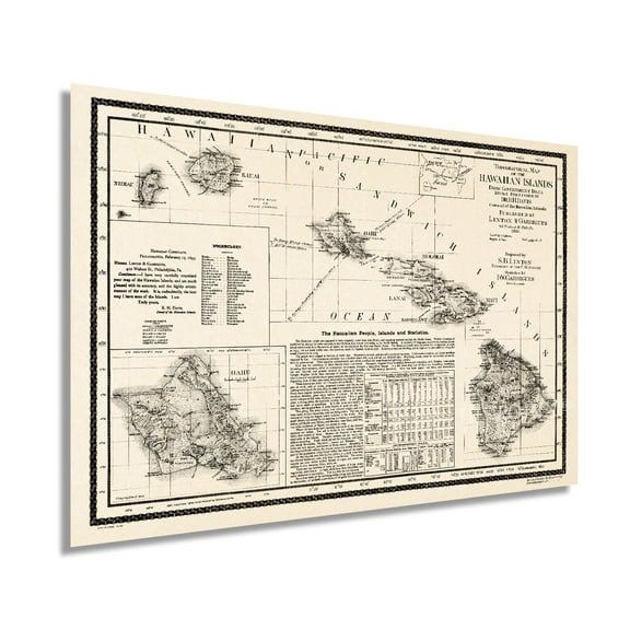 1893 Map of Hawaii - Vintage Map of Hawaiian Islands Wall Art - Hawaii Vintage Map Includes Text and Statistical Data - Vintage Map Hawaii - Hawaii Map Poster$39.99current price $39.99
Historic State Map - New Jersey United States - Cram 1888 - Vintage Wall Art
 Historic State Map - New Jersey United States - Cram 1888 - Vintage Wall Art$40.95current price $40.95
Sequoia & Kings Canyon National Parks Hand-Drawn Map - Authentic 18x24 Vintage-Style Wall Art - Lithographic Print with Soy-Based Inks - Made in USA
 Sequoia & Kings Canyon National Parks Hand-Drawn Map - Authentic 18x24 Vintage-Style Wall Art - Lithographic Print with Soy-Based Inks - Made in USA$27.73current price $27.73
Historic State Map - Rhode Island - Alden 1886 - Vintage Wall Art
 Historic State Map - Rhode Island - Alden 1886 - Vintage Wall Art$40.95current price $40.95
Xplorer Maps Chesapeake Bay Hand-Drawn Map Print - Authentic 18x24 Inch Vintage-Style Wall Art - Lithographic Print with Soy-Based Inks - Made In USA
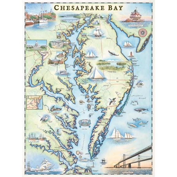 Xplorer Maps Chesapeake Bay Hand-Drawn Map Print - Authentic 18x24 Inch Vintage-Style Wall Art - Lithographic Print with Soy-Based Inks - Made In USA$31.37current price $31.37
Historic City Map - Pensacola Florida - Bellin 1764 - Vintage Wall Art
 Historic City Map - Pensacola Florida - Bellin 1764 - Vintage Wall Art$40.95current price $40.95
Historic Map - Peru - Cram 1892 - Vintage Wall Art
 Historic Map - Peru - Cram 1892 - Vintage Wall Art$40.95current price $40.95
Historic State Map - Florida - Cram 1892 - Vintage Wall Art
 Historic State Map - Florida - Cram 1892 - Vintage Wall Art$40.95current price $40.95
Historic Map - Tasmania Australia - Cram 1892 - Vintage Wall Art
 Historic Map - Tasmania Australia - Cram 1892 - Vintage Wall Art$45.95current price $45.95
Historic Map - East Indies - Bartholomew 1892 - Vintage Wall Art
 Historic Map - East Indies - Bartholomew 1892 - Vintage Wall Art$45.95current price $45.95
Historic Map - Hawaii Fiji Tahiti - Bartholomew 1892 - Vintage Wall Art
 Historic Map - Hawaii Fiji Tahiti - Bartholomew 1892 - Vintage Wall Art$40.95current price $40.95
Historic Map - Epping Forest London England - Philip 1904 - Vintage Wall Art
 Historic Map - Epping Forest London England - Philip 1904 - Vintage Wall Art$45.95current price $45.95