
Hero image 0 of Topographical Map - Newport Rhode Island Sheet - USGS 1894 - 23 x 29.52 - Vintage Wall Art, 0 of 5
Topographical Map - Newport Rhode Island Sheet - USGS 1894 - 23 x 29.52 - Vintage Wall Art
(No ratings yet)
Key item features
- OWN A HISTORICAL TOPOGRAPHICAL MAP TODAY - Topographical maps provide you a birds-eye view of how the topography of certain pieces of land are mapped out. See how much today's maps have changed from centuries ago. See how waterways have shifted, or how forrests have become thralling cities. See how history has changed the landscape with a topographical map today!
- TOPOGRAPHICAL MAPS PROVIDE IMPORTANT INFORMATION -Topographical maps show you how the borders of a county are established and were they can be found. It also highlights rivers, mountains, and other natural elements, and it will show you where the cities are located within it.
- ONLY ACCEPT THE BEST PRINT QUALITY FOR YOUR REPRODUCTIONS - There are many printers and print types available on the market, when purchasing a reproduction there is no finer quality reproduction than a reproduction using the Giclee Printing method. Giclee describes the technique or style of printing used, and it is revered as the highest quality printing because of the way it precisely sprays ink onto a surface. Trust nothing less than the best!
- GUARNANTEED TO GET EXACTLY WHAT YOU ORDERED - This map comes exactly to the specification of 23.00 x 29.52 inches/58.42 X 74.98 cm. All of our maps come rolled, wrapped, and shipped in a heavy gauge mailing tube to ensure it arrives intact.
- WHY CHOOSE MAPS OF THE PAST? - Maps of the Past is one of the single largest producers of different types of maps. They legally own the rights to the maps they sell, and provide them to you in clean, clear, and vibrant print. If you are looking for a high quality map print, then look no further than Maps of the Past!
Specs
- Size23.00 x 29.52
- MaterialMatte Art
- Decor styleVintage
- ThemeHistoric Topographic Maps
- ShapeRectangle
- Art typePainting
Current price is USDNow $40.95
You save $5.00
was $45.95$45.95
$40.95/countYou save$5.00
Price when purchased online
- Free shipping
 Free 30-day returns
How do you want your item?
Columbus, 43215
Arrives between Apr 11 - Apr 13
|Sold and shipped by Maps of the Past
4.3 stars out of 5, based on 10 seller reviews(4.3)10 seller reviews
Free 30-day returns
Check out these related products
Historic Map - Badgastein Austria - Baedeker 1910 - 23 x 32.45 - Vintage Wall Art $40.95 $40.95/count
 3 optionsAvailable in additional 3 options$4095current price $40.95$40.95/count
Historic Map - Badgastein Austria - Baedeker 1910 - 23 x 32.45 - Vintage Wall Art
Topographical Map - Pennsylvania Quakertown Sheet - USGS 1888 - 23 x 28.43 - Vintage Wall Art $40.95
 $4095current price $40.95
Topographical Map - Pennsylvania Quakertown Sheet - USGS 1888 - 23 x 28.43 - Vintage Wall Art
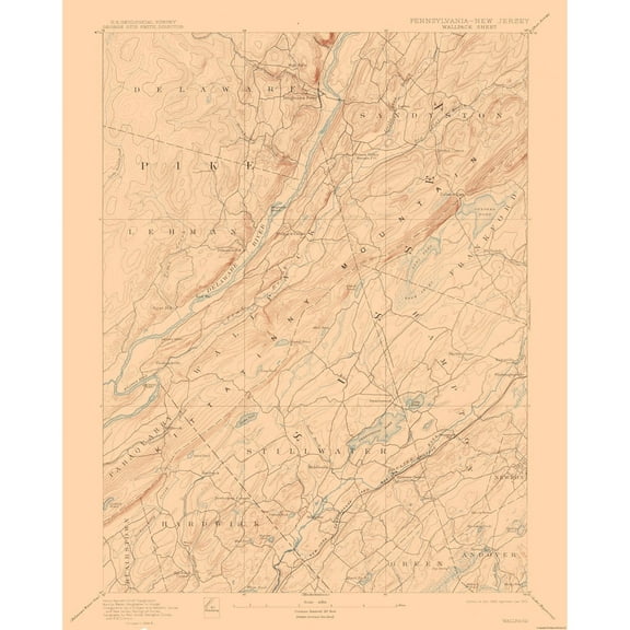
Topographical Map - Pennsylvania Wallpack Sheet - USGS 1893 - 23 x 28.70 - Vintage Wall Art $40.95 $40.95/count
 $4095current price $40.95$40.95/count
Topographical Map - Pennsylvania Wallpack Sheet - USGS 1893 - 23 x 28.70 - Vintage Wall Art
Topographical Map - Narragansett Bay Rhode Island Sheet - USGS 1892 - 23 x 29.75 - Vintage Wall Art $40.95 $40.95/count
 3 optionsAvailable in additional 3 options$4095current price $40.95$40.95/count
Topographical Map - Narragansett Bay Rhode Island Sheet - USGS 1892 - 23 x 29.75 - Vintage Wall Art
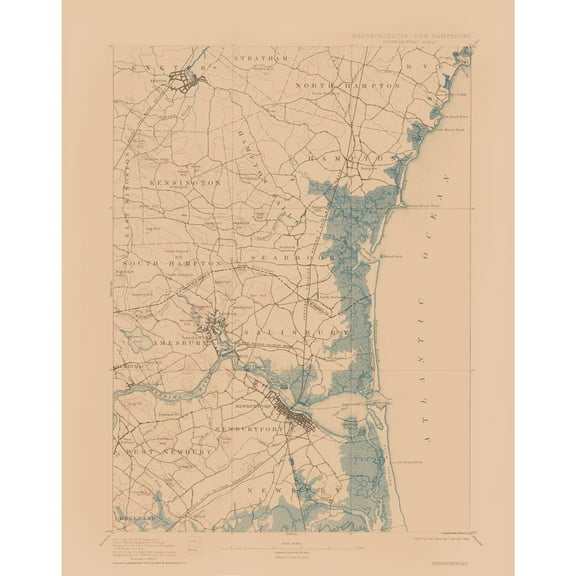
Topographical Map - Newburyport Massachusetts Sheet - USGS 1894 - Vintage Wall Art $36.95
 4 optionsAvailable in additional 4 options$3695current price $36.95
Topographical Map - Newburyport Massachusetts Sheet - USGS 1894 - Vintage Wall Art
Topographical Map - Patrick Wyoming Sheet - USGS 1946 - 23 x 30.46 - Vintage Wall Art $40.95
 $4095current price $40.95
Topographical Map - Patrick Wyoming Sheet - USGS 1946 - 23 x 30.46 - Vintage Wall Art
Historic Map - Brunn Germany - Baedeker 1910 - 30.88 x 23 - Vintage Wall Art $40.95 $40.95/count
 3 optionsAvailable in additional 3 options$4095current price $40.95$40.95/count
Historic Map - Brunn Germany - Baedeker 1910 - 30.88 x 23 - Vintage Wall Art
Historic State Map - Wisconsin - Alden 1886 - 23 x 35.83 - Vintage Wall Art $40.95 $40.95/count
 $4095current price $40.95$40.95/count
Historic State Map - Wisconsin - Alden 1886 - 23 x 35.83 - Vintage Wall Art
Topographical Map - Massachusetts Marthas Vineyard Sheet - USGS 1894 - 23 x 29.52 - Vintage Wall Art $40.95 $40.95/count
 4 optionsAvailable in additional 4 options$4095current price $40.95$40.95/count
Topographical Map - Massachusetts Marthas Vineyard Sheet - USGS 1894 - 23 x 29.52 - Vintage Wall Art
Topographical Map - Newfield Maine Sheet - USGS 1893 - Vintage Wall Art $36.95
 $3695current price $36.95
Topographical Map - Newfield Maine Sheet - USGS 1893 - Vintage Wall Art
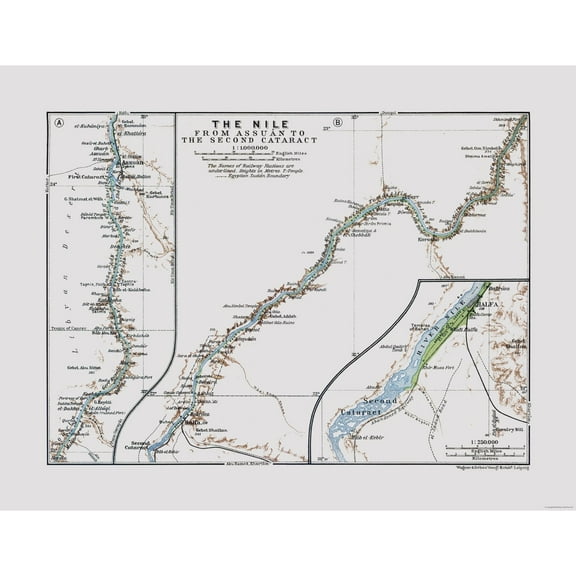
Historic Map - Aswan Egypt Second Cataract - Baedeker 1913 - 29.75 x 23 - Vintage Wall Art $40.95
 $4095current price $40.95
Historic Map - Aswan Egypt Second Cataract - Baedeker 1913 - 29.75 x 23 - Vintage Wall Art
Topographical Map - Neshannock Pennsylvania Quad - USGS 1907 - 23 x 28.72 - Vintage Wall Art $40.95
 $4095current price $40.95
Topographical Map - Neshannock Pennsylvania Quad - USGS 1907 - 23 x 28.72 - Vintage Wall Art
Historic Map - United Kingdom Britannia Hibernia - Spruner 1865 - 23 x 26.06 - Vintage Wall Art $40.95 $40.95/count
 3 optionsAvailable in additional 3 options$4095current price $40.95$40.95/count
Historic Map - United Kingdom Britannia Hibernia - Spruner 1865 - 23 x 26.06 - Vintage Wall Art
Topographical Map - Camden Illinois Quad - USGS 1981 - 23 x 31.17 - Vintage Wall Art $40.95 $40.95/count
 $4095current price $40.95$40.95/count
Topographical Map - Camden Illinois Quad - USGS 1981 - 23 x 31.17 - Vintage Wall Art
Historic State Map - Virginia - Flowman 1814 - 29.04 x 23 - Vintage Wall Art $40.95
 $4095current price $40.95
Historic State Map - Virginia - Flowman 1814 - 29.04 x 23 - Vintage Wall Art
Historical Civil War Map - Spotsylvania County Hanover Junction - Campbell 1894 - Vintage Wall Art $36.95
 $3695current price $36.95
Historical Civil War Map - Spotsylvania County Hanover Junction - Campbell 1894 - Vintage Wall Art
Historic Map - Europe - De L'isle 1731 - 44.85 x 23 - Vintage Wall Art $40.95 $40.95/count
 3 optionsAvailable in additional 3 options$4095current price $40.95$40.95/count
Historic Map - Europe - De L'isle 1731 - 44.85 x 23 - Vintage Wall Art
Historic County Map - Comanche County Texas - Walsh 1879 - 24.01 x 23 - Vintage Wall Art $40.95
 $4095current price $40.95
Historic County Map - Comanche County Texas - Walsh 1879 - 24.01 x 23 - Vintage Wall Art
Historic Map - South America - Spruner 1855 - 27.89 x 23 - Vintage Wall Art $40.95 $40.95/count
 3 optionsAvailable in additional 3 options$4095current price $40.95$40.95/count
Historic Map - South America - Spruner 1855 - 27.89 x 23 - Vintage Wall Art
Historic State Map - Massachusetts - Alden 1886 - 35.47 x 23 - Vintage Wall Art $40.95
 $4095current price $40.95
Historic State Map - Massachusetts - Alden 1886 - 35.47 x 23 - Vintage Wall Art
About this item
Product details
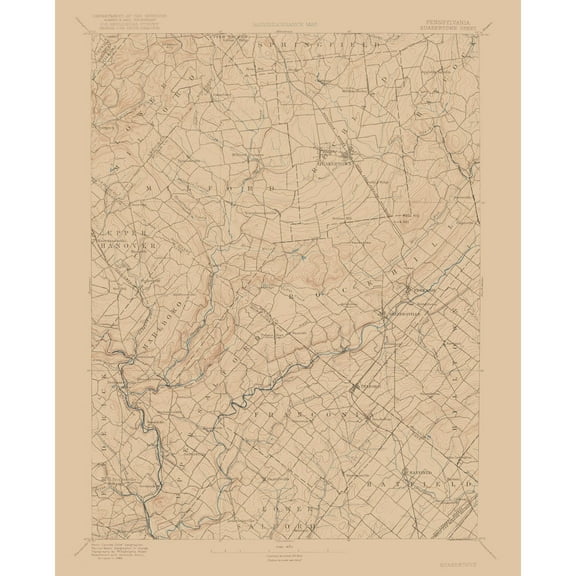
Historical Topographic Maps - Newport Rhode Island Sheet - USGS 1894 - This is an exquisite full-color Reproduction printed on high-quality gloss paper, art paper or canvas.
Print Size: 23.00 x 29.52 inches
58.42 X 74.98cm
The following towns are featured: Mooresfield, Wakefield, Bridgetown, Narragansett Pier, Newport.
This Map is Situated in: Newport, Rhode Island.
SKU: RINP0001
Original Maps are often difficult to find and usually have fold lines, identifying stamps or markings, tears, ragged edges, and assorted other natural signs of age that detract from their beauty. All of our maps have been professionally restored to depict their original beauty, while keeping all historical data intact.
These maps are fabulous pieces of history full of information useful to Historians, Genealogists, Cartographers, Relic Hunters, & Others. They make fascinating conversation pieces and splendid works of art for the home or office.
- OWN A HISTORICAL TOPOGRAPHICAL MAP TODAY - Topographical maps provide you a birds-eye view of how the topography of certain pieces of land are mapped out. See how much today's maps have changed from centuries ago. See how waterways have shifted, or how forrests have become thralling cities. See how history has changed the landscape with a topographical map today!
- TOPOGRAPHICAL MAPS PROVIDE IMPORTANT INFORMATION -Topographical maps show you how the borders of a county are established and were they can be found. It also highlights rivers, mountains, and other natural elements, and it will show you where the cities are located within it.
- ONLY ACCEPT THE BEST PRINT QUALITY FOR YOUR REPRODUCTIONS - There are many printers and print types available on the market, when purchasing a reproduction there is no finer quality reproduction than a reproduction using the Giclee Printing method. Giclee describes the technique or style of printing used, and it is revered as the highest quality printing because of the way it precisely sprays ink onto a surface. Trust nothing less than the best!
- GUARNANTEED TO GET EXACTLY WHAT YOU ORDERED - This map comes exactly to the specification of 23.00 x 29.52 inches/58.42 X 74.98 cm. All of our maps come rolled, wrapped, and shipped in a heavy gauge mailing tube to ensure it arrives intact.
- WHY CHOOSE MAPS OF THE PAST? - Maps of the Past is one of the single largest producers of different types of maps. They legally own the rights to the maps they sell, and provide them to you in clean, clear, and vibrant print. If you are looking for a high quality map print, then look no further than Maps of the Past!
info:
We aim to show you accurate product information. Manufacturers, suppliers and others provide what you see here, and we have not verified it.
Specifications
Size
23.00 x 29.52
Material
Matte Art
Decor style
Vintage
Theme
Historic Topographic Maps
Warranty
Warranty information
Please be aware that the warranty terms on items offered for sale by third party Marketplace sellers may differ from those displayed in this section (if any). To confirm warranty terms on an item offered for sale by a third party Marketplace seller, please use the 'Contact seller' feature on the third party Marketplace seller's information page and request the item's warranty terms prior to purchase.
Customer ratings & reviews
0 ratings|0 reviews
This item does not have any reviews yet
