Hero image 0 of Topographical Map - Taylor Ranch Wyoming Quad - USGS 1954 - 23 x 32.15 - Vintage Wall Art, 0 of 5
Topographical Map - Taylor Ranch Wyoming Quad - USGS 1954 - 23 x 32.15 - Vintage Wall Art
(No ratings yet)
Key item features
- OWN A HISTORICAL TOPOGRAPHICAL MAP TODAY - Topographical maps provide you a birds-eye view of how the topography of certain pieces of land are mapped out. See how much today's maps have changed from centuries ago. See how waterways have shifted, or how forrests have become thralling cities. See how history has changed the landscape with a topographical map today!
- TOPOGRAPHICAL MAPS PROVIDE IMPORTANT INFORMATION -Topographical maps show you how the borders of a county are established and were they can be found. It also highlights rivers, mountains, and other natural elements, and it will show you where the cities are located within it.
- ONLY ACCEPT THE BEST PRINT QUALITY FOR YOUR REPRODUCTIONS - There are many printers and print types available on the market, when purchasing a reproduction there is no finer quality reproduction than a reproduction using the Giclee Printing method. Giclee describes the technique or style of printing used, and it is revered as the highest quality printing because of the way it precisely sprays ink onto a surface. Trust nothing less than the best!
- GUARNANTEED TO GET EXACTLY WHAT YOU ORDERED - This map comes exactly to the specification of 23.00 x 32.14 inches/58.42 X 81.63 cm. All of our maps come rolled, wrapped, and shipped in a heavy gauge mailing tube to ensure it arrives intact.
- WHY CHOOSE MAPS OF THE PAST? - Maps of the Past is one of the single largest producers of different types of maps. They legally own the rights to the maps they sell, and provide them to you in clean, clear, and vibrant print. If you are looking for a high quality map print, then look no further than Maps of the Past!
Specs
- Size23.00 x 32.14
- MaterialMatte Art
- Decor styleVintage
- ThemeHistoric Topographic Maps
- ShapeRectangle
- Rec. roomOffice
Current price is USD$45.95
Price when purchased online
- Free shipping
 Free 30-day returns
How do you want your item?
Columbus, 43215
Arrives between Apr 11 - Apr 13
|Sold and shipped by Maps of the Past
4.3 stars out of 5, based on 10 seller reviews(4.3)10 seller reviews
Free 30-day returns
Check out these related products
Topographical Map - Austin Ranch Wyoming Quad - USGS 1961 - 23 x 31.51 - Vintage Wall Art $40.95
 $4095current price $40.95
Topographical Map - Austin Ranch Wyoming Quad - USGS 1961 - 23 x 31.51 - Vintage Wall Art
Topographical Map - Graham Ranch Wyoming Quad - USGS 1951 - 23 x 31.67 - Vintage Wall Art $40.95
 3 optionsAvailable in additional 3 options$4095current price $40.95
Topographical Map - Graham Ranch Wyoming Quad - USGS 1951 - 23 x 31.67 - Vintage Wall Art
Topographical Map - Bryant Ranch Texas Quad - USGS 1964 - 23 x 28.10 - Vintage Wall Art $40.95
 $4095current price $40.95
Topographical Map - Bryant Ranch Texas Quad - USGS 1964 - 23 x 28.10 - Vintage Wall Art
Topographical Map - TTT Ranch Wyoming Quad - USGS 1961 - 23 x 31.00 - Vintage Wall Art $40.95
 $4095current price $40.95
Topographical Map - TTT Ranch Wyoming Quad - USGS 1961 - 23 x 31.00 - Vintage Wall Art
Topographical Map - Dilts Ranch Wyoming Quad - USGS 1950 - 23 x 30.97 - Vintage Wall Art $40.95
 $4095current price $40.95
Topographical Map - Dilts Ranch Wyoming Quad - USGS 1950 - 23 x 30.97 - Vintage Wall Art
Topographical Map - Clausen Ranch Wyoming Quad - USGS 1950 - 23 x 32.37 - Vintage Wall Art $40.95 $40.95/count
 3 optionsAvailable in additional 3 options$4095current price $40.95$40.95/count
Topographical Map - Clausen Ranch Wyoming Quad - USGS 1950 - 23 x 32.37 - Vintage Wall Art
Topographical Map - Sundquist Ranch Wyoming Quad - USGS 1950 - 23 x 31.96 - Vintage Wall Art $40.95
 $4095current price $40.95
Topographical Map - Sundquist Ranch Wyoming Quad - USGS 1950 - 23 x 31.96 - Vintage Wall Art
Topographical Map - T L Ranch Wyoming Quad - USGS 1958 - 23 x 28.43 - Vintage Wall Art $40.95
 $4095current price $40.95
Topographical Map - T L Ranch Wyoming Quad - USGS 1958 - 23 x 28.43 - Vintage Wall Art
Topographical Map - Provence Ranch Wyoming Quad - USGS 1961 - 23 x 31.64 - Vintage Wall Art $40.95
 3 optionsAvailable in additional 3 options$4095current price $40.95
Topographical Map - Provence Ranch Wyoming Quad - USGS 1961 - 23 x 31.64 - Vintage Wall Art
Topographical Map - Fifty Five Ranch Wyoming Quad - USGS 1959 - 23 x 29.80 - Vintage Wall Art $40.95 $40.95/count
 $4095current price $40.95$40.95/count
Topographical Map - Fifty Five Ranch Wyoming Quad - USGS 1959 - 23 x 29.80 - Vintage Wall Art
Topographical Map - Ross Wyoming Quad - USGS 1960 - 23 x 28.55 - Vintage Wall Art $40.95 $40.95/count
 $4095current price $40.95$40.95/count
Topographical Map - Ross Wyoming Quad - USGS 1960 - 23 x 28.55 - Vintage Wall Art
Topographical Map - Campbell Hill Wyoming Quad - USGS 1950 - 23 x 31.08 - Vintage Wall Art $40.95 $40.95/count
 3 optionsAvailable in additional 3 options$4095current price $40.95$40.95/count
Topographical Map - Campbell Hill Wyoming Quad - USGS 1950 - 23 x 31.08 - Vintage Wall Art
Topographical Map - Amend Ranch Wyoming Quad - USGS 1950 - 23 x 32.67 - Vintage Wall Art $40.95
 $4095current price $40.95
Topographical Map - Amend Ranch Wyoming Quad - USGS 1950 - 23 x 32.67 - Vintage Wall Art
Topographical Map - Santa Clara New York Quad - USGS 1921 - 23 x 31.21 - Vintage Wall Art $40.95 $40.95/count
 $4095current price $40.95$40.95/count
Topographical Map - Santa Clara New York Quad - USGS 1921 - 23 x 31.21 - Vintage Wall Art
Topographical Map - Roughlock Hill Wyoming Quad - USGS 1968 - 23 x 29.17 - Vintage Wall Art $40.95 $40.95/count
 $4095current price $40.95$40.95/count
Topographical Map - Roughlock Hill Wyoming Quad - USGS 1968 - 23 x 29.17 - Vintage Wall Art
Topographical Map - Medina New York Quad - USGS 1897 - 23 x 30.06 - Vintage Wall Art $40.95
 $4095current price $40.95
Topographical Map - Medina New York Quad - USGS 1897 - 23 x 30.06 - Vintage Wall Art
Topographical Map - Dugout Ranch Wyoming Quad - USGS 1973 - 23 x 29.29 - Vintage Wall Art $40.95 $40.95/count
 $4095current price $40.95$40.95/count
Topographical Map - Dugout Ranch Wyoming Quad - USGS 1973 - 23 x 29.29 - Vintage Wall Art
Topographical Map - East Gillette Wyoming Quad - USGS 1971 - 23 x 29.87 - Vintage Wall Art $40.95 $40.95/count
 $4095current price $40.95$40.95/count
Topographical Map - East Gillette Wyoming Quad - USGS 1971 - 23 x 29.87 - Vintage Wall Art
Topographical Map - West Gillette Wyoming Quad - USGS 1971 - 23 x 29.05 - Vintage Wall Art $40.95 $40.95/count
 $4095current price $40.95$40.95/count
Topographical Map - West Gillette Wyoming Quad - USGS 1971 - 23 x 29.05 - Vintage Wall Art
Topographical Map - Newcastle Wyoming Quad - USGS 1901 - 23 x 31.06 - Vintage Wall Art $40.95 $40.95/count
 3 optionsAvailable in additional 3 options$4095current price $40.95$40.95/count
Topographical Map - Newcastle Wyoming Quad - USGS 1901 - 23 x 31.06 - Vintage Wall Art
About this item
Product details
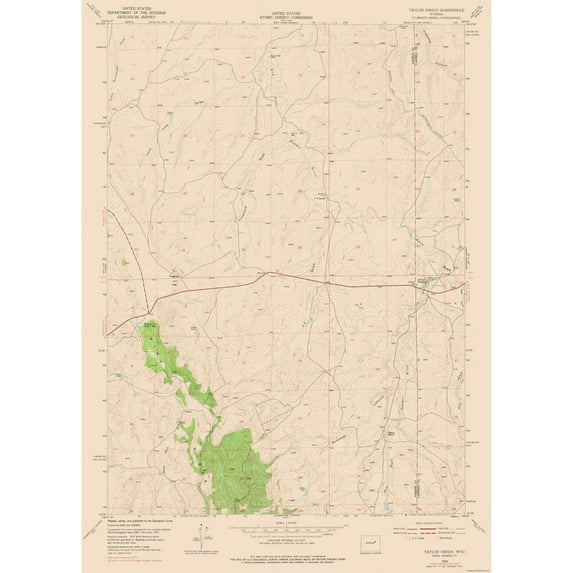
Historical Topographic Maps - Taylor Ranch Wyoming Quad - USGS 1954 - This is an exquisite full-color Reproduction printed on high-quality gloss paper, art paper or canvas.
Print Size: 23.00 x 32.14 inches
58.42 X 81.63cm
The following towns are featured: none.
This Map is Situated in: Taylor Ranch, Wyoming.
SKU: WYTR0001
Original Maps are often difficult to find and usually have fold lines, identifying stamps or markings, tears, ragged edges, and assorted other natural signs of age that detract from their beauty. All of our maps have been professionally restored to depict their original beauty, while keeping all historical data intact.
These maps are fabulous pieces of history full of information useful to Historians, Genealogists, Cartographers, Relic Hunters, & Others. They make fascinating conversation pieces and splendid works of art for the home or office.
- OWN A HISTORICAL TOPOGRAPHICAL MAP TODAY - Topographical maps provide you a birds-eye view of how the topography of certain pieces of land are mapped out. See how much today's maps have changed from centuries ago. See how waterways have shifted, or how forrests have become thralling cities. See how history has changed the landscape with a topographical map today!
- TOPOGRAPHICAL MAPS PROVIDE IMPORTANT INFORMATION -Topographical maps show you how the borders of a county are established and were they can be found. It also highlights rivers, mountains, and other natural elements, and it will show you where the cities are located within it.
- ONLY ACCEPT THE BEST PRINT QUALITY FOR YOUR REPRODUCTIONS - There are many printers and print types available on the market, when purchasing a reproduction there is no finer quality reproduction than a reproduction using the Giclee Printing method. Giclee describes the technique or style of printing used, and it is revered as the highest quality printing because of the way it precisely sprays ink onto a surface. Trust nothing less than the best!
- GUARNANTEED TO GET EXACTLY WHAT YOU ORDERED - This map comes exactly to the specification of 23.00 x 32.14 inches/58.42 X 81.63 cm. All of our maps come rolled, wrapped, and shipped in a heavy gauge mailing tube to ensure it arrives intact.
- WHY CHOOSE MAPS OF THE PAST? - Maps of the Past is one of the single largest producers of different types of maps. They legally own the rights to the maps they sell, and provide them to you in clean, clear, and vibrant print. If you are looking for a high quality map print, then look no further than Maps of the Past!
info:
We aim to show you accurate product information. Manufacturers, suppliers and others provide what you see here, and we have not verified it.
Specifications
Size
23.00 x 32.14
Material
Matte Art
Decor style
Vintage
Theme
Historic Topographic Maps
Warranty
Warranty information
Please be aware that the warranty terms on items offered for sale by third party Marketplace sellers may differ from those displayed in this section (if any). To confirm warranty terms on an item offered for sale by a third party Marketplace seller, please use the 'Contact seller' feature on the third party Marketplace seller's information page and request the item's warranty terms prior to purchase.
Customer ratings & reviews
0 ratings|0 reviews
This item does not have any reviews yet

Related pages
- Jersey Counties Map Cities
- Alabama County Map Roads
- West Virginia Maps By County
- Florida Map By County
- Map Illinois Highways
- Scenic Indiana United States Travel Books Maps Guides
- Central America Travel Books, Maps & Guides
- Northeast United States Travel Books, Maps & Guides
- Southern United States Travel Books, Maps & Guides
- General South America Travel Books, Maps & Guides
- Peru Travel Books, Maps & Guides
- Rand McNally Travel Books, Maps & Guides