
Hero image 0 of Historic City Map - Urbana Champaign Mattoon Charleston Illinois - Warner 1876 - 27.31 x 23 - Vintage Wall Art, 0 of 5
Historic City Map - Urbana Champaign Mattoon Charleston Illinois - Warner 1876 - 27.31 x 23 - Vintage Wall Art
(No ratings yet)
Historic City Map - Urbana Champaign Mattoon Charleston Illinois - Warner 1876 - 27.31 x 23 - Vintage Wall ArtUrbana Champaign Mattoon Charleston Illinois Warner 1876 27 31 x 23 Glossy Satin PaperHistoric City Map Urbana Champaign Mattoon Charleston Illinois Warner 1876 27 31 x 23 Vintage Wall Art
Material:Glossy Satin Photo Quality
Key item features
- HISTORICAL LOCAL MAPS MAKE GREAT WALL ART - Ever wonder what your country looked like during the early days of the USA? Well now you can find out! Maps of the Past provides maps from various time periods so you can track the history of your local city or town. These gorgiously detailed maps make for a great piece of art for your home or office. Own a piece of art and history today!
- LOCAL MAPS PROVIDE IMPORTANT INFORMATION - Local maps show you how the borders of a local are established and were they can be found. It also highlights rivers, mountains, and other natural element you may not know are there. Local maps can also show you transportation lanes across your local
- ONLY ACCEPT THE BEST PRINT QUALITY FOR YOUR REPRODUCTIONS - There are many printers and print types available on the market, when purchasing a reproduction there is no finer quality reproduction than a reproduction using the Giclee Printing method. Giclee describes the technique or style of printing used, and it is revered as the highest quality printing because of the way it precisely sprays ink onto a surface. Trust nothing less than the best!
- GUARNANTEED TO GET EXACTLY WHAT YOU ORDERED - This map comes exactly to the specification of 27.31 x 23.00 inches/69.36 X 58.42 cm. All of our maps come rolled, wrapped, and shipped in a heavy gauge mailing tube to ensure it arrives intact.
- WHY CHOOSE MAPS OF THE PAST? - Maps of the Past is one of the single largest producers of different types of maps. They legally own the rights to the maps they sell, and provide them to you in clean, clear, and vibrant print. If you are looking for a high quality map print, then look no further than Maps of the Past!
Specs
- Color1
- Size27.31 x 23
- MaterialGlossy Satin Photo Quality
- ThemeHistorical City Maps
- FramedN
- ShapeRectangle
Current price is USD$40.95
Price when purchased online
- Free shipping
 Free 30-day returns
How do you want your item?
Columbus, 43215
Arrives between Apr 10 - Apr 13
|Sold and shipped by Maps of the Past
4.3 stars out of 5, based on 10 seller reviews(4.3)10 seller reviews
Free 30-day returns
Check out these related products
Historic Map - Africa Prior Mohammedan - Spruner 1855 - 27.70 x 23 - Vintage Wall Art $40.95 $40.95/count
 3 optionsAvailable in additional 3 options$4095current price $40.95$40.95/count
Historic Map - Africa Prior Mohammedan - Spruner 1855 - 27.70 x 23 - Vintage Wall Art
Historic Map - Latium Campania Italy - Spruner 1865 - 29.08 x 23 - Vintage Wall Art $40.95 $40.95/count
 $4095current price $40.95$40.95/count
Historic Map - Latium Campania Italy - Spruner 1865 - 29.08 x 23 - Vintage Wall Art
Historic State Map - Indiana - Hoen 1896 - 24.19 x 23 - Vintage Wall Art $40.95 $40.95/count
 3 optionsAvailable in additional 3 options$4095current price $40.95$40.95/count
Historic State Map - Indiana - Hoen 1896 - 24.19 x 23 - Vintage Wall Art
Historic Map - Aetolia Acarnania Greece - Oxford 1828 - 27.12 x 23 - Vintage Wall Art $40.95 $40.95/count
 3 optionsAvailable in additional 3 options$4095current price $40.95$40.95/count
Historic Map - Aetolia Acarnania Greece - Oxford 1828 - 27.12 x 23 - Vintage Wall Art
Historic Map - Europe Africa Ancient World - Chapman 1830 - 23 x 27.46 - Vintage Wall Art $40.95 $40.95/count
 $4095current price $40.95$40.95/count
Historic Map - Europe Africa Ancient World - Chapman 1830 - 23 x 27.46 - Vintage Wall Art
Historic State Map - Utah - Hoen 1896 - 23 x 28.10 - Vintage Wall Art $40.95
 3 optionsAvailable in additional 3 options$4095current price $40.95
Historic State Map - Utah - Hoen 1896 - 23 x 28.10 - Vintage Wall Art
Historic State Map - Arizona - Alden 1886 - 23 x 36.12 - Vintage Wall Art $40.95 $40.95/count
 $4095current price $40.95$40.95/count
Historic State Map - Arizona - Alden 1886 - 23 x 36.12 - Vintage Wall Art
Historic Map - Italy 15 to 18 Century - Droysen 1886 - 23 x 28.56 - Vintage Wall Art $40.95 $40.95/count
 $4095current price $40.95$40.95/count
Historic Map - Italy 15 to 18 Century - Droysen 1886 - 23 x 28.56 - Vintage Wall Art
Historic Panoramic View - Quitman Georgia - Norris 1885 - Vintage Wall Art $36.95
 $3695current price $36.95
Historic Panoramic View - Quitman Georgia - Norris 1885 - Vintage Wall Art
Historic State Map - Arkansas - Hoen 1896 - Vintage Wall Art $36.95
 $3695current price $36.95
Historic State Map - Arkansas - Hoen 1896 - Vintage Wall Art
Historic Map - Wiener Neustadt Austria - Baedeker 1910 - 30.55 x 23 - Vintage Wall Art $40.95
 3 optionsAvailable in additional 3 options$4095current price $40.95
Historic Map - Wiener Neustadt Austria - Baedeker 1910 - 30.55 x 23 - Vintage Wall Art
Historic State Map - Arizona - Hoen 1896 - Vintage Wall Art $36.95
 4 optionsAvailable in additional 4 options$3695current price $36.95
Historic State Map - Arizona - Hoen 1896 - Vintage Wall Art
Historic City Map - Minneapolis Minnesota - Cram 1892 - Vintage Wall Art $36.95
 $3695current price $36.95
Historic City Map - Minneapolis Minnesota - Cram 1892 - Vintage Wall Art
Historic Panoramic View - Davenport Iowa - Andreas 1875 - 23 x 29.60 - Vintage Wall Art $40.95
 $4095current price $40.95
Historic Panoramic View - Davenport Iowa - Andreas 1875 - 23 x 29.60 - Vintage Wall Art
Topographical Map - Montrose Colorado Quad - USGS 1962 - Vintage Wall Art $36.95
 4 optionsAvailable in additional 4 options$3695current price $36.95
Topographical Map - Montrose Colorado Quad - USGS 1962 - Vintage Wall Art
Historic Map - Britain Ancient Terrain - Baldwin 1830 - 23 x 27.85 - Vintage Wall Art $40.95 $40.95/count
 3 optionsAvailable in additional 3 options$4095current price $40.95$40.95/count
Historic Map - Britain Ancient Terrain - Baldwin 1830 - 23 x 27.85 - Vintage Wall Art
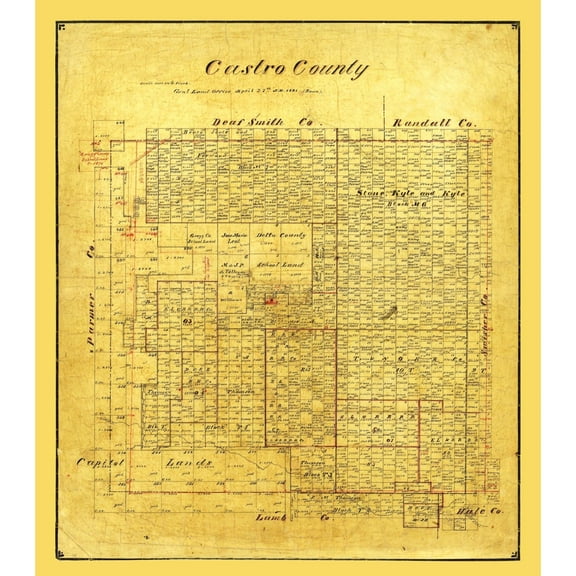
Historic County Map - Castro County Texas - Pressler 1891 - 23 x 26.19 - Vintage Wall Art $40.95
 $4095current price $40.95
Historic County Map - Castro County Texas - Pressler 1891 - 23 x 26.19 - Vintage Wall Art
Historic State Map - South Dakota - Reynold 1921 - 33.51 x 23 - Vintage Wall Art $40.95
 3 optionsAvailable in additional 3 options$4095current price $40.95
Historic State Map - South Dakota - Reynold 1921 - 33.51 x 23 - Vintage Wall Art
Historic Map - Ireland 1500 - Gardiner 1902 - 23 x 36.52 - Vintage Wall Art $40.95 $40.95/count
 $4095current price $40.95$40.95/count
Historic Map - Ireland 1500 - Gardiner 1902 - 23 x 36.52 - Vintage Wall Art
Historic Map - Judea Israel - Ortelius 1570 - 29.31 x 23 - Vintage Wall Art $40.95 $40.95/count
 3 optionsAvailable in additional 3 options$4095current price $40.95$40.95/count
Historic Map - Judea Israel - Ortelius 1570 - 29.31 x 23 - Vintage Wall Art
About this item
Product details
Old Map - Champaign, Charleston Illinois 1876 - This is an exquisite full-color Reproduction printed on high-quality gloss paper, art paper or canvas.
Print Size: 23.00 x 27.34 inches
69.36 X 58.42cm
Sites and Townships Specific To This Map Are: Champaign Wards 1 - 7, Urbana Wards 1 - 4, Mattoon Wards 1 - 2, Illinois Central Railroad, Tremont Street, Indianapolis, Bloomington, and Western Railroad, Champaign and Decatur Railroad, University Avenue, Indianapolis and St. Louis Railroad, Court House, Schools Located and Boneyard Creek.
The following towns are featured: Urbana, Champaign, Mattoon and Charleston.
This Map is Situated in: Champaign and Coles Counties, Illinois (IL)
SKU: ILUR0001
Original Maps are often difficult to find and usually have fold lines, identifying stamps or markings, tears, ragged edges, and assorted other natural signs of age that detract from their beauty. All of our maps have been professionally restored to depict their original beauty, while keeping all historical data intact.
These maps are fabulous pieces of history full of information useful to Historians, Genealogists, Cartographers, Relic Hunters, & Others. They make fascinating conversation pieces and splendid works of art for the home or office.
- HISTORICAL LOCAL MAPS MAKE GREAT WALL ART - Ever wonder what your country looked like during the early days of the USA? Well now you can find out! Maps of the Past provides maps from various time periods so you can track the history of your local city or town. These gorgiously detailed maps make for a great piece of art for your home or office. Own a piece of art and history today!
- LOCAL MAPS PROVIDE IMPORTANT INFORMATION - Local maps show you how the borders of a local are established and were they can be found. It also highlights rivers, mountains, and other natural element you may not know are there. Local maps can also show you transportation lanes across your local
- ONLY ACCEPT THE BEST PRINT QUALITY FOR YOUR REPRODUCTIONS - There are many printers and print types available on the market, when purchasing a reproduction there is no finer quality reproduction than a reproduction using the Giclee Printing method. Giclee describes the technique or style of printing used, and it is revered as the highest quality printing because of the way it precisely sprays ink onto a surface. Trust nothing less than the best!
- GUARNANTEED TO GET EXACTLY WHAT YOU ORDERED - This map comes exactly to the specification of 27.31 x 23.00 inches/69.36 X 58.42 cm. All of our maps come rolled, wrapped, and shipped in a heavy gauge mailing tube to ensure it arrives intact.
- WHY CHOOSE MAPS OF THE PAST? - Maps of the Past is one of the single largest producers of different types of maps. They legally own the rights to the maps they sell, and provide them to you in clean, clear, and vibrant print. If you are looking for a high quality map print, then look no further than Maps of the Past!
info:
We aim to show you accurate product information. Manufacturers, suppliers and others provide what you see here, and we have not verified it.
Specifications
Color
1
Size
27.31 x 23
Material
Glossy Satin Photo Quality
Theme
Historical City Maps
Warranty
Warranty information
Please be aware that the warranty terms on items offered for sale by third party Marketplace sellers may differ from those displayed in this section (if any). To confirm warranty terms on an item offered for sale by a third party Marketplace seller, please use the 'Contact seller' feature on the third party Marketplace seller's information page and request the item's warranty terms prior to purchase.
Customer ratings & reviews
0 ratings|0 reviews
This item does not have any reviews yet

Related pages
- Cheyenne Wyoming Map
- Akron Ohio Map
- Brunswick Ga Map
- Raleigh North Carolina Map
- Council Bluffs Iowa Map
- Huntsville Alabama Map
- Central America Travel Books, Maps & Guides
- National Parks Posters
- Midwest United States Travel Books, Maps & Guides
- General South America Travel Books, Maps & Guides
- Northeast United States Travel Books, Maps & Guides
- Western United States Travel Books, Maps & Guides