
Hero image 0 of Family Maps of Caddo Parish, Louisiana, 0 of 1
Family Maps of Caddo Parish, Louisiana
(No ratings yet)
Key item features
390 pages with 116 total maps Locating original landowners in maps has never been an easy task-until now. This volume in the Family Maps series contains newly created maps of original landowners (patent maps) in what is now Caddo Parish, Louisiana, gleaned from the indexes of the U.S. Bureau of Land Management. But it offers much more than that. For each township in the county, there are two additional maps accompanying the patent map: a road map and a map showing waterways, railroads, and both modern and many historical city-centers and cemeteries. Included are indexes to help you locate what you are looking for, whether you know a person's name, a last name, a place-name, or a cemetery. The combination of maps and indexes are designed to aid researchers of American history or genealogy to explore frontier neighborhoods, examine family migrations, locate hard-to-find cemeteries and towns, as well as locate land based on legal descriptions found in old documents or deeds. The patent-maps are essentially plat maps but instead of depicting owners for a particular year, these maps show original landowners, no matter when the transfer from the federal government was completed. Dates of patents typically begin near the time of statehood and run into the early 1900s. What's Mapped in this book (that you'll not likely find elsewhere) . . . 3941 Parcels of Land (with original landowner names and patent-dates labeled in the relevant map) 44 Cemeteries plus . . . Roads, and existing Rivers, Creeks, Streams, Railroads, and Small-towns (including some historical), etc. What YEARS are these maps for? Here are the counts for parcels of land mapped, by the decade in which the corresponding land patents were issued: DecadeParcel-count 1830s11 1840s1927 1850s383 1860s431 1870s57 1880s144 1890s361 1900s298 1910s114 1920s116 1930s66 1940s9 1950s10 1960s3 1970s1 1980s4 1990s1 What Cities and Towns are in Caddo Parish, Louisiana (and in this book)? Albany (historical), Arlatex, Audrey Park, Aulds (historical), Belcher, Bethany, Black Bayou (historical), Blanchard, Bonham Landing, Brent, Brian, Brown Park Estates, Buncombe (historical), Bungalo (historical), Caddo, Cannon, Cash Point, Caspiana, Cavett, Cecile, Cedar Grove, Conn, Cooper Road, Cross Lake Hills South, Cut-off Junction, De Broeck Landing, Deep Woods, Dixie, Elkins, Fairfield, Ferry Lake, Flournoy, Forbing, Four Forks, Frog Level (historical), Garfield (historical), Gas Center, Gayles, Gilliam, Greenbrook, Greenwood, Hadley, Hayti, Hollywood, Hosston, Ida, Jewella (historical), Keithville, Lachute, Lake Hayes, Lakeshore North, Lane (historical), Latex, Longwood, Lorraine, Lucas, Mail Boxes, McCoy (historical), Midway, Mira, Missionary, Mooringsport, Moss, Myrtis, Naylor, Nichols (historical), North Shreveport, Norton, Oil City, Palmer Landing, Pickett, Pleasant Grove, Preston, Reisor, River Oaks, Robson, Rodessa, Sandra, Sentell, Shipp, Shoreline, Shreveport, Solley Hill, Southern Hills, Spring Ridge, Stacy Landing, Summer Grove, Superior, Three States, Timberlane, Trees, Uni (historical), Vivian, Woodchuck, Zylks
Specs
- Book formatPaperback
- Fiction/nonfictionNon-Fiction
- GenreHistory
- Pub dateMay 20, 2010
- Pages390
- Series titleFamily Maps
Current price is USD$35.05
Price when purchased online
- Free shipping
 Free 30-day returns
How do you want your item?
Columbus, 43215
Arrives between Apr 7 - Apr 10
|Sold and shipped by Alibris Books
4.564536043308956 stars out of 5, based on 10529 seller reviews(4.6)10529 seller reviews
Free 30-day returns
Other sellers
$37.95
+Free shippingShipping, arrives by Sat, Apr 4 to Columbus, 43215
Sold and shipped by Walmart.com
Free 90-day returns
About this item
Product details
Family Maps of Caddo Parish, Louisiana
390 pages with 116 total maps Locating original landowners in maps has never been an easy task-until now. This volume in the Family Maps series contains newly created maps of original landowners (patent maps) in what is now Caddo Parish, Louisiana, gleaned from the indexes of the U.S. Bureau of Land Management. But it offers much more than that. For each township in the county, there are two additional maps accompanying the patent map: a road map and a map showing waterways, railroads, and both modern and many historical city-centers and cemeteries. Included are indexes to help you locate what you are looking for, whether you know a person's name, a last name, a place-name, or a cemetery. The combination of maps and indexes are designed to aid researchers of American history or genealogy to explore frontier neighborhoods, examine family migrations, locate hard-to-find cemeteries and towns, as well as locate land based on legal descriptions found in old documents or deeds. The patent-maps are essentially plat maps but instead of depicting owners for a particular year, these maps show original landowners, no matter when the transfer from the federal government was completed. Dates of patents typically begin near the time of statehood and run into the early 1900s. What's Mapped in this book (that you'll not likely find elsewhere) . . . 3941 Parcels of Land (with original landowner names and patent-dates labeled in the relevant map) 44 Cemeteries plus . . . Roads, and existing Rivers, Creeks, Streams, Railroads, and Small-towns (including some historical), etc. What YEARS are these maps for? Here are the counts for parcels of land mapped, by the decade in which the corresponding land patents were issued: DecadeParcel-count 1830s11 1840s1927 1850s383 1860s431 1870s57 1880s144 1890s361 1900s298 1910s114 1920s116 1930s66 1940s9 1950s10 1960s3 1970s1 1980s4 1990s1 What Cities and Towns are in Caddo Parish, Louisiana (and in this book)? Albany (historical), Arlatex, Audrey Park, Aulds (historical), Belcher, Bethany, Black Bayou (historical), Blanchard, Bonham Landing, Brent, Brian, Brown Park Estates, Buncombe (historical), Bungalo (historical), Caddo, Cannon, Cash Point, Caspiana, Cavett, Cecile, Cedar Grove, Conn, Cooper Road, Cross Lake Hills South, Cut-off Junction, De Broeck Landing, Deep Woods, Dixie, Elkins, Fairfield, Ferry Lake, Flournoy, Forbing, Four Forks, Frog Level (historical), Garfield (historical), Gas Center, Gayles, Gilliam, Greenbrook, Greenwood, Hadley, Hayti, Hollywood, Hosston, Ida, Jewella (historical), Keithville, Lachute, Lake Hayes, Lakeshore North, Lane (historical), Latex, Longwood, Lorraine, Lucas, Mail Boxes, McCoy (historical), Midway, Mira, Missionary, Mooringsport, Moss, Myrtis, Naylor, Nichols (historical), North Shreveport, Norton, Oil City, Palmer Landing, Pickett, Pleasant Grove, Preston, Reisor, River Oaks, Robson, Rodessa, Sandra, Sentell, Shipp, Shoreline, Shreveport, Solley Hill, Southern Hills, Spring Ridge, Stacy Landing, Summer Grove, Superior, Three States, Timberlane, Trees, Uni (historical), Vivian, Woodchuck, Zylks
info:
We aim to show you accurate product information. Manufacturers, suppliers and others provide what you see here, and we have not verified it.
Specifications
Book format
Paperback
Fiction/nonfiction
Non-Fiction
Genre
History
Pub date
May 20, 2010
Warranty
Warranty information
Please be aware that the warranty terms on items offered for sale by third party Marketplace sellers may differ from those displayed in this section (if any). To confirm warranty terms on an item offered for sale by a third party Marketplace seller, please use the 'Contact seller' feature on the third party Marketplace seller's information page and request the item's warranty terms prior to purchase.
Similar items you might like
Based on what customers bought
Family Maps of Randolph County, Illinois $32.64
 $3264current price $32.64
Family Maps of Randolph County, Illinois
Family Maps of Taney County, Missouri (Paperback) by Gregory a Boyd J D $32.64
 $3264current price $32.64
Family Maps of Taney County, Missouri (Paperback) by Gregory a Boyd J D
Family Maps of Lauderdale County, Mississippi $31.83
 $3183current price $31.83
Family Maps of Lauderdale County, Mississippi
Family Maps of McHenry County, Illinois $32.64
 $3264current price $32.64
Family Maps of McHenry County, Illinois
Family Maps of Boone County, Arkansas $34.95
 $3495current price $34.95
Family Maps of Boone County, Arkansas
Family Maps: Family Maps of Winn Parish, Louisiana (Paperback) $35.05
 $3505current price $35.05
Family Maps: Family Maps of Winn Parish, Louisiana (Paperback)
Family Maps of Pope County, Arkansas $32.64
 $3264current price $32.64
Family Maps of Pope County, Arkansas
Family Maps of Acadia Parish, Louisiana $31.83
 $3183current price $31.83
Family Maps of Acadia Parish, Louisiana
Family Maps of de Soto Parish, Louisiana $31.02
 $3102current price $31.02
Family Maps of de Soto Parish, Louisiana
Family Maps of Kemper County, Mississippi $32.64
 $3264current price $32.64
Family Maps of Kemper County, Mississippi
Family Maps of Oregon County, Missouri $32.64
 $3264current price $32.64
Family Maps of Oregon County, Missouri
Family Maps of Claiborne Parish, Louisiana (Paperback) by Gregory a Boyd J D $32.64
 $3264current price $32.64
Family Maps of Claiborne Parish, Louisiana (Paperback) by Gregory a Boyd J D
Family Maps of Allen Parish, Louisiana $31.83
 $3183current price $31.83
Family Maps of Allen Parish, Louisiana
Family Maps of Johnson County, Missouri $32.64
 $3264current price $32.64
Family Maps of Johnson County, Missouri
Family Maps of Jefferson County, Missouri $32.64
 $3264current price $32.64
Family Maps of Jefferson County, Missouri
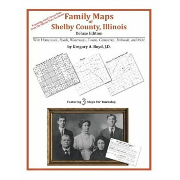
Family Maps of Shelby County, Illinois $35.05
 $3505current price $35.05
Family Maps of Shelby County, Illinois
Family Maps of Wayne County, Missouri $34.95
 $3495current price $34.95
Family Maps of Wayne County, Missouri
Family Maps of Copiah County, Mississippi (Paperback) $35.05
 $3505current price $35.05
Family Maps of Copiah County, Mississippi (Paperback)
Family Maps of St. Clair County, Missouri $34.95
 $3495current price $34.95
Family Maps of St. Clair County, Missouri

Customer ratings & reviews
0 ratings|0 reviews
This item does not have any reviews yet

Related pages
- Best Sellers In Reno Nevada Travel Books
- Best Sellers In Orlando Florida Travel Books
- Utah Utah
- Best Sellers In San Jose California Travel Books
- Best Sellers In Oregon Travel Guides
- State Park South Carolina
- General South America Travel Books, Maps & Guides
- Midwest United States Travel Books, Maps & Guides
- Western United States Travel Books, Maps & Guides
- Northeast United States Travel Books, Maps & Guides
- Canadian Prairie Provinces Travel Books, Maps & Guides
- Southern United States Travel Books, Maps & Guides