
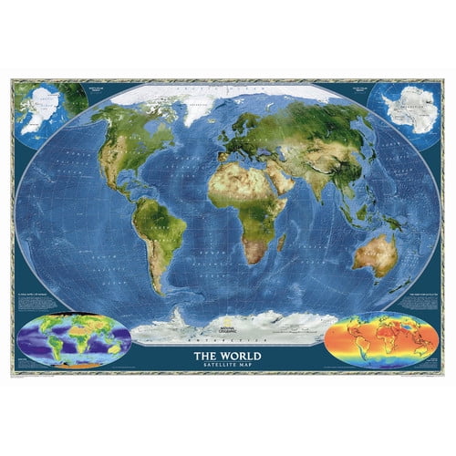
National Geographic Maps World Executive Wall Map
(No ratings yet)
Key item features
GW1004
Features
Dimensions
Map Type Standard Size (30" x 46") - Paper
Map Type Spanish Edition (26"H x 39"W)
Map Type Enlarged Size (48" x 73") - Paper
Map Type Poster (24" x 36") - Paper
Features
- Paper maps come rolled in cardboard tube, laminated maps come in a protective sleeve
- Winkel Tripel projection to reduce distortion
- Insets show vegetation and landforms
- Standard Scale = 1:36,384,000
- Enlarged Scale = 1:22,445,000
- Poster Scale = 1:45,500,000
- Product Type: World Map
- Multiple Maps: Yes
- Laminated: Yes
- Colors: Antique
- Style: Traditional/Political
Dimensions
Map Type Standard Size (30" x 46") - Paper
- Overall Height - Top to Bottom: 30"
- Overall Width - Side to Side: 46"
Map Type Spanish Edition (26"H x 39"W)
- Overall Height - Top to Bottom: 26"
- Overall Width - Side to Side: 39"
Map Type Enlarged Size (48" x 73") - Paper
- Overall Height - Top to Bottom: 48"
- Overall Width - Side to Side: 73"
Map Type Poster (24" x 36") - Paper
- Overall Height - Top to Bottom: 24"
- Overall Width - Side to Side: 36"
Specs
- Map typeWorld Map
- SubjectWorld
- FeaturesLaminated
- Size48in H x 73in W
- BrandNational Geographic
- MaterialPaper
Current price is USD$25.44
Price when purchased online
Out of stock
How do you want your item?
Out of stock
About this item
Product details
Features: -Paper maps come rolled in cardboard tube, laminated maps come in a protective sleeve. -Winkel Tripel projection to reduce distortion. -Insets show vegetation and landforms. -Standard Scale = 1:36,384,000. -Enlarged Scale = 1:22,445,000. -Poster Scale = 1:45,500,000. Product Type: -World Map. Multiple Maps: -Yes. Laminated: -Yes. Colors: -Antique. Style: -Traditional/Political. Dimensions: Map Type Standard Size (30" x 46") - Paper - Overall Height - Top to Bottom: -30". Map Type Standard Size (30" x 46") - Paper - Overall Width - Side to Side: -46". Map Type Spanish Edition (26"H x 39"W) - Overall Height - Top to Bottom: -26". Map Type Spanish Edition (26"H x 39"W) - Overall Width - Side to Side: -39". Map Type Enlarged Size (48" x 73") - Paper - Overall Height - Top to Bottom: -48". Map Type Enlarged Size (48" x 73") - Paper - Overall Width - Side to Side: -73". Map Type Poster (24" x 36") - Paper - Overall Height - Top to Bottom: -24". Map Type Poster (24
GW1004
Features
Dimensions
Map Type Standard Size (30" x 46") - Paper
Map Type Spanish Edition (26"H x 39"W)
Map Type Enlarged Size (48" x 73") - Paper
Map Type Poster (24" x 36") - Paper
Features
- Paper maps come rolled in cardboard tube, laminated maps come in a protective sleeve
- Winkel Tripel projection to reduce distortion
- Insets show vegetation and landforms
- Standard Scale = 1:36,384,000
- Enlarged Scale = 1:22,445,000
- Poster Scale = 1:45,500,000
- Product Type: World Map
- Multiple Maps: Yes
- Laminated: Yes
- Colors: Antique
- Style: Traditional/Political
Dimensions
Map Type Standard Size (30" x 46") - Paper
- Overall Height - Top to Bottom: 30"
- Overall Width - Side to Side: 46"
Map Type Spanish Edition (26"H x 39"W)
- Overall Height - Top to Bottom: 26"
- Overall Width - Side to Side: 39"
Map Type Enlarged Size (48" x 73") - Paper
- Overall Height - Top to Bottom: 48"
- Overall Width - Side to Side: 73"
Map Type Poster (24" x 36") - Paper
- Overall Height - Top to Bottom: 24"
- Overall Width - Side to Side: 36"
info:
We aim to show you accurate product information. Manufacturers, suppliers and others provide what you see here, and we have not verified it.
Specifications
Map type
World Map
Subject
World
Features
Laminated
Size
48in H x 73in W
Warranty
Warranty information
Warranty not available for this item
Please be aware that the warranty terms on items offered for sale by third party Marketplace sellers may differ from those displayed in this section (if any). To confirm warranty terms on an item offered for sale by a third party Marketplace seller, please use the 'Contact seller' feature on the third party Marketplace seller's information page and request the item's warranty terms prior to purchase.
Please be aware that the warranty terms on items offered for sale by third party Marketplace sellers may differ from those displayed in this section (if any). To confirm warranty terms on an item offered for sale by a third party Marketplace seller, please use the 'Contact seller' feature on the third party Marketplace seller's information page and request the item's warranty terms prior to purchase.
Warnings
Similar items you might like
Based on what customers bought
National geographic: world executive wall map - laminated (46 x 30.5 inches) (other): 9780792283256 $44.26
 $4426current price $44.26
National geographic: world executive wall map - laminated (46 x 30.5 inches) (other): 9780792283256
15 out of 5 Stars. 1 reviewsBig Sky Maps East Klickitat GMU Map 382 $14.97
 $1497current price $14.97
Big Sky Maps East Klickitat GMU Map 382
Xplorer Maps MAP_ACNP Acadia National Park Hand-Drawn Map $44.45
 $4445current price $44.45
Xplorer Maps MAP_ACNP Acadia National Park Hand-Drawn Map
Xplorer Maps MAP_OLY Olympic National Park Hand-Drawn Map $43.24
 $4324current price $43.24
Xplorer Maps MAP_OLY Olympic National Park Hand-Drawn Map
Xplorer Maps MAP_BHNF Black Hills National Forest Hand-Drawn Map $44.35
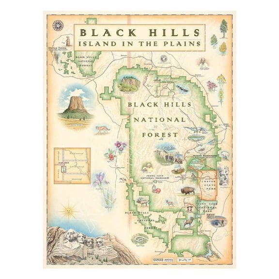 $4435current price $44.35
Xplorer Maps MAP_BHNF Black Hills National Forest Hand-Drawn Map
Xplorer Maps MAP_GSM Great Smoky Mountains National Park Hand-Drawn Map $44.15
 $4415current price $44.15
Xplorer Maps MAP_GSM Great Smoky Mountains National Park Hand-Drawn Map
Xplorer Maps MAP_GNP Glacier National Park Hand-Drawn Map $43.16
 $4316current price $43.16
Xplorer Maps MAP_GNP Glacier National Park Hand-Drawn Map
National Geographic Destination Map Pocono Mountains Map, (Paperback) $23.94
 $2394current price $23.94
National Geographic Destination Map Pocono Mountains Map, (Paperback)
Historic State Map - Vermont - Carey 1795 - 23 x 27.81 - Vintage Wall Art $40.95 $40.95/count
 3 optionsAvailable in additional 3 options$4095current price $40.95$40.95/count
Historic State Map - Vermont - Carey 1795 - 23 x 27.81 - Vintage Wall Art
National Geographic Maps World Satellite Wall Map $36.40 Was $43.86
 2 optionsAvailable in additional 2 options$3640current price $36.40, Was $43.86$43.86
National Geographic Maps World Satellite Wall Map
Adventure Map: Germany - Folded Map $13.87
 $1387current price $13.87
Adventure Map: Germany - Folded Map
15 out of 5 Stars. 1 reviewsHistorical Civil War Map - Beaufort South Carolina - Schelten 1861 - 34.81 x 23 - Vintage Wall Art $40.95 $40.95/count
 3 optionsAvailable in additional 3 options$4095current price $40.95$40.95/count
Historical Civil War Map - Beaufort South Carolina - Schelten 1861 - 34.81 x 23 - Vintage Wall Art
Historic State Map - Alabama - Cram 1888 - 23 x 29.82 - Vintage Wall Art $40.95 $40.95/count
 3 optionsAvailable in additional 3 options$4095current price $40.95$40.95/count
Historic State Map - Alabama - Cram 1888 - 23 x 29.82 - Vintage Wall Art
Xplorer Maps MAP_RMNP Rocky Mountain National Park Hand-Drawn Map $42.17 Was $54.58
 $4217current price $42.17, Was $54.58$54.58
Xplorer Maps MAP_RMNP Rocky Mountain National Park Hand-Drawn Map
1940 A Hysterical Map of Mount Rainier National Park. $40.00
 4 optionsAvailable in additional 4 options$4000current price $40.00
1940 A Hysterical Map of Mount Rainier National Park.
National Geographic RE00620151 Map Of South America - Enlarged And Laminated $40.53
 4 optionsAvailable in additional 4 options$4053current price $40.53
National Geographic RE00620151 Map Of South America - Enlarged And Laminated
National Geographic Reference Map: National Geographic Map of Discovery, Eastern Hemisphere Wall Map (19 X 21 In) (Other) $35.05
 $3505current price $35.05
National Geographic Reference Map: National Geographic Map of Discovery, Eastern Hemisphere Wall Map (19 X 21 In) (Other)
Adventure map: chile - folded map: 9781566955461 $13.90
 $1390current price $13.90
Adventure map: chile - folded map: 9781566955461
24"x36" Gallery Poster, Topographic Map, Acadia National Park, Hancock County, Maine 1931 $52.95
 $5295current price $52.95
24"x36" Gallery Poster, Topographic Map, Acadia National Park, Hancock County, Maine 1931
National Geographic Destination City Map Munich Map, (Paperback) $17.54
 $1754current price $17.54
National Geographic Destination City Map Munich Map, (Paperback)
Customer ratings & reviews
0 ratings|0 reviews
This item does not have any reviews yet

Related pages
- National Geographic Maps Wall Decor
- Framed World Map National Geographic
- Capitol Building Map
- World Map Middle East
- Continents Map Countries
- World Times Zone Map
- World Map Wall Art
- National Parks Posters
- Lonely Planet Travel Books, Maps & Guides
- Central America Travel Books, Maps & Guides
- Maps & Road Atlases
- General Europe Travel Books