
Hero image 0 of Historic Map - Canada United States - Streit 1913 - 23 x 27.76 - Vintage Wall Art, 0 of 5
Historic Map - Canada United States - Streit 1913 - 23 x 27.76 - Vintage Wall Art
(No ratings yet)
Key item features
- Historic Reproduction: This full-color reproduction is based on Streit's Atlas from 1913, showcasing an old international map of North America.
- Premium Printing: Produced using the Giclee printing method, ensuring high-quality reproduction with precise ink application for vibrant and clear prints.
- Precise Dimensions: The print measures exactly 23.00 x 27.76 inches (58.42 x 70.51 cm), matching the specified dimensions.
- Restored Detail: Professionally restored to depict original beauty while preserving all historical data, unlike original maps which often have signs of age.
- Geographic Scope: Features various towns including Fairbanks, Vancouver, Portland, and Seattle, situated within North America and the Aleutian Islands.
- Secure Packaging: Each map is rolled, wrapped, and shipped in a heavy gauge mailing tube to ensure it arrives intact.
Generated by AI
Specs
- Size23.00 x 27.76
- MaterialPaper
- Decor styleVintage
- FramedN
- ShapeRectangle
- Art typePainting
Price when purchased online
Not Available
How do you want your item?
Not available
About this item
Product details
Old International Maps - North America - Streit's Atlas 1913 - This is an exquisite full-color Reproduction printed on high-quality gloss paper, art paper or canvas.
Print Size: 23.00 x 27.76 inches
58.42 X 70.51cm
The following towns are featured: Fairbanks, Vancouver, Prince Albert, Regina, Helena, Portland, Baker City, Seattle, Bismark, Prince Rupert.
This Map is Situated in: North America, Aleutian Islands.
SKU: ITNA0055
Original Maps are often difficult to find and usually have fold lines, identifying stamps or markings, tears, ragged edges, and assorted other natural signs of age that detract from their beauty. All of our maps have been professionally restored to depict their original beauty, while keeping all historical data intact.
These maps are fabulous pieces of history full of information useful to Historians, Genealogists, Cartographers, Relic Hunters, & Others. They make fascinating conversation pieces and splendid works of art for the home or office.
- BEAUTIFUL MAPS OF THE UNITED STATES - At Maps of the Past, we have all different types of US maps. From topographical to natural resources, we have exactly the type of US map you are looking for. Check out all of the different types of US maps that we have to offer. Easily find the one that is right for your needs.
- A UNITED STATES MAP FOR EVERY NEED - At Maps of the Past, we carry a variety of US maps. From exports and natural resources, to mines and railroads. We have maps of the US that cover any need. Check our wide selection of United States maps!
- ONLY ACCEPT THE BEST PRINT QUALITY FOR YOUR REPRODUCTIONS - There are many printers and print types available on the market, when purchasing a reproduction there is no finer quality reproduction than a reproduction using the Giclee Printing method. Giclee describes the technique or style of printing used, and it is revered as the highest quality printing because of the way it precisely sprays ink onto a surface. Trust nothing less than the best!
- GUARNANTEED TO GET EXACTLY WHAT YOU ORDERED - This map comes exactly to the specification of 23.00 x 27.76 inches/58.42 X 70.51 cm. All of our maps come rolled, wrapped, and shipped in a heavy gauge mailing tube to ensure it arrives intact.
- WHY CHOOSE MAPS OF THE PAST? - Maps of the Past is one of the single largest producers of different types of maps. They legally own the rights to the maps they sell, and provide them to you in clean, clear, and vibrant print. If you are looking for a high quality map print, then look no further than Maps of the Past!
info:
We aim to show you accurate product information. Manufacturers, suppliers and others provide what you see here, and we have not verified it.
Specifications
Size
23.00 x 27.76
Material
Paper
Decor style
Vintage
Theme
Historical International Maps
Similar items you might like
Based on what customers bought
Historic Map - Scotland - 23 x 29.10 - Vintage Wall Art $40.95
 3 optionsAvailable in additional 3 options$4095current price $40.95
Historic Map - Scotland - 23 x 29.10 - Vintage Wall Art
Historic State Map - New England - Homann 1759 - 23 x 26.60 - Vintage Wall Art $40.95 $40.95/count
 3 optionsAvailable in additional 3 options$4095current price $40.95$40.95/count
Historic State Map - New England - Homann 1759 - 23 x 26.60 - Vintage Wall Art
Historic State Map - California - Hoen 1896 - Vintage Wall Art $36.95
 4 optionsAvailable in additional 4 options$3695current price $36.95
Historic State Map - California - Hoen 1896 - Vintage Wall Art
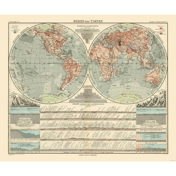
Historic Map - World - Perthes 1891 - 27.56 x 23 - Vintage Wall Art $40.95 $40.95/count
 3 optionsAvailable in additional 3 options$4095current price $40.95$40.95/count
Historic Map - World - Perthes 1891 - 27.56 x 23 - Vintage Wall Art
Historic Map - America Political - Cortambert 1880 - 23 x 30.35 - Vintage Wall Art $40.95 $40.95/count
 $4095current price $40.95$40.95/count
Historic Map - America Political - Cortambert 1880 - 23 x 30.35 - Vintage Wall Art
Historic Map - Persia Arabia - Colton 1858 - 27.37 x 23 - Vintage Wall Art $40.95
 3 optionsAvailable in additional 3 options$4095current price $40.95
Historic Map - Persia Arabia - Colton 1858 - 27.37 x 23 - Vintage Wall Art
Historic Map - World Religious - Streit 1913 - 26.88 x 23 - Vintage Wall Art $40.95
 3 optionsAvailable in additional 3 options$4095current price $40.95
Historic Map - World Religious - Streit 1913 - 26.88 x 23 - Vintage Wall Art
Historic Map - World - Hondio 1630 - 31.13 x 23 - Vintage Wall Art $40.95
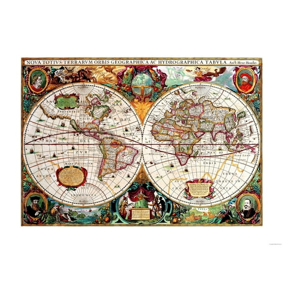 3 optionsAvailable in additional 3 options$4095current price $40.95
Historic Map - World - Hondio 1630 - 31.13 x 23 - Vintage Wall Art
Historic State Map - New York - Hoen 1896 - 27.99 x 23 - Vintage Wall Art $40.95 $40.95/count
 3 optionsAvailable in additional 3 options$4095current price $40.95$40.95/count
Historic State Map - New York - Hoen 1896 - 27.99 x 23 - Vintage Wall Art
Historic State Map - United States Western - Mitchell 1877 - 29.21 x 23 - Vintage Wall Art $40.95
 3 optionsAvailable in additional 3 options$4095current price $40.95
Historic State Map - United States Western - Mitchell 1877 - 29.21 x 23 - Vintage Wall Art
Historic Map - Europe Western 1558 - Gardiner 1902 - 23 x 28.91 - Vintage Wall Art $40.95
 $4095current price $40.95
Historic Map - Europe Western 1558 - Gardiner 1902 - 23 x 28.91 - Vintage Wall Art
Historic State Map - Pennsylvania - Hammond 1910 - 29.30 x 23 - Vintage Wall Art $40.95 $40.95/count
 3 optionsAvailable in additional 3 options$4095current price $40.95$40.95/count
Historic State Map - Pennsylvania - Hammond 1910 - 29.30 x 23 - Vintage Wall Art
Historic State Map - United States Western - Black 1867 - 31.53 x 23 - Vintage Wall Art $40.95
 3 optionsAvailable in additional 3 options$4095current price $40.95
Historic State Map - United States Western - Black 1867 - 31.53 x 23 - Vintage Wall Art
Historic Map - Central Europe 1789 - Gardiner 1902 - 29.20 x 23 - Vintage Wall Art $40.95
 3 optionsAvailable in additional 3 options$4095current price $40.95
Historic Map - Central Europe 1789 - Gardiner 1902 - 29.20 x 23 - Vintage Wall Art
Historic State Map - Pennsylvania - Howell 1792 - 37.00 x 23 - Vintage Wall Art $40.95
 3 optionsAvailable in additional 3 options$4095current price $40.95
Historic State Map - Pennsylvania - Howell 1792 - 37.00 x 23 - Vintage Wall Art
Historic Map - France 1429 English Possessions - Gardiner 1902 - 23 x 29.13 - Vintage Wall Art $40.95
 3 optionsAvailable in additional 3 options$4095current price $40.95
Historic Map - France 1429 English Possessions - Gardiner 1902 - 23 x 29.13 - Vintage Wall Art
Historic Map - Scotland 1300 - Poole 1902 - 23 x 30.26 - Vintage Wall Art $40.95
 3 optionsAvailable in additional 3 options$4095current price $40.95
Historic Map - Scotland 1300 - Poole 1902 - 23 x 30.26 - Vintage Wall Art
Historic Map - Physical Europe - Cortambert 1880 - 30.17 x 23 - Vintage Wall Art $40.95 $40.95/count
 3 optionsAvailable in additional 3 options$4095current price $40.95$40.95/count
Historic Map - Physical Europe - Cortambert 1880 - 30.17 x 23 - Vintage Wall Art
Historic Map - Europe Ancient - D'Anville 1799 - 23 x 28.37 - Vintage Wall Art $40.95 $40.95/count
 3 optionsAvailable in additional 3 options$4095current price $40.95$40.95/count
Historic Map - Europe Ancient - D'Anville 1799 - 23 x 28.37 - Vintage Wall Art
Historic Map - Ottawa Canada - White 1906 - 27.28 x 23 - Vintage Wall Art $40.95
 3 optionsAvailable in additional 3 options$4095current price $40.95
Historic Map - Ottawa Canada - White 1906 - 27.28 x 23 - Vintage Wall Art
Customer ratings & reviews
0 ratings|0 reviews
This item does not have any reviews yet

Related pages
- Maps Of Maryland Cities
- Topographic Map Elevation
- Map Midwest States
- Kappa Maps
- Maps Of Indiana Cities
- Usa Houston Map
- National Parks Posters
- World Map Wall Art
- Central America Travel Books, Maps & Guides
- Cyprus Travel Books
- Southern United States Travel Books, Maps & Guides
- Northeast United States Travel Books, Maps & Guides