
Hero image 0 of Topographical Map - Clark Brothers Ranch Texas Quad - USGS 1981 - 23 x 28.24 - Vintage Wall Art, 0 of 5
Topographical Map - Clark Brothers Ranch Texas Quad - USGS 1981 - 23 x 28.24 - Vintage Wall Art
(No ratings yet)
Key item features
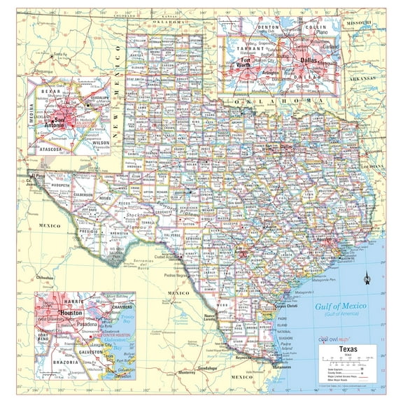
- OWN A HISTORICAL TOPOGRAPHICAL MAP TODAY - Topographical maps provide you a birds-eye view of how the topography of certain pieces of land are mapped out. See how much today's maps have changed from centuries ago. See how waterways have shifted, or how forrests have become thralling cities. See how history has changed the landscape with a topographical map today!
- TOPOGRAPHICAL MAPS PROVIDE IMPORTANT INFORMATION -Topographical maps show you how the borders of a county are established and were they can be found. It also highlights rivers, mountains, and other natural elements, and it will show you where the cities are located within it.
- ONLY ACCEPT THE BEST PRINT QUALITY FOR YOUR REPRODUCTIONS - There are many printers and print types available on the market, when purchasing a reproduction there is no finer quality reproduction than a reproduction using the Giclee Printing method. Giclee describes the technique or style of printing used, and it is revered as the highest quality printing because of the way it precisely sprays ink onto a surface. Trust nothing less than the best!
- GUARNANTEED TO GET EXACTLY WHAT YOU ORDERED - This map comes exactly to the specification of 23.00 x 28.24 inches/58.42 X 71.72 cm. All of our maps come rolled, wrapped, and shipped in a heavy gauge mailing tube to ensure it arrives intact.
- WHY CHOOSE MAPS OF THE PAST? - Maps of the Past is one of the single largest producers of different types of maps. They legally own the rights to the maps they sell, and provide them to you in clean, clear, and vibrant print. If you are looking for a high quality map print, then look no further than Maps of the Past!
Specs
 Size23.00 x 28.24
 BrandMAPS OF THE PAST
 MaterialMatte Art
 Age groupAdult
Current price is USD$40.95
Price when purchased online
- Free shipping
 Free 30-day returns
How do you want your item?
Columbus, 43215
Arrives between Apr 11 - Apr 13
|Sold and shipped by Maps of the Past
4.3 stars out of 5, based on 10 seller reviews(4.3)10 seller reviews
Free 30-day returns
About this item
Product details
Historical Topographic Maps - Clark Brothers Ranch Texas Quad - USGS 1981 - This is an exquisite full-color Reproduction printed on high-quality gloss paper, art paper or canvas.
Print Size: 23.00 x 28.24 inches
58.42 X 71.72cm
The following towns are featured: none.
This Map is Situated in: Clark Brothers Ranch, Texas.
SKU: TXCB0001
Original Maps are often difficult to find and usually have fold lines, identifying stamps or markings, tears, ragged edges, and assorted other natural signs of age that detract from their beauty. All of our maps have been professionally restored to depict their original beauty, while keeping all historical data intact.
These maps are fabulous pieces of history full of information useful to Historians, Genealogists, Cartographers, Relic Hunters, & Others. They make fascinating conversation pieces and splendid works of art for the home or office.
- OWN A HISTORICAL TOPOGRAPHICAL MAP TODAY - Topographical maps provide you a birds-eye view of how the topography of certain pieces of land are mapped out. See how much today's maps have changed from centuries ago. See how waterways have shifted, or how forrests have become thralling cities. See how history has changed the landscape with a topographical map today!
- TOPOGRAPHICAL MAPS PROVIDE IMPORTANT INFORMATION -Topographical maps show you how the borders of a county are established and were they can be found. It also highlights rivers, mountains, and other natural elements, and it will show you where the cities are located within it.
- ONLY ACCEPT THE BEST PRINT QUALITY FOR YOUR REPRODUCTIONS - There are many printers and print types available on the market, when purchasing a reproduction there is no finer quality reproduction than a reproduction using the Giclee Printing method. Giclee describes the technique or style of printing used, and it is revered as the highest quality printing because of the way it precisely sprays ink onto a surface. Trust nothing less than the best!
- GUARNANTEED TO GET EXACTLY WHAT YOU ORDERED - This map comes exactly to the specification of 23.00 x 28.24 inches/58.42 X 71.72 cm. All of our maps come rolled, wrapped, and shipped in a heavy gauge mailing tube to ensure it arrives intact.
- WHY CHOOSE MAPS OF THE PAST? - Maps of the Past is one of the single largest producers of different types of maps. They legally own the rights to the maps they sell, and provide them to you in clean, clear, and vibrant print. If you are looking for a high quality map print, then look no further than Maps of the Past!
info:
We aim to show you accurate product information. Manufacturers, suppliers and others provide what you see here, and we have not verified it.
Specifications
Size
23.00 x 28.24
Brand
MAPS OF THE PAST
Material
Matte Art
Age group
Adult
Warranty
Warranty information
Please be aware that the warranty terms on items offered for sale by third party Marketplace sellers may differ from those displayed in this section (if any). To confirm warranty terms on an item offered for sale by a third party Marketplace seller, please use the 'Contact seller' feature on the third party Marketplace seller's information page and request the item's warranty terms prior to purchase.
Similar items you might like
Based on what customers bought
Best seller 24x36 United States, USA, US Premier Wall Map Paper Folded $9.90
Best seller $990current price $9.90
24x36 United States, USA, US Premier Wall Map Paper Folded
564.3 out of 5 Stars. 56 reviewsColorado State Hand-Drawn Map Poster 24x18", Vintage-Style Wall Art, Lithographic Print with Soy-Based Inks, Gift for History Buffs, Travelers, Teachers, Made in USA $37.26
 $3726current price $37.26
Colorado State Hand-Drawn Map Poster 24x18", Vintage-Style Wall Art, Lithographic Print with Soy-Based Inks, Gift for History Buffs, Travelers, Teachers, Made in USA
Historic State Map - Texas Mexico - Carey 1822 - 28.21 x 23 - Vintage Wall Art $40.95
 3 optionsAvailable in additional 3 options$4095current price $40.95
Historic State Map - Texas Mexico - Carey 1822 - 28.21 x 23 - Vintage Wall Art
Historic State Map - New Mexico Arizona - Mitchell 1867 - 23 x 28.30 - Vintage Wall Art $45.95
 3 optionsAvailable in additional 3 options$4595current price $45.95
Historic State Map - New Mexico Arizona - Mitchell 1867 - 23 x 28.30 - Vintage Wall Art
Xplorer Maps New Hampshire State Hand-Drawn Map Poster - Authentic 18x24 Inch Vintage-Style Wall Art - Lithographic Print with Soy-Based Inks - Made In USA $37.26
 $3726current price $37.26
Xplorer Maps New Hampshire State Hand-Drawn Map Poster - Authentic 18x24 Inch Vintage-Style Wall Art - Lithographic Print with Soy-Based Inks - Made In USA
California State Hand-Drawn Map Poster 18x24", Vintage-Style Wall Art, Lithographic Print with Soy-Based Inks, Gift for History Buffs, Travelers, Teachers, Made in USA $37.26
 $3726current price $37.26
California State Hand-Drawn Map Poster 18x24", Vintage-Style Wall Art, Lithographic Print with Soy-Based Inks, Gift for History Buffs, Travelers, Teachers, Made in USA
Big Sky Maps East Klickitat GMU Map 382 $14.97
 $1497current price $14.97
Big Sky Maps East Klickitat GMU Map 382
Texas State Wall Map Rolled (Laminated 24"x25") $38.88
 $3888current price $38.88
Texas State Wall Map Rolled (Laminated 24"x25")
Cool Owl Maps Mexico, Central America & Caribbean Wall Map - Paper 40"x30" $44.99
 $4499current price $44.99
Cool Owl Maps Mexico, Central America & Caribbean Wall Map - Paper 40"x30"
Topographical Map - Threemile Creek Reservoir Wyoming Quad - USGS 1984 - 23 x 29.36 - Vintage Wall Art $45.95
 3 optionsAvailable in additional 3 options$4595current price $45.95
Topographical Map - Threemile Creek Reservoir Wyoming Quad - USGS 1984 - 23 x 29.36 - Vintage Wall Art
25x24in Dallas-Fort Worth Metroplex Map 【Photo Paper】 $22.99
 3 optionsAvailable in additional 3 options$2299current price $22.99
25x24in Dallas-Fort Worth Metroplex Map 【Photo Paper】
11 out of 5 Stars. 1 reviewsTopographical Map - Carthage East Illinois Quad - USGS 1974 - 23 x 30.07 - Vintage Wall Art $45.95
 3 optionsAvailable in additional 3 options$4595current price $45.95
Topographical Map - Carthage East Illinois Quad - USGS 1974 - 23 x 30.07 - Vintage Wall Art
Topographical Map - Chances Store Texas Quad - USGS 1980 - 23 x 27.95 - Vintage Wall Art $45.95 $45.95/count
 3 optionsAvailable in additional 3 options$4595current price $45.95$45.95/count
Topographical Map - Chances Store Texas Quad - USGS 1980 - 23 x 27.95 - Vintage Wall Art
Historic State Map - South Carolina - Mitchell 1849 - 26.80 x 23 - Vintage Wall Art $40.95
 3 optionsAvailable in additional 3 options$4095current price $40.95
Historic State Map - South Carolina - Mitchell 1849 - 26.80 x 23 - Vintage Wall Art
Topographical Map - Bates Knolls Utah Quad - USGS 1966 - 23 x 30.64 - Vintage Wall Art $45.95
 3 optionsAvailable in additional 3 options$4595current price $45.95
Topographical Map - Bates Knolls Utah Quad - USGS 1966 - 23 x 30.64 - Vintage Wall Art
30x50 RMC Classic Edition United States Wall Map - Laminated $18.99
 $1899current price $18.99
30x50 RMC Classic Edition United States Wall Map - Laminated
Historic Map - British Isles Political - Cortambert 1880 - 23 x 29.74 - Vintage Wall Art $40.95 $40.95/count
 3 optionsAvailable in additional 3 options$4095current price $40.95$40.95/count
Historic Map - British Isles Political - Cortambert 1880 - 23 x 29.74 - Vintage Wall Art
Historic State Map - Alabama - Cram 1888 - 23 x 29.82 - Vintage Wall Art $40.95 $40.95/count
 3 optionsAvailable in additional 3 options$4095current price $40.95$40.95/count
Historic State Map - Alabama - Cram 1888 - 23 x 29.82 - Vintage Wall Art
Historic Map - Mercator Projection American Continent - 28.26 x 23 - Vintage Wall Art $40.95
 3 optionsAvailable in additional 3 options$4095current price $40.95
Historic Map - Mercator Projection American Continent - 28.26 x 23 - Vintage Wall Art
Historic State Map - Vermont - Carey 1795 - 23 x 27.81 - Vintage Wall Art $40.95 $40.95/count
 3 optionsAvailable in additional 3 options$4095current price $40.95$40.95/count
Historic State Map - Vermont - Carey 1795 - 23 x 27.81 - Vintage Wall Art
Customer ratings & reviews
0 ratings|0 reviews
This item does not have any reviews yet

Related pages
- Council Bluffs Iowa Map
- Map Brattleboro Vt
- Akron Ohio Map
- Texas County Maps with Cities
- Cheyenne Wyoming Map
- North Carolina Road Map
- Central America Travel Books, Maps & Guides
- Western United States Travel Books, Maps & Guides
- General South America Travel Books, Maps & Guides
- Midwest United States Travel Books, Maps & Guides
- Northeast United States Travel Books, Maps & Guides
- Ontario Travel Books, Maps & Guides