
Hero image 0 of Historic Map - North Pole South Pole - 29.13 x 23 - Vintage Wall Art, 0 of 5
Historic Map - North Pole South Pole - 29.13 x 23 - Vintage Wall Art
(No ratings yet)
Key item features
- OWN A PIECE OF YOUR HOME COUNTRY - Looking for something that reminds you of the country you or your ancestors originate from? Well now you can own a piece of your heritage with a beautiful map of your home country. Maps of the Past has maps for every need!
- INTERNATIONAL MAPS PROVIDE IMPORTANT INFORMATION - International maps not only show you how the different countries, cities, counties, and territories are divided and where the borders can be found, but it also highlights rivers, mountains, and other natural elements of the land. International maps can also show you natural resources and exports of a country.
- ONLY ACCEPT THE BEST PRINT QUALITY FOR YOUR REPRODUCTIONS - There are many printers and print types available on the market, when purchasing a reproduction there is no finer quality reproduction than a reproduction using the Giclee Printing method. Giclee describes the technique or style of printing used, and it is revered as the highest quality printing because of the way it precisely sprays ink onto a surface. Trust nothing less than the best!
- GUARNANTEED TO GET EXACTLY WHAT YOU ORDERED - This map comes exactly to the specification of 23.00 x 29.13 inches/58.42 X 73.99 cm. All of our maps come rolled, wrapped, and shipped in a heavy gauge mailing tube to ensure it arrives intact.
- WHY CHOOSE MAPS OF THE PAST? - Maps of the Past is one of the single largest producers of different types of maps. They legally own the rights to the maps they sell, and provide them to you in clean, clear, and vibrant print. If you are looking for a high quality map print, then look no further than Maps of the Past!
Specs
- Size23.00 x 29.13
- MaterialMatte Art
- Decor styleVintage
- ShapeRectangle
- Rec. roomOffice
- BrandMAPS OF THE PAST
Current price is USDNow $45.95
You save $29.00
was $74.95$74.95
You save$29.00
Price when purchased online
- Free shipping
 Free 30-day returns
How do you want your item?
Columbus, 43215
Arrives by Thu, Apr 9
|Sold and shipped by Maps of the Past
4.3 stars out of 5, based on 10 seller reviews(4.3)10 seller reviews
Free 30-day returns
Check out these related products
Historic Map - South Pole North Pole - 1855 - 28.87 x 23 - Vintage Wall Art $40.95
 $4095current price $40.95
Historic Map - South Pole North Pole - 1855 - 28.87 x 23 - Vintage Wall Art
Historic Map - North Pole - Perthes 1858 - 29.54 x 23 - Vintage Wall Art $40.95
 3 optionsAvailable in additional 3 options$4095current price $40.95
Historic Map - North Pole - Perthes 1858 - 29.54 x 23 - Vintage Wall Art
Historic Map - North Pole South Pole - Perthes 1884 - 27.42 x 23 - Vintage Wall Art $40.95
 $4095current price $40.95
Historic Map - North Pole South Pole - Perthes 1884 - 27.42 x 23 - Vintage Wall Art
Historic Map - Celestial North Pole - Perthes 1914 - 26.30 x 23 - Vintage Wall Art $40.95 $40.95/count
 $4095current price $40.95$40.95/count
Historic Map - Celestial North Pole - Perthes 1914 - 26.30 x 23 - Vintage Wall Art
Historic Map - South Pole - Thomson 1816 - 23 x 26.95 - Vintage Wall Art $40.95 $40.95/count
 $4095current price $40.95$40.95/count
Historic Map - South Pole - Thomson 1816 - 23 x 26.95 - Vintage Wall Art
Historic Map - North Pole - Buache 1746 - 28.34 x 23 - Vintage Wall Art $40.95
 $4095current price $40.95
Historic Map - North Pole - Buache 1746 - 28.34 x 23 - Vintage Wall Art
Historic Map - Celestial South Pole - Perthes 1914 - 26.16 x 23 - Vintage Wall Art $40.95 $40.95/count
 $4095current price $40.95$40.95/count
Historic Map - Celestial South Pole - Perthes 1914 - 26.16 x 23 - Vintage Wall Art
Historic Map - South Pole - Perthes 1875 - 27.26 x 23 - Vintage Wall Art $40.95
 $4095current price $40.95
Historic Map - South Pole - Perthes 1875 - 27.26 x 23 - Vintage Wall Art
Historic Map - North Pole - Stieler 1885 - 27.57 x 23 - Vintage Wall Art $40.95 $40.95/count
 $4095current price $40.95$40.95/count
Historic Map - North Pole - Stieler 1885 - 27.57 x 23 - Vintage Wall Art
Historic Map - North South Pole World - Cram 1888 - 23 x 28.46 - Vintage Wall Art $40.95 $40.95/count
 $4095current price $40.95$40.95/count
Historic Map - North South Pole World - Cram 1888 - 23 x 28.46 - Vintage Wall Art
Historical Civil War Map - Virginia Routes Camps Positions 7 Views - Hotchkiss 1894 - WallArt $36.95
 $3695current price $36.95
Historical Civil War Map - Virginia Routes Camps Positions 7 Views - Hotchkiss 1894 - WallArt
Historic Mine Map - Dog Springs Quad New Mexico Mines - Givens 1952 - 23 x 28.34 - Vintage Wall Art $40.95 $40.95/count
 $4095current price $40.95$40.95/count
Historic Mine Map - Dog Springs Quad New Mexico Mines - Givens 1952 - 23 x 28.34 - Vintage Wall Art
Historic War Map - North America South Eastern Wars - Cram 1888 - 23 x 28.85 - Vintage Wall Art $40.95 $40.95/count
 $4095current price $40.95$40.95/count
Historic War Map - North America South Eastern Wars - Cram 1888 - 23 x 28.85 - Vintage Wall Art
Historic Map - North Polar Chart - Bartholomew 1892 - 23 x 30.23 - Vintage Wall Art $40.95 $40.95/count
 3 optionsAvailable in additional 3 options$4095current price $40.95$40.95/count
Historic Map - North Polar Chart - Bartholomew 1892 - 23 x 30.23 - Vintage Wall Art
Historic Map - Italy Southern - Ortelius 1595 - 31.84 x 23 - Vintage Wall Art $40.95 $40.95/count
 $4095current price $40.95$40.95/count
Historic Map - Italy Southern - Ortelius 1595 - 31.84 x 23 - Vintage Wall Art
Historic Map - North America Russian Lands - Cortambert 1880 - 30.39 x 23 - Vintage Wall Art $40.95 $40.95/count
 $4095current price $40.95$40.95/count
Historic Map - North America Russian Lands - Cortambert 1880 - 30.39 x 23 - Vintage Wall Art
Historic Map - Western Eastern Hemispheres - 29.64 x 23 - Vintage Wall Art $40.95
 3 optionsAvailable in additional 3 options$4095current price $40.95
Historic Map - Western Eastern Hemispheres - 29.64 x 23 - Vintage Wall Art
Historic Nautical Map - Atlantic Ocean Ports - Perthes 1914 - 26.16 x 23 - Vintage Wall Art $40.95 $40.95/count
 $4095current price $40.95$40.95/count
Historic Nautical Map - Atlantic Ocean Ports - Perthes 1914 - 26.16 x 23 - Vintage Wall Art
Historic Map - Russian Empire Precious Metals - Jlyne 1890 - 37.51 x 23 - Vintage Wall Art $40.95
 $4095current price $40.95
Historic Map - Russian Empire Precious Metals - Jlyne 1890 - 37.51 x 23 - Vintage Wall Art
Historic Map - Eastern Western Hemispheres - 28.85 x 23 - Vintage Wall Art $40.95
 $4095current price $40.95
Historic Map - Eastern Western Hemispheres - 28.85 x 23 - Vintage Wall Art
About this item
Product details
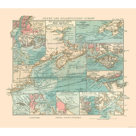
Old International Maps - North Pole and South Pole - This is an exquisite full-color Reproduction printed on high-quality gloss paper, art paper or canvas.
Print Size: 23.00 x 29.13 inches
58.42 X 73.99cm
The following towns are featured: Washington, Quito, Rio Janeiro, Valparaiso, Valdivia, New Orleans, Quebec, Caracas, Nankin, Orenburg, Ispahan.
This Map is Situated in: North Pole and South Pole.
SKU: ITWO0175
Original Maps are often difficult to find and usually have fold lines, identifying stamps or markings, tears, ragged edges, and assorted other natural signs of age that detract from their beauty. All of our maps have been professionally restored to depict their original beauty, while keeping all historical data intact.
These maps are fabulous pieces of history full of information useful to Historians, Genealogists, Cartographers, Relic Hunters, & Others. They make fascinating conversation pieces and splendid works of art for the home or office.
- OWN A PIECE OF YOUR HOME COUNTRY - Looking for something that reminds you of the country you or your ancestors originate from? Well now you can own a piece of your heritage with a beautiful map of your home country. Maps of the Past has maps for every need!
- INTERNATIONAL MAPS PROVIDE IMPORTANT INFORMATION - International maps not only show you how the different countries, cities, counties, and territories are divided and where the borders can be found, but it also highlights rivers, mountains, and other natural elements of the land. International maps can also show you natural resources and exports of a country.
- ONLY ACCEPT THE BEST PRINT QUALITY FOR YOUR REPRODUCTIONS - There are many printers and print types available on the market, when purchasing a reproduction there is no finer quality reproduction than a reproduction using the Giclee Printing method. Giclee describes the technique or style of printing used, and it is revered as the highest quality printing because of the way it precisely sprays ink onto a surface. Trust nothing less than the best!
- GUARNANTEED TO GET EXACTLY WHAT YOU ORDERED - This map comes exactly to the specification of 23.00 x 29.13 inches/58.42 X 73.99 cm. All of our maps come rolled, wrapped, and shipped in a heavy gauge mailing tube to ensure it arrives intact.
- WHY CHOOSE MAPS OF THE PAST? - Maps of the Past is one of the single largest producers of different types of maps. They legally own the rights to the maps they sell, and provide them to you in clean, clear, and vibrant print. If you are looking for a high quality map print, then look no further than Maps of the Past!
info:
We aim to show you accurate product information. Manufacturers, suppliers and others provide what you see here, and we have not verified it.
Specifications
Size
23.00 x 29.13
Material
Matte Art
Decor style
Vintage
Theme
Historical International Maps
Warranty
Warranty information
Please be aware that the warranty terms on items offered for sale by third party Marketplace sellers may differ from those displayed in this section (if any). To confirm warranty terms on an item offered for sale by a third party Marketplace seller, please use the 'Contact seller' feature on the third party Marketplace seller's information page and request the item's warranty terms prior to purchase.
Customer ratings & reviews
0 ratings|0 reviews
This item does not have any reviews yet

Related pages
- North Pole Map
- Map Midwest States
- Map Door County
- Vintage Road Maps
- Topographic Map Elevation
- Street Map Mobile Al
- National Parks Posters
- World Map Wall Art
- Central America Travel Books, Maps & Guides
- Cyprus Travel Books
- Northeast United States Travel Books, Maps & Guides
- Midwest United States Travel Books, Maps & Guides