
Hero image 0 of Historic State Map - Illinois Missouri - Burr 1839 - 23 x 30.63 - Vintage Wall Art, 0 of 5
Historic State Map - Illinois Missouri - Burr 1839 - 23 x 30.63 - Vintage Wall Art
(No ratings yet)
Historic State Map - Illinois Missouri - Burr 1839 - 23 x 30.63 - Vintage Wall ArtHistoric State Map Illinois Missouri Burr 1839 23 x 30 63 Vintage Wall ArtHistoric State Map Illinois Missouri Burr 1839 23 x 30 63 Vintage Wall ArtHistoric State Map Illinois Missouri Burr 1839 23 x 30 63 Vintage Wall Art
Key item features
- OWN A STATE MAP TODAY - If you are looking for a map of your state, or another specific state, to frame and hang on your wall, then look no further! Our state maps are also great for school projects. Our maps have a variety of uses, and they come in a variety of styles. We have every state map you could need!
- STATE MAPS PROVIDE IMPORTANT INFORMATION - State maps not only show you how the different counties and/or cities are divided up and where the borders can be found within a state, but it also highlights rivers, mountains, and other natural elements. Some of them may also provide
- ONLY ACCEPT THE BEST PRINT QUALITY FOR YOUR REPRODUCTIONS - There are many printers and print types available on the market, when purchasing a reproduction there is no finer quality reproduction than a reproduction using the Giclee Printing method. Giclee describes the technique or style of printing used, and it is revered as the highest quality printing because of the way it precisely sprays ink onto a surface. Trust nothing less than the best!
- GUARNANTEED TO GET EXACTLY WHAT YOU ORDERED - This map comes exactly to the specification of 23.00 x 30.63 inches/58.42 X 77.80 cm. All of our maps come rolled, wrapped, and shipped in a heavy gauge mailing tube to ensure it arrives intact.
- WHY CHOOSE MAPS OF THE PAST? - Maps of the Past is one of the single largest producers of different types of maps. They legally own the rights to the maps they sell, and provide them to you in clean, clear, and vibrant print. If you are looking for a high quality map print, then look no further than Maps of the Past!
Specs
- Size23 x 30.63
- MaterialCanvas, Paper
- Decor styleVintage
- ThemeOld State Maps
- ShapeRectangle
- Rec. roomOffice
Price when purchased online
Not Available
How do you want your item?
Not available
About this item
Product details
Old State Map - Illinois, Missouri - Burr 1839 - This is an exquisite full-color Reproduction printed on high-quality gloss paper, art paper or canvas.
Print Size: 23.00 x 30.63 inches
58.42 X 77.80cm
Sites and Townships Specific To This Map Are: Facts stated on this map are Missouri Territory was created in 1812, Missouri became a State in 1821, Illinois became a Territory in 1809 and Illinois became a State in 1818. Features include Illinois River, Missouri River, Sanby Creek and Fox River.
The following towns are featured: Calena, Libertyville, Kashwauke, Elk Grove, Richmond, Hennepin, Ottowa, Hamilton, Peoria, Tremont, Bloomington, Decatur, Darwin, Frankfort, Mt. Vernon, Union, Georgetown, Ripley and Chicago.
This Map is Situated in: States of Illinois (IL) & Missouri (MO)
SKU: ILZZ0005
Original Maps are often difficult to find and usually have fold lines, identifying stamps or markings, tears, ragged edges, and assorted other natural signs of age that detract from their beauty. All of our maps have been professionally restored to depict their original beauty, while keeping all historical data intact.
These maps are fabulous pieces of history full of information useful to Historians, Genealogists, Cartographers, Relic Hunters, & Others. They make fascinating conversation pieces and splendid works of art for the home or office.
- OWN A STATE MAP TODAY - If you are looking for a map of your state, or another specific state, to frame and hang on your wall, then look no further! Our state maps are also great for school projects. Our maps have a variety of uses, and they come in a variety of styles. We have every state map you could need!
- STATE MAPS PROVIDE IMPORTANT INFORMATION - State maps not only show you how the different counties and/or cities are divided up and where the borders can be found within a state, but it also highlights rivers, mountains, and other natural elements. Some of them may also provide
- ONLY ACCEPT THE BEST PRINT QUALITY FOR YOUR REPRODUCTIONS - There are many printers and print types available on the market, when purchasing a reproduction there is no finer quality reproduction than a reproduction using the Giclee Printing method. Giclee describes the technique or style of printing used, and it is revered as the highest quality printing because of the way it precisely sprays ink onto a surface. Trust nothing less than the best!
- GUARNANTEED TO GET EXACTLY WHAT YOU ORDERED - This map comes exactly to the specification of 23.00 x 30.63 inches/58.42 X 77.80 cm. All of our maps come rolled, wrapped, and shipped in a heavy gauge mailing tube to ensure it arrives intact.
- WHY CHOOSE MAPS OF THE PAST? - Maps of the Past is one of the single largest producers of different types of maps. They legally own the rights to the maps they sell, and provide them to you in clean, clear, and vibrant print. If you are looking for a high quality map print, then look no further than Maps of the Past!
info:
We aim to show you accurate product information. Manufacturers, suppliers and others provide what you see here, and we have not verified it.
Specifications
Size
23 x 30.63
Material
Canvas, Paper
Decor style
Vintage
Theme
Old State Maps
Similar items you might like
Based on what customers bought
In 50+ people's carts Home Decor Collection Gold Metro Beaded Oval Framed Landscape Wall Art, Vintage-Style Décor for Living Room, Entryway, Bedroom, or Office, 14x11 $7.49
In 50+ people's carts $749current price $7.49
Home Decor Collection Gold Metro Beaded Oval Framed Landscape Wall Art, Vintage-Style Décor for Living Room, Entryway, Bedroom, or Office, 14x11
1734.4 out of 5 Stars. 173 reviewsHistoric State Map - Illinois Missouri - Tanner 1823 - 23 x 28.51 - Vintage Wall Art $40.95
 3 optionsAvailable in additional 3 options$4095current price $40.95
Historic State Map - Illinois Missouri - Tanner 1823 - 23 x 28.51 - Vintage Wall Art
Historic State Map - California - 1650 - 23 x 32.68 - Vintage Wall Art $94.95
 $9495current price $94.95
Historic State Map - California - 1650 - 23 x 32.68 - Vintage Wall Art
Historic State Map - Kentucky - Putnam 1838 - 23 x 28.38 - Vintage Wall Art $94.95 $94.95/count
 $9495current price $94.95$94.95/count
Historic State Map - Kentucky - Putnam 1838 - 23 x 28.38 - Vintage Wall Art
Historic State Map - New York - Mitchell 1846 - 27.5 x 23 - Vintage Wall Art $94.95 $94.95/count
 3 optionsAvailable in additional 3 options$9495current price $94.95$94.95/count
Historic State Map - New York - Mitchell 1846 - 27.5 x 23 - Vintage Wall Art
Historic City Map - St Louis Missouri - Hutawa 1870 - 23 x 3267 - Vintage Wall Art $94.95
 $9495current price $94.95
Historic City Map - St Louis Missouri - Hutawa 1870 - 23 x 3267 - Vintage Wall Art
Historic State Map - Maine - Burr 1835 - 23 x 28.44 - Vintage Wall Art $40.95
 $4095current price $40.95
Historic State Map - Maine - Burr 1835 - 23 x 28.44 - Vintage Wall Art
Historic State Map - Louisiana - Carey 1814 - 25.5 x 23 - Vintage Wall Art $45.95 Was $74.95 $45.95/count
 $4595current price $45.95, Was $74.95$74.95$45.95/count
Historic State Map - Louisiana - Carey 1814 - 25.5 x 23 - Vintage Wall Art
Historic State Map - Florida Intracoastal Waterway - US Dept of Commerce 1932 - 23 x 34 - Vintage Wall Art $40.95 $40.95/count
 $4095current price $40.95$40.95/count
Historic State Map - Florida Intracoastal Waterway - US Dept of Commerce 1932 - 23 x 34 - Vintage Wall Art
Historic State Map - Missouri - Finley 1831 - Vintage Wall Art $45.95
 4 optionsAvailable in additional 4 options$4595current price $45.95
Historic State Map - Missouri - Finley 1831 - Vintage Wall Art
Historic State Map - Kansas - Mitchell 1859 - 23 x 27.80 - Vintage Wall Art $40.95 $40.95/count
 $4095current price $40.95$40.95/count
Historic State Map - Kansas - Mitchell 1859 - 23 x 27.80 - Vintage Wall Art
Historic State Map - Illinois - Lucas 1823 - 23 x 30.5 - Vintage Wall Art $40.95 $40.95/count
 3 optionsAvailable in additional 3 options$4095current price $40.95$40.95/count
Historic State Map - Illinois - Lucas 1823 - 23 x 30.5 - Vintage Wall Art
Historic State Map - Nebraska Iowa - Johnson 1860 - 23 x 27.32 - Vintage Wall Art $40.95 $40.95/count
 3 optionsAvailable in additional 3 options$4095current price $40.95$40.95/count
Historic State Map - Nebraska Iowa - Johnson 1860 - 23 x 27.32 - Vintage Wall Art
Historic State Map - South Carolina - Rathbun 1893 - 23 x 28.43 - Vintage Wall Art $40.95 $40.95/count
 3 optionsAvailable in additional 3 options$4095current price $40.95$40.95/count
Historic State Map - South Carolina - Rathbun 1893 - 23 x 28.43 - Vintage Wall Art
Historic State Map - Nebraska - Colton 1855 - 28.19 x 23 - Vintage Wall Art $94.95 $94.95/count
 3 optionsAvailable in additional 3 options$9495current price $94.95$94.95/count
Historic State Map - Nebraska - Colton 1855 - 28.19 x 23 - Vintage Wall Art
Historic State Map - Michigan - Burr 1831 - 23 x 27.24 - Vintage Wall Art $45.95 Was $74.95 $45.95/count
 $4595current price $45.95, Was $74.95$74.95$45.95/count
Historic State Map - Michigan - Burr 1831 - 23 x 27.24 - Vintage Wall Art
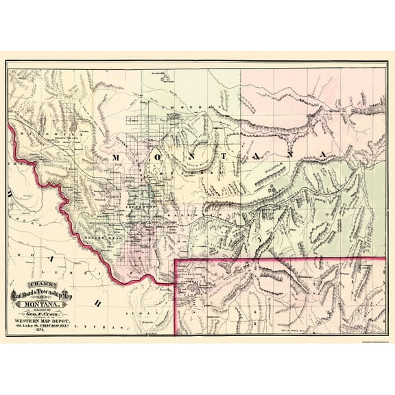
Historic State Map - Montana Territory - Cram 1875 - 31 x 23 - Vintage Wall Art $40.95 $40.95/count
 $4095current price $40.95$40.95/count
Historic State Map - Montana Territory - Cram 1875 - 31 x 23 - Vintage Wall Art
Historic State Map - Virginia - 1644 - 26.96 x 23 - Vintage Wall Art $40.95 $40.95/count
 3 optionsAvailable in additional 3 options$4095current price $40.95$40.95/count
Historic State Map - Virginia - 1644 - 26.96 x 23 - Vintage Wall Art
Historic State Map - Texas - Colton 1858 - 23 x 27 - Vintage Wall Art $40.95
 3 optionsAvailable in additional 3 options$4095current price $40.95
Historic State Map - Texas - Colton 1858 - 23 x 27 - Vintage Wall Art
Historic State Map - Virginia Maryland - Jefferys 1751 - 23 x 35.45 - Vintage Wall Art $94.95 $94.95/count
 3 optionsAvailable in additional 3 options$9495current price $94.95$94.95/count
Historic State Map - Virginia Maryland - Jefferys 1751 - 23 x 35.45 - Vintage Wall Art
Customer ratings & reviews
0 ratings|0 reviews
This item does not have any reviews yet

Related pages
- Map Brattleboro Vt
- Georgia Atlanta Map
- Wisconsin Map
- Chicago Landmark Map
- Chicago World's Fair Map
- Michigan State Map
- National Parks Posters
- Central America Travel Books, Maps & Guides
- Midwest United States Travel Books, Maps & Guides
- Northeast United States Travel Books, Maps & Guides
- Southern United States Travel Books, Maps & Guides
- General South America Travel Books, Maps & Guides