
Hero image 0 of Historic Panoramic View - Guttenberg Iowa - Ruger 1869 - 23 x 29.76 - Vintage Wall Art, 0 of 5
Historic Panoramic View - Guttenberg Iowa - Ruger 1869 - 23 x 29.76 - Vintage Wall Art
(No ratings yet)
Key item features
- HISTORICAL PANORAMIC MAPS MAKE GREAT WALL ART - Ever wonder what your country looked like during the early days of the USA? Well now you can find out! Maps of the Past provides panoramic maps from various time periods so you can track the history of your local area. These gorgiously detailed maps make for a great piece of art for your home or office. Own a piece of art and history today!
- PANORAMIC MAPS PROVIDE IMPORTANT INFORMATION - Local maps show you how the borders of a local are established and were they can be found. It also highlights rivers, mountains, and other natural element you may not know are there. Local maps can also show you transportation lanes across your local
- ONLY ACCEPT THE BEST PRINT QUALITY FOR YOUR REPRODUCTIONS - There are many printers and print types available on the market, when purchasing a reproduction there is no finer quality reproduction than a reproduction using the Giclee Printing method. Giclee describes the technique or style of printing used, and it is revered as the highest quality printing because of the way it precisely sprays ink onto a surface. Trust nothing less than the best!
- GUARNANTEED TO GET EXACTLY WHAT YOU ORDERED - This map comes exactly to the specification of 23.00 x 29.76 inches/58.42 X 75.59 cm. All of our maps come rolled, wrapped, and shipped in a heavy gauge mailing tube to ensure it arrives intact.
- WHY CHOOSE MAPS OF THE PAST? - Maps of the Past is one of the single largest producers of different types of maps. They legally own the rights to the maps they sell, and provide them to you in clean, clear, and vibrant print. If you are looking for a high quality map print, then look no further than Maps of the Past!
Specs
- Size23.00 x 29.76
- MaterialGlossy Satin Photo Quality
- Decor styleVintage
- ThemeOld Panoramic Maps
- ShapeRectangle
- Rec. roomOffice
Current price is USD$40.95$40.95/count
Price when purchased online
- Free shipping
 Free 30-day returns
How do you want your item?
Columbus, 43215
Arrives between Apr 11 - Apr 13
|Sold and shipped by Maps of the Past
4.3 stars out of 5, based on 10 seller reviews(4.3)10 seller reviews
Free 30-day returns
Check out these related products
Historic Map - France Ancient - Fenner 1830 - 28.31 x 23 - Vintage Wall Art $40.95 $40.95/count
 $4095current price $40.95$40.95/count
Historic Map - France Ancient - Fenner 1830 - 28.31 x 23 - Vintage Wall Art
Historic Panoramic View - Princeton Illinois - Ruger 1870 - 23 x 27.90 - Vintage Wall Art $40.95
 3 optionsAvailable in additional 3 options$4095current price $40.95
Historic Panoramic View - Princeton Illinois - Ruger 1870 - 23 x 27.90 - Vintage Wall Art
Historic Panoramic View - Kankakee Illinois - Ruger 1869 - 23 x 28.58 - Vintage Wall Art $40.95
 $4095current price $40.95
Historic Panoramic View - Kankakee Illinois - Ruger 1869 - 23 x 28.58 - Vintage Wall Art
Historic Map - Syria - Fenner 1830 - 23 x 27.87 - Vintage Wall Art $40.95
 $4095current price $40.95
Historic Map - Syria - Fenner 1830 - 23 x 27.87 - Vintage Wall Art
Historic Panoramic View - Delphi Indiana - Ruger 1869 - 23 x 27.73 - Vintage Wall Art $40.95
 3 optionsAvailable in additional 3 options$4095current price $40.95
Historic Panoramic View - Delphi Indiana - Ruger 1869 - 23 x 27.73 - Vintage Wall Art
Historic Map - British Isles - Alden 1886 - 23 x 34.06 - Vintage Wall Art $40.95 $40.95/count
 3 optionsAvailable in additional 3 options$4095current price $40.95$40.95/count
Historic Map - British Isles - Alden 1886 - 23 x 34.06 - Vintage Wall Art
Historic State Map - Western Texas - Cram 1892 - 23 x 33.58 - Vintage Wall Art $40.95
 3 optionsAvailable in additional 3 options$4095current price $40.95
Historic State Map - Western Texas - Cram 1892 - 23 x 33.58 - Vintage Wall Art
Topographical Map - Big Spring Howard County Texas Quad - USGS 1954 - 33.98 x 23 - Vintage Wall Art $40.95 $40.95/count
 $4095current price $40.95$40.95/count
Topographical Map - Big Spring Howard County Texas Quad - USGS 1954 - 33.98 x 23 - Vintage Wall Art
Historic Panoramic View - Lafayette Indiana - Ruger 1868 - 23 x 29.24 - Vintage Wall Art $40.95
 3 optionsAvailable in additional 3 options$4095current price $40.95
Historic Panoramic View - Lafayette Indiana - Ruger 1868 - 23 x 29.24 - Vintage Wall Art
Historic Panoramic View - Belleville Illinois - Ruger 1867 - 23 x 29.45 - Vintage Wall Art $40.95 $40.95/count
 $4095current price $40.95$40.95/count
Historic Panoramic View - Belleville Illinois - Ruger 1867 - 23 x 29.45 - Vintage Wall Art
Historic Map - France Ancient - Hewitt 1830 - 23 x 24.90 - Vintage Wall Art $40.95
 $4095current price $40.95
Historic Map - France Ancient - Hewitt 1830 - 23 x 24.90 - Vintage Wall Art
Historic Map - Alexandria Egypt Environs - Baedeker 1913 - 31.20 x 23 - Vintage Wall Art $40.95 $40.95/count
 $4095current price $40.95$40.95/count
Historic Map - Alexandria Egypt Environs - Baedeker 1913 - 31.20 x 23 - Vintage Wall Art
Historic Panoramic View - Pacific Missouri - Ruger 1869 - Vintage Wall Art $36.95
 $3695current price $36.95
Historic Panoramic View - Pacific Missouri - Ruger 1869 - Vintage Wall Art
Historic Map - Italy Southern Ancient - Chapman 1830 - 29.92 x 23 - Vintage Wall Art $40.95
 3 optionsAvailable in additional 3 options$4095current price $40.95
Historic Map - Italy Southern Ancient - Chapman 1830 - 29.92 x 23 - Vintage Wall Art
Historic Map - Cairo Egypt Regions - Baedeker 1913 - 23 x 29.50 - Vintage Wall Art $40.95 $40.95/count
 $4095current price $40.95$40.95/count
Historic Map - Cairo Egypt Regions - Baedeker 1913 - 23 x 29.50 - Vintage Wall Art
Historic War Map - Cynocephalae Greece Battle - Oxford 1828 - 32.83 x 23 - Vintage Wall Art $40.95
 3 optionsAvailable in additional 3 options$4095current price $40.95
Historic War Map - Cynocephalae Greece Battle - Oxford 1828 - 32.83 x 23 - Vintage Wall Art
Historic Map - Cairo Egypt - Baedeker 1913 - 36.34 x 23 - Vintage Wall Art $40.95 $40.95/count
 3 optionsAvailable in additional 3 options$4095current price $40.95$40.95/count
Historic Map - Cairo Egypt - Baedeker 1913 - 36.34 x 23 - Vintage Wall Art
Historic Map - Julische Alpen Region Slovenia Italy - Baedeker 1910 - 30.24 x 23 - Vintage Wall Art $40.95
 $4095current price $40.95
Historic Map - Julische Alpen Region Slovenia Italy - Baedeker 1910 - 30.24 x 23 - Vintage Wall Art
Historic Map - Victoria Australia - Cram 1892 - 30.83 x 23 - Vintage Wall Art $40.95 $40.95/count
 3 optionsAvailable in additional 3 options$4095current price $40.95$40.95/count
Historic Map - Victoria Australia - Cram 1892 - 30.83 x 23 - Vintage Wall Art
Historic City Map - Nashville Tennessee - Cram 1892 - 23 x 28.19 - Vintage Wall Art $40.95 $40.95/count
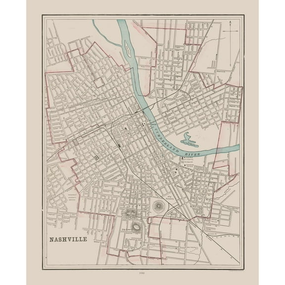 $4095current price $40.95$40.95/count
Historic City Map - Nashville Tennessee - Cram 1892 - 23 x 28.19 - Vintage Wall Art
About this item
Product details
Panoramic Print - Guttenberg Iowa - Merchants 1869 - This is an exquisite full-color Reproduction printed on high-quality gloss paper, art paper or canvas.
Print Size: 23.00 x 29.76 inches
58.42 X 75.59cm
Sites and Townships Specific To This Map Are: Guttenberg.
The following towns are featured: artistic drawing in the title include the Catholic and Lutheran Churches. Refernces on the map include the high school, catholic school, city park hall, and cemeteries.
This Map is Situated in: Clayton County, Iowa (IA).
SKU: IAGU0001
Original Maps are often difficult to find and usually have fold lines, identifying stamps or markings, tears, ragged edges, and assorted other natural signs of age that detract from their beauty. All of our maps have been professionally restored to depict their original beauty, while keeping all historical data intact.
These maps are fabulous pieces of history full of information useful to Historians, Genealogists, Cartographers, Relic Hunters, & Others. They make fascinating conversation pieces and splendid works of art for the home or office.
- HISTORICAL PANORAMIC MAPS MAKE GREAT WALL ART - Ever wonder what your country looked like during the early days of the USA? Well now you can find out! Maps of the Past provides panoramic maps from various time periods so you can track the history of your local area. These gorgiously detailed maps make for a great piece of art for your home or office. Own a piece of art and history today!
- PANORAMIC MAPS PROVIDE IMPORTANT INFORMATION - Local maps show you how the borders of a local are established and were they can be found. It also highlights rivers, mountains, and other natural element you may not know are there. Local maps can also show you transportation lanes across your local
- ONLY ACCEPT THE BEST PRINT QUALITY FOR YOUR REPRODUCTIONS - There are many printers and print types available on the market, when purchasing a reproduction there is no finer quality reproduction than a reproduction using the Giclee Printing method. Giclee describes the technique or style of printing used, and it is revered as the highest quality printing because of the way it precisely sprays ink onto a surface. Trust nothing less than the best!
- GUARNANTEED TO GET EXACTLY WHAT YOU ORDERED - This map comes exactly to the specification of 23.00 x 29.76 inches/58.42 X 75.59 cm. All of our maps come rolled, wrapped, and shipped in a heavy gauge mailing tube to ensure it arrives intact.
- WHY CHOOSE MAPS OF THE PAST? - Maps of the Past is one of the single largest producers of different types of maps. They legally own the rights to the maps they sell, and provide them to you in clean, clear, and vibrant print. If you are looking for a high quality map print, then look no further than Maps of the Past!
info:
We aim to show you accurate product information. Manufacturers, suppliers and others provide what you see here, and we have not verified it.
Specifications
Size
23.00 x 29.76
Material
Glossy Satin Photo Quality
Decor style
Vintage
Theme
Old Panoramic Maps
Warranty
Warranty information
Please be aware that the warranty terms on items offered for sale by third party Marketplace sellers may differ from those displayed in this section (if any). To confirm warranty terms on an item offered for sale by a third party Marketplace seller, please use the 'Contact seller' feature on the third party Marketplace seller's information page and request the item's warranty terms prior to purchase.
Customer ratings & reviews
0 ratings|0 reviews
This item does not have any reviews yet
