
Hero image 0 of Historical Civil War Map - Gettysburg Battlefield Third Day - Warren 1876 - Vintage Wall Art, 0 of 4
Historical Civil War Map - Gettysburg Battlefield Third Day - Warren 1876 - Vintage Wall Art
(No ratings yet)
Historical Civil War Map - Gettysburg Battlefield Third Day - Warren 1876 - Vintage Wall ArtHistorical Civil War Map Gettysburg Battlefield Third Day Warren 1876 23 x 28 46 Vintage Wall ArtHistorical Civil War Map Gettysburg Battlefield Third Day Warren 1876 Vintage Wall ArtHistorical Civil War Map Gettysburg Battlefield Third Day Warren 1876 Vintage Wall ArtHistorical Civil War Map Gettysburg Battlefield Third Day Warren 1876 23 x 28 46 Vintage Wall Art
Material:Glossy Photo
Size:23.00 x 28.46
Key item features
- MAP OF THE CIVIL WAR ERA UNITED STATES - Ever wonder what a certain state or region looked like during the Civil War? Now you can see for yourself and own a piece of USA history! We have maps of colonies, states, all the way up to the entire eastern half of North America. Our maps date all the way back to as early as the 1700's!
- GREAT COMPLIMENT TO ANY COLLECTION - If you are a Civil war-buff, then you likely own a number of pieces of memorabelia from that era. Some items may be replica's, and if you are lucky, some items are originals. A beautiful map from the Civil War era is a great compliment to any collection and adds a finishing touch to collection rooms!
- ONLY ACCEPT THE BEST PRINT QUALITY FOR YOUR REPRODUCTIONS - There are many printers and print types available on the market, when purchasing a reproduction there is no finer quality reproduction than a reproduction using the Giclee Printing method. Giclee describes the technique or style of printing used, and it is revered as the highest quality printing because of the way it precisely sprays ink onto a surface. Trust nothing less than the best!
- GUARANTEED TO GET EXACTLY WHAT YOU ORDERED - All of our maps come rolled, wrapped, and shipped in a heavy gauge mailing tube to ensure it arrives intact.
- WHY CHOOSE MAPS OF THE PAST? - Maps of the Past is one of the single largest producers of different types of maps. They legally own the rights to the maps they sell, and provide them to you in clean, clear, and vibrant print. If you are looking for a high quality map print, then look no further than Maps of the Past!
Specs
- ColorMulticolor
- Decor styleIndustrial
- ThemeCivil War Maps
- FramedN
- ShapeRectangle
- Art typePhotography
Current price is USD$40.95
Price when purchased online
- Free shipping
 Free 30-day returns
How do you want your item?
Columbus, 43215
Arrives between Apr 10 - Apr 13
|Sold and shipped by Maps of the Past
4.3 stars out of 5, based on 10 seller reviews(4.3)10 seller reviews
Free 30-day returns
Similar items you might like
Based on what customers bought
Historic State Map - America Septentrionali - 1751 - 26.63 x 23 - Vintage Wall Art $40.95 $40.95/count
 3 optionsAvailable in additional 3 options$4095current price $40.95$40.95/count
Historic State Map - America Septentrionali - 1751 - 26.63 x 23 - Vintage Wall Art
Historic State Map - Kentucky - Stockdale 1794 - Vintage Wall Art $36.95
 $3695current price $36.95
Historic State Map - Kentucky - Stockdale 1794 - Vintage Wall Art
Historical Civil War Map - Gettysburg Battlefield- Hammond 1898 - Vintage Wall Art $36.95
 $3695current price $36.95
Historical Civil War Map - Gettysburg Battlefield- Hammond 1898 - Vintage Wall Art
Historical Civil War Map - Western Border States Military Portraits - Lloyd 1861 - Vintage Wall Art $36.95
 $3695current price $36.95
Historical Civil War Map - Western Border States Military Portraits - Lloyd 1861 - Vintage Wall Art
Historical Civil War Map - Fort Donelson Tennessee Attack Capture - Grant 1862 - Vintage Wall Art $36.95
 $3695current price $36.95
Historical Civil War Map - Fort Donelson Tennessee Attack Capture - Grant 1862 - Vintage Wall Art
Historic State Map - Idaho - Rathbun 1893 - 23 x 28.59 - Vintage Wall Art $40.95 $40.95/count
 3 optionsAvailable in additional 3 options$4095current price $40.95$40.95/count
Historic State Map - Idaho - Rathbun 1893 - 23 x 28.59 - Vintage Wall Art
Historical Civil War Map - Gettysburg Pennsylvania Battlefield - Lloyd 1864 - Vintage Wall Art $36.95
 $3695current price $36.95
Historical Civil War Map - Gettysburg Pennsylvania Battlefield - Lloyd 1864 - Vintage Wall Art
Historical Civil War Map - United States Military Railroads 1862 1866 - Bien 1866 - WallArt $36.95
 $3695current price $36.95
Historical Civil War Map - United States Military Railroads 1862 1866 - Bien 1866 - WallArt
Historical Civil War Map - Carolinas Virginia Coasts- Prang 1863 - Vintage Wall Art $36.95
 $3695current price $36.95
Historical Civil War Map - Carolinas Virginia Coasts- Prang 1863 - Vintage Wall Art
Historic Revolutionary War Map - Boston Harbour Environs - Page 1775 - 23 x 31.34 - Vintage Wall Art $40.95 $40.95/count
 3 optionsAvailable in additional 3 options$4095current price $40.95$40.95/count
Historic Revolutionary War Map - Boston Harbour Environs - Page 1775 - 23 x 31.34 - Vintage Wall Art
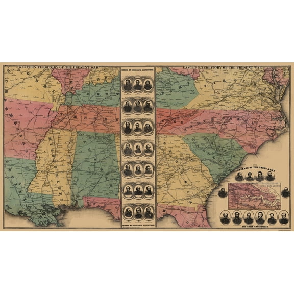
Historical Civil War Map - Eastern Western Territories - 1862 - Vintage Wall Art $36.95
 4 optionsAvailable in additional 4 options$3695current price $36.95
Historical Civil War Map - Eastern Western Territories - 1862 - Vintage Wall Art
Historic County Map - Carbon County Montana - Gibson 1912 - 27.19 x 23 - Vintage Wall Art $45.95 Was $74.95 $45.95/count
 $4595current price $45.95, Was $74.95$74.95$45.95/count
Historic County Map - Carbon County Montana - Gibson 1912 - 27.19 x 23 - Vintage Wall Art
Historic State Map - Washington Territory West Cascades - Duval 1857 - 23 x 34 - Vintage Wall Art $40.95 $40.95/count
 3 optionsAvailable in additional 3 options$4095current price $40.95$40.95/count
Historic State Map - Washington Territory West Cascades - Duval 1857 - 23 x 34 - Vintage Wall Art
Historic Revolutionary War Map - Virginia Major General Lafayette Campaign - Michel 1781 - 23 x 26 - Vintage Wall Art $40.95
 3 optionsAvailable in additional 3 options$4095current price $40.95
Historic Revolutionary War Map - Virginia Major General Lafayette Campaign - Michel 1781 - 23 x 26 - Vintage Wall Art
Historic State Map - Maryland Delaware - Rathbun 1893 - 23 x 28.94 - Vintage Wall Art $45.95 Was $74.95
 4 optionsAvailable in additional 4 options$4595current price $45.95, Was $74.95$74.95
Historic State Map - Maryland Delaware - Rathbun 1893 - 23 x 28.94 - Vintage Wall Art
Historic Map - North America - Smiley 1842 - 23 x 29.44 - Vintage Wall Art $40.95 $40.95/count
 3 optionsAvailable in additional 3 options$4095current price $40.95$40.95/count
Historic Map - North America - Smiley 1842 - 23 x 29.44 - Vintage Wall Art
Historic Map - Persia Arabia - Mitchell 1846 - 23 x 27.10 - Vintage Wall Art $40.95 $40.95/count
 3 optionsAvailable in additional 3 options$4095current price $40.95$40.95/count
Historic Map - Persia Arabia - Mitchell 1846 - 23 x 27.10 - Vintage Wall Art
Historic Map - Arabian Peninsula- Blaeu 1662 - 23 x 28.50 - Vintage Wall Art $40.95 $40.95/count
 3 optionsAvailable in additional 3 options$4095current price $40.95$40.95/count
Historic Map - Arabian Peninsula- Blaeu 1662 - 23 x 28.50 - Vintage Wall Art
Historic Map - Northern Hemisphere - Thomson 1814 - 23 x 26.10 - Vintage Wall Art $40.95 $40.95/count
 3 optionsAvailable in additional 3 options$4095current price $40.95$40.95/count
Historic Map - Northern Hemisphere - Thomson 1814 - 23 x 26.10 - Vintage Wall Art
Historic State Map - Kentucky Tennessee - Johnson 1864 - 23 x 32.65 - Vintage Wall Art $40.95 $40.95/count
 4 optionsAvailable in additional 4 options$4095current price $40.95$40.95/count
Historic State Map - Kentucky Tennessee - Johnson 1864 - 23 x 32.65 - Vintage Wall Art
About this item
Product details
Civil War Map - Gettysburg Battlefield 3rd Days Battle - 1876 - This is an exquisite full-color Reproduction printed on gloss paper or art paper.
Sites and Townships Specific To This Map Are: Gettysburg
The following towns are featured: Carriage Shop, Black Horse Tavern, Mills, Marsh Creek, Willoughby Run, School House, Pitzer Run, Herr Tavern, Chambersburg Pike, Mummasburg Road, Benners Hill, Hanover Road, Rock Creek, Gettysburg & Hanover RR, Wolf Hill, many named landowners and troop positions.
This Map is Situated in: Adams County, Pennsylvania (PA)
SKU: CWGE0010
Original Maps are often difficult to find and usually have fold lines, identifying stamps or markings, tears, ragged edges, and assorted other natural signs of age that detract from their beauty. All of our maps have been professionally restored to depict their original beauty, while keeping all historical data intact.
These maps are fabulous pieces of history full of information useful to Historians, Genealogists, Cartographers, Relic Hunters, & Others. They make fascinating conversation pieces and splendid works of art for the home or office.
- MAP OF THE CIVIL WAR ERA UNITED STATES - Ever wonder what a certain state or region looked like during the Civil War? Now you can see for yourself and own a piece of USA history! We have maps of colonies, states, all the way up to the entire eastern half of North America. Our maps date all the way back to as early as the 1700's!
- GREAT COMPLIMENT TO ANY COLLECTION - If you are a Civil war-buff, then you likely own a number of pieces of memorabelia from that era. Some items may be replica's, and if you are lucky, some items are originals. A beautiful map from the Civil War era is a great compliment to any collection and adds a finishing touch to collection rooms!
- ONLY ACCEPT THE BEST PRINT QUALITY FOR YOUR REPRODUCTIONS - There are many printers and print types available on the market, when purchasing a reproduction there is no finer quality reproduction than a reproduction using the Giclee Printing method. Giclee describes the technique or style of printing used, and it is revered as the highest quality printing because of the way it precisely sprays ink onto a surface. Trust nothing less than the best!
- GUARANTEED TO GET EXACTLY WHAT YOU ORDERED - All of our maps come rolled, wrapped, and shipped in a heavy gauge mailing tube to ensure it arrives intact.
- WHY CHOOSE MAPS OF THE PAST? - Maps of the Past is one of the single largest producers of different types of maps. They legally own the rights to the maps they sell, and provide them to you in clean, clear, and vibrant print. If you are looking for a high quality map print, then look no further than Maps of the Past!
info:
We aim to show you accurate product information. Manufacturers, suppliers and others provide what you see here, and we have not verified it.
Specifications
Color
Multicolor
Decor style
Industrial
Theme
Civil War Maps
Framed
N
Warranty
Warranty information
Please be aware that the warranty terms on items offered for sale by third party Marketplace sellers may differ from those displayed in this section (if any). To confirm warranty terms on an item offered for sale by a third party Marketplace seller, please use the 'Contact seller' feature on the third party Marketplace seller's information page and request the item's warranty terms prior to purchase.
Customer ratings & reviews
0 ratings|0 reviews
This item does not have any reviews yet
