
Hero image 0 of Topographical Map - New Holland Pennsylvania Quad - USGS 1908 - 23 x 29.25 - Vintage Wall Art, 0 of 5
Topographical Map - New Holland Pennsylvania Quad - USGS 1908 - 23 x 29.25 - Vintage Wall Art
(No ratings yet)
Key item features
- OWN A HISTORICAL TOPOGRAPHICAL MAP TODAY - Topographical maps provide you a birds-eye view of how the topography of certain pieces of land are mapped out. See how much today's maps have changed from centuries ago. See how waterways have shifted, or how forrests have become thralling cities. See how history has changed the landscape with a topographical map today!
- TOPOGRAPHICAL MAPS PROVIDE IMPORTANT INFORMATION -Topographical maps show you how the borders of a county are established and were they can be found. It also highlights rivers, mountains, and other natural elements, and it will show you where the cities are located within it.
- ONLY ACCEPT THE BEST PRINT QUALITY FOR YOUR REPRODUCTIONS - There are many printers and print types available on the market, when purchasing a reproduction there is no finer quality reproduction than a reproduction using the Giclee Printing method. Giclee describes the technique or style of printing used, and it is revered as the highest quality printing because of the way it precisely sprays ink onto a surface. Trust nothing less than the best!
- GUARNANTEED TO GET EXACTLY WHAT YOU ORDERED - This map comes exactly to the specification of 23.00 x 29.24 inches/58.42 X 74.26 cm. All of our maps come rolled, wrapped, and shipped in a heavy gauge mailing tube to ensure it arrives intact.
- WHY CHOOSE MAPS OF THE PAST? - Maps of the Past is one of the single largest producers of different types of maps. They legally own the rights to the maps they sell, and provide them to you in clean, clear, and vibrant print. If you are looking for a high quality map print, then look no further than Maps of the Past!
Specs
 Size23.00 x 29.24
 BrandMAPS OF THE PAST
 MaterialMatte Art
 Age groupAdult
Current price is USD$74.95$74.95/count
Price when purchased online
- Free shipping
 Free 30-day returns
How do you want your item?
Columbus, 43215
Arrives between Feb 10 - Feb 12
|Sold and shipped by Maps of the Past
4.3 stars out of 5, based on 10 seller reviews(4.3)10 seller reviews
Free 30-day returns
About this item
Product details
Historical Topographic Maps - New Holland Pennsylvania Quad - USGS 1908 - This is an exquisite full-color Reproduction printed on high-quality gloss paper, art paper or canvas.
Print Size: 23.00 x 29.24 inches
58.42 X 74.26cm
The following towns are featured: Union, Lincoln, Springville, Denver, Durlach, Ephrata, Adamstown, Goodville, New Holland, Vogansville, New Miltown, Paradise.
This Map is Situated in: New Holland, Pennsylvania.
SKU: PANH0001
Original Maps are often difficult to find and usually have fold lines, identifying stamps or markings, tears, ragged edges, and assorted other natural signs of age that detract from their beauty. All of our maps have been professionally restored to depict their original beauty, while keeping all historical data intact.
These maps are fabulous pieces of history full of information useful to Historians, Genealogists, Cartographers, Relic Hunters, & Others. They make fascinating conversation pieces and splendid works of art for the home or office.
- OWN A HISTORICAL TOPOGRAPHICAL MAP TODAY - Topographical maps provide you a birds-eye view of how the topography of certain pieces of land are mapped out. See how much today's maps have changed from centuries ago. See how waterways have shifted, or how forrests have become thralling cities. See how history has changed the landscape with a topographical map today!
- TOPOGRAPHICAL MAPS PROVIDE IMPORTANT INFORMATION -Topographical maps show you how the borders of a county are established and were they can be found. It also highlights rivers, mountains, and other natural elements, and it will show you where the cities are located within it.
- ONLY ACCEPT THE BEST PRINT QUALITY FOR YOUR REPRODUCTIONS - There are many printers and print types available on the market, when purchasing a reproduction there is no finer quality reproduction than a reproduction using the Giclee Printing method. Giclee describes the technique or style of printing used, and it is revered as the highest quality printing because of the way it precisely sprays ink onto a surface. Trust nothing less than the best!
- GUARNANTEED TO GET EXACTLY WHAT YOU ORDERED - This map comes exactly to the specification of 23.00 x 29.24 inches/58.42 X 74.26 cm. All of our maps come rolled, wrapped, and shipped in a heavy gauge mailing tube to ensure it arrives intact.
- WHY CHOOSE MAPS OF THE PAST? - Maps of the Past is one of the single largest producers of different types of maps. They legally own the rights to the maps they sell, and provide them to you in clean, clear, and vibrant print. If you are looking for a high quality map print, then look no further than Maps of the Past!
info:
We aim to show you accurate product information. Manufacturers, suppliers and others provide what you see here, and we have not verified it.
Specifications
Size
23.00 x 29.24
Brand
MAPS OF THE PAST
Material
Matte Art
Age group
Adult
Warranty
Warranty information
Please be aware that the warranty terms on items offered for sale by third party Marketplace sellers may differ from those displayed in this section (if any). To confirm warranty terms on an item offered for sale by a third party Marketplace seller, please use the 'Contact seller' feature on the third party Marketplace seller's information page and request the item's warranty terms prior to purchase.
Check out these related products
Topographical Map - New Kensington Pennsylvania Quad - USGS 1910 - 23 x 29.62 - Vintage Wall Art $36.95
 3 optionsAvailable in additional 3 options$3695current price $36.95Options from $36.95 – $94.95
Topographical Map - New Kensington Pennsylvania Quad - USGS 1910 - 23 x 29.62 - Vintage Wall Art
Shipping, arrives in 3+ daysTopographical Map - Tyrone New Mexico Quad - USGS 1950 - 23 x 28.47 - Vintage Wall Art $36.95
 3 optionsAvailable in additional 3 options$3695current price $36.95Options from $36.95 – $94.95
Topographical Map - Tyrone New Mexico Quad - USGS 1950 - 23 x 28.47 - Vintage Wall Art
Shipping, arrives in 3+ daysTopographical Map - New Castle Pennsylvania Quad - USGS 1904 - 23 x 29.54 - Vintage Wall Art $36.95
 3 optionsAvailable in additional 3 options$3695current price $36.95Options from $36.95 – $94.95
Topographical Map - New Castle Pennsylvania Quad - USGS 1904 - 23 x 29.54 - Vintage Wall Art
Shipping, arrives in 3+ daysTopographical Map - West Hurley New Mexico Quad - USGS 1949 - 23 x 28.25 - Vintage Wall Art $36.95
 3 optionsAvailable in additional 3 options$3695current price $36.95Options from $36.95 – $94.95
Topographical Map - West Hurley New Mexico Quad - USGS 1949 - 23 x 28.25 - Vintage Wall Art
Shipping, arrives in 3+ daysTopographical Map - Glenwood New Mexico Quad - USGS 1965 - 23 x 28.77 - Vintage Wall Art $36.95
 3 optionsAvailable in additional 3 options$3695current price $36.95Options from $36.95 – $94.95
Topographical Map - Glenwood New Mexico Quad - USGS 1965 - 23 x 28.77 - Vintage Wall Art
Shipping, arrives in 3+ daysHistoric Map - World - Alden 1886 - 23 x 35.21 - Vintage Wall Art $74.95
 3 optionsAvailable in additional 3 options$7495current price $74.95More options from $36.95
Historic Map - World - Alden 1886 - 23 x 35.21 - Vintage Wall Art
Shipping, arrives in 3+ daysTopographical Map - Garrison New Mexico Quad - USGS 1972 - 23 x 28.36 - Vintage Wall Art $36.95
 3 optionsAvailable in additional 3 options$3695current price $36.95Options from $36.95 – $94.95
Topographical Map - Garrison New Mexico Quad - USGS 1972 - 23 x 28.36 - Vintage Wall Art
Shipping, arrives in 3+ daysTopographical Map - New London Connecticut Sheet - USGS 1893 - 23 x 29.84 - Vintage Wall Art $36.95
 3 optionsAvailable in additional 3 options$3695current price $36.95Options from $36.95 – $94.95
Topographical Map - New London Connecticut Sheet - USGS 1893 - 23 x 29.84 - Vintage Wall Art
Shipping, arrives in 3+ daysTopographical Map - Cliff New Mexico Quad - USGS 1959 - 23 x 28.26 - Vintage Wall Art $36.95
 3 optionsAvailable in additional 3 options$3695current price $36.95Options from $36.95 – $94.95
Topographical Map - Cliff New Mexico Quad - USGS 1959 - 23 x 28.26 - Vintage Wall Art
Shipping, arrives in 3+ daysTopographical Map - Canador Peak New Mexico Quad - USGS 1959 - 23 x 28.34 - Vintage Wall Art $36.95
 3 optionsAvailable in additional 3 options$3695current price $36.95Options from $36.95 – $94.95
Topographical Map - Canador Peak New Mexico Quad - USGS 1959 - 23 x 28.34 - Vintage Wall Art
Shipping, arrives in 3+ daysTopographical Map - Gary New Mexico Quad - USGS 1964 - 23 x 28.16 - Vintage Wall Art $36.95
 3 optionsAvailable in additional 3 options$3695current price $36.95Options from $36.95 – $94.95
Topographical Map - Gary New Mexico Quad - USGS 1964 - 23 x 28.16 - Vintage Wall Art
Shipping, arrives in 3+ daysTopographical Map - Mogollon New Mexico Quad - USGS 1963 - 23 x 28.25 - Vintage Wall Art $36.95
 3 optionsAvailable in additional 3 options$3695current price $36.95
Topographical Map - Mogollon New Mexico Quad - USGS 1963 - 23 x 28.25 - Vintage Wall Art
Shipping, arrives in 3+ daysTopographical Map - Steins New Mexico Quad - USGS 1965 - 23 x 28.06 - Vintage Wall Art $36.95
 3 optionsAvailable in additional 3 options$3695current price $36.95Options from $36.95 – $94.95
Topographical Map - Steins New Mexico Quad - USGS 1965 - 23 x 28.06 - Vintage Wall Art
Shipping, arrives in 3+ daysTopographical Map - New Haven Colorado Quad - USGS 1972 - 23 x 28.84 - Vintage Wall Art $36.95
 3 optionsAvailable in additional 3 options$3695current price $36.95Options from $36.95 – $94.95
Topographical Map - New Haven Colorado Quad - USGS 1972 - 23 x 28.84 - Vintage Wall Art
Shipping, arrives in 3+ daysTopographical Map - Twin Sisters New Mexico Quad - USGS 1947 - 23 x 28.12 - Vintage Wall Art $36.95
 3 optionsAvailable in additional 3 options$3695current price $36.95Options from $36.95 – $94.95
Topographical Map - Twin Sisters New Mexico Quad - USGS 1947 - 23 x 28.12 - Vintage Wall Art
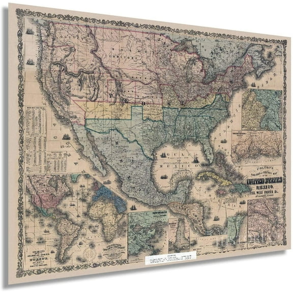
Shipping, arrives in 3+ daysHistoric Map - New Brunswick Nova Scotia Canada - Cram 1888 - 28.65 x 23 - Vintage Wall Art $36.95
 3 optionsAvailable in additional 3 options$3695current price $36.95
Historic Map - New Brunswick Nova Scotia Canada - Cram 1888 - 28.65 x 23 - Vintage Wall Art
Shipping, arrives in 3+ daysHistoric State Map - New Mexico Texas Detail - Hoen 1896 - 29.00 x 23 - Vintage Wall Art $36.95
 3 optionsAvailable in additional 3 options$3695current price $36.95Options from $36.95 – $94.95
Historic State Map - New Mexico Texas Detail - Hoen 1896 - 29.00 x 23 - Vintage Wall Art
Shipping, arrives in 3+ daysTopographical Map - Steeple Rock New Mexico Quad - USGS 1959 - 23 x 28.01 - Vintage Wall Art $36.95
 3 optionsAvailable in additional 3 options$3695current price $36.95
Topographical Map - Steeple Rock New Mexico Quad - USGS 1959 - 23 x 28.01 - Vintage Wall Art
Shipping, arrives in 3+ daysTopographical Map - Dora New Mexico Quad - USGS 1972 - 23 x 29.02 - Vintage Wall Art $36.95
 3 optionsAvailable in additional 3 options$3695current price $36.95Options from $36.95 – $94.95
Topographical Map - Dora New Mexico Quad - USGS 1972 - 23 x 29.02 - Vintage Wall Art
Shipping, arrives in 3+ daysTopographical Map - Salize Pass New Mexico Quad - USGS 1963 - 23 x 28.43 - Vintage Wall Art $36.95
 3 optionsAvailable in additional 3 options$3695current price $36.95Options from $36.95 – $94.95
Topographical Map - Salize Pass New Mexico Quad - USGS 1963 - 23 x 28.43 - Vintage Wall Art
Shipping, arrives in 3+ days
Popular items in this category
Best selling items that customers love
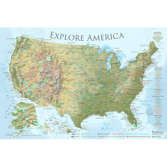
GeoJango United States Wall Map Poster - Lite Terrain (24x16 Inches) $39.00
 3 optionsAvailable in additional 3 options$3900current price $39.00Options from $39.00 – $59.00
GeoJango United States Wall Map Poster - Lite Terrain (24x16 Inches)
Shipping, arrives in 3+ days24" x 36" Smithsonian Journeys Tan Ocean World Wall Map - Laminated $17.89
 3 optionsAvailable in additional 3 options$1789current price $17.89
24" x 36" Smithsonian Journeys Tan Ocean World Wall Map - Laminated
94.6 out of 5 Stars. 9 reviewsSave with Shipping, arrives in 2 days
HISTORIX 1862 United States Railroad and Military Map Vintage Poster Wall Art Print, 18 x 24 Inch $39.99
 2 optionsAvailable in additional 2 options$3999current price $39.99Options from $39.99 – $59.99
HISTORIX 1862 United States Railroad and Military Map Vintage Poster Wall Art Print, 18 x 24 Inch
Shipping, arrives in 3+ daysLaminated World Wall Map (67'' W X 45'' H) (Other) $19.99
 $1999current price $19.99
Laminated World Wall Map (67'' W X 45'' H) (Other)
Save withShipping, arrives in 2 days48" x 78" Swiftmaps Blue Ocean Premier World Wall Map - Laminated $49.90
 4 optionsAvailable in additional 4 options$4990current price $49.90
48" x 78" Swiftmaps Blue Ocean Premier World Wall Map - Laminated
254.7 out of 5 Stars. 25 reviewsSave withShipping, arrives in 2 daysNational Geographic: World Classic Wall Map (36 X 24 Inches) $19.95 Was $25.89
 Now$1995current price Now $19.95, Was $25.89$25.89
National Geographic: World Classic Wall Map (36 X 24 Inches)
11 out of 5 Stars. 1 reviewsSave withShipping, arrives in 2 daysGeoJango USA Wall Map Poster - Black & White (24x16 Inches) $39.00
 3 optionsAvailable in additional 3 options$3900current price $39.00Options from $39.00 – $59.00
GeoJango USA Wall Map Poster - Black & White (24x16 Inches)
15 out of 5 Stars. 1 reviewsShipping, arrives in 3+ daysRand McNally Easy to Read Foldable 2024 State Map, 3.94 x 0.16 in $9.29
 $929current price $9.29
Rand McNally Easy to Read Foldable 2024 State Map, 3.94 x 0.16 in
45 out of 5 Stars. 4 reviewsSave withShipping, arrives tomorrowRMC Signature United States USA and World Wall Map Set - Laminated $29.90
 2 optionsAvailable in additional 2 options$2990current price $29.90
RMC Signature United States USA and World Wall Map Set - Laminated
284.6 out of 5 Stars. 28 reviewsSave withShipping, arrives in 2 daysDelorme Atlas & Gazetteer: Texas $25.65
 $2565current price $25.65
Delorme Atlas & Gazetteer: Texas
124.8 out of 5 Stars. 12 reviewsSave withShipping, arrives tomorrowNational Geographic Reference Map: National Geographic World Wall Map - Classic - Laminated (Poster Size: 36 X 24 In) (Other) $26.58
 $2658current price $26.58
National Geographic Reference Map: National Geographic World Wall Map - Classic - Laminated (Poster Size: 36 X 24 In) (Other)
15 out of 5 Stars. 1 reviewsSave withShipping, arrives in 2 daysBaseball Stadium Map Poster Vintage Edition 36x24 inches $59.00
 3 optionsAvailable in additional 3 options$5900current price $59.00
Baseball Stadium Map Poster Vintage Edition 36x24 inches
15 out of 5 Stars. 1 reviewsShipping, arrives in 3+ daysWaypoint Geographic Blue Ocean World 24" x 36" Laminated Wall Map $37.28
 $3728current price $37.28
Waypoint Geographic Blue Ocean World 24" x 36" Laminated Wall Map
Shipping, arrives in 3+ daysNational geographic adventure map: united states, southeast - folded map: 9781566957205 $13.34
 $1334current price $13.34
National geographic adventure map: united states, southeast - folded map: 9781566957205
Save withShipping, arrives tomorrowCruisin' the Fossil Freeway Map: The Ultimate Prehistoric Road Map to the Best of the American West (Other) $18.31
 $1831current price $18.31
Cruisin' the Fossil Freeway Map: The Ultimate Prehistoric Road Map to the Best of the American West (Other)
Shipping, arrives in 3+ daysRand McNally Foldable Missouri State Map, 3.94 x 0.16 in $9.99
 $999current price $9.99
Rand McNally Foldable Missouri State Map, 3.94 x 0.16 in
15 out of 5 Stars. 1 reviewsSave withShipping, arrives in 2 daysRand McNally Folded Map: Kansas City Street Map, (Paperback) $8.99
 $899current price $8.99
Rand McNally Folded Map: Kansas City Street Map, (Paperback)
12 out of 5 Stars. 1 reviewsSave withShipping, arrives in 2 daysRand McNally Easy to Read: Michigan State Map, (Paperback) $9.99
 $999current price $9.99
Rand McNally Easy to Read: Michigan State Map, (Paperback)
44 out of 5 Stars. 4 reviewsSave withShipping, arrives in 2 daysNational Geographic Africa Classic Map, Laminated, 24" x 30.75" $35.12
 $3512current price $35.12
National Geographic Africa Classic Map, Laminated, 24" x 30.75"
Shipping, arrives in 3+ days
Customer ratings & reviews
0 ratings|0 reviews
This item does not have any reviews yet

Related pages
- Illinois Counties Map
- Paper Map Florida
- Missouri Map Counties
- Maps Of Illinois Cities & Towns
- Maps Of Maryland Cities
- Stanford Map
- National Parks Posters
- Central America Travel Books, Maps & Guides
- Northeast United States Travel Books, Maps & Guides
- Southern United States Travel Books, Maps & Guides
- General Canada Travel Books, Maps & Guides
- Ontario Travel Books, Maps & Guides