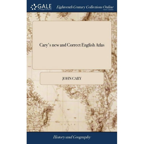
Cary's new and Correct English Atlas: Being a new set of County Maps From Actual Surveys. Exhibiting all the Direct & Principal Cross Roads, Cities, Towns, and Most Considerable Villages, Parks, River
(No ratings yet)
Key item features
Cary's new and Correct English Atlas: Being a new set of County Maps From Actual Surveys. Exhibiting all the Direct & Principal Cross Roads, Cities, Towns, and Most Considerable Villages, Parks, River
Specs
- Book formatHardcover
- Fiction/nonfictionNon-Fiction
- GenreHistory
- Pub date1793
- Pages206
- Subgenre18th Century
Current price is USD$32.95
Price when purchased online
 Free 90-day returns
How do you want your item?
Try 30 days of Free Shipping with Walmart+! Choose plan at checkout.
Columbus, 43215
Arrives by Tomorrow
.Order within 1 hr 6 min
Sold and shipped by Walmart.com
Free 90-day returns
This item is gift eligible
Other sellers
$32.94
+ $5.98 shippingShipping, arrives by Wed, Apr 8 to Columbus, 43215
Sold and shipped by Best Prices & Service
Free 30-day returns
Get free delivery, shipping and more*
*Restrictions apply Try Walmart+ now
About this item
Product details
The 18th century was a wealth of knowledge, exploration and rapidly growing technology and expanding record-keeping made possible by advances in the printing press. In its determination to preserve the century of revolution, Gale initiated a revolution of its own: digitization of epic proportions to preserve these invaluable works in the largest archive of its kind. Now for the first time these high-quality digital copies of original 18th century manuscripts are available in print, making them highly accessible to libraries, undergraduate students, and independent scholars.
Rich in titles on English life and social history, this collection spans the world as it was known to eighteenth-century historians and explorers. Titles include a wealth of travel accounts and diaries, histories of nations from throughout the world, and maps and charts of a world that was still being discovered. Students of the War of American Independence will find fascinating accounts from the British side of conflict.
++++
The below data was compiled from various identification fields in the bibliographic record of this title. This data is provided as an additional tool in helping to insure edition identification:
++++
Bodleian Library (Oxford)
T301139
Maps mostly dated 1787. London or Greenwich meridians. Relief shown by hachures. Descriptions of the counties include lists of seats and views. Includes lists of market and borough towns, with market days and distances from London, and principal post and sub-post towns with their receiving houses and times of arrival and departure. Dedicated to Thomas, Lord Lieutenant Weymouth, Baron Thynne of Warminster.
London.: Printed for John Cary, ..., [1793]. [2], 17 p., [48] leaves, [46] leaves of plates: maps; 4°
Cary's new and Correct English Atlas: Being a new set of County Maps From Actual Surveys. Exhibiting all the Direct & Principal Cross Roads, Cities, Towns, and Most Considerable Villages, Parks, River
info:
We aim to show you accurate product information. Manufacturers, suppliers and others provide what you see here, and we have not verified it.
Specifications
Book format
Hardcover
Fiction/nonfiction
Non-Fiction
Genre
History
Pub date
1793
Warranty
Warranty information
Please be aware that the warranty terms on items offered for sale by third party Marketplace sellers may differ from those displayed in this section (if any). To confirm warranty terms on an item offered for sale by a third party Marketplace seller, please use the 'Contact seller' feature on the third party Marketplace seller's information page and request the item's warranty terms prior to purchase.
Similar items you might like
Based on what customers bought
Standard Atlas of Kent County, Michigan : Including a Plat Book of the Cities, Villages and Township...patrons Directory, Reference Business Directory.. (Hardcover) $31.95
 $3195current price $31.95
Standard Atlas of Kent County, Michigan : Including a Plat Book of the Cities, Villages and Township...patrons Directory, Reference Business Directory.. (Hardcover)
Cary's Traveller's Companion: Or, A Delineation of The Turnpike Roads of England and Wales. Shewing The Rout To Every Market and Borough Town Throughout The Kingdom. Laid Down From The Best Authoritie $29.95
 $2995current price $29.95
Cary's Traveller's Companion: Or, A Delineation of The Turnpike Roads of England and Wales. Shewing The Rout To Every Market and Borough Town Throughout The Kingdom. Laid Down From The Best Authoritie
Cary's Traveller's Companion, or, a Delineation of the Turnpike Roads of England and Wales : Shewing the Immediate Rout to Every Market and Borough Town Throughout the Kingdom. Laid Down From the Best Authorities (Hardcover) $29.95
 $2995current price $29.95
Cary's Traveller's Companion, or, a Delineation of the Turnpike Roads of England and Wales : Shewing the Immediate Rout to Every Market and Borough Town Throughout the Kingdom. Laid Down From the Best Authorities (Hardcover)
Cary's Traveller's Companion: Or, a Delineation of the Turnpike Roads of England and Wales. Shewing the Rout to Every Market and Borough Town Throughout the Kingdom. Laid Down from the Best Authoritie $17.75
 $1775current price $17.75
Cary's Traveller's Companion: Or, a Delineation of the Turnpike Roads of England and Wales. Shewing the Rout to Every Market and Borough Town Throughout the Kingdom. Laid Down from the Best Authoritie
Cary's Survey of the High Roads From London to Hampton Court, ... Richmond. On a Scale of one Inch to a Mile; ... to Which is Added the Number of Inns on Each Separate Route; Also, the Different Turnp $26.95
 $2695current price $26.95
Cary's Survey of the High Roads From London to Hampton Court, ... Richmond. On a Scale of one Inch to a Mile; ... to Which is Added the Number of Inns on Each Separate Route; Also, the Different Turnp
Cary's new and Correct English Atlas: Being a new set of County Maps From Actual Surveys. Exhibiting all the ... Roads, Cities, Towns, ... Preceded by a General map of South Britain, (Hardcover) $31.05
 $3105current price $31.05
Cary's new and Correct English Atlas: Being a new set of County Maps From Actual Surveys. Exhibiting all the ... Roads, Cities, Towns, ... Preceded by a General map of South Britain, (Hardcover)
The Nord Stream Conspiracy: The Inside Story of the Explosions That Shook the World, (Hardcover) $29.99
 $2999current price $29.99
The Nord Stream Conspiracy: The Inside Story of the Explosions That Shook the World, (Hardcover)
Carys Actual Survey of the Country Fifteen Miles Round London. On a Scale of one Inch to a Mile. ... Preceded by a General map of the Whole. To Which is Added, an Index of all the Names Contained in t $30.10
 $3010current price $30.10
Carys Actual Survey of the Country Fifteen Miles Round London. On a Scale of one Inch to a Mile. ... Preceded by a General map of the Whole. To Which is Added, an Index of all the Names Contained in t
Geographia Magn] Britanni]. Or, Correct Maps of All the Counties in England, Scotland, and Wales; ... Together with Tables of the High and Cross Roads Paperback $19.18
![Geographia Magn] Britanni]. Or, Correct Maps of All the Counties in England, Scotland, and Wales; ... Together with Tables of the High and Cross Roads Paperback](https://i5.walmartimages.com/asr/32d4980a-c79f-48bc-b44c-561d1dd171c1.bd928866055180f833b4472eca51bb0f.jpeg?odnHeight=576&odnWidth=576&odnBg=FFFFFF) $1918current price $19.18
$1918current price $19.18Geographia Magn] Britanni]. Or, Correct Maps of All the Counties in England, Scotland, and Wales; ... Together with Tables of the High and Cross Roads Paperback
Darton's New Miniature Atlas Containing a Complete set of County Maps, in Which are Carefully Delineated all the Principal Direct & Cross Roads, Cities, Towns, Villages, Parks, Seats, Rivers & Navigab $32.95
 $3295current price $32.95
Darton's New Miniature Atlas Containing a Complete set of County Maps, in Which are Carefully Delineated all the Principal Direct & Cross Roads, Cities, Towns, Villages, Parks, Seats, Rivers & Navigab
Cary's new Itinerary; or, an Accurate Delineation of the Great Roads, Both Direct and Cross, Throughout England and Wales; With Many of the Principal Roads in Scotland (Hardcover) $39.56
 $3956current price $39.56
Cary's new Itinerary; or, an Accurate Delineation of the Great Roads, Both Direct and Cross, Throughout England and Wales; With Many of the Principal Roads in Scotland (Hardcover)
A New Universal Pocket Gazetteer : Containing Descriptions of the Most Remarkable Empires, Kingdoms, Nations, States, Tribes, Cities, Towns, Villages, Mountains, Islands, Rivers, Seas, Lakes, Cataracts, Canals, and Railroads in the Known World, With Notice (Paperback) $23.95
 $2395current price $23.95
A New Universal Pocket Gazetteer : Containing Descriptions of the Most Remarkable Empires, Kingdoms, Nations, States, Tribes, Cities, Towns, Villages, Mountains, Islands, Rivers, Seas, Lakes, Cataracts, Canals, and Railroads in the Known World, With Notice (Paperback)
A Compleat and Humorous Account of All the Remarkable Clubs and Societies in the Cities of London and Westminster, ... Compil'd from the Original Papers of a Gent. Who Frequented Those Places Upwards $27.75
 $2775current price $27.75
A Compleat and Humorous Account of All the Remarkable Clubs and Societies in the Cities of London and Westminster, ... Compil'd from the Original Papers of a Gent. Who Frequented Those Places Upwards
A new Atlas of France (Hardcover) $32.94
 $3294current price $32.94
A new Atlas of France (Hardcover)
Villare Cantianum: or, Kent Surveyed and Illustrated. Being An Exact Description of All The Parishes, Boroughs, Villages, and Other Respective Manors In The County of Kent. By Thomas Philipott Second $32.00
 $3200current price $32.00
Villare Cantianum: or, Kent Surveyed and Illustrated. Being An Exact Description of All The Parishes, Boroughs, Villages, and Other Respective Manors In The County of Kent. By Thomas Philipott Second
The history and antiquities of the county of Somerset, collected from authentick records, and an actual survey made by the late Mredmund Rack Adorned with a map and engravings By the Reverend John Col $33.33
 $3333current price $33.33
The history and antiquities of the county of Somerset, collected from authentick records, and an actual survey made by the late Mredmund Rack Adorned with a map and engravings By the Reverend John Col
A new and Accurate Description of the Present Great Roads and the Principal Cross Roads of England and Wales, Commencing at London, ... To Which are Added, the Ancient Roman Roads and Stations in Brit $32.95
 $3295current price $32.95
A new and Accurate Description of the Present Great Roads and the Principal Cross Roads of England and Wales, Commencing at London, ... To Which are Added, the Ancient Roman Roads and Stations in Brit
Standard Atlas of Edwards County, Illinois: Including a Plat Book of the Villages, Cities and Townships of the County. Map of the State, United States and World. Patrons Directory, Reference Business $30.95
 $3095current price $30.95
Standard Atlas of Edwards County, Illinois: Including a Plat Book of the Villages, Cities and Townships of the County. Map of the State, United States and World. Patrons Directory, Reference Business
Westchester County in History; Manual and Civil List, Past and Present. County History: Towns, Hamlets, Villages and Cities; Volume 2 (Paperback) $25.95
 $2595current price $25.95
Westchester County in History; Manual and Civil List, Past and Present. County History: Towns, Hamlets, Villages and Cities; Volume 2 (Paperback)
Geographia Scotiæ: Being new and Correct Maps of all the Counties and Islands in the Kingdom of Scotland. Containing the Universities, Cities, ... With a General map of the Whole Kingdom, (Hardcover) $27.27
 $2727current price $27.27
Geographia Scotiæ: Being new and Correct Maps of all the Counties and Islands in the Kingdom of Scotland. Containing the Universities, Cities, ... With a General map of the Whole Kingdom, (Hardcover)
Customer ratings & reviews
0 ratings|0 reviews
This item does not have any reviews yet

Related pages
- Mta Maps
- Highway 80 Map
- Elevation Map
- Route 66 Maps
- South America Atlas
- Philadelphia Atlas
- Midwest United States Travel Books, Maps & Guides
- Central America Travel Books, Maps & Guides
- Western United States Travel Books, Maps & Guides
- Southern United States Travel Books, Maps & Guides
- Northeast United States Travel Books, Maps & Guides
- Maps & Road Atlases