
Hero image 0 of 1872 Map of Nevada and California, 0 of 1
1872 Map of Nevada and California
(No ratings yet)
1872 Map of Nevada and California1872 Map of Nevada and California1875 County Map of California and Nevada1856 California1856 California1872 Map of Nevada and CaliforniaThe Vintage Map Shop 1872 Map of Nevada and California 24x201856 California1856 California1872 Map of Nevada and California
Size:35" x 42"
Key item features
- VINTAGE MAP REPRODUCTIONS: Shop fine print giclée reproduction posters of vintage and antique maps that add unique wall décor to any room. Perfect for interior design with modern, vintage, rustic, historic, or retro style
- HISTORICAL DESCRIPTIONS INCLUDED: All vintage map reproductions come with historic descriptions about the history, geography, or artistic style of the map. These unique descriptions help you make our maps a conversation piece
- MUSEUM QUALITY INKS AND PAPER: Printed on the highest quality 248 GSM premium archival matte paper with top grade giclee inks, offering a lifetime guarantee not to fade when properly framed.
- CUSTOM MADE TO ORDER IN THE USA: Each custom made, and hand trimmed artisan print, made in the U.S.A. High resolution scans of historic maps digitally restored to with high image quality and color.
- READY FOR FRAMING: Your unframed, hand-trimmed fine print includes a narrow margin on all sides for easy framing in many standard sizes such as 16x24, 18x24, 24x30, 24x36, 30x58. Add matting for enhanced visual effects.
Specs
- Size35" x 42"
- BrandThe Vintage Map Shop
- ColorMulti Color
- Pieces1
Current price is USD$100.00
Price when purchased online
- Free shipping
 Free 30-day returns
How do you want your item?
Ships to
Arrives between May 22 - May 26
|Sold and shipped by The Vintage Map Shop
Free 30-day returns
About this item
Product details
For Sale: Vintage Map Print of California and Nevada by Warner & Beers, published out of Chicago in 1872. Paiutes, San Francisco, Los Angeles, San Diego, Santa Barbara, Monterey, Las Vegas, Carson City, Mining Towns
- VINTAGE MAP REPRODUCTIONS: Shop fine print giclée reproduction posters of vintage and antique maps that add unique wall décor to any room. Perfect for interior design with modern, vintage, rustic, historic, or retro style
- HISTORICAL DESCRIPTIONS INCLUDED: All vintage map reproductions come with historic descriptions about the history, geography, or artistic style of the map. These unique descriptions help you make our maps a conversation piece
- MUSEUM QUALITY INKS AND PAPER: Printed on the highest quality 248 GSM premium archival matte paper with top grade giclee inks, offering a lifetime guarantee not to fade when properly framed.
- CUSTOM MADE TO ORDER IN THE USA: Each custom made, and hand trimmed artisan print, made in the U.S.A. High resolution scans of historic maps digitally restored to with high image quality and color.
- READY FOR FRAMING: Your unframed, hand-trimmed fine print includes a narrow margin on all sides for easy framing in many standard sizes such as 16x24, 18x24, 24x30, 24x36, 30x58. Add matting for enhanced visual effects.
info:
We aim to show you accurate product information. Manufacturers, suppliers and others provide what you see here, and we have not verified it.
Specifications
Size
35" x 42"
Brand
The Vintage Map Shop
Color
Multi Color
Pieces
1
Warranty
Warranty information
Please be aware that the warranty terms on items offered for sale by third party Marketplace sellers may differ from those displayed in this section (if any). To confirm warranty terms on an item offered for sale by a third party Marketplace seller, please use the 'Contact seller' feature on the third party Marketplace seller's information page and request the item's warranty terms prior to purchase.
Similar items you might like
Based on what customers bought
1872 Johnson's California also Utah, Nevada, Colorado New Mexico and Arizona $45.00
 4 optionsAvailable in additional 4 options$4500current price $45.00
1872 Johnson's California also Utah, Nevada, Colorado New Mexico and Arizona
Xplorer Maps MAP_UT Utah State Hand-Drawn Map $37.26
 $3726current price $37.26
Xplorer Maps MAP_UT Utah State Hand-Drawn Map
Xplorer Maps MAP_CCSP California Central Coast State Parks Hand-Drawn Map $37.26
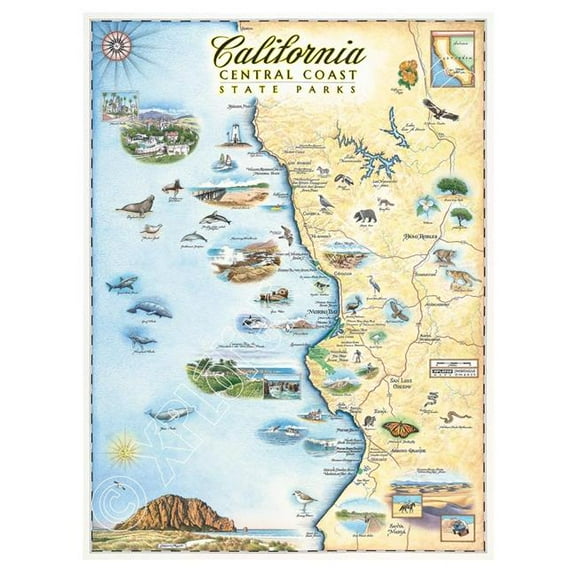 $3726current price $37.26
Xplorer Maps MAP_CCSP California Central Coast State Parks Hand-Drawn Map
Xplorer Maps MAP_TN Tennessee Hand-Drawn Map $33.63
 $3363current price $33.63
Xplorer Maps MAP_TN Tennessee Hand-Drawn Map
Xplorer Maps MAP_LTH Lake Tahoe Hand-Drawn Map $37.26
 $3726current price $37.26
Xplorer Maps MAP_LTH Lake Tahoe Hand-Drawn Map
1856 Kentucky and Tennessee $35.00
 5 optionsAvailable in additional 5 options$3500current price $35.00
1856 Kentucky and Tennessee
California State Hand-Drawn Map Poster 18x24", Vintage-Style Wall Art, Lithographic Print with Soy-Based Inks, Gift for History Buffs, Travelers, Teachers, Made in USA $32.99
 $3299current price $32.99
California State Hand-Drawn Map Poster 18x24", Vintage-Style Wall Art, Lithographic Print with Soy-Based Inks, Gift for History Buffs, Travelers, Teachers, Made in USA
1873 Map of the City of Chicago $35.00
 4 optionsAvailable in additional 4 options$3500current price $35.00
1873 Map of the City of Chicago
1936 The Story Map of the West Indies $35.00
 4 optionsAvailable in additional 4 options$3500current price $35.00
1936 The Story Map of the West Indies
1861 Johnson's Florida | Plan of the Florida Keys $35.00
 5 optionsAvailable in additional 5 options$3500current price $35.00
1861 Johnson's Florida | Plan of the Florida Keys
1940 A Hysterical Map of Mount Rainier National Park. $40.00
 4 optionsAvailable in additional 4 options$4000current price $40.00
1940 A Hysterical Map of Mount Rainier National Park.
Xplorer Maps MAP_NC North Carolina State Hand-Drawn Map $11.97 Was $15.01
 $1197current price $11.97, Was $15.01$15.01
Xplorer Maps MAP_NC North Carolina State Hand-Drawn Map
Wall Art Impressions Laminated California Road Map with Cities and Highways, 24" x 24" $19.99
 3 optionsAvailable in additional 3 options$1999current price $19.99
Wall Art Impressions Laminated California Road Map with Cities and Highways, 24" x 24"
15 out of 5 Stars. 1 reviewsHistoric State Map - South Carolina - Mitchell 1849 - Vintage Wall Art $36.95
 $3695current price $36.95
Historic State Map - South Carolina - Mitchell 1849 - Vintage Wall Art
Luckies Scratch Map | World Travel Map | A3 Poster | Neon Purple $12.00
 $1200current price $12.00
Luckies Scratch Map | World Travel Map | A3 Poster | Neon Purple
Xplorer Maps MAP_CATI Santa Catalina Island Hand-Drawn Map $37.26
 $3726current price $37.26
Xplorer Maps MAP_CATI Santa Catalina Island Hand-Drawn Map
Xplorer Maps MAP_MB Monterey Bay Hand-Drawn Map $37.26
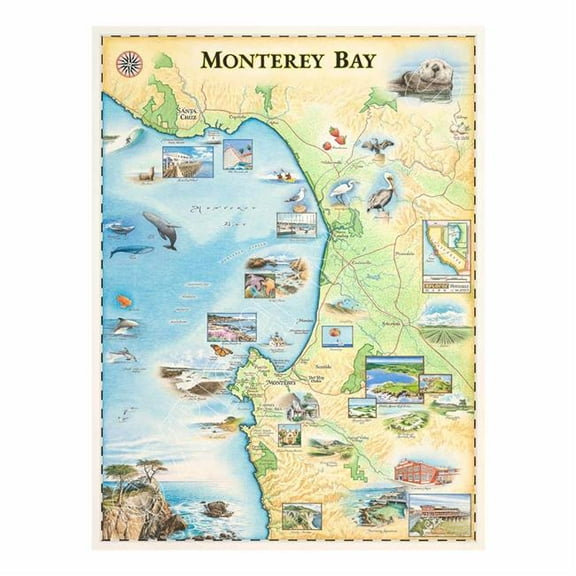 $3726current price $37.26
Xplorer Maps MAP_MB Monterey Bay Hand-Drawn Map
California 3D Raised Relief Map $39.99
 $3999current price $39.99
California 3D Raised Relief Map
Historic State Map - Nebraska Kansas - Colton 1855 - Vintage Wall Art $36.95
 4 optionsAvailable in additional 4 options$3695current price $36.95
Historic State Map - Nebraska Kansas - Colton 1855 - Vintage Wall Art
1943 The United States at War $45.00
 4 optionsAvailable in additional 4 options$4500current price $45.00
1943 The United States at War
Customer ratings & reviews
0 ratings|0 reviews
This item does not have any reviews yet
