
Hero image 0 of Historic Map - Rochefort Belvaux Belgium - Baedeker 1910 - 23 x 33.59 - Vintage Wall Art, 0 of 5
Historic Map - Rochefort Belvaux Belgium - Baedeker 1910 - 23 x 33.59 - Vintage Wall Art
(No ratings yet)
Key item features
- OWN A PIECE OF YOUR HOME COUNTRY - Looking for something that reminds you of the country you or your ancestors originate from? Well now you can own a piece of your heritage with a beautiful map of your home country. Maps of the Past has maps for every need!
- INTERNATIONAL MAPS PROVIDE IMPORTANT INFORMATION - International maps not only show you how the different countries, cities, counties, and territories are divided and where the borders can be found, but it also highlights rivers, mountains, and other natural elements of the land. International maps can also show you natural resources and exports of a country.
- ONLY ACCEPT THE BEST PRINT QUALITY FOR YOUR REPRODUCTIONS - There are many printers and print types available on the market, when purchasing a reproduction there is no finer quality reproduction than a reproduction using the Giclee Printing method. Giclee describes the technique or style of printing used, and it is revered as the highest quality printing because of the way it precisely sprays ink onto a surface. Trust nothing less than the best!
- GUARNANTEED TO GET EXACTLY WHAT YOU ORDERED - This map comes exactly to the specification of 23.00 x 33.59 inches/58.42 X 85.31 cm. All of our maps come rolled, wrapped, and shipped in a heavy gauge mailing tube to ensure it arrives intact.
- WHY CHOOSE MAPS OF THE PAST? - Maps of the Past is one of the single largest producers of different types of maps. They legally own the rights to the maps they sell, and provide them to you in clean, clear, and vibrant print. If you are looking for a high quality map print, then look no further than Maps of the Past!
Specs
- Color1
- Size23.00 x 33.59
- MaterialMatte Art
- Decor styleVintage
- ShapeRectangle
- Rec. roomOffice
Current price is USD$45.95$45.95/count
Price when purchased online
- Free shipping
 Free 30-day returns
How do you want your item?
Columbus, 43215
Arrives by Mon, Apr 13
|Sold and shipped by Maps of the Past
4.3 stars out of 5, based on 10 seller reviews(4.3)10 seller reviews
Free 30-day returns
About this item
Product details
Old International Maps - Rochefort - Belvaux - Belgium - Baedeker 1910 - This is an exquisite full-color Reproduction printed on high-quality gloss paper, art paper or canvas.
Print Size: 23.00 x 33.59 inches
58.42 X 85.31cm
The following towns are featured: Rochefort, Belvaux, Eprave, Hamerenne, Hans-sur-Lesse, Auffe, Thiore.
This Map is Situated in: Rochefort, Belvaux, Belgium.
SKU: ITBE0046
Original Maps are often difficult to find and usually have fold lines, identifying stamps or markings, tears, ragged edges, and assorted other natural signs of age that detract from their beauty. All of our maps have been professionally restored to depict their original beauty, while keeping all historical data intact.
These maps are fabulous pieces of history full of information useful to Historians, Genealogists, Cartographers, Relic Hunters, & Others. They make fascinating conversation pieces and splendid works of art for the home or office.
- OWN A PIECE OF YOUR HOME COUNTRY - Looking for something that reminds you of the country you or your ancestors originate from? Well now you can own a piece of your heritage with a beautiful map of your home country. Maps of the Past has maps for every need!
- INTERNATIONAL MAPS PROVIDE IMPORTANT INFORMATION - International maps not only show you how the different countries, cities, counties, and territories are divided and where the borders can be found, but it also highlights rivers, mountains, and other natural elements of the land. International maps can also show you natural resources and exports of a country.
- ONLY ACCEPT THE BEST PRINT QUALITY FOR YOUR REPRODUCTIONS - There are many printers and print types available on the market, when purchasing a reproduction there is no finer quality reproduction than a reproduction using the Giclee Printing method. Giclee describes the technique or style of printing used, and it is revered as the highest quality printing because of the way it precisely sprays ink onto a surface. Trust nothing less than the best!
- GUARNANTEED TO GET EXACTLY WHAT YOU ORDERED - This map comes exactly to the specification of 23.00 x 33.59 inches/58.42 X 85.31 cm. All of our maps come rolled, wrapped, and shipped in a heavy gauge mailing tube to ensure it arrives intact.
- WHY CHOOSE MAPS OF THE PAST? - Maps of the Past is one of the single largest producers of different types of maps. They legally own the rights to the maps they sell, and provide them to you in clean, clear, and vibrant print. If you are looking for a high quality map print, then look no further than Maps of the Past!
info:
We aim to show you accurate product information. Manufacturers, suppliers and others provide what you see here, and we have not verified it.
Specifications
Color
1
Size
23.00 x 33.59
Material
Matte Art
Decor style
Vintage
Warranty
Warranty information
Please be aware that the warranty terms on items offered for sale by third party Marketplace sellers may differ from those displayed in this section (if any). To confirm warranty terms on an item offered for sale by a third party Marketplace seller, please use the 'Contact seller' feature on the third party Marketplace seller's information page and request the item's warranty terms prior to purchase.
Check out these related products
Historic Map - Spa Belgium - Baedeker 1910 - 23 x 32.25 - Vintage Wall Art $40.95 $40.95/count
 $4095current price $40.95$40.95/count
Historic Map - Spa Belgium - Baedeker 1910 - 23 x 32.25 - Vintage Wall Art
Historic City Map - Atlanta Georgia - Reynold 1921 - Vintage Wall Art $36.95
 $3695current price $36.95
Historic City Map - Atlanta Georgia - Reynold 1921 - Vintage Wall Art
Historic Map - Ostend Belgium - Baedeker 1910 - 32.21 x 23 - Vintage Wall Art $40.95 $40.95/count
 3 optionsAvailable in additional 3 options$4095current price $40.95$40.95/count
Historic Map - Ostend Belgium - Baedeker 1910 - 32.21 x 23 - Vintage Wall Art
Historic Nautical Map - North Sea Belgium - Baedeker 1910 - 30.21 x 23 - Vintage Wall Art $40.95 $40.95/count
 3 optionsAvailable in additional 3 options$4095current price $40.95$40.95/count
Historic Nautical Map - North Sea Belgium - Baedeker 1910 - 30.21 x 23 - Vintage Wall Art
Historic Map - Europe Ancient - D'Anville 1799 - 23 x 28.37 - Vintage Wall Art $40.95 $40.95/count
 $4095current price $40.95$40.95/count
Historic Map - Europe Ancient - D'Anville 1799 - 23 x 28.37 - Vintage Wall Art
Historic War Map - Syvota Greece - Oxford 1828 - 32.04 x 23 - Vintage Wall Art $40.95 $40.95/count
 $4095current price $40.95$40.95/count
Historic War Map - Syvota Greece - Oxford 1828 - 32.04 x 23 - Vintage Wall Art
Topographical Map - Tracy Missouri Quad - USGS 1961 - Vintage Wall Art $36.95
 4 optionsAvailable in additional 4 options$3695current price $36.95
Topographical Map - Tracy Missouri Quad - USGS 1961 - Vintage Wall Art
Historic Map - Armenia Colchis Albania Iberia Asia - Oxford 1828 - 30.04 x 23 - Vintage Wall Art $40.95
 3 optionsAvailable in additional 3 options$4095current price $40.95
Historic Map - Armenia Colchis Albania Iberia Asia - Oxford 1828 - 30.04 x 23 - Vintage Wall Art
Historic Map - Paris France Northern - Blue Guides 1921 - 23 x 28.04 - Vintage Wall Art $40.95 $40.95/count
 $4095current price $40.95$40.95/count
Historic Map - Paris France Northern - Blue Guides 1921 - 23 x 28.04 - Vintage Wall Art
Historic Map - Amsterdam Netherlands - Baedeker 1910 - 23 x 28.76 - Vintage Wall Art $40.95 $40.95/count
 3 optionsAvailable in additional 3 options$4095current price $40.95$40.95/count
Historic Map - Amsterdam Netherlands - Baedeker 1910 - 23 x 28.76 - Vintage Wall Art
Historic Map - Thrace Dacia Macedonia Greece - Oxford 1828 - 32.03 x 23 - Vintage Wall Art $40.95
 $4095current price $40.95
Historic Map - Thrace Dacia Macedonia Greece - Oxford 1828 - 32.03 x 23 - Vintage Wall Art
Historic Map - Samos Mycale Greece - Oxford 1828 - 29.88 x 23 - Vintage Wall Art $40.95
 $4095current price $40.95
Historic Map - Samos Mycale Greece - Oxford 1828 - 29.88 x 23 - Vintage Wall Art
Historic Map - Brussels Belgium - Baedeker 1910 - 33.10 x 23 - Vintage Wall Art $40.95 $40.95/count
 $4095current price $40.95$40.95/count
Historic Map - Brussels Belgium - Baedeker 1910 - 33.10 x 23 - Vintage Wall Art
Historic Map - Asia - Oxford 1828 - 29.53 x 23 - Vintage Wall Art $40.95 $40.95/count
 3 optionsAvailable in additional 3 options$4095current price $40.95$40.95/count
Historic Map - Asia - Oxford 1828 - 29.53 x 23 - Vintage Wall Art
Historic City Map - Atlanta Georgia - Cram 1892 - Vintage Wall Art $36.95
 $3695current price $36.95
Historic City Map - Atlanta Georgia - Cram 1892 - Vintage Wall Art
Historic War Map - Allied Forces Final Drive World War I - Reynold 1921 - 23 x 28.97 - Vintage Wall Art $40.95 $40.95/count
 3 optionsAvailable in additional 3 options$4095current price $40.95$40.95/count
Historic War Map - Allied Forces Final Drive World War I - Reynold 1921 - 23 x 28.97 - Vintage Wall Art
Topographical Map - Tallahassee Florida Quad - USGS 1954 - Vintage Wall Art $36.95
 4 optionsAvailable in additional 4 options$3695current price $36.95
Topographical Map - Tallahassee Florida Quad - USGS 1954 - Vintage Wall Art
Historic Map - Salamis Island Greece - Oxford 1828 - 31.01 x 23 - Vintage Wall Art $40.95
 3 optionsAvailable in additional 3 options$4095current price $40.95
Historic Map - Salamis Island Greece - Oxford 1828 - 31.01 x 23 - Vintage Wall Art
Topographical Map - Neshannock Pennsylvania Quad - USGS 1907 - 23 x 28.72 - Vintage Wall Art $40.95
 $4095current price $40.95
Topographical Map - Neshannock Pennsylvania Quad - USGS 1907 - 23 x 28.72 - Vintage Wall Art
Topographical Map - Alexandria Louisiana Quad - USGS 1957 - Vintage Wall Art $36.95
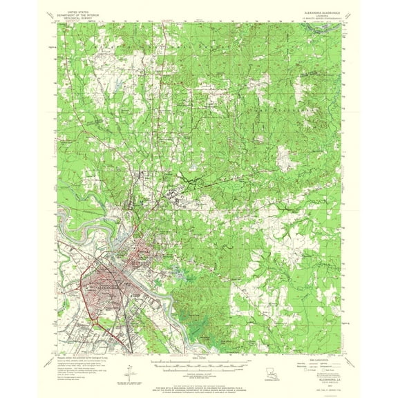 $3695current price $36.95
Topographical Map - Alexandria Louisiana Quad - USGS 1957 - Vintage Wall Art
Customer ratings & reviews
0 ratings|0 reviews
This item does not have any reviews yet
