
Hero image 0 of C-Map CMAMNAY204MS Reveal Coastal Gulf of Mexico & Bahamas, 0 of 1
C-Map CMAMNAY204MS Reveal Coastal Gulf of Mexico & Bahamas
(No ratings yet)
Key item features
- 3D Shaded Relief: Experience lifelike 3D representations of land and underwater elevations, including Ultra-High-Res Bathy seafloor imagery.
- Vector Charts: Navigate easily with accurate, up-to-date vector chart details derived from official Hydrographic Office information.
- High-Res Bathy: Identify shallow areas, drop-offs, ledges, holes, or humps with compiled and quality-controlled Genesis detail.
- Custom Depth Shading: Set a safety depth, maintain a paper-like view, or create your custom shading for better navigation.
- Dynamic Raster Charts: Enjoy the traditional chart look and feel with easy access to all objects on the chart.
- Easy Routing: Automatically plot the shortest, safest route based on detailed chart data and your personalized vessel information.
- Aerial & Satellite Imagery: Access thousands of photos of marinas, harbors, inlets, and other navigational features for additional detail.
- Tides & Currents: View projections of water levels and tide directions to plan your day effectively.
Generated by AI
Specs
- Map typeCoastal
- SubjectGulf of Mexico and Bahamas
- FeaturesWater-Resistant
- SizeGulf of Mexico & Bahamas
- MaterialPaper
- FormBooks
Current price is USD$249.99
Price when purchased online
- Free shipping
 Free 45-day returns
How do you want your item?
Columbus, 43215
Arrives between Apr 15 - Apr 18
|Sold and shipped by Focus Camera
4.369622245540398 stars out of 5, based on 3813 seller reviews(4.4)3813 seller reviews
Free 45-day returns
Other sellers
$260.00
+Free shippingShipping, arrives by Tue, Apr 14 to Columbus, 43215
Sold and shipped by Boating Store
Free 30-day returns
About this item
Product details
Experience superior navigational features with the C-MAP® REVEAL™ for Gulf of Mexico and The Bahamas. Designed for cruising, fishing, or sailing, these coastal charts offer the best of C-MAP. With features like Shaded Relief, Reveal Seafloor Imagery, Aerial Photography, Satellite Overlay, and Dynamic Raster Chart presentation, you'll have a comprehensive understanding of your surroundings. Key Features: Shaded Relief: Get a lifelike 3D representation of the land and underwater elevation, including areas of Ultra-High-Res Bathy seafloor imagery. Full-Featured Vector Charts: Navigate easily with accurate, up-to-date vector chart detail derived from official Hydrographic Office information. High-Res Bathy: Identify shallow areas, drop-offs, ledges, holes or humps. It includes compiled and quality-controlled Genesis® detail as part of a singular HRB layer. Custom Depth Shading: Set a safety depth, maintain a paper-like view, or create your custom shading. Dynamic Raster Charts: Get the traditional chart look and feel, coupled with easy access to all objects on the chart. Easy Routing™: Plot the shortest, safest route automatically based on detailed chart data and your personalized vessel information. Aerial Photography & Satellite Overlay: Provides an additional level of detail with thousands of photos of marinas, harbors, inlets, and other navigational features. Tides & Currents: Shows projections of water level and direction of tides, helping you plan your day effectively. Detailed Marina Port Plans: Dock in an unfamiliar port easily with precise layouts of thousands of marinas. Harbor & Approach Details: Approach any harbor and inlet with confidence with an unprecedented level of detail. Online Updates: Keep your chart up-to-date with 12 months’ free online updates. These charts are compatible with Lowrance, Simrad & B&G Chartplotters. Enhance your seafaring experience with the best of C-MAP® REVEAL™.
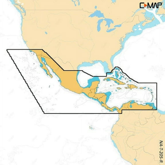
- C-MAP Reveal Coastal Gulf of Mexico and Bahamas M-NA-Y204-MS
-
C-MAP M-NA-Y204-MS Reveal Coastal Gulf of Mexico and The Bahamas
Model: M-NA-Y204-MS
- Shaded Relief — bring the world around you to life, with 3D rendered land and underwater elevation — including areas of Ultra-High-Res Bathy seafloor imagery, previously only available in MAX-N+ Reveal a game changer for anglers.
- Full-Featured Vector Charts — making navigation easy by giving you accurate, up-to-date vector chart detail derive from official Hydrographic Office information.
- High-Res Bathy — helps you identify shallow areas, drop-offs, ledges, holes or humps. Now includes compiled and quality-controlled Genesis® detail as part of singular HRB layer.
- Custom Depth Shading — set a clear safety depth, maintain a paper-like view or create your own custom shading.
- Dynamic Raster Charts — providing the traditional chart look and feel, coupled with easy access to all objects on the chart.
- Easy Routing™ — helps you automatically plot the shortest, safest route based on detailed chart data and your personalized vessel information.
- Aerial Photography — a collection of thousands of photos of marinas, harbors, inlets and other notable navigational features included to offer an additional level of detail.
- Satellite Overlay — satellite imagery gives information about the surroundings when you find yourself in an unfamiliar place.
- Tides & Currents — shows projections of water level and direction of tides to help plan your day out, cruising, angling or sailing.
- Detailed Marina Port Plans — docking in an unfamiliar port is no problem when you have precise layouts of thousands of marinas, including slip spaces, restricted areas and other valuable navigation information.
- Harbor & Approach Details — unprecedented level of detail. Approach any harbor and inlet with confidence. The perfect conclusion to a long voyage, sailing adventure or an exciting day of fishing.
- Online Updates — keep your chart up to date, with 12 months’ free online updates.
Cruising, fishing or sailing, C-MAP® REVEAL™ Coastal charts offer the very best of C-MAP. With Shaded Relief, including game-changing Reveal Seafloor Imagery, Aerial Photography, Satellite Overlay and Dynamic Raster Chart presentation added to the core C-MAP features found in DISCOVER™ — full-featured Vector Charts, with Custom Depth Shading, Tides & Currents and subscription-free Easy Routing™. It also includes the very best of C-MAP High-Res Bathy, including integrated Genesis® data. Purchase includes a full 12 months of free online updates. Compatible with Lowrance, Simrad & B&G Chartplotters.
- Shaded Relief — bring the world around you to life, with 3D rendered land and underwater elevation — including areas of Ultra-High-Res Bathy seafloor imagery, previously only available in MAX-N+ Reveal a game changer for anglers.
- Full-Featured Vector Charts — making navigation easy by giving you accurate, up-to-date vector chart detail derive from official Hydrographic Office information.
- High-Res Bathy — helps you identify shallow areas, drop-offs, ledges, holes or humps. Now includes compiled and quality-controlled Genesis® detail as part of singular HRB layer.
- Custom Depth Shading — set a clear safety depth, maintain a paper-like view or create your own custom shading.
- Dynamic Raster Charts — providing the traditional chart look and feel, coupled with easy access to all objects on the chart.
- Easy Routing™ — helps you automatically plot the shortest, safest route based on detailed chart data and your personalized vessel information.
- Aerial Photography — a collection of thousands of photos of marinas, harbors, inlets and other notable navigational features included to offer an additional level of detail.
- Satellite Overlay — satellite imagery gives information about the surroundings when you find yourself in an unfamiliar place.
- Tides & Currents — shows projections of water level and direction of tides to help plan your day out, cruising, angling or sailing.
- Detailed Marina Port Plans — docking in an unfamiliar port is no problem when you have precise layouts of thousands of marinas, including slip spaces, restricted areas and other valuable navigation information.
- Harbor & Approach Details — unprecedented level of detail. Approach any harbor and inlet with confidence. The perfect conclusion to a long voyage, sailing adventure or an exciting day of fishing.
- Online Updates — keep your chart up to date, with 12 months’ free online updates.
- M-NA-Y204-MS
info:
We aim to show you accurate product information. Manufacturers, suppliers and others provide what you see here, and we have not verified it.
Specifications
Map type
Coastal
Subject
Gulf of Mexico and Bahamas
Features
Water-Resistant
Size
Gulf of Mexico & Bahamas
Warranty
Warranty information
One year product warranty
Please be aware that the warranty terms on items offered for sale by third party Marketplace sellers may differ from those displayed in this section (if any). To confirm warranty terms on an item offered for sale by a third party Marketplace seller, please use the 'Contact seller' feature on the third party Marketplace seller's information page and request the item's warranty terms prior to purchase.
Please be aware that the warranty terms on items offered for sale by third party Marketplace sellers may differ from those displayed in this section (if any). To confirm warranty terms on an item offered for sale by a third party Marketplace seller, please use the 'Contact seller' feature on the third party Marketplace seller's information page and request the item's warranty terms prior to purchase.
Warnings
Similar items you might like
Based on what customers bought
C-MAP Reveal X Custom Depth Shading 2023 Central America and Caribbean microSD Map, 32GB x 24mm $260.00
 $26000current price $260.00
C-MAP Reveal X Custom Depth Shading 2023 Central America and Caribbean microSD Map, 32GB x 24mm
C-map Max Na-m024 - U.s. West Coast & Hawaii - Sd™ Card $295.89
 $29589current price $295.89
C-map Max Na-m024 - U.s. West Coast & Hawaii - Sd™ Card
C-MAP 4D NA-D028 - Alaska - Full Content $355.94
 $35594current price $355.94
C-MAP 4D NA-D028 - Alaska - Full Content
30" x 48" Smithsonian Journeys Blue Ocean World Wall Map - Laminated $49.90
 4 optionsAvailable in additional 4 options$4990current price $49.90
30" x 48" Smithsonian Journeys Blue Ocean World Wall Map - Laminated
274.7 out of 5 Stars. 27 reviewsXplorer Maps MAP_FLX Finger Lakes Hand-Drawn Map $43.39
 $4339current price $43.39
Xplorer Maps MAP_FLX Finger Lakes Hand-Drawn Map
Xplorer Maps MAP_OBX Outer Banks Hand-Drawn Map $28.98
 $2898current price $28.98
Xplorer Maps MAP_OBX Outer Banks Hand-Drawn Map
Luckies Scratch Map | Scratch Off World Map Poster | A3 Coral $12.00
 $1200current price $12.00
Luckies Scratch Map | Scratch Off World Map Poster | A3 Coral
Xplorer Maps MAP_NC North Carolina State Hand-Drawn Map $13.73 Was $18.85
 $1373current price $13.73, Was $18.85$18.85
Xplorer Maps MAP_NC North Carolina State Hand-Drawn Map
Cool Owl Maps Mexico, Central America & Caribbean Wall Map - Paper 40"x30" $44.99
 $4499current price $44.99
Cool Owl Maps Mexico, Central America & Caribbean Wall Map - Paper 40"x30"
Map of Arabia The Persian Gulf & The Red Sea Circa. 1760 From Atlas De Poster Print $24.32
 $2432current price $24.32
Map of Arabia The Persian Gulf & The Red Sea Circa. 1760 From Atlas De Poster Print
Nearshore/Inshore Matagorda to Aransas Pass, TX $29.95
 $2995current price $29.95
Nearshore/Inshore Matagorda to Aransas Pass, TX
Top Spot Fishing Map N231, Panacea to Apalachee Bay Area Gulf Of Mexico $27.61 Was $32.31
 $2761current price $27.61, Was $32.31$32.31
Top Spot Fishing Map N231, Panacea to Apalachee Bay Area Gulf Of Mexico
California 3D Raised Relief Map $39.99
 $3999current price $39.99
California 3D Raised Relief Map
Cool Owl Maps Mexico Wall Map Poster - Laminated 35"x30" $54.99
 $5499current price $54.99
Cool Owl Maps Mexico Wall Map Poster - Laminated 35"x30"
BLUE RIVER, COLORADO GPS MAP $7.95
 $795current price $7.95
BLUE RIVER, COLORADO GPS MAP
BIGHORN RIVER, MONTANA GPS MAP $7.95
 $795current price $7.95
BIGHORN RIVER, MONTANA GPS MAP
1816 Map of the United States with the contiguous British and Spanish Possessions $85.00
 3 optionsAvailable in additional 3 options$8500current price $85.00
1816 Map of the United States with the contiguous British and Spanish Possessions
4 Foot United States Map with Flags [72116] $22.99
![4 Foot United States Map with Flags [72116]](https://i5.walmartimages.com/asr/8833907b-671e-4608-ba73-103c8f1379da.18e29dae1be105a1542fd65296dfc579.jpeg?odnHeight=576&odnWidth=576&odnBg=FFFFFF) $2299current price $22.99
$2299current price $22.994 Foot United States Map with Flags [72116]
BIGWOOD RIVER, IDAHO GPS MAP $7.95
 $795current price $7.95
BIGWOOD RIVER, IDAHO GPS MAP
Franko's Belize Dive Map $7.88 Was $10.88
 $788current price $7.88, Was $10.88$10.88
Franko's Belize Dive Map
Customer ratings & reviews
0 ratings|0 reviews
This item does not have any reviews yet
