
Hero image 0 of Railroad Map - New York Central and Hudson River Railroad - Rand McNally 1876 - 23 x 29 - Vintage Wall Art, 0 of 5
Railroad Map - New York Central and Hudson River Railroad - Rand McNally 1876 - 23 x 29 - Vintage Wall Art
(No ratings yet)
Railroad Map - New York Central and Hudson River Railroad - Rand McNally 1876 - 23 x 29 - Vintage Wall ArtRailroad Map New York Central and Hudson River Railroad Rand McNally 1876 23 x 29 Vintage Wall ArtRailroad Map New York Central and Hudson River Railroad Rand McNally 1876 23 x 29 Vintage Wall Art
Material:Glossy Satin Photo Quality
Key item features
- WHAT IS A RAILROAD SYSTEM? - Railroad systems were the original means of transporting both goods and people across the US, and many other countries across the globe. Railroads were built beginning in the 1800's and grew rapidly. They span coast to coast and are still heavily used today in many countries.
- ARE YOU A RAILROAD ENTHUSIAST? - If so, then add to your collection with prints of the original mappings of the railroad systems. Compare it against what is present today and see how much or how little it has changed since it's inceptions likely more than 100 years ago.
- ONLY ACCEPT THE BEST PRINT QUALITY FOR YOUR REPRODUCTIONS - There are many printers and print types available on the market, when purchasing a reproduction there is no finer quality reproduction than a reproduction using the Giclee Printing method. Giclee describes the technique or style of printing used, and it is revered as the highest quality printing because of the way it precisely sprays ink onto a surface. Trust nothing less than the best!
- GUARNANTEED TO GET EXACTLY WHAT YOU ORDERED - This map comes exactly to the specification of 23.00 x 29.12 inches/58.42 X 73.96 cm. All of our maps come rolled, wrapped, and shipped in a heavy gauge mailing tube to ensure it arrives intact.
- WHY CHOOSE MAPS OF THE PAST? - Maps of the Past is one of the single largest producers of different types of maps. They legally own the rights to the maps they sell, and provide them to you in clean, clear, and vibrant print. If you are looking for a high quality map print, then look no further than Maps of the Past!
Specs
- Size23.00 x 29.12
- MaterialGlossy Satin Photo Quality
- Decor styleVintage
- ThemeOld Railroad Maps
- ShapeRectangle
- Art typePainting
Current price is USD$40.95$40.95/count
Price when purchased online
- Free shipping
 Free 30-day returns
How do you want your item?
Columbus, 43215
Arrives between Apr 14 - Apr 16
|Sold and shipped by Maps of the Past
4.3 stars out of 5, based on 10 seller reviews(4.3)10 seller reviews
Free 30-day returns
About this item
Product details
Old Railroad Map - New York Central and Hudson River Railroad 1876 - This is an exquisite full-color Reproduction printed on high-quality gloss paper, art paper or canvas.
Print Size: 23.00 x 29.12 inches
58.42 X 73.96cm
Sites and Townships Specific To This Map Are: St Louis, Chicago, New York, Albany, Boston, Philadelphia, Cincinnati, Memphis, and Little Rock.
The following towns are featured: a notation banner that states it is the Only 4 Track Rail Road in the World Laid with Steel Rails. An inset map shows the West Central portion of the US. It shows major drainage, cities and towns, the railroad network, with names of lines, and the main ones indicated in heavy black. No railroad connections appear in the south where the hand indicator is located.
This Map is Situated in: Eastern United States (US).
SKU: USNE0019
Original Maps are often difficult to find and usually have fold lines, identifying stamps or markings, tears, ragged edges, and assorted other natural signs of age that detract from their beauty. All of our maps have been professionally restored to depict their original beauty, while keeping all historical data intact.
These maps are fabulous pieces of history full of information useful to Historians, Genealogists, Cartographers, Relic Hunters, & Others. They make fascinating conversation pieces and splendid works of art for the home or office.
- WHAT IS A RAILROAD SYSTEM? - Railroad systems were the original means of transporting both goods and people across the US, and many other countries across the globe. Railroads were built beginning in the 1800's and grew rapidly. They span coast to coast and are still heavily used today in many countries.
- ARE YOU A RAILROAD ENTHUSIAST? - If so, then add to your collection with prints of the original mappings of the railroad systems. Compare it against what is present today and see how much or how little it has changed since it's inceptions likely more than 100 years ago.
- ONLY ACCEPT THE BEST PRINT QUALITY FOR YOUR REPRODUCTIONS - There are many printers and print types available on the market, when purchasing a reproduction there is no finer quality reproduction than a reproduction using the Giclee Printing method. Giclee describes the technique or style of printing used, and it is revered as the highest quality printing because of the way it precisely sprays ink onto a surface. Trust nothing less than the best!
- GUARNANTEED TO GET EXACTLY WHAT YOU ORDERED - This map comes exactly to the specification of 23.00 x 29.12 inches/58.42 X 73.96 cm. All of our maps come rolled, wrapped, and shipped in a heavy gauge mailing tube to ensure it arrives intact.
- WHY CHOOSE MAPS OF THE PAST? - Maps of the Past is one of the single largest producers of different types of maps. They legally own the rights to the maps they sell, and provide them to you in clean, clear, and vibrant print. If you are looking for a high quality map print, then look no further than Maps of the Past!
info:
We aim to show you accurate product information. Manufacturers, suppliers and others provide what you see here, and we have not verified it.
Specifications
Size
23.00 x 29.12
Material
Glossy Satin Photo Quality
Decor style
Vintage
Theme
Old Railroad Maps
Warranty
Warranty information
Please be aware that the warranty terms on items offered for sale by third party Marketplace sellers may differ from those displayed in this section (if any). To confirm warranty terms on an item offered for sale by a third party Marketplace seller, please use the 'Contact seller' feature on the third party Marketplace seller's information page and request the item's warranty terms prior to purchase.
Similar items you might like
Based on what customers bought
Best seller Home Decor Collection Gold Metro Beaded Oval Framed Landscape Wall Art, Vintage-Style Décor for Living Room, Entryway, Bedroom, or Office, 14x11 $7.49
Best seller $749current price $7.49
Home Decor Collection Gold Metro Beaded Oval Framed Landscape Wall Art, Vintage-Style Décor for Living Room, Entryway, Bedroom, or Office, 14x11
1774.4 out of 5 Stars. 177 reviewsBest seller Beautiful Classic Landscape Wall Art Set of 3, Vintage Framed Wall Décor, Gold Brushed Multi-Size Frames, Farmhouse Landscape Art for Living Room, Office, Entry $18.23
Best seller $1823current price $18.23
Beautiful Classic Landscape Wall Art Set of 3, Vintage Framed Wall Décor, Gold Brushed Multi-Size Frames, Farmhouse Landscape Art for Living Room, Office, Entry
1074.5 out of 5 Stars. 107 reviewsBest seller My Texas House Brown Horse Framed Art 14x11 $34.67
Best seller $3467current price $34.67
My Texas House Brown Horse Framed Art 14x11
94.6 out of 5 Stars. 9 reviewsBest seller Beautiful Blue Spring Leaf 3-Piece Botanical Wall Art Set – 11x14 Framed Rectangle Prints in Hickory Frame – Modern Blue Green Foliage Home Décor $29.97
Best seller $2997current price $29.97
Beautiful Blue Spring Leaf 3-Piece Botanical Wall Art Set – 11x14 Framed Rectangle Prints in Hickory Frame – Modern Blue Green Foliage Home Décor
45 out of 5 Stars. 4 reviewsHarbortown 9x24 Magnolia Glass Wall Art, 2-Piece Set, White Etched Print, Modern Farmhouse Decor $30.87
 $3087current price $30.87
Harbortown 9x24 Magnolia Glass Wall Art, 2-Piece Set, White Etched Print, Modern Farmhouse Decor
574.8 out of 5 Stars. 57 reviewsHistoric City Map - Franklin Pennsylvania - Mayer 1865 - 26 x 23 - Vintage Wall Art $40.95
 $4095current price $40.95
Historic City Map - Franklin Pennsylvania - Mayer 1865 - 26 x 23 - Vintage Wall Art
Best seller Florals in Vase set of 2 Black Print on Clear Framed Wall Decor 11" x 14" $29.96
Best seller $2996current price $29.96
Florals in Vase set of 2 Black Print on Clear Framed Wall Decor 11" x 14"
1364.7 out of 5 Stars. 136 reviewsHistoric City Map - Stuyvesant New York - Beers 1873 - 23 x 28.51 - Vintage Wall Art $40.95
 3 optionsAvailable in additional 3 options$4095current price $40.95
Historic City Map - Stuyvesant New York - Beers 1873 - 23 x 28.51 - Vintage Wall Art
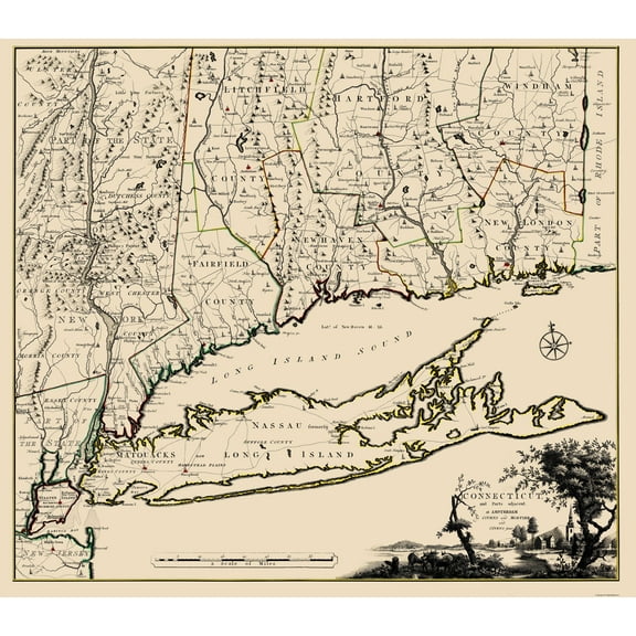
Historic State Map - Connecticut Long Island New York - Covens 1780 - Vintage Wall Art $36.95
 4 optionsAvailable in additional 4 options$3695current price $36.95
Historic State Map - Connecticut Long Island New York - Covens 1780 - Vintage Wall Art
Historic Map - Puerto Rico - Rand McNally 1921 - Vintage Wall Art $36.95
 3 optionsAvailable in additional 3 options$3695current price $36.95
Historic Map - Puerto Rico - Rand McNally 1921 - Vintage Wall Art
Railroad Map - Baltimore and Ohio Railroad - Hoen 1860 - Vintage Wall Art $36.95
 $3695current price $36.95
Railroad Map - Baltimore and Ohio Railroad - Hoen 1860 - Vintage Wall Art
Historic County Map - Adams Pennsylvania County - Hopkins 1857 - Vintage Wall Art $36.95
 $3695current price $36.95
Historic County Map - Adams Pennsylvania County - Hopkins 1857 - Vintage Wall Art
Railroad Map - Texas Railroads - Dodge 1926 - 23 x 24.11 - Vintage Wall Art $40.95 $40.95/count
 $4095current price $40.95$40.95/count
Railroad Map - Texas Railroads - Dodge 1926 - 23 x 24.11 - Vintage Wall Art
Historic City Map - St Louis Missouri Illinois - Rand McNally 1907 - 23 x 31.17 - Vintage Wall Art $40.95
 4 optionsAvailable in additional 4 options$4095current price $40.95
Historic City Map - St Louis Missouri Illinois - Rand McNally 1907 - 23 x 31.17 - Vintage Wall Art
Historic State Map - Hawaii - Rand McNally 1912 - Vintage Wall Art $36.95
 $3695current price $36.95
Historic State Map - Hawaii - Rand McNally 1912 - Vintage Wall Art
Historic State Map - Alaska - Graham 1906 - Vintage Wall Art $36.95
 $3695current price $36.95
Historic State Map - Alaska - Graham 1906 - Vintage Wall Art
Historic City Map - Toledo Ohio - Rand McNally 1897 - 35.13 x 23 - Vintage Wall Art $40.95 $40.95/count
 4 optionsAvailable in additional 4 options$4095current price $40.95$40.95/count
Historic City Map - Toledo Ohio - Rand McNally 1897 - 35.13 x 23 - Vintage Wall Art
Historic City Map - Boston Massachusetts - William Price 1769 - Vintage Wall Art $36.95
 3 optionsAvailable in additional 3 options$3695current price $36.95
Historic City Map - Boston Massachusetts - William Price 1769 - Vintage Wall Art
Historic State Map - Oklahoma Indian Territory - Rand McNally 1894 - 23 x 30.06 - Vintage Wall Art $40.95
 $4095current price $40.95
Historic State Map - Oklahoma Indian Territory - Rand McNally 1894 - 23 x 30.06 - Vintage Wall Art
Historic State Map - Michigan - Burr 1835 - Vintage Wall Art $36.95
 4 optionsAvailable in additional 4 options$3695current price $36.95
Historic State Map - Michigan - Burr 1835 - Vintage Wall Art
Customer ratings & reviews
0 ratings|0 reviews
This item does not have any reviews yet

Related pages
- Tennessee Railroad Maps
- Texas Railroad Map
- Map Of Kentucky Counties
- Old Railroad Maps Michigan
- California Missions Map
- Georgia State Map
- National Parks Posters
- Central America Travel Books, Maps & Guides
- Northeast United States Travel Books, Maps & Guides
- Midwest United States Travel Books, Maps & Guides
- General South America Travel Books, Maps & Guides
- Ontario Travel Books, Maps & Guides