Hero image 0 of Posterazzi DPI1859963LARGE Map of The West Indies & The Mexican Gulf Circa.1760 From Atlas De Toutes Les Parties Connues Du Globe Terrestre Poster Print, Large - 34 x 24, 0 of 3
Posterazzi DPI1859963LARGE Map of The West Indies & The Mexican Gulf Circa.1760 From Atlas De Toutes Les Parties Connues Du Globe Terrestre Poster Print, Large - 34 x 24
(No ratings yet)
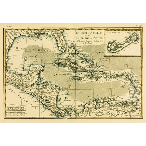
Posterazzi DPI1859963LARGE Map of The West Indies & The Mexican Gulf Circa.1760 From Atlas De Toutes Les Parties Connues Du Globe Terrestre Poster Print, Large - 34 x 24Posterazzi DPI1859963LARGE Map West Indies Mexican Gulf Circa 1760 Atlas De Toutes Les Parties Connues Du Globe Terrestre Poster Print Large 34 x 24Posterazzi Map West Indies Mexican Gulf Circa 1760 Atlas De Toutes Les Parties Connues Du Globe Terrestre Cartographer Rigobert Bonne Published Genev
Size:34" x 24"
Current price is USD$68.94
Price when purchased online
- Free shipping
- Free 30-day returns
How do you want your item?
Ships to
Arrives by Wed, May 20
|Sold and shipped by UnbeatableSale Local
4.115063408598824 stars out of 5, based on 6466 seller reviews(4.1)
Free 30-day returns
More seller options (1)
Starting from $61.85
About this item
Customer ratings & reviews
0 ratings|0 reviews
This item does not have any reviews yet
