National Geographic Maps: Trails Illustrated: Pagosa Springs, Bayfield - Folded Map
Key item features
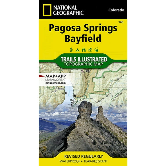
- National Geographic Trails Illustrated M Pagosa Springs, Bayfield Map, Book 145, (Paperback)
- Author: National Geographic Maps
- ISBN: 9781566952392
- Format: Paperback
- Publication Date: 2023-01-01
- Page Count: 2
Specs
- Map typeTopographic Maps
- FeaturesWaterproof
- Size25.5" x 37.75"
- BrandTrails Illustrated
- MaterialPaper
- FormBooks
More seller options (1)
About this item
Product details
- Waterproof - Tear-Resistant - Topographic Map
National Geographic's Trails Illustrated map of Pagosa Springs and Bayfield provides unparalleled detail of this area on the western slope of the Continental Divide in southwestern Colorado. Expertly researched and created in partnership with the U.S. Forest Service, Southern Ute Indian Tribe, Bureau of Land Management and others, the map's coverage includes San Juan National Forest, Piedra Area and River, Vallecito and Lemon Reservoirs, Chimney Rock National Monument and Southern Ute Indian Reservation.
Get off the beaten path and back on again by following the map to trailheads and then along trails that are labeled according to their designated usage. High clearance and four-wheel drive roads are marked as well. To aid in your navigation, the map includes contour lines, elevations, labeled peaks, water features, waypoints, and clear boundaries between national park and Indian land, which is closed to the public for recreational purposes. Many recreation points of interest, for all seasons, are clearly noted, including campgrounds and campsites, cross-country ski areas and snowmobile trails, boat launch and river access points, fishing areas, scenic viewpoints and wildlife viewing areas. In addition, the map provides background information of the area, survival tips and contact information of both public and private organizations involved in maintaining the region.
Every Trails Illustrated map is printed on "Backcountry Tough" waterproof, tear-resistant paper. A full UTM grid is printed on the map to aid with GPS navigation.
Other features found on this map include: Mesa Mountains, Navajo River, San Juan National Forest, Vallecito Reservoir, Weminuche Wilderness.
- Map Scale = 1:63,360
- Sheet Size = 25.5" x 37.75"
- Folded Size = 4" x 7.5"
- National Geographic Trails Illustrated M Pagosa Springs, Bayfield Map, Book 145, (Paperback)
- Author: National Geographic Maps
- ISBN: 9781566952392
- Format: Paperback
- Publication Date: 2023-01-01
- Page Count: 2
Specifications
Map type
Subject
Features
Size
Warranty
Warranty information
Similar items you might like
Based on what customers bought
National Geographic Maps: Trails Illustrated: Holy Cross, Ruedi Reservoir - Folded Map $14.92
 $1492current price $14.92
National Geographic Maps: Trails Illustrated: Holy Cross, Ruedi Reservoir - Folded Map
National Geographic Trails Illustrated M Zion National Park Map, Book 214, (Paperback) $11.80 Was $13.94
 $1180current price $11.80, Was $13.94$13.94
National Geographic Trails Illustrated M Zion National Park Map, Book 214, (Paperback)
15 out of 5 Stars. 1 reviewsNational Geographic Trails Illustrated M San Rafael Swell Map [Blm - Price Field Office], Book 712, (Paperback) $16.39 Was $27.85
![National Geographic Trails Illustrated M San Rafael Swell Map [Blm - Price Field Office], Book 712, (Paperback)](https://i5.walmartimages.com/asr/c608053d-5846-4e34-901e-46bd0fcc8a29.08b5396aace40bcf306b003d3ab63041.jpeg?odnHeight=576&odnWidth=576&odnBg=FFFFFF) $1639current price $16.39, Was $27.85$27.85
$1639current price $16.39, Was $27.85$27.85National Geographic Trails Illustrated M San Rafael Swell Map [Blm - Price Field Office], Book 712, (Paperback)
National geographic maps: trails illustrated: northville, raquette lake: adirondack park - folded ma: 9781566953108 $24.17
 $2417current price $24.17
National geographic maps: trails illustrated: northville, raquette lake: adirondack park - folded ma: 9781566953108
National Geographic Maps: Trails Illustrated: Merced and Tuolumne Rivers [stanislaus National Forest] - Folded Map $24.17
![National Geographic Maps: Trails Illustrated: Merced and Tuolumne Rivers [stanislaus National Forest] - Folded Map](https://i5.walmartimages.com/asr/f4ed4e2a-269c-492f-b4df-df54e3a20d68.d9ffd81e2016c10c1e3d85f15e58a98a.jpeg?odnHeight=576&odnWidth=576&odnBg=FFFFFF) $2417current price $24.17
$2417current price $24.17National Geographic Maps: Trails Illustrated: Merced and Tuolumne Rivers [stanislaus National Forest] - Folded Map
National Geographic Trails Illustrated M Ogden, Monte Cristo Range Map, Book 700, (Paperback) $24.17
 $2417current price $24.17
National Geographic Trails Illustrated M Ogden, Monte Cristo Range Map, Book 700, (Paperback)
National Geographic Trails Illustrated M Virgin Islands National Park Map, Book 236, (Paperback) $24.17
 $2417current price $24.17
National Geographic Trails Illustrated M Virgin Islands National Park Map, Book 236, (Paperback)
National Geographic Trails Illustrated M Buena Vista, Collegiate Peaks Map, Book 129, (Paperback) $24.17
 $2417current price $24.17
National Geographic Trails Illustrated M Buena Vista, Collegiate Peaks Map, Book 129, (Paperback)
National Geographic Trails Illustrated Map Cedar Mountain / Pine Valley Mountain: Dixie National Forest; Utah, USA - Hardcover $24.17
 $2417current price $24.17
National Geographic Trails Illustrated Map Cedar Mountain / Pine Valley Mountain: Dixie National Forest; Utah, USA - Hardcover
National Geographic Trails Illustrated Map: Canyonlands National Park [map Pack Bundle] - Folded Map $24.99 Was $29.95
![National Geographic Trails Illustrated Map: Canyonlands National Park [map Pack Bundle] - Folded Map](https://i5.walmartimages.com/asr/6c402785-26dc-4c7f-8ab6-674d7e909a98.3f4345eb364943b51ca6608be793645a.jpeg?odnHeight=576&odnWidth=576&odnBg=FFFFFF) $2499current price $24.99, Was $29.95$29.95
$2499current price $24.99, Was $29.95$29.95National Geographic Trails Illustrated Map: Canyonlands National Park [map Pack Bundle] - Folded Map
National Geographic Trails Illustrated M Los Padres National Forest West Map, Book 813, (Paperback) $24.17
 $2417current price $24.17
National Geographic Trails Illustrated M Los Padres National Forest West Map, Book 813, (Paperback)
National Geographic Trails Illustrated M Allagash Wilderness Waterway South Map, Book 401, (Paperback) $16.39
 $1639current price $16.39
National Geographic Trails Illustrated M Allagash Wilderness Waterway South Map, Book 401, (Paperback)
National geographic maps: trails illustrated: glacier and waterton lakes national parks - folded map: 9781566953184 $28.11
 $2811current price $28.11
National geographic maps: trails illustrated: glacier and waterton lakes national parks - folded map: 9781566953184
12 out of 5 Stars. 1 reviewsMazatzal and Pine Mountain Wilderness Areas [coconino, Prescott, and Tonto National Forests] $14.19
![Mazatzal and Pine Mountain Wilderness Areas [coconino, Prescott, and Tonto National Forests]](https://i5.walmartimages.com/asr/38b218b8-d397-4faa-8600-7c77d4679f23.3ff8d0f725018bfd871714ae9caaf1ff.jpeg?odnHeight=576&odnWidth=576&odnBg=FFFFFF) $1419current price $14.19
$1419current price $14.19Mazatzal and Pine Mountain Wilderness Areas [coconino, Prescott, and Tonto National Forests]
National geographic maps: trails illustrated: flagstaff, sedona [coconino and kaibab national forest: 9781566955157 $13.93
 $1393current price $13.93
National geographic maps: trails illustrated: flagstaff, sedona [coconino and kaibab national forest: 9781566955157
National Geographic Trails Illustrated M Tahoe National Forest East Map [Sierra Buttes, Donner Pass], Book 805, (Paperback) $24.17
![National Geographic Trails Illustrated M Tahoe National Forest East Map [Sierra Buttes, Donner Pass], Book 805, (Paperback)](https://i5.walmartimages.com/asr/9f304e32-127c-4d02-92a4-bd01f851491b.44dd885dfc75f4f40a3e43aff115dbd3.jpeg?odnHeight=576&odnWidth=576&odnBg=FFFFFF) $2417current price $24.17
$2417current price $24.17National Geographic Trails Illustrated M Tahoe National Forest East Map [Sierra Buttes, Donner Pass], Book 805, (Paperback)
National Geographic Trails Illustrated M Camino de Santiago East Map [Map Pack Bundle] Map, (Paperback) $44.28
![National Geographic Trails Illustrated M Camino de Santiago East Map [Map Pack Bundle] Map, (Paperback)](https://i5.walmartimages.com/asr/7fa81240-6318-47cf-ab4a-0a25f4794db0.6fd581629740590c55e96bdb7b84a049.jpeg?odnHeight=576&odnWidth=576&odnBg=FFFFFF) $4428current price $44.28
$4428current price $44.28National Geographic Trails Illustrated M Camino de Santiago East Map [Map Pack Bundle] Map, (Paperback)
National Geographic Trails Illustrated Map Adirondack Park - Paperback $24.17
 $2417current price $24.17
National Geographic Trails Illustrated Map Adirondack Park - Paperback
National Geographic Trails Illustrated Map: Banff National Park [map Pack Bundle] - Folded Map $20.60 Was $24.95
![National Geographic Trails Illustrated Map: Banff National Park [map Pack Bundle] - Folded Map](https://i5.walmartimages.com/asr/18b63917-cd32-4dd2-bbe1-0c5192b82175.751942fd4fc63a68a636ad91b0071ecf.jpeg?odnHeight=576&odnWidth=576&odnBg=FFFFFF) $2060current price $20.60, Was $24.95$24.95
$2060current price $20.60, Was $24.95$24.95National Geographic Trails Illustrated Map: Banff National Park [map Pack Bundle] - Folded Map
15 out of 5 Stars. 1 reviewsNational Geographic Trails Illustrated M Redwood National and State Parks Map, Book 218, (Paperback) $28.11
 $2811current price $28.11
National Geographic Trails Illustrated M Redwood National and State Parks Map, Book 218, (Paperback)
Customer ratings & reviews

Related pages
- Overland Trails Map
- Lonely Planet York
- Atlas Mountain Range
- Peninsula Countries
- Lonely Planet Zealand
- Polar Regions Travel Books, Maps & Guides
- Overlanding Maps
- Rail Travel Books, Maps & Guides
- Lonely Planet Travel Books, Maps & Guides
- Insight Guides Travel Books, Maps & Guides
- Rough Guides Travel Books, Maps & Guides
- Road Travel Books, Maps & Guides