
Hero image 0 of Topographical Map - Klamath Falls Oregon California Quad - USGS 1968 - 23 x 29.88 - Vintage Wall Art, 0 of 5
Topographical Map - Klamath Falls Oregon California Quad - USGS 1968 - 23 x 29.88 - Vintage Wall Art
(No ratings yet)
Topographical Map - Klamath Falls Oregon California Quad - USGS 1968 - 23 x 29.88 - Vintage Wall ArtTopographical Map Klamath Falls Oregon California Quad USGS 1968 23 x 29 88 Vintage Wall ArtTopographical Map Klamath Falls Oregon California Quad USGS 1968 23 x 29 88 Vintage Wall Art
Material:Matte Art
Key item features
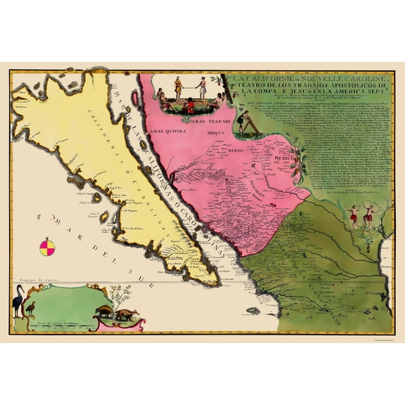
- OWN A HISTORICAL TOPOGRAPHICAL MAP TODAY - Topographical maps provide you a birds-eye view of how the topography of certain pieces of land are mapped out. See how much today's maps have changed from centuries ago. See how waterways have shifted, or how forrests have become thralling cities. See how history has changed the landscape with a topographical map today!
- TOPOGRAPHICAL MAPS PROVIDE IMPORTANT INFORMATION -Topographical maps show you how the borders of a county are established and were they can be found. It also highlights rivers, mountains, and other natural elements, and it will show you where the cities are located within it.
- ONLY ACCEPT THE BEST PRINT QUALITY FOR YOUR REPRODUCTIONS - There are many printers and print types available on the market, when purchasing a reproduction there is no finer quality reproduction than a reproduction using the Giclee Printing method. Giclee describes the technique or style of printing used, and it is revered as the highest quality printing because of the way it precisely sprays ink onto a surface. Trust nothing less than the best!
- GUARNANTEED TO GET EXACTLY WHAT YOU ORDERED - This map comes exactly to the specification of 23.00 x 29.88 inches/58.42 X 75.89 cm. All of our maps come rolled, wrapped, and shipped in a heavy gauge mailing tube to ensure it arrives intact.
- WHY CHOOSE MAPS OF THE PAST? - Maps of the Past is one of the single largest producers of different types of maps. They legally own the rights to the maps they sell, and provide them to you in clean, clear, and vibrant print. If you are looking for a high quality map print, then look no further than Maps of the Past!
Specs
- ColorFull-color
- Size23.00 x 29.88
- MaterialMatte Art
- ThemeHistoric Topographic Maps
- FramedN
- ShapeRectangle
Current price is USD$45.95
Price when purchased online
- Free shipping
 Free 30-day returns
How do you want your item?
Columbus, 43215
Arrives by Mon, Apr 13
|Sold and shipped by Maps of the Past
4.3 stars out of 5, based on 10 seller reviews(4.3)10 seller reviews
Free 30-day returns
About this item
Product details
Topographical Map - Klamath Falls Oregon, California Quad 1968 - This is an exquisite full-color Reproduction printed on high-quality gloss paper, art paper or canvas.
Print Size: 23.00 x 29.88 inches
58.42 X 75.89cm
Sites and Townships Specific To This Map Are: Klamath Falls, Lakeview, Paisley, Summer Lake, Chinchalo and many more.
The following towns are featured: U.S. geological survey of the Klamath Falls quadrangle in California and Oregon. This type of map focuses on elevation, bodies of water, city infrastructure and roadways. Mountainous regions and changes in elevation are distinguished by light red lines, while water is distinguished in light blue. Features of note include: Winema National Forest, Fremont National Forest, Saddle Mountain, Crane Mountain, Sprague River Valley, Winter Ridge, Chewaucan River, Sprague River, Williamson River, Klamath River, Agency Lake, Summer Lake, Lake Abert and Caledonia Marsh. Along the bottom of the map are a legend, distance scales and location diagram.
This Map is Situated in: States of Oregon and California (OR/CA)
SKU: ORKF0001
Original Maps are often difficult to find and usually have fold lines, identifying stamps or markings, tears, ragged edges, and assorted other natural signs of age that detract from their beauty. All of our maps have been professionally restored to depict their original beauty, while keeping all historical data intact.
These maps are fabulous pieces of history full of information useful to Historians, Genealogists, Cartographers, Relic Hunters, & Others. They make fascinating conversation pieces and splendid works of art for the home or office.
- OWN A HISTORICAL TOPOGRAPHICAL MAP TODAY - Topographical maps provide you a birds-eye view of how the topography of certain pieces of land are mapped out. See how much today's maps have changed from centuries ago. See how waterways have shifted, or how forrests have become thralling cities. See how history has changed the landscape with a topographical map today!
- TOPOGRAPHICAL MAPS PROVIDE IMPORTANT INFORMATION -Topographical maps show you how the borders of a county are established and were they can be found. It also highlights rivers, mountains, and other natural elements, and it will show you where the cities are located within it.
- ONLY ACCEPT THE BEST PRINT QUALITY FOR YOUR REPRODUCTIONS - There are many printers and print types available on the market, when purchasing a reproduction there is no finer quality reproduction than a reproduction using the Giclee Printing method. Giclee describes the technique or style of printing used, and it is revered as the highest quality printing because of the way it precisely sprays ink onto a surface. Trust nothing less than the best!
- GUARNANTEED TO GET EXACTLY WHAT YOU ORDERED - This map comes exactly to the specification of 23.00 x 29.88 inches/58.42 X 75.89 cm. All of our maps come rolled, wrapped, and shipped in a heavy gauge mailing tube to ensure it arrives intact.
- WHY CHOOSE MAPS OF THE PAST? - Maps of the Past is one of the single largest producers of different types of maps. They legally own the rights to the maps they sell, and provide them to you in clean, clear, and vibrant print. If you are looking for a high quality map print, then look no further than Maps of the Past!
info:
We aim to show you accurate product information. Manufacturers, suppliers and others provide what you see here, and we have not verified it.
Specifications
Color
Full-color
Size
23.00 x 29.88
Material
Matte Art
Theme
Historic Topographic Maps
Warranty
Warranty information
Please be aware that the warranty terms on items offered for sale by third party Marketplace sellers may differ from those displayed in this section (if any). To confirm warranty terms on an item offered for sale by a third party Marketplace seller, please use the 'Contact seller' feature on the third party Marketplace seller's information page and request the item's warranty terms prior to purchase.
Similar items you might like
Based on what customers bought
In 50+ people's carts Beautiful Classic Landscape Wall Art Set of 3, Vintage Framed Wall Décor, Gold Brushed Multi-Size Frames, Farmhouse Landscape Art for Living Room, Office, Entry $18.23
In 50+ people's carts $1823current price $18.23
Beautiful Classic Landscape Wall Art Set of 3, Vintage Framed Wall Décor, Gold Brushed Multi-Size Frames, Farmhouse Landscape Art for Living Room, Office, Entry
1074.5 out of 5 Stars. 107 reviewsBest seller Beautiful 16.63" x 20.63" Framed Vintage Floral Field Landscape Wall Art by Drew Barrymore $14.88 Was $24.98
Best seller $1488current price $14.88, Was $24.98$24.98
Beautiful 16.63" x 20.63" Framed Vintage Floral Field Landscape Wall Art by Drew Barrymore
1944.5 out of 5 Stars. 194 reviewsBest seller Beautiful Spring Beauty White Floral Wall Art – Brush Texture Print in Antique Gold Frame – Elegant Flower Art, 16x20 $26.52
Best seller $2652current price $26.52
Beautiful Spring Beauty White Floral Wall Art – Brush Texture Print in Antique Gold Frame – Elegant Flower Art, 16x20
564.7 out of 5 Stars. 56 reviewsBest seller Vintage 11x14in3pcs Natural Framed Landscape Wall Art Prairie in Full Bloom Wall Prints Classic Retro Farmhouse Decorations for Living Room Bedroom $25.99
Best seller


 $2599current price $25.99
Vintage 11x14in3pcs Natural Framed Landscape Wall Art Prairie in Full Bloom Wall Prints Classic Retro Farmhouse Decorations for Living Room Bedroom
564.5 out of 5 Stars. 56 reviewsHistoric State Map - Idaho - Rand McNally 1897 - 23 x 34.66 - Vintage Wall Art $40.95
 3 optionsAvailable in additional 3 options$4095current price $40.95
Historic State Map - Idaho - Rand McNally 1897 - 23 x 34.66 - Vintage Wall Art
Best seller Style House 16"x 20" Contemporary Arch Framed Wall Art $13.90
Best seller 2 optionsAvailable in additional 2 options$1390current price $13.90
Style House 16"x 20" Contemporary Arch Framed Wall Art
1934.7 out of 5 Stars. 193 reviewsBest seller Drsoum Bohemian Flower Wall Decor for Bathroom Office Boho Leaf Artwork Ready to Hang 11x14in4pcs Black Framed $23.99
Best seller


 $2399current price $23.99
Drsoum Bohemian Flower Wall Decor for Bathroom Office Boho Leaf Artwork Ready to Hang 11x14in4pcs Black Framed
794.5 out of 5 Stars. 79 reviewsHistoric State Map - Washington Territory West Cascades - Duval 1857 - 23 x 34 - Vintage Wall Art $40.95 $40.95/count
 3 optionsAvailable in additional 3 options$4095current price $40.95$40.95/count
Historic State Map - Washington Territory West Cascades - Duval 1857 - 23 x 34 - Vintage Wall Art
Historic State Map - Nebraska Kansas - Colton 1875 - 23 x 35.34 - Vintage Wall Art $40.95
 4 optionsAvailable in additional 4 options$4095current price $40.95
Historic State Map - Nebraska Kansas - Colton 1875 - 23 x 35.34 - Vintage Wall Art
Historic Map - California Island - De Fer 1720 - 23 x 33.05 - Vintage Wall Art $40.95
 3 optionsAvailable in additional 3 options$4095current price $40.95
Historic Map - California Island - De Fer 1720 - 23 x 33.05 - Vintage Wall Art
Historic State Map - Iowa - Colton 1856 - 27.44 x 23 - Vintage Wall Art $40.95 $40.95/count
 3 optionsAvailable in additional 3 options$4095current price $40.95$40.95/count
Historic State Map - Iowa - Colton 1856 - 27.44 x 23 - Vintage Wall Art
Topographical Map - Likely California Quad - USGS 1964 - Vintage Wall Art $36.95
 $3695current price $36.95
Topographical Map - Likely California Quad - USGS 1964 - Vintage Wall Art
Topographical Map - Ramona California Quad - USGS 1903 - Vintage Wall Art $36.95
 $3695current price $36.95
Topographical Map - Ramona California Quad - USGS 1903 - Vintage Wall Art
Topographical Map - Clearwater National Forest Idaho - USDA 1961 - 23 x 25.60 - Vintage Wall Art $40.95 $40.95/count
 3 optionsAvailable in additional 3 options$4095current price $40.95$40.95/count
Topographical Map - Clearwater National Forest Idaho - USDA 1961 - 23 x 25.60 - Vintage Wall Art
Historic State Map - California Nevada - Thompson 1877 - Vintage Wall Art $36.95
 4 optionsAvailable in additional 4 options$3695current price $36.95
Historic State Map - California Nevada - Thompson 1877 - Vintage Wall Art
Historic State Map - Massachusetts - Colton 1856 - Vintage Wall Art $36.95
 3 optionsAvailable in additional 3 options$3695current price $36.95
Historic State Map - Massachusetts - Colton 1856 - Vintage Wall Art
Historic State Map - Oklahoma Arapahoe Territory - King 1894 - 34.25 x 23 - Vintage Wall Art $40.95 $40.95/count
 3 optionsAvailable in additional 3 options$4095current price $40.95$40.95/count
Historic State Map - Oklahoma Arapahoe Territory - King 1894 - 34.25 x 23 - Vintage Wall Art
Topographical Map - Boise Idaho Oregon Quad - USGS 1962 - 23 x 30.12 - Vintage Wall Art $40.95
 3 optionsAvailable in additional 3 options$4095current price $40.95
Topographical Map - Boise Idaho Oregon Quad - USGS 1962 - 23 x 30.12 - Vintage Wall Art
Topographical Map - Dallas Texas Quad - USGS 1963 - 23 x 35.35 - Vintage Wall Art $40.95
 3 optionsAvailable in additional 3 options$4095current price $40.95
Topographical Map - Dallas Texas Quad - USGS 1963 - 23 x 35.35 - Vintage Wall Art
Historic State Map - Ohio Indiana - Johnson 1860 - 23 x 37.44 - Vintage Wall Art $40.95
 3 optionsAvailable in additional 3 options$4095current price $40.95
Historic State Map - Ohio Indiana - Johnson 1860 - 23 x 37.44 - Vintage Wall Art
Customer ratings & reviews
0 ratings|0 reviews
This item does not have any reviews yet

Related pages
- Jersey Counties Map Cities
- West Virginia Maps By County
- Alabama County Map Roads
- Akron Ohio Map
- West Virginia Map
- Map Illinois Highways
- Central America Travel Books, Maps & Guides
- Northeast United States Travel Books, Maps & Guides
- General South America Travel Books, Maps & Guides
- Midwest United States Travel Books, Maps & Guides
- Southern United States Travel Books, Maps & Guides
- Peru Travel Books, Maps & Guides