
Hero image 0 of Historic Panoramic View - Amarillo Texas - Sturdivant 1912 - Vintage Wall Art, 0 of 4
Historic Panoramic View - Amarillo Texas - Sturdivant 1912 - Vintage Wall Art
(No ratings yet)
Historic Panoramic View - Amarillo Texas - Sturdivant 1912 - Vintage Wall ArtHistoric Panoramic View Amarillo Texas Sturdivant 1912 23 x 26 04 Vintage Wall ArtHistoric Panoramic View Amarillo Texas Sturdivant 1912 Vintage Wall ArtHistoric Panoramic View Amarillo Texas Sturdivant 1912 Vintage Wall ArtHistoric Panoramic View Amarillo Texas Sturdivant 1912 23 x 26 04 Vintage Wall Art
Material:Glossy Photo
Size:23.00 x 26.04
Key item features
- HISTORICAL PANORAMIC MAPS MAKE GREAT WALL ART - Ever wonder what your country looked like during the early days of the USA? Well now you can find out! Maps of the Past provides panoramic maps from various time periods so you can track the history of your local area. These gorgiously detailed maps make for a great piece of art for your home or office. Own a piece of art and history today!
- PANORAMIC MAPS PROVIDE IMPORTANT INFORMATION - Local maps show you how the borders of a local are established and were they can be found. It also highlights rivers, mountains, and other natural element you may not know are there. Local maps can also show you transportation lanes across your local
- ONLY ACCEPT THE BEST PRINT QUALITY FOR YOUR REPRODUCTIONS - There are many printers and print types available on the market, when purchasing a reproduction there is no finer quality reproduction than a reproduction using the Giclee Printing method. Giclee describes the technique or style of printing used, and it is revered as the highest quality printing because of the way it precisely sprays ink onto a surface. Trust nothing less than the best!
- GUARANTEED TO GET EXACTLY WHAT YOU ORDERED - All of our maps come rolled, wrapped, and shipped in a heavy gauge mailing tube to ensure it arrives intact.
- WHY CHOOSE MAPS OF THE PAST? - Maps of the Past is one of the single largest producers of different types of maps. They legally own the rights to the maps they sell, and provide them to you in clean, clear, and vibrant print. If you are looking for a high quality map print, then look no further than Maps of the Past!
Specs
- ColorMulticolor
- Decor styleIndustrial
- ThemeOld Panoramic Maps
- FramedN
- ShapeRectangle
- Art typePhotography
Current price is USD$40.95
Price when purchased online
- Free shipping
 Free 30-day returns
How do you want your item?
Columbus, 43215
Arrives between Apr 18 - Apr 20
|Sold and shipped by Maps of the Past
4.3 stars out of 5, based on 10 seller reviews(4.3)10 seller reviews
Free 30-day returns
Check out these related products
Historic Panoramic View - Denison Texas - Wellge 1886 - Vintage Wall Art $36.95
 4 optionsAvailable in additional 4 options$3695current price $36.95
Historic Panoramic View - Denison Texas - Wellge 1886 - Vintage Wall Art
Historic Panoramic View - Waco Texas - Wellge 1886 - Vintage Wall Art $36.95
 $3695current price $36.95
Historic Panoramic View - Waco Texas - Wellge 1886 - Vintage Wall Art
Topographical Map - Cleburne West Texas Quad - USGS 1978 - Vintage Wall Art $36.95
 $3695current price $36.95
Topographical Map - Cleburne West Texas Quad - USGS 1978 - Vintage Wall Art
Topographical Map - Batesville Texas South West Quad - USGS 1972 - 23 x 27.90 - Vintage Wall Art $40.95 $40.95/count
 $4095current price $40.95$40.95/count
Topographical Map - Batesville Texas South West Quad - USGS 1972 - 23 x 27.90 - Vintage Wall Art
Topographical Map - Ayers Island Texas Quad - USGS 1985 - Vintage Wall Art $36.95
 $3695current price $36.95
Topographical Map - Ayers Island Texas Quad - USGS 1985 - Vintage Wall Art
Historic Panoramic View - Quitman Georgia - Norris 1885 - Vintage Wall Art $36.95
 $3695current price $36.95
Historic Panoramic View - Quitman Georgia - Norris 1885 - Vintage Wall Art
Historic City Map - Ostrander Little Wolf Ogdenburg Wisconsin - 23 x 26.31 - Vintage Wall Art $40.95
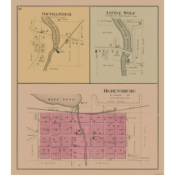 $4095current price $40.95
Historic City Map - Ostrander Little Wolf Ogdenburg Wisconsin - 23 x 26.31 - Vintage Wall Art
Topographical Map - Clay Texas Quad - USGS 1980 - 23 x 27.61 - Vintage Wall Art $40.95
 4 optionsAvailable in additional 4 options$4095current price $40.95
Topographical Map - Clay Texas Quad - USGS 1980 - 23 x 27.61 - Vintage Wall Art
Historical Civil War Map - East Texas Theatre of War - Lamont 1894 - Vintage Wall Art $36.95
 $3695current price $36.95
Historical Civil War Map - East Texas Theatre of War - Lamont 1894 - Vintage Wall Art
Historic City Map - Los Angeles California - Hammond 1910 - 23 x 29.86 - Vintage Wall Art $40.95
 3 optionsAvailable in additional 3 options$4095current price $40.95
Historic City Map - Los Angeles California - Hammond 1910 - 23 x 29.86 - Vintage Wall Art
Historic Map - Samos Mycale Greece - Oxford 1828 - Vintage Wall Art $36.95
 $3695current price $36.95
Historic Map - Samos Mycale Greece - Oxford 1828 - Vintage Wall Art
Topographical Map - East Tovar Creek Texas Quad - USGS 1982 - 23 x 27.43 - Vintage Wall Art $40.95
 4 optionsAvailable in additional 4 options$4095current price $40.95
Topographical Map - East Tovar Creek Texas Quad - USGS 1982 - 23 x 27.43 - Vintage Wall Art
Topographical Map - Bastrop Texas South West Quad - USGS 1982 - Vintage Wall Art $36.95
 4 optionsAvailable in additional 4 options$3695current price $36.95
Topographical Map - Bastrop Texas South West Quad - USGS 1982 - Vintage Wall Art
Historic Map - Thrace Dacia Macedonia Greece - Oxford 1828 - Vintage Wall Art $36.95
 $3695current price $36.95
Historic Map - Thrace Dacia Macedonia Greece - Oxford 1828 - Vintage Wall Art
Topographical Map - Bryan Texas East Quad - USGS 1962 - 23 x 28.43 - Vintage Wall Art $40.95
 4 optionsAvailable in additional 4 options$4095current price $40.95
Topographical Map - Bryan Texas East Quad - USGS 1962 - 23 x 28.43 - Vintage Wall Art
Historic Panoramic View - Baltimore Maryland - Sachese 1869 - Vintage Wall Art $36.95
 $3695current price $36.95
Historic Panoramic View - Baltimore Maryland - Sachese 1869 - Vintage Wall Art
Historic Map - Aetolia Acarnania Greece - Oxford 1828 - 27.12 x 23 - Vintage Wall Art $45.95 $45.95/count
 $4595current price $45.95$45.95/count
Historic Map - Aetolia Acarnania Greece - Oxford 1828 - 27.12 x 23 - Vintage Wall Art
Historic State Map - Wyoming - Cram 1892 - 28.49 x 23 - Vintage Wall Art $40.95
 3 optionsAvailable in additional 3 options$4095current price $40.95
Historic State Map - Wyoming - Cram 1892 - 28.49 x 23 - Vintage Wall Art
Historic State Map - Ohio - Reynold 1921 - 23 x 32.57 - Vintage Wall Art $40.95 $40.95/count
 3 optionsAvailable in additional 3 options$4095current price $40.95$40.95/count
Historic State Map - Ohio - Reynold 1921 - 23 x 32.57 - Vintage Wall Art
Topographical Map - Arizona Creek Texas Quad - USGS 1984 - Vintage Wall Art $36.95
 $3695current price $36.95
Topographical Map - Arizona Creek Texas Quad - USGS 1984 - Vintage Wall Art
About this item
Product details
Panoramic Print - Amarillo Texas - Sturdivant 1912 - This is an exquisite full-color Reproduction printed on gloss paper or art paper.
Sites and Townships Specific To This Map Are: Amarillo.
The following towns are featured: a map of the town's business district. Insets of the Star Mill & Elevator Co, Central Presbyterian Church, First Methodist Church, High School, and St. Charles Apartments are shown. There is a description of the development of Amarillo, with a population index from 1903 to 1911. A list of Wholesale and Jobbing Houses, as well as Manufacturing Facilities is also shown.
This Map is Situated in: Potter & Randall Counties, Texas (TX).
SKU: TXAM0001
Original Maps are often difficult to find and usually have fold lines, identifying stamps or markings, tears, ragged edges, and assorted other natural signs of age that detract from their beauty. All of our maps have been professionally restored to depict their original beauty, while keeping all historical data intact.
These maps are fabulous pieces of history full of information useful to Historians, Genealogists, Cartographers, Relic Hunters, & Others. They make fascinating conversation pieces and splendid works of art for the home or office.
- HISTORICAL PANORAMIC MAPS MAKE GREAT WALL ART - Ever wonder what your country looked like during the early days of the USA? Well now you can find out! Maps of the Past provides panoramic maps from various time periods so you can track the history of your local area. These gorgiously detailed maps make for a great piece of art for your home or office. Own a piece of art and history today!
- PANORAMIC MAPS PROVIDE IMPORTANT INFORMATION - Local maps show you how the borders of a local are established and were they can be found. It also highlights rivers, mountains, and other natural element you may not know are there. Local maps can also show you transportation lanes across your local
- ONLY ACCEPT THE BEST PRINT QUALITY FOR YOUR REPRODUCTIONS - There are many printers and print types available on the market, when purchasing a reproduction there is no finer quality reproduction than a reproduction using the Giclee Printing method. Giclee describes the technique or style of printing used, and it is revered as the highest quality printing because of the way it precisely sprays ink onto a surface. Trust nothing less than the best!
- GUARANTEED TO GET EXACTLY WHAT YOU ORDERED - All of our maps come rolled, wrapped, and shipped in a heavy gauge mailing tube to ensure it arrives intact.
- WHY CHOOSE MAPS OF THE PAST? - Maps of the Past is one of the single largest producers of different types of maps. They legally own the rights to the maps they sell, and provide them to you in clean, clear, and vibrant print. If you are looking for a high quality map print, then look no further than Maps of the Past!
info:
We aim to show you accurate product information. Manufacturers, suppliers and others provide what you see here, and we have not verified it.
Specifications
Color
Multicolor
Decor style
Industrial
Theme
Old Panoramic Maps
Framed
N
Warranty
Warranty information
Please be aware that the warranty terms on items offered for sale by third party Marketplace sellers may differ from those displayed in this section (if any). To confirm warranty terms on an item offered for sale by a third party Marketplace seller, please use the 'Contact seller' feature on the third party Marketplace seller's information page and request the item's warranty terms prior to purchase.
Customer ratings & reviews
0 ratings|0 reviews
This item does not have any reviews yet
