
Hero image 0 of Historic City Map - Chicago Illinois - Mitchell 1870 - Vintage Wall Art, 0 of 4
Historic City Map - Chicago Illinois - Mitchell 1870 - Vintage Wall Art
(No ratings yet)
Historic City Map - Chicago Illinois - Mitchell 1870 - Vintage Wall ArtHistoric City Map Chicago Illinois Mitchell 1870 23 x 27 70 Vintage Wall ArtHistoric City Map Chicago Illinois Mitchell 1870 Vintage Wall ArtHistoric City Map Chicago Illinois Mitchell 1870 23 x 27 70 Vintage Wall ArtHistoric City Map Chicago Illinois Mitchell 1870 Vintage Wall Art
Material:Matte Art
Size:23.00 x 27.70
Key item features
- HISTORICAL LOCAL MAPS MAKE GREAT WALL ART - Ever wonder what your country looked like during the early days of the USA? Well now you can find out! Maps of the Past provides maps from various time periods so you can track the history of your local city or town. These gorgiously detailed maps make for a great piece of art for your home or office. Own a piece of art and history today!
- LOCAL MAPS PROVIDE IMPORTANT INFORMATION - Local maps show you how the borders of a local are established and were they can be found. It also highlights rivers, mountains, and other natural element you may not know are there. Local maps can also show you transportation lanes across your local
- ONLY ACCEPT THE BEST PRINT QUALITY FOR YOUR REPRODUCTIONS - There are many printers and print types available on the market, when purchasing a reproduction there is no finer quality reproduction than a reproduction using the Giclee Printing method. Giclee describes the technique or style of printing used, and it is revered as the highest quality printing because of the way it precisely sprays ink onto a surface. Trust nothing less than the best!
- GUARANTEED TO GET EXACTLY WHAT YOU ORDERED - All of our maps come rolled, wrapped, and shipped in a heavy gauge mailing tube to ensure it arrives intact.
- WHY CHOOSE MAPS OF THE PAST? - Maps of the Past is one of the single largest producers of different types of maps. They legally own the rights to the maps they sell, and provide them to you in clean, clear, and vibrant print. If you are looking for a high quality map print, then look no further than Maps of the Past!
Specs
- ColorMulticolor
- Size23.00 x 27.70
- MaterialMatte Art
- Decor styleIndustrial
- ThemeHistorical City Maps
- FramedN
Current price is USD$45.95$45.95/count
Price when purchased online
- Free shipping
 Free 30-day returns
How do you want your item?
Ships to
Arrives between May 23 - May 26
|Sold and shipped by Maps of the Past
4.363636363636363 stars out of 5, based on 11 seller reviews(4.4)11 seller reviews
Free 30-day returns
About this item
Product details
Old City Map - Chicago Illinois - Mitchell 1870 - This is an exquisite full-color Reproduction printed on gloss paper or art paper.
Sites and Townships Specific To This Map Are: Chicago.
The following towns are featured: the Chicago River and all of its many branches clearly marked. Union Depot with the rail lines leading into it. Color shading of the different wards throughout the city.
This Map is Situated in: Cook & DuPage Counties, Illinois (IL).
SKU: ILCH0007
Original Maps are often difficult to find and usually have fold lines, identifying stamps or markings, tears, ragged edges, and assorted other natural signs of age that detract from their beauty. All of our maps have been professionally restored to depict their original beauty, while keeping all historical data intact.
These maps are fabulous pieces of history full of information useful to Historians, Genealogists, Cartographers, Relic Hunters, & Others. They make fascinating conversation pieces and splendid works of art for the home or office.
- HISTORICAL LOCAL MAPS MAKE GREAT WALL ART - Ever wonder what your country looked like during the early days of the USA? Well now you can find out! Maps of the Past provides maps from various time periods so you can track the history of your local city or town. These gorgiously detailed maps make for a great piece of art for your home or office. Own a piece of art and history today!
- LOCAL MAPS PROVIDE IMPORTANT INFORMATION - Local maps show you how the borders of a local are established and were they can be found. It also highlights rivers, mountains, and other natural element you may not know are there. Local maps can also show you transportation lanes across your local
- ONLY ACCEPT THE BEST PRINT QUALITY FOR YOUR REPRODUCTIONS - There are many printers and print types available on the market, when purchasing a reproduction there is no finer quality reproduction than a reproduction using the Giclee Printing method. Giclee describes the technique or style of printing used, and it is revered as the highest quality printing because of the way it precisely sprays ink onto a surface. Trust nothing less than the best!
- GUARANTEED TO GET EXACTLY WHAT YOU ORDERED - All of our maps come rolled, wrapped, and shipped in a heavy gauge mailing tube to ensure it arrives intact.
- WHY CHOOSE MAPS OF THE PAST? - Maps of the Past is one of the single largest producers of different types of maps. They legally own the rights to the maps they sell, and provide them to you in clean, clear, and vibrant print. If you are looking for a high quality map print, then look no further than Maps of the Past!
info:
We aim to show you accurate product information. Manufacturers, suppliers and others provide what you see here, and we have not verified it.
Specifications
Color
Multicolor
Size
23.00 x 27.70
Material
Matte Art
Decor style
Industrial
Warranty
Warranty information
Please be aware that the warranty terms on items offered for sale by third party Marketplace sellers may differ from those displayed in this section (if any). To confirm warranty terms on an item offered for sale by a third party Marketplace seller, please use the 'Contact seller' feature on the third party Marketplace seller's information page and request the item's warranty terms prior to purchase.
Similar items you might like
Based on what customers bought
50+ bought since yesterday Home Decor Collection Black Round Wall Art or Tabletop, White Rose Floral Print by Antoine Monnoyer with Gold Beaded Frame, Classic Decorative Artwork, 6x8 $7.83
50+ bought since yesterday $783current price $7.83
Home Decor Collection Black Round Wall Art or Tabletop, White Rose Floral Print by Antoine Monnoyer with Gold Beaded Frame, Classic Decorative Artwork, 6x8
2244.7 out of 5 Stars. 224 reviewsIn 50+ people's carts Home Decor Collection Gold Metro Beaded Oval Framed Landscape Wall Art, Vintage-Style Décor for Living Room, Entryway, Bedroom, or Office, 14x11 $7.49
In 50+ people's carts $749current price $7.49
Home Decor Collection Gold Metro Beaded Oval Framed Landscape Wall Art, Vintage-Style Décor for Living Room, Entryway, Bedroom, or Office, 14x11
1964.4 out of 5 Stars. 196 reviewsHistoric City Map - Detroit Michigan Plan - Mullet 1830 - 23 x 29.97 - Vintage Wall Art $40.95
 $4095current price $40.95
Historic City Map - Detroit Michigan Plan - Mullet 1830 - 23 x 29.97 - Vintage Wall Art
Historic City Map - Springfield Illinois - Warner 1876 - 23 x 29.56 - Vintage Wall Art $45.95 $45.95/count
 $4595current price $45.95$45.95/count
Historic City Map - Springfield Illinois - Warner 1876 - 23 x 29.56 - Vintage Wall Art
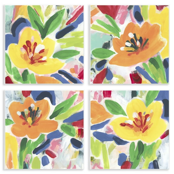
Stupell Industries Vintage Farm Garden Vegetables Food & Beverage Painting Unframed Art Print Wall Art, 11 x 14, Set of 4 $117.99
 $11799current price $117.99
Stupell Industries Vintage Farm Garden Vegetables Food & Beverage Painting Unframed Art Print Wall Art, 11 x 14, Set of 4
Historic State Map - California - 1650 - 23 x 32.68 - Vintage Wall Art $40.95 $40.95/count
 $4095current price $40.95$40.95/count
Historic State Map - California - 1650 - 23 x 32.68 - Vintage Wall Art
Historic City Map - St Louis Missouri - Hutawa 1870 - 23 x 3267 - Vintage Wall Art $45.95 Was $74.95
 $4595current price $45.95, Was $74.95$74.95
Historic City Map - St Louis Missouri - Hutawa 1870 - 23 x 3267 - Vintage Wall Art
Stupell Industries Fresh Vivid Blossoms Floral Painting Unframed Art Print Wall Art, 12 x 12, Set of 4 $117.99
 $11799current price $117.99
Stupell Industries Fresh Vivid Blossoms Floral Painting Unframed Art Print Wall Art, 12 x 12, Set of 4
Historic City Map - Brecksville Ohio - Titus 1874- 26 x 23 - Vintage Wall Art $40.95 $40.95/count
 $4095current price $40.95$40.95/count
Historic City Map - Brecksville Ohio - Titus 1874- 26 x 23 - Vintage Wall Art
Stupell Industries Blue Seashells on Beige Animals Painting Unframed Art Print Wall Art, 11 x 14, Set of 4 $117.99
 $11799current price $117.99
Stupell Industries Blue Seashells on Beige Animals Painting Unframed Art Print Wall Art, 11 x 14, Set of 4
Historic State Map - Colorado - Thayer 1880 - 23 x 28.78 - Vintage Wall Art $40.95
 $4095current price $40.95
Historic State Map - Colorado - Thayer 1880 - 23 x 28.78 - Vintage Wall Art
Stupell Industries Rustic Heirloom Laundry Bath & Laundry Painting Unframed Art Print Wall Art, 11 x 14, Set of 4 $117.99
 $11799current price $117.99
Stupell Industries Rustic Heirloom Laundry Bath & Laundry Painting Unframed Art Print Wall Art, 11 x 14, Set of 4
Historic City Map - Boston Massachusetts - Bowen 1830 - 23 x 23.23 - Vintage Wall Art $45.95 Was $74.95
 $4595current price $45.95, Was $74.95$74.95
Historic City Map - Boston Massachusetts - Bowen 1830 - 23 x 23.23 - Vintage Wall Art
Historic City Map - San Francisco California Guidemap - Wilbur 1890 - 28.94 x 23 - Vintage Wall Art $45.95 Was $74.95
 $4595current price $45.95, Was $74.95$74.95
Historic City Map - San Francisco California Guidemap - Wilbur 1890 - 28.94 x 23 - Vintage Wall Art
Historic City Map - Carson City Nevada Plat - Curtis 1948 - 23 x 36.44 - Vintage Wall Art $45.95
 $4595current price $45.95
Historic City Map - Carson City Nevada Plat - Curtis 1948 - 23 x 36.44 - Vintage Wall Art
Historic City Map - Hope Arkansas - Knobel 1916 - 23 x 25.75 - Vintage Wall Art $40.95 $40.95/count
 $4095current price $40.95$40.95/count
Historic City Map - Hope Arkansas - Knobel 1916 - 23 x 25.75 - Vintage Wall Art
Stupell Industries Various Vintage Palm Leaves Floral Painting Unframed Art Print Wall Art, 11 x 14, Set of 4 $117.99
 $11799current price $117.99
Stupell Industries Various Vintage Palm Leaves Floral Painting Unframed Art Print Wall Art, 11 x 14, Set of 4
Historic City Map - Houston Texas - Jones 1930 - 23 x 36.86 - Vintage Wall Art $40.95
 $4095current price $40.95
Historic City Map - Houston Texas - Jones 1930 - 23 x 36.86 - Vintage Wall Art
Stupell Industries Modern Fern Impressions Plants & Flowers Painting Unframed Art Print Wall Art, 10 x 15, Set of 4 $117.99
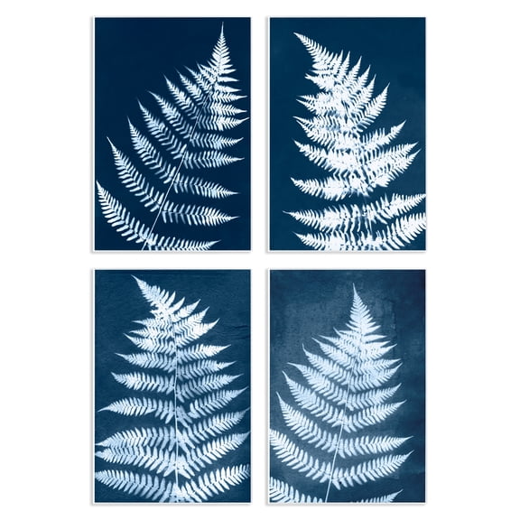 2 optionsAvailable in additional 2 options$11799current price $117.99
Stupell Industries Modern Fern Impressions Plants & Flowers Painting Unframed Art Print Wall Art, 10 x 15, Set of 4
Historic County Map - Bureau County Illinois - Warner 1876 - 26.88 x 23 - Vintage Wall Art $45.95 $45.95/count
 $4595current price $45.95$45.95/count
Historic County Map - Bureau County Illinois - Warner 1876 - 26.88 x 23 - Vintage Wall Art
Customer ratings & reviews
0 ratings|0 reviews
This item does not have any reviews yet

Related pages
- Washington Dc Museum Map
- Georgetown Map Dc
- Chicago World's Fair Map
- Map Midwest States
- State Park Map
- Washington Dc Museums Map
- National Parks Posters
- Central America Travel Books, Maps & Guides
- Midwest United States Travel Books, Maps & Guides
- Southern United States Travel Books, Maps & Guides
- Northeast United States Travel Books, Maps & Guides
- General United States Travel Books, Maps & Guides