Map Of Spain And Portugal From Smiths General Atlas Published London 1850 By C.
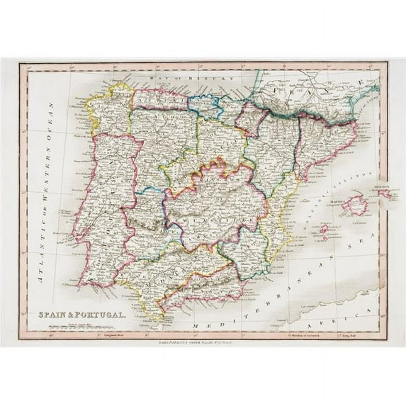
Hero image 0 of Map Of Spain And Portugal From Smiths General Atlas Published London 1850 By C., 0 of 2

Map Of Spain And Portugal From Smiths General Atlas Published London 1850 By C.

(No ratings yet)

Key item features

Map of Spain & Portugal From Smiths General Atlas Published London 1850 by C. Poster Print.

Map Of Spain And Portugal From Smith's General Atlas Published London 1850 By C. Smith Mapseller Number 172 The Strand is a licensed reproduction that was printed on Premium Heavy Stock Paper which captures all of the vivid colors and details of the original. This poster is ready for hanging or framing and will make a great addition to your wall decor.

Specifications
  • Artist: Ken Welsh / Design Pics
  • Publisher: Design Pics
  • Size: 34 x 24
- SKU: PSTRZ75572
Current price is $68.94
Price when purchased online
  • Free shipping
  • Free 30-day returns

How do you want your item?

How do you want your item?
Columbus, 43215
Arrives by Fri, May 8
|
Sold and shipped by UnbeatableSale Local
4.113222361809045 stars out of 5, based on 6368 seller reviews(4.1)
Report an issue with this seller
Free 30-day returns - in store or online
Other sellers
$68.25
+Free shipping
Shipping, arrives by Fri, May 8 to Columbus, 43215
Sold and shipped by UnbeatableSale
Free 30-day returns

About this item

Product details

Specifications

Directions

Warranty

Warnings

Customer ratings & reviews

0 ratings|0 reviews
This item does not have any reviews yet