Sort by|
Map Mobile Bay(1)
Uses item details. Price when purchased online
Historical Civil War Map - Spanish Fort Mobile Bay Alabama - Palfrey 1866 - Vintage Wall Art From $36.95

2 options
Available in additional 2 optionsFrom$3695
Historical Civil War Map - Spanish Fort Mobile Bay Alabama - Palfrey 1866 - Vintage Wall Art
Other options to consider(63)
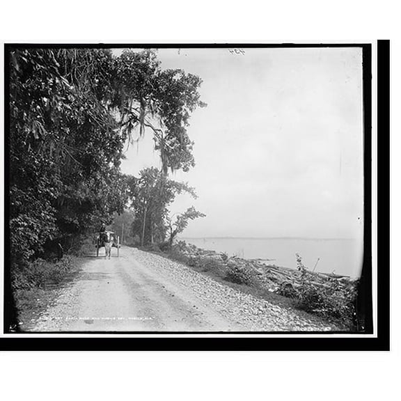
Historic Print, Bay Shell Road and Mobile Bay, Mobile, Ala., 18" x 24" From $57.00
2 options
Available in additional 2 optionsFrom$5700
Historic Print, Bay Shell Road and Mobile Bay, Mobile, Ala., 18" x 24"
Betsy Drake TP13246 24 x 30 in. Cape Cod Bay, MA Nautical Map Wall Hanging $39.72

$3972
current price $39.72Betsy Drake TP13246 24 x 30 in. Cape Cod Bay, MA Nautical Map Wall Hanging
Historic Print, [Bay Shell Road, Mobile, Ala.], 18" x 24"
![Historic Print, [Bay Shell Road, Mobile, Ala.], 18" x 24"](https://i5.walmartimages.com/seo/Historic-Print-Bay-Shell-Road-Mobile-Ala-18-x-24_6ddccae3-9d09-4514-8b9b-0f4e08e137da.63e3e1a245c4cc43f29278866bb00841.jpeg?odnHeight=576&odnWidth=576&odnBg=FFFFFF)
Historic Print, [Bay Shell Road, Mobile, Ala.], 18" x 24"
Historic Print, Bay Shell Road, Mobile, Ala., 16" x 20" From $57.00

2 options
Available in additional 2 optionsFrom$5700
Historic Print, Bay Shell Road, Mobile, Ala., 16" x 20"
Historic Print, Bay Shell Road, Mobile, Ala. - 2, 16" x 20" From $57.00

2 options
Available in additional 2 optionsFrom$5700
Historic Print, Bay Shell Road, Mobile, Ala. - 2, 16" x 20"
NOAA Historical Map and Chart Collection 16x15 Black Modern Framed Museum Art Print Titled - Nautical Chart - Tampa Bay - Northern Part ca. 1975 - Sepia Tinted From $29.99

4 options
Available in additional 4 optionsFrom$2999
NOAA Historical Map and Chart Collection 16x15 Black Modern Framed Museum Art Print Titled - Nautical Chart - Tampa Bay - Northern Part ca. 1975 - Sepia Tinted
Historic Nautical Map - Tampa Bay - Dericcion De Hidrografia 1809 - Vintage Wall Art From $36.95

2 options
Available in additional 2 optionsFrom$3695
Historic Nautical Map - Tampa Bay - Dericcion De Hidrografia 1809 - Vintage Wall Art
Stupell Industries Detailed Map Tampa Bay Florida Anchor Symbol , 11 x 14, Design by Lil' Rue From $20.44

6 options
Available in additional 6 optionsFrom$2044
Stupell Industries Detailed Map Tampa Bay Florida Anchor Symbol , 11 x 14, Design by Lil' Rue
Save with
NOAA Historical Map and Chart Collection 14x12 White Modern Wood Framed Museum Art Print Titled - Nautical Chart - San Francisco Bay ca. 1975 From $29.99

4 options
Available in additional 4 optionsFrom$2999
NOAA Historical Map and Chart Collection 14x12 White Modern Wood Framed Museum Art Print Titled - Nautical Chart - San Francisco Bay ca. 1975
Stupell Industries Tampa Bay Florida Detailed Map Anchor Symbol , 30 x 40, Design by Lil' Rue From $19.54

6 options
Available in additional 6 optionsFrom$1954
Stupell Industries Tampa Bay Florida Detailed Map Anchor Symbol , 30 x 40, Design by Lil' Rue
Save with
Historic County Map - Bay County Michigan - Walling 1873 - Vintage Wall Art From $36.95

2 options
Available in additional 2 optionsFrom$3695
Historic County Map - Bay County Michigan - Walling 1873 - Vintage Wall Art
Framed Art Print, Natural gas drilling platform in Mobile Bay by Panoramic Images, 31-7/8" x 11-7/8" From $439.04

3 options
Available in additional 3 optionsFrom$43904
Framed Art Print, Natural gas drilling platform in Mobile Bay by Panoramic Images, 31-7/8" x 11-7/8"
Stupell Industries Detailed Tampa Bay Florida Map Anchor Symbol , 30 x 40, Design by Lil' Rue From $17.52

7 options
Available in additional 7 optionsFrom$1752
Stupell Industries Detailed Tampa Bay Florida Map Anchor Symbol , 30 x 40, Design by Lil' Rue
Save with
NOAA Historical Map and Chart Collection 16x15 Black Modern Framed Museum Art Print Titled - Nautical Chart - Tampa Bay - Northern Part ca. 1975 From $29.99

4 options
Available in additional 4 optionsFrom$2999
NOAA Historical Map and Chart Collection 16x15 Black Modern Framed Museum Art Print Titled - Nautical Chart - Tampa Bay - Northern Part ca. 1975
Historic Nautical Map - New York Bay Harbor - USCS 1845 - Vintage Wall Art From $36.95

2 options
Available in additional 2 optionsFrom$3695
Historic Nautical Map - New York Bay Harbor - USCS 1845 - Vintage Wall Art
NOAA Historical Map and Chart Collection 14x12 Black Modern Framed Museum Art Print Titled - Nautical Chart - Massachusetts Bay ca. 1970 - Sepia Tinted From $29.99

4 options
Available in additional 4 optionsFrom$2999
NOAA Historical Map and Chart Collection 14x12 Black Modern Framed Museum Art Print Titled - Nautical Chart - Massachusetts Bay ca. 1970 - Sepia Tinted
Betsy Drake NC13246 16 x 20 in. Cape Cod Bay, MA Nautical Map Noncorded Indoor & Outdoor Pillow $33.32

$3332
current price $33.32Betsy Drake NC13246 16 x 20 in. Cape Cod Bay, MA Nautical Map Noncorded Indoor & Outdoor Pillow
Historic Nautical Map - Lituya Bay - Depot De La Marine 1797 - Vintage Wall Art From $36.95

2 options
Available in additional 2 optionsFrom$3695
Historic Nautical Map - Lituya Bay - Depot De La Marine 1797 - Vintage Wall Art
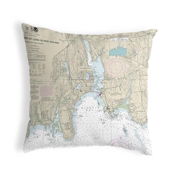
12 x 12 in. North Shore Long Island to Niantic Bay, CT Nautical Map Non-Corded Indoor & Outdoor Pillow $45.23
$4523
current price $45.2312 x 12 in. North Shore Long Island to Niantic Bay, CT Nautical Map Non-Corded Indoor & Outdoor Pillow
Historic Nautical Map - Honduras Bay Mosquito Coast - Robertson 1764 - Vintage Wall Art From $36.95

2 options
Available in additional 2 optionsFrom$3695
Historic Nautical Map - Honduras Bay Mosquito Coast - Robertson 1764 - Vintage Wall Art
11 x 14 in. Essex Bay & Essex River, MA Nautical Map Non-Corded Indoor & Outdoor Pillow $45.23

$4523
current price $45.2311 x 14 in. Essex Bay & Essex River, MA Nautical Map Non-Corded Indoor & Outdoor Pillow
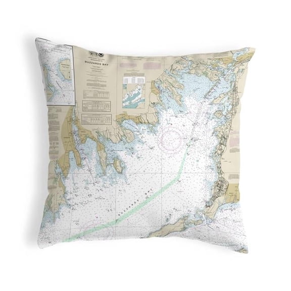
12 x 12 in. Buzzards Bay, MA Nautical Map Non-Corded Indoor & Outdoor Pillow $45.23
$4523
current price $45.2312 x 12 in. Buzzards Bay, MA Nautical Map Non-Corded Indoor & Outdoor Pillow
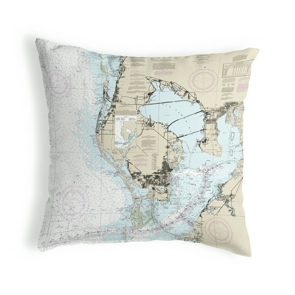
11 x 14 in. Miami to Marathon & Florida Bay, FL Nautical Map Non-Corded Indoor & Outdoor Pillow $45.23

$4523
current price $45.2311 x 14 in. Miami to Marathon & Florida Bay, FL Nautical Map Non-Corded Indoor & Outdoor Pillow
NOAA Historical Map and Chart Collection 14x12 Black Ornate Wood Framed with Double Matting Museum Art Print Titled - Nautical Chart - Massachusetts Bay ca. 1970 From $29.99

4 options
Available in additional 4 optionsFrom$2999
NOAA Historical Map and Chart Collection 14x12 Black Ornate Wood Framed with Double Matting Museum Art Print Titled - Nautical Chart - Massachusetts Bay ca. 1970
Betsy Drake ZP13246 20 x 24 in. Cape Cod Bay, MA Nautical Map Extra Large Zippered Indoor & Outdoor Pillow $51.74

$5174
current price $51.74Betsy Drake ZP13246 20 x 24 in. Cape Cod Bay, MA Nautical Map Extra Large Zippered Indoor & Outdoor Pillow
11 x 14 in. St Louis Bay, MS Nautical Map Non-Corded Indoor & Outdoor Pillow $45.23

$4523
current price $45.2311 x 14 in. St Louis Bay, MS Nautical Map Non-Corded Indoor & Outdoor Pillow
Betsy Drake NC11412 Tampa Bay, FL Nautical Map Noncorded Indoor & Outdoor Pillow - 16 x 20 in. $33.32

$3332
current price $33.32Betsy Drake NC11412 Tampa Bay, FL Nautical Map Noncorded Indoor & Outdoor Pillow - 16 x 20 in.
Betsy Drake Interiors Choctawhatchee Bay, FL Nautical Map Noncorded Indoor/Outdoor Pillow 11x14 $34.47

$3447
current price $34.47Betsy Drake Interiors Choctawhatchee Bay, FL Nautical Map Noncorded Indoor/Outdoor Pillow 11x14
Betsy Drake NC11425 Blackburn Bay, FL Nautical Map Noncorded Indoor & Outdoor Pillow - 16 x 20 in. $33.32

$3332
current price $33.32Betsy Drake NC11425 Blackburn Bay, FL Nautical Map Noncorded Indoor & Outdoor Pillow - 16 x 20 in.
Betsy Drake HJ11412 Tampa Bay, FL Nautical Map Large Corded Indoor & Outdoor Pillow - 16 x 20 in. $43.66

$4366
current price $43.66Betsy Drake HJ11412 Tampa Bay, FL Nautical Map Large Corded Indoor & Outdoor Pillow - 16 x 20 in.
Historic Print, North Atlantic squadron in bay, Rockport, Mass., 16" x 20" From $57.00

2 options
Available in additional 2 optionsFrom$5700
Historic Print, North Atlantic squadron in bay, Rockport, Mass., 16" x 20"
Historic Print, [Sandy Bay and North Atlantic squadron, Rockport, Mass.], 16" x 20" From $57.00
![Historic Print, [Sandy Bay and North Atlantic squadron, Rockport, Mass.], 16" x 20"](https://i5.walmartimages.com/seo/Historic-Print-Sandy-Bay-and-North-Atlantic-squadron-Rockport-Mass-16-x-20_7b011c1f-75a8-410b-ab3b-47b0f91f3c1c.0693e4c7a6e6d8457cb1148245214d44.jpeg?odnHeight=576&odnWidth=576&odnBg=FFFFFF)
2 options
Available in additional 2 optionsFrom$5700
Historic Print, [Sandy Bay and North Atlantic squadron, Rockport, Mass.], 16" x 20"
Historic Print, North Atlantic squadron in bay, Rockport, Mass. - 2, 18" x 24" From $57.00

2 options
Available in additional 2 optionsFrom$5700
Historic Print, North Atlantic squadron in bay, Rockport, Mass. - 2, 18" x 24"
St Louis Bay, MS Nautical Map Large Corded Indoor & Outdoor Pillow - 16 x 20 in. $44.69

$4469
current price $44.69St Louis Bay, MS Nautical Map Large Corded Indoor & Outdoor Pillow - 16 x 20 in.
Betsy Drake KS11412 12 x 12 in. Tampa Bay, FL Nautical Map Non-Corded Indoor & Outdoor Pillow $26.71
$2671
current price $26.71Betsy Drake KS11412 12 x 12 in. Tampa Bay, FL Nautical Map Non-Corded Indoor & Outdoor Pillow
Betsy Drake Interiors Choctawhatchee Bay, FL Nautical Map Large Corded Indoor/Outdoor Pillow 16x20 $37.54

$3754
current price $37.54Betsy Drake Interiors Choctawhatchee Bay, FL Nautical Map Large Corded Indoor/Outdoor Pillow 16x20
Blackburn Bay, FL Nautical Map Extra Large Zippered Indoor & Outdoor Pillow - 20 x 24 in. $52.95

$5295
current price $52.95Blackburn Bay, FL Nautical Map Extra Large Zippered Indoor & Outdoor Pillow - 20 x 24 in.
Betsy Drake ZP11412 Tampa Bay, FL Nautical Map Extra Large Zippered Indoor & Outdoor Pillow - 20 x 24 in. $51.74 Was $62.24

Now$5174
current price Now $51.74, Was $62.24$62.24
Betsy Drake ZP11412 Tampa Bay, FL Nautical Map Extra Large Zippered Indoor & Outdoor Pillow - 20 x 24 in.
Historic Print, [North Atlantic squadron in Sandy Bay, Rockport, Mass.] - 3, 18" x 24" From $57.00
![Historic Print, [North Atlantic squadron in Sandy Bay, Rockport, Mass.] - 3, 18" x 24"](https://i5.walmartimages.com/seo/Historic-Print-North-Atlantic-squadron-in-Sandy-Bay-Rockport-Mass-3-18-x-24_cac0d765-b986-4499-8100-f41f1bcecfe7.68605eaa6585dd4fd562d7a352e3c9f4.jpeg?odnHeight=576&odnWidth=576&odnBg=FFFFFF)
2 options
Available in additional 2 optionsFrom$5700
Historic Print, [North Atlantic squadron in Sandy Bay, Rockport, Mass.] - 3, 18" x 24"
Popular in Map Mobile Bay
- Platte River Map
- Map South Carolina
- Florida Map Wall Art
- Detailed Maps Of Tennessee Wall Art
- California Landscape Map
- Map Plattsburgh York
- National Parks Posters
- World Map Wall Art
- Central America Travel Books, Maps & Guides
- Caribbean & West Indies Travel Books, Maps & Guides
- Cyprus Travel Books
- Ontario Travel Books, Maps & Guides
Related Products
Global Gallery George W. Blum 'Map of California Roads for Cyclers, 1896' Canvas Wall Art
 Global Gallery George W. Blum 'Map of California Roads for Cyclers, 1896' Canvas Wall Art$121.55current price $121.55
Historic Mine Map - Nevada Lincoln County Bristol Silver Mine - USGS 1953 - Vintage Wall Art
 Historic Mine Map - Nevada Lincoln County Bristol Silver Mine - USGS 1953 - Vintage Wall Art$40.95current price $40.95
Historic State Map - Florida - Cram 1892 - Vintage Wall Art
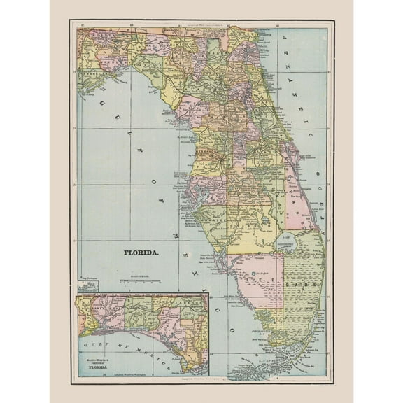 Historic State Map - Florida - Cram 1892 - Vintage Wall Art$45.95current price $45.95
Historic State Map - Florida - Cram 1892 - Vintage Wall Art
 Historic State Map - Florida - Cram 1892 - Vintage Wall Art$40.95current price $40.95
Sequoia & Kings Canyon National Parks Hand-Drawn Map - Authentic 18x24 Vintage-Style Wall Art - Lithographic Print with Soy-Based Inks - Made in USA
 Sequoia & Kings Canyon National Parks Hand-Drawn Map - Authentic 18x24 Vintage-Style Wall Art - Lithographic Print with Soy-Based Inks - Made in USA$27.73current price $27.73
Historic Map - Tasmania Australia - Cram 1892 - Vintage Wall Art
 Historic Map - Tasmania Australia - Cram 1892 - Vintage Wall Art$45.95current price $45.95
Historic Map - West Midlands England - Bartholomew 1892 - Vintage Wall Art
 Historic Map - West Midlands England - Bartholomew 1892 - Vintage Wall Art$45.95current price $45.95
Historic State Map - Montana Yellowstone National Park - Hoen 1896 - Vintage Wall Art
 Historic State Map - Montana Yellowstone National Park - Hoen 1896 - Vintage Wall Art$45.95current price $45.95
Historic City Map - Pensacola Florida - Bellin 1764 - Vintage Wall Art
 Historic City Map - Pensacola Florida - Bellin 1764 - Vintage Wall Art$40.95current price $40.95
Historic Map - Richmond Mortlake London - Bartholomew 1921 - Vintage Wall Art
 Historic Map - Richmond Mortlake London - Bartholomew 1921 - Vintage Wall Art$45.95current price $45.95
Historic State Map - New Jersey United States - Cram 1888 - Vintage Wall Art
 Historic State Map - New Jersey United States - Cram 1888 - Vintage Wall Art$40.95current price $40.95
Historic Map - Westminster Abbey London - Bartholomew 1921 - Vintage Wall Art
 Historic Map - Westminster Abbey London - Bartholomew 1921 - Vintage Wall Art$40.95current price $40.95
Historic City Map - Portland Maine - Cram 1892 - Vintage Wall Art
 Historic City Map - Portland Maine - Cram 1892 - Vintage Wall Art$45.95current price $45.95
Historic Map - Epping Forest London England - Philip 1904 - Vintage Wall Art
 Historic Map - Epping Forest London England - Philip 1904 - Vintage Wall Art$45.95current price $45.95
Historic State Map - Louisiana - Cram 1892 - Vintage Wall Art
 Historic State Map - Louisiana - Cram 1892 - Vintage Wall Art$40.95current price $40.95