Canterbury Map(5)
Uses item details. Price when purchased online
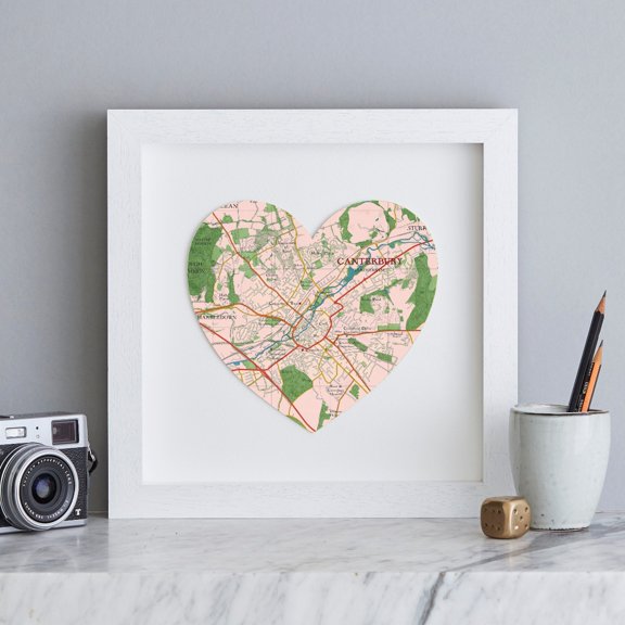
Canterbury map heart print $74.00
$7400
current price $74.00Canterbury map heart print
Historic Panoramic View - Canterbury New Hampshire - Foster 1849 - Vintage Wall Art From $36.95

2 options
Available in additional 2 optionsFrom$3695
Historic Panoramic View - Canterbury New Hampshire - Foster 1849 - Vintage Wall Art
Kna Prints - 1 Pc Poster Canterbury Travel , Travel Print Of Canterbury, Canterbury, England, Uk, UNFRAMED-12x18

Kna Prints - 1 Pc Poster Canterbury Travel , Travel Print Of Canterbury, Canterbury, England, Uk, UNFRAMED-12x18
Canterbury Travel Poster Travel Print Of Canterbury Canterbury England Uk Home Decor Office Wall Art From $18.99

5 options
Available in additional 5 optionsFrom$1899
Canterbury Travel Poster Travel Print Of Canterbury Canterbury England Uk Home Decor Office Wall Art
Historic Print, Archb. of Canterbury, 18" x 24" $71.00

$7100
current price $71.00Historic Print, Archb. of Canterbury, 18" x 24"
Other options to consider(102)
Canterbury Travel Print Canterbury Poster Canterbury England Uk Travel Poster Home Decor Office Wall Art From $18.99

5 options
Available in additional 5 optionsFrom$1899
Canterbury Travel Print Canterbury Poster Canterbury England Uk Travel Poster Home Decor Office Wall Art
Canterbury Travel Poster Style Cathedral Print C201380 From $28.00

5 options
Available in additional 5 optionsFrom$2800
Canterbury Travel Poster Style Cathedral Print C201380
Canterbury Travel Print Travel Poster of Canterbury England Canterbury Cathedral Kent Art Lovers Gift Wall Art Print From $18.99

4 options
Available in additional 4 optionsFrom$1899
Canterbury Travel Print Travel Poster of Canterbury England Canterbury Cathedral Kent Art Lovers Gift Wall Art Print
Canterbury Travel Prints Canterbury Travel Poster UK Town Travel Prints UK Travel Art UK Wall Art Travel Art A1A2A3A4 Set 3 From $36.99

4 options
Available in additional 4 optionsFrom$3699
Canterbury Travel Prints Canterbury Travel Poster UK Town Travel Prints UK Travel Art UK Wall Art Travel Art A1A2A3A4 Set 3
Historic Print, West Gate Canterbury England, 18" x 24" From $57.00

2 options
Available in additional 2 optionsFrom$5700
Historic Print, West Gate Canterbury England, 18" x 24"
Foster 12x14 Black Modern Framed Museum Art Print Titled - Canterbury New Hampshire - Foster 1849 From $29.99

4 options
Available in additional 4 optionsFrom$2999
Foster 12x14 Black Modern Framed Museum Art Print Titled - Canterbury New Hampshire - Foster 1849
Cloudscape Canterbury New Zealand Poster Print (36 x 12)

Cloudscape Canterbury New Zealand Poster Print (36 x 12)
Posterazzi PDDAU02DWA5193 Akaroa Harbor Canterbury South Island New Zealand Poster Print by David Wall - 23 x 34 in. $65.46

$6546
current price $65.46Posterazzi PDDAU02DWA5193 Akaroa Harbor Canterbury South Island New Zealand Poster Print by David Wall - 23 x 34 in.
Thomas Rowlandson 18x13 Black Modern Framed Museum Art Print Titled - Canterbury (ca. 1780-1825) From $29.99

3 options
Available in additional 3 optionsFrom$2999
Thomas Rowlandson 18x13 Black Modern Framed Museum Art Print Titled - Canterbury (ca. 1780-1825)
Panoramic View of Canterbury England in The Sixteenth Century Poster Print - 16 x 13 $25.23

$2523
current price $25.23Panoramic View of Canterbury England in The Sixteenth Century Poster Print - 16 x 13
Historic Print, St. Martins Church Canterbury England, 16" x 20"

Historic Print, St. Martins Church Canterbury England, 16" x 20"
Akaroa Harbor Canterbury New Zealand Poster Print (18 x 6) $19.99

$1999
current price $19.99Akaroa Harbor Canterbury New Zealand Poster Print (18 x 6)
Posterazzi PDDAU02DWA6526 Clouds Mackenzie Canterbury South Island New Zealand Poster Print by David Wall - 25 x 38 in. $77.68

$7768
current price $77.68Posterazzi PDDAU02DWA6526 Clouds Mackenzie Canterbury South Island New Zealand Poster Print by David Wall - 25 x 38 in.
New Zealand South Island Canterbury Akaroa Harbor Poster Print by David Wall - 23 x 34 in. $65.40

$6540
current price $65.40New Zealand South Island Canterbury Akaroa Harbor Poster Print by David Wall - 23 x 34 in.
Historic Print, Mordington, Canterbury-Milford Road, Frederica vicinity, Kent County, DE, 16" x 20" From $57.00

2 options
Available in additional 2 optionsFrom$5700
Historic Print, Mordington, Canterbury-Milford Road, Frederica vicinity, Kent County, DE, 16" x 20"
Posterazzi PDDAU02DWA6452 Sun & Lenticular Cloud Over Ohau Range Canterbury South Island New Zealand Print by David Wall $77.68

$7768
current price $77.68Posterazzi PDDAU02DWA6452 Sun & Lenticular Cloud Over Ohau Range Canterbury South Island New Zealand Print by David Wall
Art Print (Unframed), Cloudscape Canterbury New Zealand by Panoramic Images, 24" x 8" From $118.00

6 options
Available in additional 6 optionsFrom$11800
Art Print (Unframed), Cloudscape Canterbury New Zealand by Panoramic Images, 24" x 8"
Posterazzi DPI1857418 Panoramic View of Canterbury England in The Sixteenth Century Poster Print, 16 x 13 From $25.58

2 options
Available in additional 2 optionsFrom$2558
Posterazzi DPI1857418 Panoramic View of Canterbury England in The Sixteenth Century Poster Print, 16 x 13
Historic Print, St. Martins Church Canterbury England, 18" x 24" $71.00

$7100
current price $71.00Historic Print, St. Martins Church Canterbury England, 18" x 24"
Posterazzi PDDAU02DWA6456 Road to Aoraki Mount Cook Mackenzie Country South Canterbury South Island New Zealand Print by David Wall $67.86

$6786
current price $67.86Posterazzi PDDAU02DWA6456 Road to Aoraki Mount Cook Mackenzie Country South Canterbury South Island New Zealand Print by David Wall
Historic Print, Mordington, Canterbury-Milford Road, Frederica vicinity, Kent County, DE - 2, 18" x 24"

Historic Print, Mordington, Canterbury-Milford Road, Frederica vicinity, Kent County, DE - 2, 18" x 24"
Historic Print, First Congregational Church, Canterbury, Windham County, CT, 16" x 20" From $57.00

2 options
Available in additional 2 optionsFrom$5700
Historic Print, First Congregational Church, Canterbury, Windham County, CT, 16" x 20"
New Zealand, South Island, Canterbury, Trail through AorakiMt Cook National Park Stretched Canvas Wall Art by Walter Bibikow Sold by Art.Com

New Zealand, South Island, Canterbury, Trail through AorakiMt Cook National Park Stretched Canvas Wall Art by Walter Bibikow Sold by Art.Com
Historic Print, [Canterbury Cathedral], 18" x 24"
![Historic Print, [Canterbury Cathedral], 18" x 24"](https://i5.walmartimages.com/seo/Historic-Print-Canterbury-Cathedral-18-x-24_9fa3ddcf-2f8e-4510-bd41-550f8443a28b.e9ebba75a7ab76f5584bebad0be30c8a.jpeg?odnHeight=576&odnWidth=576&odnBg=FFFFFF)
Historic Print, [Canterbury Cathedral], 18" x 24"
Historic Print, Mordington, Canterbury-Milford Road, Frederica vicinity, Kent County, DE - 3, 16" x 20" From $57.00

2 options
Available in additional 2 optionsFrom$5700
Historic Print, Mordington, Canterbury-Milford Road, Frederica vicinity, Kent County, DE - 3, 16" x 20"
Panoramic View of Canterbury England in The Sixteenth Century Poster Print - Large - 32 x 26 $69.76

$6976
current price $69.76Panoramic View of Canterbury England in The Sixteenth Century Poster Print - Large - 32 x 26
Historic Print, Canterbury Cathedral, the most famous in England, 18" x 24" $71.00

$7100
current price $71.00Historic Print, Canterbury Cathedral, the most famous in England, 18" x 24"
24"x36" Gallery Poster, Canterbury Cathedral Floor Plan 17th Century $52.95

$5295
current price $52.9524"x36" Gallery Poster, Canterbury Cathedral Floor Plan 17th Century
Historic Print, [Canterbury Cathedral, England], 18" x 24" From $57.00
![Historic Print, [Canterbury Cathedral, England], 18" x 24"](https://i5.walmartimages.com/seo/Historic-Print-Canterbury-Cathedral-England-18-x-24_f7d3b03a-9fe0-49f8-a8e6-4daece38ffba.b5457807936e01d579dafae6f8484b73.jpeg?odnHeight=576&odnWidth=576&odnBg=FFFFFF)
2 options
Available in additional 2 optionsFrom$5700
Historic Print, [Canterbury Cathedral, England], 18" x 24"
Historic Print, Archbishop of Canterbury, 18" x 24" From $57.00

2 options
Available in additional 2 optionsFrom$5700
Historic Print, Archbishop of Canterbury, 18" x 24"
Historic Print, Mordington, Canterbury-Milford Road, Frederica vicinity, Kent County, DE - 4, 16" x 20" From $57.00

2 options
Available in additional 2 optionsFrom$5700
Historic Print, Mordington, Canterbury-Milford Road, Frederica vicinity, Kent County, DE - 4, 16" x 20"
Historic Print, First Congregational Church, Canterbury, Windham County, CT - 2, 16" x 20"

Historic Print, First Congregational Church, Canterbury, Windham County, CT - 2, 16" x 20"
Historic Print, David Kinney House, Black Hill Road, Canterbury, Windham County, CT, 16" x 20" From $57.00

2 options
Available in additional 2 optionsFrom$5700
Historic Print, David Kinney House, Black Hill Road, Canterbury, Windham County, CT, 16" x 20"
Christopher Colombus 1436-1506 - Trans-Atlantic Map - Vintage Pictorial Map by Lucien Boucher c.1927 - Bamboo Fine Art 290gsm Paper (Unframed) 12x16in From $14.98

19 options
Available in additional 19 optionsFrom$1498
Christopher Colombus 1436-1506 - Trans-Atlantic Map - Vintage Pictorial Map by Lucien Boucher c.1927 - Bamboo Fine Art 290gsm Paper (Unframed) 12x16in
Art Print (Unframed), Farmland S Canterbury New Zealand by Panoramic Images, 15" x 24" From $100.00

6 options
Available in additional 6 optionsFrom$10000
Art Print (Unframed), Farmland S Canterbury New Zealand by Panoramic Images, 15" x 24"
Popular in Canterbury Map
Related Products
Historic Map - Alps Europe - Thiers 1866 - Vintage Wall Art
 Historic Map - Alps Europe - Thiers 1866 - Vintage Wall Art$45.95current price $45.95
Historic Map - Alessandria Province Italy - Robert 1748 - Vintage Wall Art
 Historic Map - Alessandria Province Italy - Robert 1748 - Vintage Wall Art$45.95current price $45.95
Historic Framed Print, MI Bessemer 1886 MAP, 17-7/8" x 21-7/8"
 Historic Framed Print, MI Bessemer 1886 MAP, 17-7/8" x 21-7/8"$298.00current price $298.00
Historic Map - Middle East Sacred Sites - Drioux 1882 - Vintage Wall Art
 Historic Map - Middle East Sacred Sites - Drioux 1882 - Vintage Wall Art$40.95current price $40.95
Topographical Map - Seiad California Quad - USGS 1922 - Vintage Wall Art
 Topographical Map - Seiad California Quad - USGS 1922 - Vintage Wall Art$40.95current price $40.95
Historic Map - Tower of London England - Philip 1904 - Vintage Wall Art
 Historic Map - Tower of London England - Philip 1904 - Vintage Wall Art$45.95current price $45.95