
Hero image 0 of Historic State Map - Yellowstone Grand Teton National Parks Boundary 1929 - 23 x 36 - Vintage Wall Art, 0 of 5
Historic State Map - Yellowstone Grand Teton National Parks Boundary 1929 - 23 x 36 - Vintage Wall Art
(No ratings yet)
Historic State Map - Yellowstone Grand Teton National Parks Boundary 1929 - 23 x 36 - Vintage Wall ArtHistoric State Map Yellowstone Grand Teton National Parks Boundary 1929 23 x 36 Vintage Wall ArtHistoric State Map Yellowstone Grand Teton National Parks Boundary 1929 23 x 36 Vintage Wall Art
Material:Glossy Satin Photo Quality
Key item features
- BEAUTIFULLY DETAILED MAPS OF PARKS AND MOUNTAIN RANGES - The US has thousands of deignated national, state, and local parks, as well as various mountain ranges that span across a number of states. These rich and detailed maps show you the layout of these parks and mountains and provide you the insights into what you might expect when traveling there.
- NATIONAL PARKS ARE OUR MOST TREASURED RESOURCE - If you have even been through a National Park, then you can appreciate why the natural beauty of these swaths of land are preserved. Proudly display one of our national treasures with a map from Maps of the Past.
- ONLY ACCEPT THE BEST PRINT QUALITY FOR YOUR REPRODUCTIONS - There are many printers and print types available on the market, when purchasing a reproduction there is no finer quality reproduction than a reproduction using the Giclee Printing method. Giclee describes the technique or style of printing used, and it is revered as the highest quality printing because of the way it precisely sprays ink onto a surface. Trust nothing less than the best!
- GUARNANTEED TO GET EXACTLY WHAT YOU ORDERED - This map comes exactly to the specification of 23.00 x 36.30 inches/58.42 X 92.20 cm. All of our maps come rolled, wrapped, and shipped in a heavy gauge mailing tube to ensure it arrives intact.
- WHY CHOOSE MAPS OF THE PAST? - Maps of the Past is one of the single largest producers of different types of maps. They legally own the rights to the maps they sell, and provide them to you in clean, clear, and vibrant print. If you are looking for a high quality map print, then look no further than Maps of the Past!
Specs
- Size23.00 x 36.30
- MaterialGlossy Satin Photo Quality
- Decor styleVintage
- ThemeParks
- ShapeRectangle
- Rec. roomOffice
Current price is USD$40.95$40.95/count
Price when purchased online
- Free shipping
 Free 30-day returns
How do you want your item?
Columbus, 43215
Arrives between Feb 27 - Mar 2
|Sold and shipped by Maps of the Past
4.3 stars out of 5, based on 10 seller reviews(4.3)10 seller reviews
Free 30-day returns
About this item
Product details
Old State Map - Yellowstone, Grand Teton National Parks Boundary 1929 - This is an exquisite full-color Reproduction printed on high-quality gloss paper, art paper or canvas.
Print Size: 23.00 x 36.30 inches
58.42 X 92.20cm
Sites and Townships Specific To This Map Are: Gardiner, Cooke City, Moran, Kelly, Jackson, and Wilson.
The following towns are featured: landmarks including the Snake River, Mt Moren, Mt Owen, Grand Teton, Phillips Canyon, Buffalo Fork, Snake River, Continental Divide, Yellowston Lake, Old Faithful, Yellowston River, and Mammoth Hot Springs.
This Map is Situated in: States of Wyoming (WY), Montana (MT), & Idaho (ID).
SKU: WYYE0020
Original Maps are often difficult to find and usually have fold lines, identifying stamps or markings, tears, ragged edges, and assorted other natural signs of age that detract from their beauty. All of our maps have been professionally restored to depict their original beauty, while keeping all historical data intact.
These maps are fabulous pieces of history full of information useful to Historians, Genealogists, Cartographers, Relic Hunters, & Others. They make fascinating conversation pieces and splendid works of art for the home or office.
- BEAUTIFULLY DETAILED MAPS OF PARKS AND MOUNTAIN RANGES - The US has thousands of deignated national, state, and local parks, as well as various mountain ranges that span across a number of states. These rich and detailed maps show you the layout of these parks and mountains and provide you the insights into what you might expect when traveling there.
- NATIONAL PARKS ARE OUR MOST TREASURED RESOURCE - If you have even been through a National Park, then you can appreciate why the natural beauty of these swaths of land are preserved. Proudly display one of our national treasures with a map from Maps of the Past.
- ONLY ACCEPT THE BEST PRINT QUALITY FOR YOUR REPRODUCTIONS - There are many printers and print types available on the market, when purchasing a reproduction there is no finer quality reproduction than a reproduction using the Giclee Printing method. Giclee describes the technique or style of printing used, and it is revered as the highest quality printing because of the way it precisely sprays ink onto a surface. Trust nothing less than the best!
- GUARNANTEED TO GET EXACTLY WHAT YOU ORDERED - This map comes exactly to the specification of 23.00 x 36.30 inches/58.42 X 92.20 cm. All of our maps come rolled, wrapped, and shipped in a heavy gauge mailing tube to ensure it arrives intact.
- WHY CHOOSE MAPS OF THE PAST? - Maps of the Past is one of the single largest producers of different types of maps. They legally own the rights to the maps they sell, and provide them to you in clean, clear, and vibrant print. If you are looking for a high quality map print, then look no further than Maps of the Past!
info:
We aim to show you accurate product information. Manufacturers, suppliers and others provide what you see here, and we have not verified it.
Specifications
Size
23.00 x 36.30
Material
Glossy Satin Photo Quality
Decor style
Vintage
Theme
Parks
Warranty
Warranty information
Please be aware that the warranty terms on items offered for sale by third party Marketplace sellers may differ from those displayed in this section (if any). To confirm warranty terms on an item offered for sale by a third party Marketplace seller, please use the 'Contact seller' feature on the third party Marketplace seller's information page and request the item's warranty terms prior to purchase.
Similar items you might like
Based on what customers bought
Historic State Map - Grand Canyon Visitors Brochure - US Park Services 1977 - 23 x 29 - Vintage Wall Art $94.95 $94.95/count
 $9495current price $94.95$94.95/count
Historic State Map - Grand Canyon Visitors Brochure - US Park Services 1977 - 23 x 29 - Vintage Wall Art
Historic State Map - California - 1650 - 23 x 32.68 - Vintage Wall Art $94.95
 3 optionsAvailable in additional 3 options$9495current price $94.95
Historic State Map - California - 1650 - 23 x 32.68 - Vintage Wall Art
old state map - connecticut - colton 1856 - 28 x 23 $94.95 $94.95/count
 3 optionsAvailable in additional 3 options$9495current price $94.95$94.95/count
old state map - connecticut - colton 1856 - 28 x 23
Historic County Map - Southern Counties California Geological - Fairbanks 1893 - 23 x 24.91 - Vintage Wall Art $94.95 $94.95/count
 3 optionsAvailable in additional 3 options$9495current price $94.95$94.95/count
Historic County Map - Southern Counties California Geological - Fairbanks 1893 - 23 x 24.91 - Vintage Wall Art
Historic State Map - Colorado - Thayer 1880 - 23 x 28.78 - Vintage Wall Art $94.95 $94.95/count
 3 optionsAvailable in additional 3 options$9495current price $94.95$94.95/count
Historic State Map - Colorado - Thayer 1880 - 23 x 28.78 - Vintage Wall Art
Historic State Map - Pennsylvania County Oil Districts - Colton 1865 - 28 x 23 - Vintage Wall Art $94.95
 3 optionsAvailable in additional 3 options$9495current price $94.95
Historic State Map - Pennsylvania County Oil Districts - Colton 1865 - 28 x 23 - Vintage Wall Art
Historic State Map - Great Smoky Mountain National Park - 1934 - 47.31 x 23 - Vintage Wall Art $94.95 $94.95/count
 3 optionsAvailable in additional 3 options$9495current price $94.95$94.95/count
Historic State Map - Great Smoky Mountain National Park - 1934 - 47.31 x 23 - Vintage Wall Art
Historic City Map - Abilene Kansas - Everts 1887 - 23.00 x 25.64 - Vintage Wall Art $94.95 $94.95/count
 3 optionsAvailable in additional 3 options$9495current price $94.95$94.95/count
Historic City Map - Abilene Kansas - Everts 1887 - 23.00 x 25.64 - Vintage Wall Art
Historic State Map - Mississippi River Fort Le Assumption - Demarigny 1743 - 23 x 26 - Vintage Wall Art $94.95
 3 optionsAvailable in additional 3 options$9495current price $94.95
Historic State Map - Mississippi River Fort Le Assumption - Demarigny 1743 - 23 x 26 - Vintage Wall Art
Historic State Map - Virginia - Burr 1834 - 28.13 x 23 - Vintage Wall Art $94.95 $94.95/count
 3 optionsAvailable in additional 3 options$9495current price $94.95$94.95/count
Historic State Map - Virginia - Burr 1834 - 28.13 x 23 - Vintage Wall Art
Railroad Map - Yellowstone National Park - Northern Pacific 1910 - 23 x 25 - Vintage Wall Art $94.95 $94.95/count
 3 optionsAvailable in additional 3 options$9495current price $94.95$94.95/count
Railroad Map - Yellowstone National Park - Northern Pacific 1910 - 23 x 25 - Vintage Wall Art
Historic State Map - Nebraska - Colton 1855 - 28.19 x 23 - Vintage Wall Art $94.95 $94.95/count
 3 optionsAvailable in additional 3 options$9495current price $94.95$94.95/count
Historic State Map - Nebraska - Colton 1855 - 28.19 x 23 - Vintage Wall Art
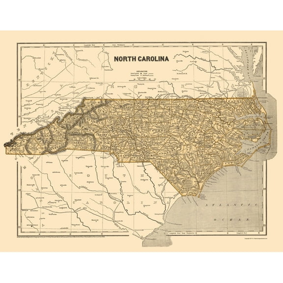
Historic State Map - North Carolina - Morse 1845 - 23 x 29.34 - Vintage Wall Art $94.95 $94.95/count
 3 optionsAvailable in additional 3 options$9495current price $94.95$94.95/count
Historic State Map - North Carolina - Morse 1845 - 23 x 29.34 - Vintage Wall Art
Historic State Map - Vermont - Rand McNally 1897 - 23 x 33.88 - Vintage Wall Art $94.95
 3 optionsAvailable in additional 3 options$9495current price $94.95
Historic State Map - Vermont - Rand McNally 1897 - 23 x 33.88 - Vintage Wall Art
Historic City Map - Nashua New Hampshire - Hitchcock 1877 - 23 x 30.24 - Vintage Wall Art $94.95 $94.95/count
 2 optionsAvailable in additional 2 options$9495current price $94.95$94.95/count
Historic City Map - Nashua New Hampshire - Hitchcock 1877 - 23 x 30.24 - Vintage Wall Art
Historic State Map - Pennsylvania - Mitchell 1846 - 27.81 x 23 - Vintage Wall Art $40.95 $40.95/count
 3 optionsAvailable in additional 3 options$4095current price $40.95$40.95/count
Historic State Map - Pennsylvania - Mitchell 1846 - 27.81 x 23 - Vintage Wall Art
Historic State Map - New Hampshire Agricultural - Hitchcock 1877 - 23 x 29.29 - Vintage Wall Art $40.95 $40.95/count
 3 optionsAvailable in additional 3 options$4095current price $40.95$40.95/count
Historic State Map - New Hampshire Agricultural - Hitchcock 1877 - 23 x 29.29 - Vintage Wall Art
Topographical Map - Yellowstone River Montana Aeronautical Sheet - USAF 1961 - 23 x 30.17 - Vintage Wall Art $40.95 $40.95/count
 3 optionsAvailable in additional 3 options$4095current price $40.95$40.95/count
Topographical Map - Yellowstone River Montana Aeronautical Sheet - USAF 1961 - 23 x 30.17 - Vintage Wall Art
Historic State Map - South Carolina - Rathbun 1893 - 23 x 28.43 - Vintage Wall Art $40.95 $40.95/count
 3 optionsAvailable in additional 3 options$4095current price $40.95$40.95/count
Historic State Map - South Carolina - Rathbun 1893 - 23 x 28.43 - Vintage Wall Art
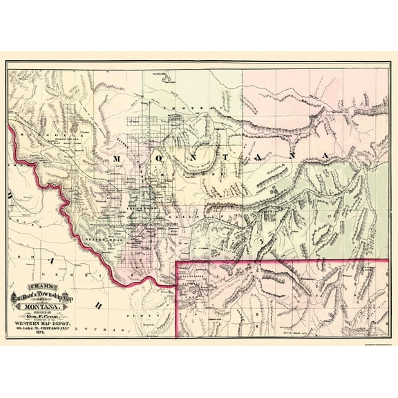
Historic State Map - Montana Territory - Cram 1875 - 31 x 23 - Vintage Wall Art $40.95 $40.95/count
 3 optionsAvailable in additional 3 options$4095current price $40.95$40.95/count
Historic State Map - Montana Territory - Cram 1875 - 31 x 23 - Vintage Wall Art
Customer ratings & reviews
0 ratings|0 reviews
This item does not have any reviews yet
