Hero image 0 of Historic Map - World Principal Rivers Mountains - Tanner 1836 - 28.39 x 23 - Vintage Wall Art, 0 of 5
Historic Map - World Principal Rivers Mountains - Tanner 1836 - 28.39 x 23 - Vintage Wall Art
(No ratings yet)
Key item features
- BEAUTIFULLY DETAILED WORLD MAPS - At Maps of the Past, we have all different types of world maps. From topographical to trade routes, we have them all. Check out all of the different types of world maps that we have to offer. Easily find the one that is right for your needs.
- NORTH POLE TO SOUTH POLE, WORLD MAPS HAVE IT ALL - World maps are the most commonly displayed maps. They are proudly displayed in offices, schools and homes. Add one to your home or office today with Maps of the Past world maps!
- ONLY ACCEPT THE BEST PRINT QUALITY FOR YOUR REPRODUCTIONS - There are many printers and print types available on the market, when purchasing a reproduction there is no finer quality reproduction than a reproduction using the Giclee Printing method. Giclee describes the technique or style of printing used, and it is revered as the highest quality printing because of the way it precisely sprays ink onto a surface. Trust nothing less than the best!
- GUARNANTEED TO GET EXACTLY WHAT YOU ORDERED - This map comes exactly to the specification of 23.00 x 28.38 inches/58.42 X 72.08 cm. All of our maps come rolled, wrapped, and shipped in a heavy gauge mailing tube to ensure it arrives intact.
- WHY CHOOSE MAPS OF THE PAST? - Maps of the Past is one of the single largest producers of different types of maps. They legally own the rights to the maps they sell, and provide them to you in clean, clear, and vibrant print. If you are looking for a high quality map print, then look no further than Maps of the Past!
Specs
- Size23.00 x 28.38
- MaterialGlossy Satin Photo Quality
- Decor styleVintage
- ShapeRectangle
- Rec. roomOffice
- BrandMAPS OF THE PAST
Current price is USD$40.95
Price when purchased online
- Free shipping
 Free 30-day returns
How do you want your item?
Columbus, 43215
Arrives between Feb 24 - Feb 26
|Sold and shipped by Maps of the Past
4.3 stars out of 5, based on 10 seller reviews(4.3)10 seller reviews
Free 30-day returns
Popular items in this category
Best selling items that customers love
Birds on a Beach 24x20 Framed Art Print by Adams, Ansel $55.00
 Sponsored$5500current price $55.00
Birds on a Beach 24x20 Framed Art Print by Adams, Ansel
Shipping, arrives in 3+ daysNorth Carolina Map - 11x14 Unframed Art Print - Great Vintage Gift and Decor for History Buffs and Old Map Enthusiasts Under $15 $14.99
 $1499current price $14.99
North Carolina Map - 11x14 Unframed Art Print - Great Vintage Gift and Decor for History Buffs and Old Map Enthusiasts Under $15
Shipping, arrives in 3+ daysHistoric Print, Deep Cut Bitter Creek near Green River, 16" x 20" $80.00
 3 optionsAvailable in additional 3 options$8000current price $80.00Options from $80.00 – $327.00
Historic Print, Deep Cut Bitter Creek near Green River, 16" x 20"
Shipping, arrives in 3+ days1818 Map of Washington DC Art Print - 11x14 Unframed Art Print - Great Vintage Home Decor $14.99
 $1499current price $14.99
1818 Map of Washington DC Art Print - 11x14 Unframed Art Print - Great Vintage Home Decor
Shipping, arrives in 3+ days1845 Map of Maine Art Print - 11x14 Unframed Art Print - Great Vintage Home Decor $14.99
 $1499current price $14.99
1845 Map of Maine Art Print - 11x14 Unframed Art Print - Great Vintage Home Decor
Shipping, arrives in 3+ days1845 Michigan Map Art Print - 11x14 Unframed Art Print - Great Vintage Home Decor $14.99
 $1499current price $14.99
1845 Michigan Map Art Print - 11x14 Unframed Art Print - Great Vintage Home Decor
Shipping, arrives in 3+ days1938 Michigan Map Art Print - 11x14 Unframed Art Print - Great Vintage Home Decor $14.99
 $1499current price $14.99
1938 Michigan Map Art Print - 11x14 Unframed Art Print - Great Vintage Home Decor
Shipping, arrives in 3+ daysHistoric Print, [Sunset sky across Lake Champlain, Burlington, Vt.] - 3, 16" x 20" $80.00
![Historic Print, [Sunset sky across Lake Champlain, Burlington, Vt.] - 3, 16" x 20"](https://i5.walmartimages.com/seo/Historic-Print-Sunset-sky-across-Lake-Champlain-Burlington-Vt-3-16-x-20_ac1a219b-3db2-4cfa-8553-12ef2b0fe270.34f8a54b1f9720af54dd0c717ab53d41.jpeg?odnHeight=576&odnWidth=576&odnBg=FFFFFF) 3 optionsAvailable in additional 3 options$8000current price $80.00Options from $80.00 – $327.00
3 optionsAvailable in additional 3 options$8000current price $80.00Options from $80.00 – $327.00Historic Print, [Sunset sky across Lake Champlain, Burlington, Vt.] - 3, 16" x 20"
Shipping, arrives in 3+ daysTexas Map Houston and Texas Central Railroad Art Print - 11x14 Unframed Art Print - Great Vintage Home Decor $14.99
 $1499current price $14.99
Texas Map Houston and Texas Central Railroad Art Print - 11x14 Unframed Art Print - Great Vintage Home Decor
Shipping, arrives in 3+ daysNew York Subway Map 1948 Art Print - 11x14 Unframed Art Print - Great Vintage Home Decor $14.99
 $1499current price $14.99
New York Subway Map 1948 Art Print - 11x14 Unframed Art Print - Great Vintage Home Decor
Shipping, arrives in 3+ daysContours 20x24 Framed Art Print by Hanks, Steve $49.99
 $4999current price $49.99
Contours 20x24 Framed Art Print by Hanks, Steve
Shipping, arrives in 3+ daysFlat Earth Map of the Square and Stationary Earth - 11x14 1893 Map by Orlando Ferguson This Map Is the Bible Map of the World $14.99
 $1499current price $14.99
Flat Earth Map of the Square and Stationary Earth - 11x14 1893 Map by Orlando Ferguson This Map Is the Bible Map of the World
15 out of 5 Stars. 1 reviewsMap of Florida 1855 Art Print - 11x14 Unframed Art Print - Great Vintage Home Decor $14.99
 $1499current price $14.99
Map of Florida 1855 Art Print - 11x14 Unframed Art Print - Great Vintage Home Decor
Shipping, arrives in 3+ daysHistoric Print, Saving daylight ends for 1918 Sunday Oct. 27th Set your clock back one hour at 2 A.M. Sunday October 27th., 16" x 20" $80.00
 3 optionsAvailable in additional 3 options$8000current price $80.00Options from $80.00 – $327.00
Historic Print, Saving daylight ends for 1918 Sunday Oct. 27th Set your clock back one hour at 2 A.M. Sunday October 27th., 16" x 20"
Shipping, arrives in 3+ daysArt.com Map of the World on Mercator's Projection, Showing the Chief Countries and their Colonies Art Print by Encyclopaedia Britannica, Black Frame Wall Art, 29" x 23" $130.00
 15 optionsAvailable in additional 15 options$13000current price $130.00More options from $19.00
Art.com Map of the World on Mercator's Projection, Showing the Chief Countries and their Colonies Art Print by Encyclopaedia Britannica, Black Frame Wall Art, 29" x 23"
Shipping, arrives in 2 daysHistoric Print, Sunset study, San Francisco Bay - 2, 16" x 20" $80.00
 3 optionsAvailable in additional 3 options$8000current price $80.00Options from $80.00 – $327.00
Historic Print, Sunset study, San Francisco Bay - 2, 16" x 20"
Shipping, arrives in 3+ daysJesus - The Good Shepherd - Vintage Religious Art by Walter Sallman - Master Art Print (Unframed) 9in x 12in $14.98
 24 optionsAvailable in additional 24 options$1498current price $14.98+$5.95 shippingOptions from $14.98 – $199.98
Jesus - The Good Shepherd - Vintage Religious Art by Walter Sallman - Master Art Print (Unframed) 9in x 12in
Shipping, arrives in 3+ days
About this item
Product details
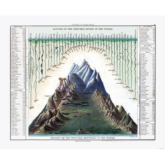
Old International Maps - Principal Rivers and Mountains - World - Tanner 1836 - This is an exquisite full-color Reproduction printed on high-quality gloss paper, art paper or canvas.
Print Size: 23.00 x 28.38 inches
58.42 X 72.08cm
The following towns are featured: Quebec, Florence, Buenos Ayres, Macapa, Calcutta, Azov, Nankin, Honan, Paris, Washington, New York.
This Map is Situated in: Principal Rivers and Mountains of the World.
SKU: ITWO0110
Original Maps are often difficult to find and usually have fold lines, identifying stamps or markings, tears, ragged edges, and assorted other natural signs of age that detract from their beauty. All of our maps have been professionally restored to depict their original beauty, while keeping all historical data intact.
These maps are fabulous pieces of history full of information useful to Historians, Genealogists, Cartographers, Relic Hunters, & Others. They make fascinating conversation pieces and splendid works of art for the home or office.
- BEAUTIFULLY DETAILED WORLD MAPS - At Maps of the Past, we have all different types of world maps. From topographical to trade routes, we have them all. Check out all of the different types of world maps that we have to offer. Easily find the one that is right for your needs.
- NORTH POLE TO SOUTH POLE, WORLD MAPS HAVE IT ALL - World maps are the most commonly displayed maps. They are proudly displayed in offices, schools and homes. Add one to your home or office today with Maps of the Past world maps!
- ONLY ACCEPT THE BEST PRINT QUALITY FOR YOUR REPRODUCTIONS - There are many printers and print types available on the market, when purchasing a reproduction there is no finer quality reproduction than a reproduction using the Giclee Printing method. Giclee describes the technique or style of printing used, and it is revered as the highest quality printing because of the way it precisely sprays ink onto a surface. Trust nothing less than the best!
- GUARNANTEED TO GET EXACTLY WHAT YOU ORDERED - This map comes exactly to the specification of 23.00 x 28.38 inches/58.42 X 72.08 cm. All of our maps come rolled, wrapped, and shipped in a heavy gauge mailing tube to ensure it arrives intact.
- WHY CHOOSE MAPS OF THE PAST? - Maps of the Past is one of the single largest producers of different types of maps. They legally own the rights to the maps they sell, and provide them to you in clean, clear, and vibrant print. If you are looking for a high quality map print, then look no further than Maps of the Past!
info:
We aim to show you accurate product information. Manufacturers, suppliers and others provide what you see here, and we have not verified it.
Specifications
Size
23.00 x 28.38
Material
Glossy Satin Photo Quality
Decor style
Vintage
Theme
Historical International Maps
Warranty
Warranty information
Please be aware that the warranty terms on items offered for sale by third party Marketplace sellers may differ from those displayed in this section (if any). To confirm warranty terms on an item offered for sale by a third party Marketplace seller, please use the 'Contact seller' feature on the third party Marketplace seller's information page and request the item's warranty terms prior to purchase.
Check out these related products
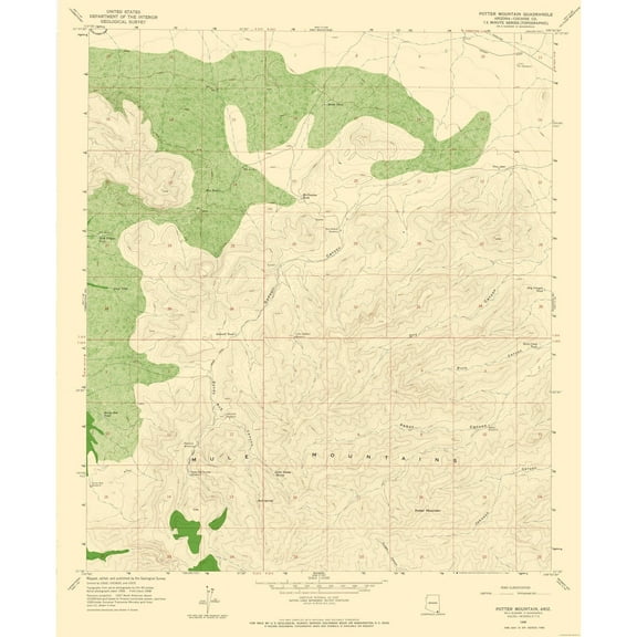
Topographical Map - Potter Mountain Arizona Quad - USGS 1958 - 23 x 27.91 - Vintage Wall Art $40.95
 3 optionsAvailable in additional 3 options$4095current price $40.95Options from $40.95 – $45.95
Topographical Map - Potter Mountain Arizona Quad - USGS 1958 - 23 x 27.91 - Vintage Wall Art
Shipping, arrives in 3+ daysTopographical Map - Hay Mountain Arizona Quad - USGS 1957 - 23 x 27.98 - Vintage Wall Art $40.95
 3 optionsAvailable in additional 3 options$4095current price $40.95Options from $40.95 – $45.95
Topographical Map - Hay Mountain Arizona Quad - USGS 1957 - 23 x 27.98 - Vintage Wall Art
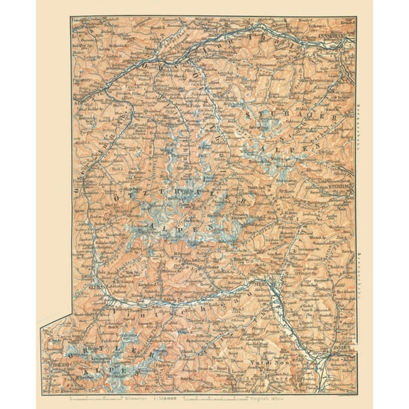
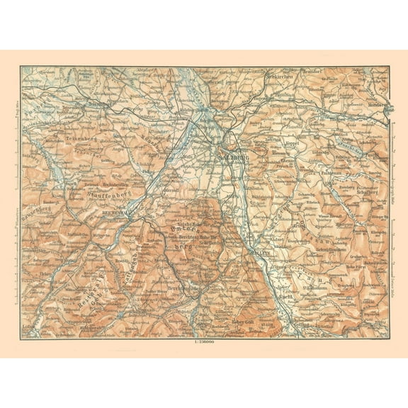
Shipping, arrives in 3+ daysHistoric Map - Austria Italy Mountains - Baedeker 1896 - 23 x 27.91 - Vintage Wall Art $40.95
 3 optionsAvailable in additional 3 options$4095current price $40.95Options from $40.95 – $45.95
Historic Map - Austria Italy Mountains - Baedeker 1896 - 23 x 27.91 - Vintage Wall Art
Shipping, arrives in 3+ daysTopographical Map - Buck Mountain Texas Quad - USGS 1961 - 23 x 28.52 - Vintage Wall Art $40.95
 3 optionsAvailable in additional 3 options$4095current price $40.95Options from $40.95 – $45.95
Topographical Map - Buck Mountain Texas Quad - USGS 1961 - 23 x 28.52 - Vintage Wall Art
Shipping, arrives in 3+ daysTopographical Map - Pedragosa Mountains Arizona Quad - USGS 1958 - 23 x 28.19 - Vintage Wall Art $40.95
 3 optionsAvailable in additional 3 options$4095current price $40.95Options from $40.95 – $45.95
Topographical Map - Pedragosa Mountains Arizona Quad - USGS 1958 - 23 x 28.19 - Vintage Wall Art
Shipping, arrives in 3+ daysTopographical Map - Casa Diablo Mountain California Quad - USGS 1953 - 23 x 27.54 - Vintage Wall Art $40.95
 3 optionsAvailable in additional 3 options$4095current price $40.95Options from $40.95 – $45.95
Topographical Map - Casa Diablo Mountain California Quad - USGS 1953 - 23 x 27.54 - Vintage Wall Art
Shipping, arrives in 3+ daysHistoric Map - Austria Italy Mountains - Baedeker 1896 - 23 x 30.41 - Vintage Wall Art $40.95
 3 optionsAvailable in additional 3 options$4095current price $40.95Options from $40.95 – $45.95
Historic Map - Austria Italy Mountains - Baedeker 1896 - 23 x 30.41 - Vintage Wall Art
Shipping, arrives in 3+ daysTopographical Map - North East Arrastra Mountains Arizona Quad - USGS 1967 - 23 x 28.61 - Vintage Wall Art $40.95
 3 optionsAvailable in additional 3 options$4095current price $40.95Options from $40.95 – $45.95
Topographical Map - North East Arrastra Mountains Arizona Quad - USGS 1967 - 23 x 28.61 - Vintage Wall Art
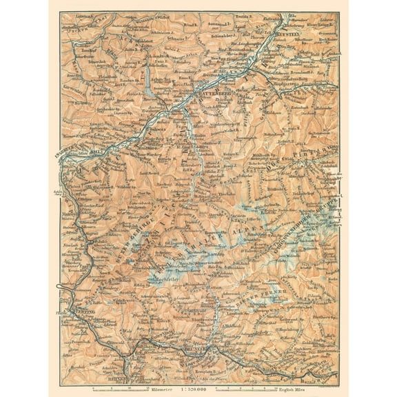
Shipping, arrives in 3+ daysHistoric Map - Germany South Austria Mountains - Baedeker 1896 - 42.69 x 23 - Vintage Wall Art $40.95
 3 optionsAvailable in additional 3 options$4095current price $40.95Options from $40.95 – $45.95
Historic Map - Germany South Austria Mountains - Baedeker 1896 - 42.69 x 23 - Vintage Wall Art
Shipping, arrives in 3+ daysHistoric Map - Austria Germany Mountains - Baedeker 1896 - 30.43 x 23 - Vintage Wall Art $40.95
 3 optionsAvailable in additional 3 options$4095current price $40.95Options from $40.95 – $45.95
Historic Map - Austria Germany Mountains - Baedeker 1896 - 30.43 x 23 - Vintage Wall Art
Topographical Map - Arrastra Mountains Arizona Quad - USGS 1967 - 23 x 28.78 - Vintage Wall Art $40.95
 3 optionsAvailable in additional 3 options$4095current price $40.95Options from $40.95 – $45.95
Topographical Map - Arrastra Mountains Arizona Quad - USGS 1967 - 23 x 28.78 - Vintage Wall Art
Shipping, arrives in 3+ daysTopographical Map - South East Arrastra Mountain Arizona Quad - USGS 1967 - 23 x 28.40 - Vintage Wall Art $40.95
 3 optionsAvailable in additional 3 options$4095current price $40.95Options from $40.95 – $45.95
Topographical Map - South East Arrastra Mountain Arizona Quad - USGS 1967 - 23 x 28.40 - Vintage Wall Art
Shipping, arrives in 3+ daysHistoric Map - Poland Slovakia Hohe Tatra Mountains - Baedeker 1896 - 33.14 x 23 - Vintage Wall Art $40.95
 3 optionsAvailable in additional 3 options$4095current price $40.95Options from $40.95 – $45.95
Historic Map - Poland Slovakia Hohe Tatra Mountains - Baedeker 1896 - 33.14 x 23 - Vintage Wall Art
Shipping, arrives in 3+ daysHistoric Map - Italy Gran Paradiso Mountains - Bertarelli 1914 - 30.37 x 23 - Vintage Wall Art $40.95
 3 optionsAvailable in additional 3 options$4095current price $40.95Options from $40.95 – $45.95
Historic Map - Italy Gran Paradiso Mountains - Bertarelli 1914 - 30.37 x 23 - Vintage Wall Art
Shipping, arrives in 3+ daysHistoric Map - Wetterstein Mountains Germany - Baedeker 1914 - 34.61 x 23 - Vintage Wall Art $40.95
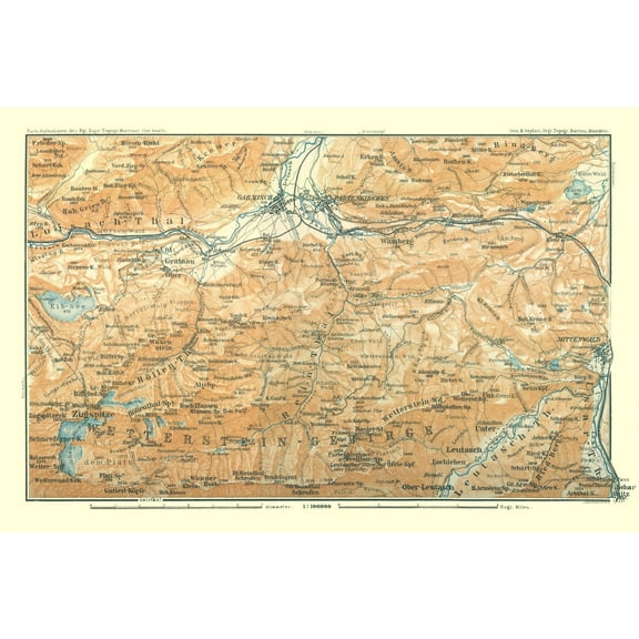 3 optionsAvailable in additional 3 options$4095current price $40.95Options from $40.95 – $45.95
Historic Map - Wetterstein Mountains Germany - Baedeker 1914 - 34.61 x 23 - Vintage Wall Art
Shipping, arrives in 3+ daysHistoric Map - Austria Dauchstein Mountains - Baedeker 1896 - 30.80 x 23 - Vintage Wall Art $40.95
 3 optionsAvailable in additional 3 options$4095current price $40.95Options from $40.95 – $45.95
Historic Map - Austria Dauchstein Mountains - Baedeker 1896 - 30.80 x 23 - Vintage Wall Art
Shipping, arrives in 3+ daysHistoric Map - Germany Austria Mountains - Baedeker 1914 - 30.69 x 23 - Vintage Wall Art $40.95
 3 optionsAvailable in additional 3 options$4095current price $40.95Options from $40.95 – $45.95
Historic Map - Germany Austria Mountains - Baedeker 1914 - 30.69 x 23 - Vintage Wall Art
Shipping, arrives in 3+ daysTopographical Map - Cedar Mountain Texas Quad - USGS 1981 - 23 x 28.30 - Vintage Wall Art $40.95
 3 optionsAvailable in additional 3 options$4095current price $40.95Options from $40.95 – $45.95
Topographical Map - Cedar Mountain Texas Quad - USGS 1981 - 23 x 28.30 - Vintage Wall Art
Shipping, arrives in 3+ daysTopographical Map - Grouse Mountain New Mexico Quad - USGS 1965 - 23 x 28.27 - Vintage Wall Art $40.95
 3 optionsAvailable in additional 3 options$4095current price $40.95Options from $40.95 – $45.95
Topographical Map - Grouse Mountain New Mexico Quad - USGS 1965 - 23 x 28.27 - Vintage Wall Art
Shipping, arrives in 3+ daysTopographical Map - Reading Mountain New Mexico Quad - USGS 1950 - 23 x 28.97 - Vintage Wall Art $40.95
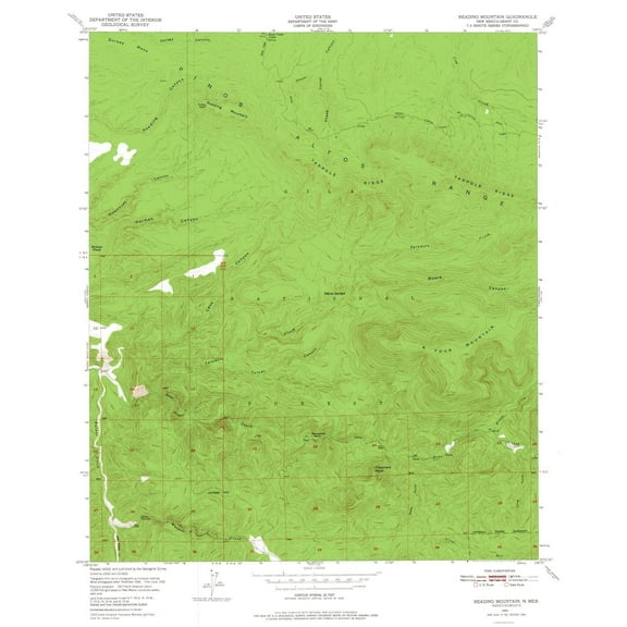 3 optionsAvailable in additional 3 options$4095current price $40.95Options from $40.95 – $45.95
Topographical Map - Reading Mountain New Mexico Quad - USGS 1950 - 23 x 28.97 - Vintage Wall Art
Shipping, arrives in 3+ days
Customer ratings & reviews
0 ratings|0 reviews
This item does not have any reviews yet

Related pages
- Pacific Coast Map
- Big Bend T Map
- Air Route Map
- Map Acadia National Park
- California Map Cities
- Florida Map Wall Art
- National Parks Posters
- World Map Wall Art
- Central America Travel Books, Maps & Guides
- Northeast United States Travel Books, Maps & Guides
- Caribbean & West Indies Travel Books, Maps & Guides
- Ontario Travel Books, Maps & Guides