

Hero image 0 of Historic State Map - Vermont - Rand McNally 1897 - 23 x 33.88 - Vintage Wall Art, 0 of 5
Historic State Map - Vermont - Rand McNally 1897 - 23 x 33.88 - Vintage Wall Art
(No ratings yet)
Historic State Map - Vermont - Rand McNally 1897 - 23 x 33.88 - Vintage Wall ArtHistoric State Map Vermont Rand McNally 1897 23 x 33 88 Vintage Wall ArtHistoric State Map Vermont Rand McNally 1897 23 x 33 88 Vintage Wall ArtHistoric State Map Vermont Rand McNally 1897 23 x 33 88 Vintage Wall Art
Material:Glossy Satin Photo Quality
Key item features
- OWN A STATE MAP TODAY - If you are looking for a map of your state, or another specific state, to frame and hang on your wall, then look no further! Our state maps are also great for school projects. Our maps have a variety of uses, and they come in a variety of styles. We have every state map you could need!
- STATE MAPS PROVIDE IMPORTANT INFORMATION - State maps not only show you how the different counties and/or cities are divided up and where the borders can be found within a state, but it also highlights rivers, mountains, and other natural elements. Some of them may also provide
- ONLY ACCEPT THE BEST PRINT QUALITY FOR YOUR REPRODUCTIONS - There are many printers and print types available on the market, when purchasing a reproduction there is no finer quality reproduction than a reproduction using the Giclee Printing method. Giclee describes the technique or style of printing used, and it is revered as the highest quality printing because of the way it precisely sprays ink onto a surface. Trust nothing less than the best!
- GUARNANTEED TO GET EXACTLY WHAT YOU ORDERED - This map comes exactly to the specification of 23.00 x 33.88 inches/58.42 X 86.05 cm. All of our maps come rolled, wrapped, and shipped in a heavy gauge mailing tube to ensure it arrives intact.
- WHY CHOOSE MAPS OF THE PAST? - Maps of the Past is one of the single largest producers of different types of maps. They legally own the rights to the maps they sell, and provide them to you in clean, clear, and vibrant print. If you are looking for a high quality map print, then look no further than Maps of the Past!
Specs
- Size23.00 x 33.88
- MaterialGlossy Satin Photo Quality
- Decor styleVintage
- ThemeOld State Maps
- ShapeRectangle
- Rec. roomOffice
Current price is USD$36.95
Price when purchased online
- Free shipping
Free 30-day returns
How do you want your item?
Columbus, 43215
Arrives between Feb 14 - Feb 18
|Sold and shipped by Maps of the Past
4.3 stars out of 5, based on 10 seller reviews(4.3)10 seller reviews
Free 30-day returns
Compare with similar items
| Product | Viewing this itemHistoric State Map - Vermont - Rand McNally 1897 - 23 x 33.88 - Vintage Wall Art ![]() $36.95 current price $36.95 | Historic State Map - California - 1650 - 23 x 32.68 - Vintage Wall Art ![]() $94.95 current price $94.95 | Historic State Map - Connecticut - Colton 1856 - 28 x 23 - Vintage Wall Art ![]() $94.95 current price $94.95 | Historic Nautical Map - New England Coast - 1776 - 23 x 32.81 - Vintage Wall Art ![]() $94.95 current price $94.95 | Historic City Map - Lynn Massachusetts - Walling 1871 - 23 x 29.18 - Vintage Wall Art ![]() $94.95 current price $94.95 | Historic City Map - Abilene Kansas - Everts 1887 - 23.00 x 25.64 - Vintage Wall Art ![]() $94.95 current price $94.95 | Historic City Map - Hope Arkansas - Knobel 1916 - 23 x 25.75 - Vintage Wall Art ![]() $94.95 current price $94.95 | Historic State Map - North Carolina - Morse 1845 - 23 x 29.34 - Vintage Wall Art ![]() $94.95 current price $94.95 | Historic City Map - Nashua New Hampshire - Hitchcock 1877 - 23 x 30.24 - Vintage Wall Art ![]() $94.95 current price $94.95 | Historic City Map - Charleston South Carolina - Stanford 1861 - 23 x 29.44 - Vintage Wall Art ![]() $94.95 current price $94.95 |
|---|
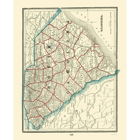
| Size | 23.00 x 33.88Historic State Map - Vermont - Rand McNally 1897 - 23 x 33.88 - Vintage Wall Art | 23.00 x 32.68Historic State Map - California - 1650 - 23 x 32.68 - Vintage Wall Art | 28 x 23Historic State Map - Connecticut - Colton 1856 - 28 x 23 - Vintage Wall Art | 23.00 x 32.81Historic Nautical Map - New England Coast - 1776 - 23 x 32.81 - Vintage Wall Art | 23.00 x 29.18Historic City Map - Lynn Massachusetts - Walling 1871 - 23 x 29.18 - Vintage Wall Art | 23.00 x 25.64Historic City Map - Abilene Kansas - Everts 1887 - 23.00 x 25.64 - Vintage Wall Art | 23 x 25.75Historic City Map - Hope Arkansas - Knobel 1916 - 23 x 25.75 - Vintage Wall Art | 23.00 x 29.34Historic State Map - North Carolina - Morse 1845 - 23 x 29.34 - Vintage Wall Art | 23.00 x 30.24Historic City Map - Nashua New Hampshire - Hitchcock 1877 - 23 x 30.24 - Vintage Wall Art | 23 x 29.44Historic City Map - Charleston South Carolina - Stanford 1861 - 23 x 29.44 - Vintage Wall Art |
|---|---|---|---|---|---|---|---|---|---|---|
| Material | Glossy Satin Photo QualityHistoric State Map - Vermont - Rand McNally 1897 - 23 x 33.88 - Vintage Wall Art | Matte Bright CanvasHistoric State Map - California - 1650 - 23 x 32.68 - Vintage Wall Art | Matte Bright CanvasHistoric State Map - Connecticut - Colton 1856 - 28 x 23 - Vintage Wall Art | Matte Bright CanvasHistoric Nautical Map - New England Coast - 1776 - 23 x 32.81 - Vintage Wall Art | Matte Bright CanvasHistoric City Map - Lynn Massachusetts - Walling 1871 - 23 x 29.18 - Vintage Wall Art | Matte Bright CanvasHistoric City Map - Abilene Kansas - Everts 1887 - 23.00 x 25.64 - Vintage Wall Art | Matte Bright CanvasHistoric City Map - Hope Arkansas - Knobel 1916 - 23 x 25.75 - Vintage Wall Art | Matte Bright CanvasHistoric State Map - North Carolina - Morse 1845 - 23 x 29.34 - Vintage Wall Art | Matte Bright CanvasHistoric City Map - Nashua New Hampshire - Hitchcock 1877 - 23 x 30.24 - Vintage Wall Art | Matte Bright CanvasHistoric City Map - Charleston South Carolina - Stanford 1861 - 23 x 29.44 - Vintage Wall Art |
| Decor style | VintageHistoric State Map - Vermont - Rand McNally 1897 - 23 x 33.88 - Vintage Wall Art | -Historic State Map - California - 1650 - 23 x 32.68 - Vintage Wall Art | VintageHistoric State Map - Connecticut - Colton 1856 - 28 x 23 - Vintage Wall Art | -Historic Nautical Map - New England Coast - 1776 - 23 x 32.81 - Vintage Wall Art | -Historic City Map - Lynn Massachusetts - Walling 1871 - 23 x 29.18 - Vintage Wall Art | VintageHistoric City Map - Abilene Kansas - Everts 1887 - 23.00 x 25.64 - Vintage Wall Art | -Historic City Map - Hope Arkansas - Knobel 1916 - 23 x 25.75 - Vintage Wall Art | VintageHistoric State Map - North Carolina - Morse 1845 - 23 x 29.34 - Vintage Wall Art | -Historic City Map - Nashua New Hampshire - Hitchcock 1877 - 23 x 30.24 - Vintage Wall Art | VintageHistoric City Map - Charleston South Carolina - Stanford 1861 - 23 x 29.44 - Vintage Wall Art |
| Theme | Old State MapsHistoric State Map - Vermont - Rand McNally 1897 - 23 x 33.88 - Vintage Wall Art | Old State MapsHistoric State Map - California - 1650 - 23 x 32.68 - Vintage Wall Art | Old State MapsHistoric State Map - Connecticut - Colton 1856 - 28 x 23 - Vintage Wall Art | Old Transportaion MapsHistoric Nautical Map - New England Coast - 1776 - 23 x 32.81 - Vintage Wall Art | Historical City MapsHistoric City Map - Lynn Massachusetts - Walling 1871 - 23 x 29.18 - Vintage Wall Art | Historical City MapsHistoric City Map - Abilene Kansas - Everts 1887 - 23.00 x 25.64 - Vintage Wall Art | Historical City MapsHistoric City Map - Hope Arkansas - Knobel 1916 - 23 x 25.75 - Vintage Wall Art | Old State MapsHistoric State Map - North Carolina - Morse 1845 - 23 x 29.34 - Vintage Wall Art | Historical City MapsHistoric City Map - Nashua New Hampshire - Hitchcock 1877 - 23 x 30.24 - Vintage Wall Art | Historical City MapsHistoric City Map - Charleston South Carolina - Stanford 1861 - 23 x 29.44 - Vintage Wall Art |
Now hiding additional rows in the Table
About this item
Product details
Old State Map - Vermont - Rand McNally 1897 - This is an exquisite full-color Reproduction printed on high-quality gloss paper, art paper or canvas.
Print Size: 23.00 x 33.88 inches
58.42 X 86.05cm
Sites and Townships Specific To This Map Are: Bennington, Wilmington, Shaftsbury, Newfane, Somerset, Dover, Newfane, Wardsboro, Townshend, Strattom, Arlington, Barnumville, Chester, Springfield, Manchester, Weston, Wallingford and many others.
The following towns are featured: the counties of Bennington, Windham, Windsor, Rutland, Orange, Addison, Washington, Chittenden, Lamoille, Caledonia, Essex, Orleans and Franklin along with all of the townships contained within each county. Also shown are Lake George, Lake Champlain, Lake Memphremagog, Connecticut River, Sextons River, Williams River, Black River, White River, Onion River, Otter River, Stephens River, Sugar River, Bald Mountain, Mount Independence, Mount Sawyer, Somerset Mountain, Mount Glastonbury and many other landmarks of interest.
This Map is Situated in: Vermont, (VT), United States.
SKU: VTZZ0020
Original Maps are often difficult to find and usually have fold lines, identifying stamps or markings, tears, ragged edges, and assorted other natural signs of age that detract from their beauty. All of our maps have been professionally restored to depict their original beauty, while keeping all historical data intact.
These maps are fabulous pieces of history full of information useful to Historians, Genealogists, Cartographers, Relic Hunters, & Others. They make fascinating conversation pieces and splendid works of art for the home or office.
- OWN A STATE MAP TODAY - If you are looking for a map of your state, or another specific state, to frame and hang on your wall, then look no further! Our state maps are also great for school projects. Our maps have a variety of uses, and they come in a variety of styles. We have every state map you could need!
- STATE MAPS PROVIDE IMPORTANT INFORMATION - State maps not only show you how the different counties and/or cities are divided up and where the borders can be found within a state, but it also highlights rivers, mountains, and other natural elements. Some of them may also provide
- ONLY ACCEPT THE BEST PRINT QUALITY FOR YOUR REPRODUCTIONS - There are many printers and print types available on the market, when purchasing a reproduction there is no finer quality reproduction than a reproduction using the Giclee Printing method. Giclee describes the technique or style of printing used, and it is revered as the highest quality printing because of the way it precisely sprays ink onto a surface. Trust nothing less than the best!
- GUARNANTEED TO GET EXACTLY WHAT YOU ORDERED - This map comes exactly to the specification of 23.00 x 33.88 inches/58.42 X 86.05 cm. All of our maps come rolled, wrapped, and shipped in a heavy gauge mailing tube to ensure it arrives intact.
- WHY CHOOSE MAPS OF THE PAST? - Maps of the Past is one of the single largest producers of different types of maps. They legally own the rights to the maps they sell, and provide them to you in clean, clear, and vibrant print. If you are looking for a high quality map print, then look no further than Maps of the Past!
info:
We aim to show you accurate product information. Manufacturers, suppliers and others provide what you see here, and we have not verified it. Â
Specifications
Size
23.00 x 33.88
Material
Glossy Satin Photo Quality
Decor style
Vintage
Theme
Old State Maps
Warranty
Warranty information
Please be aware that the warranty terms on items offered for sale by third party Marketplace sellers may differ from those displayed in this section (if any). To confirm warranty terms on an item offered for sale by a third party Marketplace seller, please use the 'Contact seller' feature on the third party Marketplace seller's information page and request the item's warranty terms prior to purchase.
Similar items you might like
Based on what customers bought
Historic State Map - California - 1650 - 23 x 32.68 - Vintage Wall Art $94.95
3 optionsAvailable in additional 3 options$9495current price $94.95More options from $36.95Historic State Map - California - 1650 - 23 x 32.68 - Vintage Wall Art
Shipping, arrives in 3+ daysHistoric State Map - Connecticut - Colton 1856 - 28 x 23 - Vintage Wall Art $94.95
3 optionsAvailable in additional 3 options$9495current price $94.95More options from $36.95Historic State Map - Connecticut - Colton 1856 - 28 x 23 - Vintage Wall Art
Shipping, arrives in 3+ daysHistoric Nautical Map - New England Coast - 1776 - 23 x 32.81 - Vintage Wall Art $94.95
3 optionsAvailable in additional 3 options$9495current price $94.95More options from $36.95Historic Nautical Map - New England Coast - 1776 - 23 x 32.81 - Vintage Wall Art
Shipping, arrives in 3+ daysHistoric City Map - Lynn Massachusetts - Walling 1871 - 23 x 29.18 - Vintage Wall Art $94.95
3 optionsAvailable in additional 3 options$9495current price $94.95More options from $36.95Historic City Map - Lynn Massachusetts - Walling 1871 - 23 x 29.18 - Vintage Wall Art
Shipping, arrives in 3+ daysHistoric City Map - Abilene Kansas - Everts 1887 - 23.00 x 25.64 - Vintage Wall Art $94.95
3 optionsAvailable in additional 3 options$9495current price $94.95More options from $36.95Historic City Map - Abilene Kansas - Everts 1887 - 23.00 x 25.64 - Vintage Wall Art
Historic City Map - Hope Arkansas - Knobel 1916 - 23 x 25.75 - Vintage Wall Art $94.95
3 optionsAvailable in additional 3 options$9495current price $94.95More options from $36.95Historic City Map - Hope Arkansas - Knobel 1916 - 23 x 25.75 - Vintage Wall Art
Shipping, arrives in 3+ daysHistoric State Map - North Carolina - Morse 1845 - 23 x 29.34 - Vintage Wall Art $94.95
3 optionsAvailable in additional 3 options$9495current price $94.95More options from $36.95Historic State Map - North Carolina - Morse 1845 - 23 x 29.34 - Vintage Wall Art
Shipping, arrives in 3+ daysHistoric City Map - Nashua New Hampshire - Hitchcock 1877 - 23 x 30.24 - Vintage Wall Art $94.95
2 optionsAvailable in additional 2 options$9495current price $94.95More options from $36.95Historic City Map - Nashua New Hampshire - Hitchcock 1877 - 23 x 30.24 - Vintage Wall Art
Shipping, arrives in 3+ daysHistoric City Map - Charleston South Carolina - Stanford 1861 - 23 x 29.44 - Vintage Wall Art $94.95
3 optionsAvailable in additional 3 options$9495current price $94.95More options from $36.95Historic City Map - Charleston South Carolina - Stanford 1861 - 23 x 29.44 - Vintage Wall Art
Historic State Map - Nebraska - Colton 1855 - 28.19 x 23 - Vintage Wall Art $94.95
3 optionsAvailable in additional 3 options$9495current price $94.95More options from $36.95Historic State Map - Nebraska - Colton 1855 - 28.19 x 23 - Vintage Wall Art
Shipping, arrives in 3+ daysHistoric State Map - New Hampshire Agricultural - Hitchcock 1877 - 23 x 29.29 - Vintage Wall Art $94.95
3 optionsAvailable in additional 3 options$9495current price $94.95More options from $36.95Historic State Map - New Hampshire Agricultural - Hitchcock 1877 - 23 x 29.29 - Vintage Wall Art
Shipping, arrives in 3+ daysHistoric State Map - New York - Mitchell 1846 - 27.5 x 23 - Vintage Wall Art $94.95
3 optionsAvailable in additional 3 options$9495current price $94.95More options from $36.95Historic State Map - New York - Mitchell 1846 - 27.5 x 23 - Vintage Wall Art
Shipping, arrives in 3+ daysHistoric City Map - Springfield Massachusetts - Walling 1871 - 23 x 23.42 - Vintage Wall Art $94.95
3 optionsAvailable in additional 3 options$9495current price $94.95More options from $36.95Historic City Map - Springfield Massachusetts - Walling 1871 - 23 x 23.42 - Vintage Wall Art
Shipping, arrives in 3+ daysHistoric City Map - Medford Massachusetts County - Walling 1855 - 23 x 24.39 - Vintage Wall Art $94.95
3 optionsAvailable in additional 3 options$9495current price $94.95More options from $36.95Historic City Map - Medford Massachusetts County - Walling 1855 - 23 x 24.39 - Vintage Wall Art
Shipping, arrives in 3+ daysHistoric State Map - Kentucky - Putnam 1838 - 23 x 28.38 - Vintage Wall Art $94.95
3 optionsAvailable in additional 3 options$9495current price $94.95More options from $36.95Historic State Map - Kentucky - Putnam 1838 - 23 x 28.38 - Vintage Wall Art
Shipping, arrives in 3+ daysHistoric State Map - Nevada - Rand McNally 1897 - 23 x 28.44 - Vintage Wall Art $94.95
3 optionsAvailable in additional 3 options$9495current price $94.95More options from $36.95Historic State Map - Nevada - Rand McNally 1897 - 23 x 28.44 - Vintage Wall Art
Shipping, arrives in 3+ daysHistoric State Map - New Mexico - Rand McNally 1897 - 23 x 33.07 - Vintage Wall Art $74.95
3 optionsAvailable in additional 3 options$7495current price $74.95More options from $36.95Historic State Map - New Mexico - Rand McNally 1897 - 23 x 33.07 - Vintage Wall Art
Shipping, arrives in 3+ daysHistoric State Map - South Carolina - Rathbun 1893 - 23 x 28.43 - Vintage Wall Art $94.95
3 optionsAvailable in additional 3 options$9495current price $94.95More options from $36.95Historic State Map - South Carolina - Rathbun 1893 - 23 x 28.43 - Vintage Wall Art
Shipping, arrives in 3+ daysHistoric City Map - Cleveland Ohio - Rand McNally 1897 - 35.19 x 23 - Vintage Wall Art $94.95
3 optionsAvailable in additional 3 options$9495current price $94.95More options from $36.95Historic City Map - Cleveland Ohio - Rand McNally 1897 - 35.19 x 23 - Vintage Wall Art
Shipping, arrives in 3+ daysHistoric County Map - Chittenden County Vermont - Beers 1878 - 23 x 28.25 - Vintage Wall Art $36.95
$3695current price $36.95Historic County Map - Chittenden County Vermont - Beers 1878 - 23 x 28.25 - Vintage Wall Art
Shipping, arrives in 3+ days
Popular items in this category
Best selling items that customers love
North Carolina Map - 11x14 Unframed Art Print - Great Vintage Gift and Decor for History Buffs and Old Map Enthusiasts Under $15 $14.99
$1499current price $14.99North Carolina Map - 11x14 Unframed Art Print - Great Vintage Gift and Decor for History Buffs and Old Map Enthusiasts Under $15
Shipping, arrives in 3+ daysTrademark Fine Art Masters Fine Art USA License Plate Map on Wood Canvas Wall Art - 14x19 $32.95
4 optionsAvailable in additional 4 options$3295current price $32.95Options from $32.95 – $99.95Trademark Fine Art Masters Fine Art USA License Plate Map on Wood Canvas Wall Art - 14x19
15 out of 5 Stars. 1 reviewsShipping, arrives in 3+ daysNew York Subway Map 1948 Art Print - 11x14 Unframed Art Print - Great Vintage Home Decor $14.99
$1499current price $14.99New York Subway Map 1948 Art Print - 11x14 Unframed Art Print - Great Vintage Home Decor
Shipping, arrives in 3+ daysMap of Florida 1855 Art Print - 11x14 Unframed Art Print - Great Vintage Home Decor $14.99
$1499current price $14.99Map of Florida 1855 Art Print - 11x14 Unframed Art Print - Great Vintage Home Decor
Shipping, arrives in 3+ daysTrademark Fine Art Ethan Harper Back Study I Canvas Wall Art - 24x32 $59.95
4 optionsAvailable in additional 4 options$5995current price $59.95More options from $32.95Trademark Fine Art Ethan Harper Back Study I Canvas Wall Art - 24x32
Shipping, arrives in 3+ daysRustic Farmhouse Vintage Barn Country Field Landscape Canvas Art Prints $21.73
3 optionsAvailable in additional 3 options$2173current price $21.73Rustic Farmhouse Vintage Barn Country Field Landscape Canvas Art Prints
11 out of 5 Stars. 1 reviewsShipping, arrives in 3+ daysRollback Vintage 11x14in3pcs Natural Framed Landscape Wall Art Prairie in Full Bloom Wall Prints Classic Retro Farmhouse Decorations for Living Room Bedroom $29.99
$2999current price $29.99More options from $10.99Vintage 11x14in3pcs Natural Framed Landscape Wall Art Prairie in Full Bloom Wall Prints Classic Retro Farmhouse Decorations for Living Room Bedroom
444.5 out of 5 Stars. 44 reviewsSave withShipping, arrives in 2 daysRustic Barn Windmill Canvas Wall Art Old Red Truck Barn Picture Vintage Coutryside Painting Wall Decor Mordern Artwork Prints Home Decorative For Living Room Bedroom Bathroom Framed 12x16inch $19.99
$1999current price $19.99+$1.00 shippingRustic Barn Windmill Canvas Wall Art Old Red Truck Barn Picture Vintage Coutryside Painting Wall Decor Mordern Artwork Prints Home Decorative For Living Room Bedroom Bathroom Framed 12x16inch
15 out of 5 Stars. 1 reviewsShipping, arrives in 3+ daysFarmhouse Canvas Wall Art Framed Landscape Painting Teal Old Barn Rustic Country Farm Decor Picture for Bedroom Living Room Ready to Hang Size 12"x16"x3Panels $32.99
$3299current price $32.99Farmhouse Canvas Wall Art Framed Landscape Painting Teal Old Barn Rustic Country Farm Decor Picture for Bedroom Living Room Ready to Hang Size 12"x16"x3Panels
Shipping, arrives in 3+ days1818 Map of Washington DC Art Print - 11x14 Unframed Art Print - Great Vintage Home Decor $14.99
$1499current price $14.991818 Map of Washington DC Art Print - 11x14 Unframed Art Print - Great Vintage Home Decor
Shipping, arrives in 3+ days
Customer ratings & reviews
0 ratings|0 reviews
This item does not have any reviews yet
Related pages
- Map Illinois Highways
- Illinois Counties Map
- Wisconsin County Map
- Interstate Highways Map
- Missouri Map Counties
- Usgs Maps California
- National Parks Posters
- Central America Travel Books, Maps & Guides
- Northeast United States Travel Books, Maps & Guides
- Southern United States Travel Books, Maps & Guides
- Midwest United States Travel Books, Maps & Guides
- General South America Travel Books, Maps & Guides


