

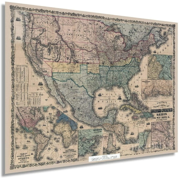
Hero image 0 of Topographical Map - Oregon Trail Wyoming 4 of 7 - Fremont 1846 - 23 x 34.50 - Vintage Wall Art, 0 of 5
Topographical Map - Oregon Trail Wyoming 4 of 7 - Fremont 1846 - 23 x 34.50 - Vintage Wall Art
(No ratings yet)
Topographical Map - Oregon Trail Wyoming 4 of 7 - Fremont 1846 - 23 x 34.50 - Vintage Wall ArtTopographical Map Oregon Trail Wyoming 4 of 7 Fremont 1846 23 x 34 50 Vintage Wall ArtTopographical Map Oregon Trail Wyoming 4 of 7 Fremont 1846 23 x 34 50 Vintage Wall ArtTopographical Map Oregon Trail Wyoming 4 of 7 Fremont 1846 23 x 34 50 Vintage Wall Art
Material:Matte Bright Canvas
Key item features
- OWN A HISTORICAL TOPOGRAPHICAL MAP TODAY - Topographical maps provide you a birds-eye view of how the topography of certain pieces of land are mapped out. See how much today's maps have changed from centuries ago. See how waterways have shifted, or how forrests have become thralling cities. See how history has changed the landscape with a topographical map today!
- TOPOGRAPHICAL MAPS PROVIDE IMPORTANT INFORMATION -Topographical maps show you how the borders of a county are established and were they can be found. It also highlights rivers, mountains, and other natural elements, and it will show you where the cities are located within it.
- ONLY ACCEPT THE BEST PRINT QUALITY FOR YOUR REPRODUCTIONS - There are many printers and print types available on the market, when purchasing a reproduction there is no finer quality reproduction than a reproduction using the Giclee Printing method. Giclee describes the technique or style of printing used, and it is revered as the highest quality printing because of the way it precisely sprays ink onto a surface. Trust nothing less than the best!
- GUARNANTEED TO GET EXACTLY WHAT YOU ORDERED - This map comes exactly to the specification of 23.00 x 34.50 inches/58.42 X 87.63 cm. All of our maps come rolled, wrapped, and shipped in a heavy gauge mailing tube to ensure it arrives intact.
- WHY CHOOSE MAPS OF THE PAST? - Maps of the Past is one of the single largest producers of different types of maps. They legally own the rights to the maps they sell, and provide them to you in clean, clear, and vibrant print. If you are looking for a high quality map print, then look no further than Maps of the Past!
Specs
- Size23.00 x 34.50
- MaterialMatte Bright Canvas
- Decor styleVintage
- ThemeHistoric Topographic Maps
- ShapeRectangle
- Rec. roomOffice
Current price is USD$94.95$94.95/count
Price when purchased online
- Free shipping
Free 30-day returns
Pro Wall Hanging Service
How do you want your item?
Columbus, 43215
Arrives between Feb 7 - Feb 10
|Sold and shipped by Maps of the Past
4.3 stars out of 5, based on 10 seller reviews(4.3)10 seller reviews
Free 30-day returns
Similar items you might like
Based on what customers bought
Historic State Map - Oregon Upper California Territories - Preuss 1848 - 23 x 28.50 - Vintage Wall Art $36.95
3 optionsAvailable in additional 3 options$3695current price $36.95Options from $36.95 – $94.95Historic State Map - Oregon Upper California Territories - Preuss 1848 - 23 x 28.50 - Vintage Wall Art
Shipping, arrives in 3+ daysHistoric State Map - Oregon - Gousha 1935 - 23 x 30.75 - Vintage Wall Art $36.95
3 optionsAvailable in additional 3 options$3695current price $36.95Options from $36.95 – $94.95Historic State Map - Oregon - Gousha 1935 - 23 x 30.75 - Vintage Wall Art
Shipping, arrives in 3+ daysTopographical Map - Bryson City North Carolina Quad - USGS 1935 - 23 x 29.19 - Vintage Wall Art $36.95
3 optionsAvailable in additional 3 options$3695current price $36.95Options from $36.95 – $94.95Topographical Map - Bryson City North Carolina Quad - USGS 1935 - 23 x 29.19 - Vintage Wall Art
Shipping, arrives in 3+ daysHistoric County Map - Fremont County California - Thompson 1876 - 23 x 35.93 - Vintage Wall Art $36.95
3 optionsAvailable in additional 3 options$3695current price $36.95Options from $36.95 – $94.95Historic County Map - Fremont County California - Thompson 1876 - 23 x 35.93 - Vintage Wall Art
Shipping, arrives in 3+ daysHistoric State Map - Arizona Territory - Bien 1887 - 23 x 27.31 - Vintage Wall Art $36.95
3 optionsAvailable in additional 3 options$3695current price $36.95Options from $36.95 – $94.95Historic State Map - Arizona Territory - Bien 1887 - 23 x 27.31 - Vintage Wall Art
Shipping, arrives in 3+ daysHistoric State Map - Oregon - Cram 1875 - 27.63 x 23 - Vintage Wall Art $36.95
3 optionsAvailable in additional 3 options$3695current price $36.95Options from $36.95 – $94.95Historic State Map - Oregon - Cram 1875 - 27.63 x 23 - Vintage Wall Art
Shipping, arrives in 3+ daysTopographical Map - Cape Foulweather Oregon Quad - USGS 1967 - 23 x 28.36 - Vintage Wall Art $36.95
3 optionsAvailable in additional 3 options$3695current price $36.95Options from $36.95 – $94.95Topographical Map - Cape Foulweather Oregon Quad - USGS 1967 - 23 x 28.36 - Vintage Wall Art
Shipping, arrives in 3+ daysTopographical Map - Oregon Trail Idaho 7 of 7 - Fremont 1846 - 23 x 35.55 - Vintage Wall Art $36.95
3 optionsAvailable in additional 3 options$3695current price $36.95Options from $36.95 – $94.95Topographical Map - Oregon Trail Idaho 7 of 7 - Fremont 1846 - 23 x 35.55 - Vintage Wall Art
Shipping, arrives in 3+ daysHistoric State Map - Kentucky - Gridley 1814 - 23 x 38.85 - Vintage Wall Art $36.95
3 optionsAvailable in additional 3 options$3695current price $36.95Options from $36.95 – $94.95Historic State Map - Kentucky - Gridley 1814 - 23 x 38.85 - Vintage Wall Art
Shipping, arrives in 3+ daysTopographical Map - San Jose California Quad - USGS 1899 - 23 x 29.75 - Vintage Wall Art $36.95
3 optionsAvailable in additional 3 options$3695current price $36.95Options from $36.95 – $94.95Topographical Map - San Jose California Quad - USGS 1899 - 23 x 29.75 - Vintage Wall Art
Shipping, arrives in 3+ daysTopographical Map - Salem Oregon Quad - USGS 1963 - 23 x 32.76 - Vintage Wall Art $36.95
3 optionsAvailable in additional 3 options$3695current price $36.95Options from $36.95 – $94.95Topographical Map - Salem Oregon Quad - USGS 1963 - 23 x 32.76 - Vintage Wall Art
Shipping, arrives in 3+ daysHistoric County Map - Kingman County Kansas - Everts 1887 - 23 x 41.22 - Vintage Wall Art $36.95
3 optionsAvailable in additional 3 options$3695current price $36.95Options from $36.95 – $94.95Historic County Map - Kingman County Kansas - Everts 1887 - 23 x 41.22 - Vintage Wall Art
Historic County Map - Mcpherson County Kansas - Everts 1887 - 23 x 36.51 - Vintage Wall Art $36.95
3 optionsAvailable in additional 3 options$3695current price $36.95Options from $36.95 – $94.95Historic County Map - Mcpherson County Kansas - Everts 1887 - 23 x 36.51 - Vintage Wall Art
Shipping, arrives in 3+ daysIn 50+ people's carts Home Decor Collection Gold Metro Beaded Oval Framed Landscape Wall Art, Vintage-Style Décor for Living Room, Entryway, Bedroom, or Office, 14x11 $7.67
In 50+ people's carts
$767current price $7.67Home Decor Collection Gold Metro Beaded Oval Framed Landscape Wall Art, Vintage-Style Décor for Living Room, Entryway, Bedroom, or Office, 14x11
1414.3 out of 5 Stars. 141 reviewsSave withShipping, arrives in 2 daysTopographical Map - Oregon Trail Nebraska 2 of 7 - Fremont 1846 - 23 x 35.55 - Vintage Wall Art $36.95
3 optionsAvailable in additional 3 options$3695current price $36.95Options from $36.95 – $94.95Topographical Map - Oregon Trail Nebraska 2 of 7 - Fremont 1846 - 23 x 35.55 - Vintage Wall Art
Shipping, arrives in 3+ daysTopographical Map - Glendora California Quad - USGS 1927 - 23 x 28.91 - Vintage Wall Art $36.95
3 optionsAvailable in additional 3 options$3695current price $36.95Options from $36.95 – $94.95Topographical Map - Glendora California Quad - USGS 1927 - 23 x 28.91 - Vintage Wall Art
Shipping, arrives in 3+ daysHistoric County Map - Eastland County Texas - Highway Department 1936 - 23 x 31.53 - Vintage Wall Art $36.95
3 optionsAvailable in additional 3 options$3695current price $36.95Options from $36.95 – $94.95Historic County Map - Eastland County Texas - Highway Department 1936 - 23 x 31.53 - Vintage Wall Art
Shipping, arrives in 3+ daysHistoric State Map - Alaska - Graham 1906 - 23 x 29.50 - Vintage Wall Art $36.95
3 optionsAvailable in additional 3 options$3695current price $36.95Options from $36.95 – $94.95Historic State Map - Alaska - Graham 1906 - 23 x 29.50 - Vintage Wall Art
Shipping, arrives in 3+ daysHistoric County Map - Effingham County Georgia - Highway Board 1932 - 23 x 29.70 - Vintage Wall Art $36.95
3 optionsAvailable in additional 3 options$3695current price $36.95Options from $36.95 – $94.95Historic County Map - Effingham County Georgia - Highway Board 1932 - 23 x 29.70 - Vintage Wall Art
Shipping, arrives in 3+ daysHistoric Map - North America - Walker 1820 - 23 x 28.5 - Vintage Wall Art $36.95
3 optionsAvailable in additional 3 options$3695current price $36.95Options from $36.95 – $94.95Historic Map - North America - Walker 1820 - 23 x 28.5 - Vintage Wall Art
Shipping, arrives in 3+ days
About this item
Product details
Topographical Map - Oregon Trail Wyoming 4 of 7 - Fremont 1846 - This is an exquisite full-color Reproduction printed on high-quality gloss paper, art paper or canvas.
Print Size: 23.00 x 34.50 inches
58.42 X 87.63cm
The following towns are featured: map of the Oregon Trail, used by pioneers and miners seeking new lives in the west. It is the the fourth portion of the trail, which stretched from the Black Hills to the Rocky Mountains of Wyoming. Land features include: North Fork of the Platte River, Deer Creek, Green River, Sweet Water River, Black Hills, Rocky Mountains, Sweet Water Mountains, Table Rock, Pilot Butte, Red Buttes, and Rock Independence among many others. Dates and miles are shown along the trail. Sioux Indians are distinguished in the south eastern portion of the map.The Center of the map shows the Snake and Sioux Indian War Ground. The divide between waters that feed the Pacific and Atlantic is also distinguished. A chart of meteorological observations, showing weather from July, 26, 1842 to August, 16, 1843, sits in the right corner of the map and remarks give advice on traveling this portion of the trial.
SKU: ORTR0004
Original Maps are often difficult to find and usually have fold lines, identifying stamps or markings, tears, ragged edges, and assorted other natural signs of age that detract from their beauty. All of our maps have been professionally restored to depict their original beauty, while keeping all historical data intact.
These maps are fabulous pieces of history full of information useful to Historians, Genealogists, Cartographers, Relic Hunters, & Others. They make fascinating conversation pieces and splendid works of art for the home or office.
- OWN A HISTORICAL TOPOGRAPHICAL MAP TODAY - Topographical maps provide you a birds-eye view of how the topography of certain pieces of land are mapped out. See how much today's maps have changed from centuries ago. See how waterways have shifted, or how forrests have become thralling cities. See how history has changed the landscape with a topographical map today!
- TOPOGRAPHICAL MAPS PROVIDE IMPORTANT INFORMATION -Topographical maps show you how the borders of a county are established and were they can be found. It also highlights rivers, mountains, and other natural elements, and it will show you where the cities are located within it.
- ONLY ACCEPT THE BEST PRINT QUALITY FOR YOUR REPRODUCTIONS - There are many printers and print types available on the market, when purchasing a reproduction there is no finer quality reproduction than a reproduction using the Giclee Printing method. Giclee describes the technique or style of printing used, and it is revered as the highest quality printing because of the way it precisely sprays ink onto a surface. Trust nothing less than the best!
- GUARNANTEED TO GET EXACTLY WHAT YOU ORDERED - This map comes exactly to the specification of 23.00 x 34.50 inches/58.42 X 87.63 cm. All of our maps come rolled, wrapped, and shipped in a heavy gauge mailing tube to ensure it arrives intact.
- WHY CHOOSE MAPS OF THE PAST? - Maps of the Past is one of the single largest producers of different types of maps. They legally own the rights to the maps they sell, and provide them to you in clean, clear, and vibrant print. If you are looking for a high quality map print, then look no further than Maps of the Past!
info:
We aim to show you accurate product information. Manufacturers, suppliers and others provide what you see here, and we have not verified it. Â
Specifications
Size
23.00 x 34.50
Material
Matte Bright Canvas
Decor style
Vintage
Theme
Historic Topographic Maps
Warranty
Warranty information
Please be aware that the warranty terms on items offered for sale by third party Marketplace sellers may differ from those displayed in this section (if any). To confirm warranty terms on an item offered for sale by a third party Marketplace seller, please use the 'Contact seller' feature on the third party Marketplace seller's information page and request the item's warranty terms prior to purchase.
Compare with similar items
| Product | Viewing this itemTopographical Map - Oregon Trail Wyoming 4 of 7 - Fremont 1846 - 23 x 34.50 - Vintage Wall Art ![]() $94.95 current price $94.95 | Historic State Map - Oregon Upper California Territories - Preuss 1848 - 23 x 28.50 - Vintage Wall Art ![]() $36.95 current price $36.95 | Historic State Map - Oregon - Gousha 1935 - 23 x 30.75 - Vintage Wall Art ![]() $36.95 current price $36.95 | Topographical Map - Bryson City North Carolina Quad - USGS 1935 - 23 x 29.19 - Vintage Wall Art ![]() $36.95 current price $36.95 | Historic County Map - Fremont County California - Thompson 1876 - 23 x 35.93 - Vintage Wall Art ![]() $36.95 current price $36.95 | Historic State Map - Arizona Territory - Bien 1887 - 23 x 27.31 - Vintage Wall Art ![]() $36.95 current price $36.95 | Historic State Map - Oregon - Cram 1875 - 27.63 x 23 - Vintage Wall Art ![]() $36.95 current price $36.95 | Topographical Map - Cape Foulweather Oregon Quad - USGS 1967 - 23 x 28.36 - Vintage Wall Art ![]() $36.95 current price $36.95 | Topographical Map - Oregon Trail Idaho 7 of 7 - Fremont 1846 - 23 x 35.55 - Vintage Wall Art ![]() $36.95 current price $36.95 | Historic State Map - Kentucky - Gridley 1814 - 23 x 38.85 - Vintage Wall Art ![]() $36.95 current price $36.95 |
|---|
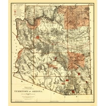
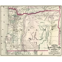
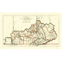
| Size | 23.00 x 34.50Topographical Map - Oregon Trail Wyoming 4 of 7 - Fremont 1846 - 23 x 34.50 - Vintage Wall Art | 23.00 x 28.50Historic State Map - Oregon Upper California Territories - Preuss 1848 - 23 x 28.50 - Vintage Wall Art | 23.00 x 30.75Historic State Map - Oregon - Gousha 1935 - 23 x 30.75 - Vintage Wall Art | 23.00 x 29.19Topographical Map - Bryson City North Carolina Quad - USGS 1935 - 23 x 29.19 - Vintage Wall Art | 23.00 x 35.93Historic County Map - Fremont County California - Thompson 1876 - 23 x 35.93 - Vintage Wall Art | 23.00 x 27.31Historic State Map - Arizona Territory - Bien 1887 - 23 x 27.31 - Vintage Wall Art | 27.63 x 23Historic State Map - Oregon - Cram 1875 - 27.63 x 23 - Vintage Wall Art | 23.00 x 28.36Topographical Map - Cape Foulweather Oregon Quad - USGS 1967 - 23 x 28.36 - Vintage Wall Art | 23.00 x 35.55Topographical Map - Oregon Trail Idaho 7 of 7 - Fremont 1846 - 23 x 35.55 - Vintage Wall Art | 23.00 x 38.85Historic State Map - Kentucky - Gridley 1814 - 23 x 38.85 - Vintage Wall Art |
|---|---|---|---|---|---|---|---|---|---|---|
| Material | Matte Bright CanvasTopographical Map - Oregon Trail Wyoming 4 of 7 - Fremont 1846 - 23 x 34.50 - Vintage Wall Art | Glossy Satin Photo QualityHistoric State Map - Oregon Upper California Territories - Preuss 1848 - 23 x 28.50 - Vintage Wall Art | Glossy Satin Photo QualityHistoric State Map - Oregon - Gousha 1935 - 23 x 30.75 - Vintage Wall Art | Glossy Satin Photo QualityTopographical Map - Bryson City North Carolina Quad - USGS 1935 - 23 x 29.19 - Vintage Wall Art | Glossy Satin Photo QualityHistoric County Map - Fremont County California - Thompson 1876 - 23 x 35.93 - Vintage Wall Art | Glossy Satin Photo QualityHistoric State Map - Arizona Territory - Bien 1887 - 23 x 27.31 - Vintage Wall Art | Glossy Satin Photo QualityHistoric State Map - Oregon - Cram 1875 - 27.63 x 23 - Vintage Wall Art | Glossy Satin Photo QualityTopographical Map - Cape Foulweather Oregon Quad - USGS 1967 - 23 x 28.36 - Vintage Wall Art | Glossy Satin Photo QualityTopographical Map - Oregon Trail Idaho 7 of 7 - Fremont 1846 - 23 x 35.55 - Vintage Wall Art | Glossy Satin Photo QualityHistoric State Map - Kentucky - Gridley 1814 - 23 x 38.85 - Vintage Wall Art |
| Decor style | VintageTopographical Map - Oregon Trail Wyoming 4 of 7 - Fremont 1846 - 23 x 34.50 - Vintage Wall Art | -Historic State Map - Oregon Upper California Territories - Preuss 1848 - 23 x 28.50 - Vintage Wall Art | VintageHistoric State Map - Oregon - Gousha 1935 - 23 x 30.75 - Vintage Wall Art | VintageTopographical Map - Bryson City North Carolina Quad - USGS 1935 - 23 x 29.19 - Vintage Wall Art | -Historic County Map - Fremont County California - Thompson 1876 - 23 x 35.93 - Vintage Wall Art | VintageHistoric State Map - Arizona Territory - Bien 1887 - 23 x 27.31 - Vintage Wall Art | -Historic State Map - Oregon - Cram 1875 - 27.63 x 23 - Vintage Wall Art | -Topographical Map - Cape Foulweather Oregon Quad - USGS 1967 - 23 x 28.36 - Vintage Wall Art | -Topographical Map - Oregon Trail Idaho 7 of 7 - Fremont 1846 - 23 x 35.55 - Vintage Wall Art | VintageHistoric State Map - Kentucky - Gridley 1814 - 23 x 38.85 - Vintage Wall Art |
| Theme | Historic Topographic MapsTopographical Map - Oregon Trail Wyoming 4 of 7 - Fremont 1846 - 23 x 34.50 - Vintage Wall Art | Old State MapsHistoric State Map - Oregon Upper California Territories - Preuss 1848 - 23 x 28.50 - Vintage Wall Art | Old State MapsHistoric State Map - Oregon - Gousha 1935 - 23 x 30.75 - Vintage Wall Art | Historic Topographic MapsTopographical Map - Bryson City North Carolina Quad - USGS 1935 - 23 x 29.19 - Vintage Wall Art | Historical County MapsHistoric County Map - Fremont County California - Thompson 1876 - 23 x 35.93 - Vintage Wall Art | Old State MapsHistoric State Map - Arizona Territory - Bien 1887 - 23 x 27.31 - Vintage Wall Art | Old State MapsHistoric State Map - Oregon - Cram 1875 - 27.63 x 23 - Vintage Wall Art | Historic Topographic MapsTopographical Map - Cape Foulweather Oregon Quad - USGS 1967 - 23 x 28.36 - Vintage Wall Art | Historic Topographic MapsTopographical Map - Oregon Trail Idaho 7 of 7 - Fremont 1846 - 23 x 35.55 - Vintage Wall Art | Old State MapsHistoric State Map - Kentucky - Gridley 1814 - 23 x 38.85 - Vintage Wall Art |
Now hiding additional rows in the Table
Popular items in this category
Best selling items that customers love
Best seller Drsoum Vintage Landscape Wall Art Grassland Meadow Wildflower Field Wall Prints Classic Retro Farmhouse Rustic Decorations 11x14in3pcs Natural Framed $29.99
Sponsored$2999current price $29.99More options from $10.99Drsoum Vintage Landscape Wall Art Grassland Meadow Wildflower Field Wall Prints Classic Retro Farmhouse Rustic Decorations 11x14in3pcs Natural Framed
384.5 out of 5 Stars. 38 reviewsSave withELITEART-Among the Sierra Nevada Mountains, California (1868), By Albert Bierstadt Oil Painting Reproduction Giclee Wall Art Canvas Prints-Framed Size:21" x 30" $132.49
$13249current price $132.49ELITEART-Among the Sierra Nevada Mountains, California (1868), By Albert Bierstadt Oil Painting Reproduction Giclee Wall Art Canvas Prints-Framed Size:21" x 30"
Shipping, arrives in 3+ daysTexas Map Houston and Texas Central Railroad Art Print - 11x14 Unframed Art Print - Great Vintage Home Decor $14.99
$1499current price $14.99Texas Map Houston and Texas Central Railroad Art Print - 11x14 Unframed Art Print - Great Vintage Home Decor
New York Subway Map 1948 Art Print - 11x14 Unframed Art Print - Great Vintage Home Decor $14.99
$1499current price $14.99New York Subway Map 1948 Art Print - 11x14 Unframed Art Print - Great Vintage Home Decor
Shipping, arrives in 3+ daysOhio is My Home Vintage Chic Wall Decor 6x18 Metal Sign 106180025034 $29.95
$2995current price $29.95Ohio is My Home Vintage Chic Wall Decor 6x18 Metal Sign 106180025034
Shipping, arrives in 3+ daysThideape Rustic Bathroom Sign Please Seat Yourself Print 16" x 20" Framed Canvas Art $9.99
$999current price $9.99Options from $9.99 – $19.99Thideape Rustic Bathroom Sign Please Seat Yourself Print 16" x 20" Framed Canvas Art
84.1 out of 5 Stars. 8 reviewsSave withShipping, arrives in 2 daysMap of Florida 1855 Art Print - 11x14 Unframed Art Print - Great Vintage Home Decor $14.99
$1499current price $14.99Map of Florida 1855 Art Print - 11x14 Unframed Art Print - Great Vintage Home Decor
Shipping, arrives in 3+ days1818 Map of Washington DC Art Print - 11x14 Unframed Art Print - Great Vintage Home Decor $14.99
$1499current price $14.991818 Map of Washington DC Art Print - 11x14 Unframed Art Print - Great Vintage Home Decor
Shipping, arrives in 3+ days48x78 Huge United States, USA Contemporary Elite Wall Map Laminated $44.00
3 optionsAvailable in additional 3 options$4400current price $44.00More options from $18.9048x78 Huge United States, USA Contemporary Elite Wall Map Laminated
114.1 out of 5 Stars. 11 reviewsShipping, arrives in 3+ daysTrademark Fine Art Masters Fine Art USA License Plate Map on Wood Canvas Wall Art - 14x19 $32.95
4 optionsAvailable in additional 4 options$3295current price $32.95Options from $32.95 – $99.95Trademark Fine Art Masters Fine Art USA License Plate Map on Wood Canvas Wall Art - 14x19
15 out of 5 Stars. 1 reviewsShipping, arrives in 3+ daysAdams, Ansel 14x12 Black Modern Framed Museum Art Print Titled - The Tetons - Snake River, Grand Teton National Park, Wyoming , 1941 $29.99
8 optionsAvailable in additional 8 options$2999current price $29.99Options from $29.99 – $199.99Adams, Ansel 14x12 Black Modern Framed Museum Art Print Titled - The Tetons - Snake River, Grand Teton National Park, Wyoming , 1941
25 out of 5 Stars. 2 reviewsShipping, arrives in 3+ days24x36 United States, USA Classic Elite Wall Map Mural Poster $21.90
3 optionsAvailable in additional 3 options$2190current price $21.90More options from $12.9924x36 United States, USA Classic Elite Wall Map Mural Poster
254.4 out of 5 Stars. 25 reviewsSave withShipping, arrives in 2 daysd Western Cowboy Canvas Wall Art Set of 3 - Vintage Cowboy Pictures Wall Decor, Rustic Mid Century Southwestern Ranch Landscapes Horse Prints Paintings for Living Room Bedroom 12x16 inch $25.87
$2587current price $25.87d Western Cowboy Canvas Wall Art Set of 3 - Vintage Cowboy Pictures Wall Decor, Rustic Mid Century Southwestern Ranch Landscapes Horse Prints Paintings for Living Room Bedroom 12x16 inch
Shipping, arrives in 3+ daysRivers Edge Products Canvas Wall Art, Licensed Art by Victoria Wilson-Schultz, Country Wild West Western Decor for Bedroom Home Office and Living Room Wall Decor, 12 Inch x 16 Inch, Cowboy $14.99
7 optionsAvailable in additional 7 options$1499current price $14.99Rivers Edge Products Canvas Wall Art, Licensed Art by Victoria Wilson-Schultz, Country Wild West Western Decor for Bedroom Home Office and Living Room Wall Decor, 12 Inch x 16 Inch, Cowboy
Shipping, arrives in 3+ daysd Western Cowboy Canvas Wall Art Set of 3 - Vintage Cowboy Pictures Wall Decor, Rustic Mid Century Southwestern Ranch Landscapes Horse Prints Paintings for Living Room Bedroom 12x16 inch $25.87
$2587current price $25.87More options from $16.88d Western Cowboy Canvas Wall Art Set of 3 - Vintage Cowboy Pictures Wall Decor, Rustic Mid Century Southwestern Ranch Landscapes Horse Prints Paintings for Living Room Bedroom 12x16 inch
Shipping, arrives in 3+ days1845 Map of Maine Art Print - 11x14 Unframed Art Print - Great Vintage Home Decor $14.99
$1499current price $14.991845 Map of Maine Art Print - 11x14 Unframed Art Print - Great Vintage Home Decor
Shipping, arrives in 3+ daysHISTORIX 1862 United States Railroad and Military Map Vintage Poster Wall Art Print, 18 x 24 Inch $39.99
2 optionsAvailable in additional 2 options$3999current price $39.99Options from $39.99 – $59.99HISTORIX 1862 United States Railroad and Military Map Vintage Poster Wall Art Print, 18 x 24 Inch
Shipping, arrives in 3+ daysNorth Carolina Map - 11x14 Unframed Art Print - Great Vintage Gift and Decor for History Buffs and Old Map Enthusiasts Under $15 $14.99
$1499current price $14.99North Carolina Map - 11x14 Unframed Art Print - Great Vintage Gift and Decor for History Buffs and Old Map Enthusiasts Under $15
Shipping, arrives in 3+ daysFrameToWall - Walk to Paradise Garden 20x24 Framed Art Print by Smith, W. Eugene $64.99
$6499current price $64.99FrameToWall - Walk to Paradise Garden 20x24 Framed Art Print by Smith, W. Eugene
Shipping, arrives in 3+ days
Customer ratings & reviews
0 ratings|0 reviews
This item does not have any reviews yet
Related pages
- Alabama County Map Roads
- Jersey Counties Map Cities
- West Virginia Maps By County
- Missouri Map Counties
- Florida Map By County
- Map Illinois Highways
- Northeast United States Travel Books, Maps & Guides
- Central America Travel Books, Maps & Guides
- General South America Travel Books, Maps & Guides
- Midwest United States Travel Books, Maps & Guides
- Peru Travel Books, Maps & Guides
- Rand McNally Travel Books, Maps & Guides


