Hero image 0 of CMAP Central America & Caribbean Coastal Chart CW82672, 0 of 1
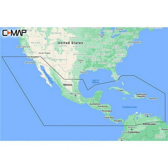
CMAP Central America & Caribbean Coastal Chart CW82672
(No ratings yet)
Key item features
- Visual Navigation: Features Shaded Relief for 3D land and underwater elevation, Aerial Photography of marinas and harbors, and Satellite Overlay for real-world reference.
- Detailed Seafloor: Includes Ultra-High Resolution Bathymetric imagery and Reveal Seafloor data, beneficial for identifying shallow areas and underwater structures.
- Chart Versatility: Offers both Dynamic Raster Charts and Full-Featured Vector Charts for comprehensive navigation.
- Custom Depth: Provides Custom Depth Shading and High-Resolution Bathymetry for precise depth information.
- Navigation Aids: Incorporates Easy Routing, Tides & Currents, Detailed Marina Port Plans, and Harbor & Approach Details for confident navigation.
- Angler Insights: Integrates Vegetation and Bottom Composition layers sourced from CMAP Genesis & Biobase users, aiding fishing enthusiasts.
Generated by AI
Specs
- Map typeCoastal Chart
- FeaturesWater-Resistant
- BrandC-MAP
- MaterialPaper
- FormBooks
- Book formatOther
Current price is USD$260.00
Price when purchased online
- Free shipping
 Free 30-day returns
How do you want your item?
Columbus, 43215
Arrives by Thu, Feb 5
|Sold and shipped by Boating Store
4.663021868787276 stars out of 5, based on 1006 seller reviews(4.7)1006 seller reviews
Free 30-day returns
About this item
Product details
The CMAP Central America & Caribbean Coastal Chart CW82672 is a comprehensive navigation tool designed for both cruising and fishing enthusiasts. It features the best of CMAP REVEAL Coastal charts, offering advanced features such as Shaded Relief, Aerial Photography, Satellite Overlay, and Dynamic Raster Chart presentation. These enhancements provide a detailed and immersive navigation experience. With Shaded Relief, the chart brings the world around you to life with 3D rendered land and underwater elevation. Ultra-High Resolution Bathymetric imagery and Reveal Seafloor data offer a game-changing experience for anglers, providing detailed information about shallow areas, drop-offs, ledges, and more. The chart includes Aerial Photography, showcasing thousands of photos of marinas, harbors, and other navigational features, adding an additional level of detail and familiarity. Satellite Overlay provides real-world reference and enhances situational awareness for coastal navigation. CMAP Central America & Caribbean Coastal Chart also offers Dynamic Raster Charts, Full-Featured Vector Charts, Custom Depth Shading, High-Resolution Bathymetry, Easy Routing, Tides & Currents, Detailed Marina Port Plans, and Harbor & Approach Details. These features ensure accurate and up-to-date navigation information, helping you navigate unfamiliar waters with confidence.
- Shaded Relief for 3D rendered land and underwater elevation
- Ultra-High Resolution Bathymetric imagery and Reveal Seafloor data
- Aerial Photography of marinas, harbors, and navigational features
- Satellite Overlay for real-world reference
- Dynamic Raster Charts and Full-Featured Vector Charts
- Custom Depth Shading and High-Resolution Bathymetry
- Easy Routing, Tides & Currents, Detailed Marina Port Plans
- Harbor & Approach Details for confident navigation
- Vegetation and Bottom Composition layers from CMAP Genesis & Biobase users
- Raster Charts, Shaded Relief, and Satellite Overlay for enhanced visualization
info:
We aim to show you accurate product information. Manufacturers, suppliers and others provide what you see here, and we have not verified it.
Specifications
Map type
Coastal Chart
Subject
Central America & Caribbean
Features
Water-Resistant
Size
Central America & Caribbean
Warranty
Warranty information
One year product warranty
Please be aware that the warranty terms on items offered for sale by third party Marketplace sellers may differ from those displayed in this section (if any). To confirm warranty terms on an item offered for sale by a third party Marketplace seller, please use the 'Contact seller' feature on the third party Marketplace seller's information page and request the item's warranty terms prior to purchase.
Please be aware that the warranty terms on items offered for sale by third party Marketplace sellers may differ from those displayed in this section (if any). To confirm warranty terms on an item offered for sale by a third party Marketplace seller, please use the 'Contact seller' feature on the third party Marketplace seller's information page and request the item's warranty terms prior to purchase.
Warnings
Similar items you might like
Based on what customers bought
Louisiana Laminated Wall Map (48” Wide x 44” high) $188.10
 $18810current price $188.10
Louisiana Laminated Wall Map (48” Wide x 44” high)
Shipping, arrives in 3+ daysCool Owl Maps Mexico, Central America & Caribbean Wall Map - Paper 40"x30" $44.99
 $4499current price $44.99
Cool Owl Maps Mexico, Central America & Caribbean Wall Map - Paper 40"x30"
Shipping, arrives in 3+ days4 Foot United States Map with Flags [72116] $21.99
![4 Foot United States Map with Flags [72116]](https://i5.walmartimages.com/asr/8833907b-671e-4608-ba73-103c8f1379da.18e29dae1be105a1542fd65296dfc579.jpeg?odnHeight=576&odnWidth=576&odnBg=FFFFFF) $2199current price $21.99
$2199current price $21.994 Foot United States Map with Flags [72116]
Shipping, arrives in 3+ daysCentral Sierra Trail Map $11.95
 $1195current price $11.95
Central Sierra Trail Map
Shipping, arrives in 3+ daysMap of Granada, Nicaragua, Multiline Coordinates Colored (8x10) $16.95
 6 optionsAvailable in additional 6 options$1695current price $16.95Options from $16.95 – $49.95
Map of Granada, Nicaragua, Multiline Coordinates Colored (8x10)
Shipping, arrives in 3+ daysHawaii 3D Raised Relief Map $39.99
 $3999current price $39.99
Hawaii 3D Raised Relief Map
Shipping, arrives in 3+ days36x44 Louisiana State Official Executive Laminated Wall Map $62.99
 $6299current price $62.99
36x44 Louisiana State Official Executive Laminated Wall Map
Shipping, arrives in 3+ daysFranko Maps - Kauai Reef Fish ID $9.98
 $998current price $9.98+$2.99 shipping
Franko Maps - Kauai Reef Fish ID
Shipping, arrives in 3+ daysC MAP Reveal Coastal Alaska, Shaded Relief, Vector Charts, 2024, Poster, 34x22 $249.99
 $24999current price $249.99
C MAP Reveal Coastal Alaska, Shaded Relief, Vector Charts, 2024, Poster, 34x22
Shipping, arrives in 3+ daysWashington DC 3D Raised Relief Map $39.99
 $3999current price $39.99
Washington DC 3D Raised Relief Map
Shipping, arrives in 3+ daysAlaska 3D Raised Relief Map $39.99
 $3999current price $39.99
Alaska 3D Raised Relief Map
Shipping, arrives in 3+ daysOlympic National Park 3D Raised Relief Map $39.99
 $3999current price $39.99
Olympic National Park 3D Raised Relief Map
Shipping, arrives in 3+ daysLas Vegas 3D Raised Relief Map $39.99
 $3999current price $39.99
Las Vegas 3D Raised Relief Map
Shipping, arrives in 3+ days48x78 Iowa State Official Executive Laminated Wall Map $106.45
 $10645current price $106.45
48x78 Iowa State Official Executive Laminated Wall Map
Shipping, arrives in 3+ daysOrange County Bikeways & Trails Map $7.88
 $788current price $7.88
Orange County Bikeways & Trails Map
Shipping, arrives in 3+ daysXplorer Maps MAP_NC North Carolina State Hand-Drawn Map $22.47 Was $37.26
 Now$2247current price Now $22.47, Was $37.26$37.26
Xplorer Maps MAP_NC North Carolina State Hand-Drawn Map
Shipping, arrives in 3+ daysCalifornia 3D Raised Relief Map $39.99
 $3999current price $39.99
California 3D Raised Relief Map
Shipping, arrives in 3+ daysXplorer Maps PLCD_ME Maine Map Playing Cards $27.06
 $2706current price $27.06
Xplorer Maps PLCD_ME Maine Map Playing Cards
Shipping, arrives in 3+ days
Popular items in this category
Best selling items that customers love
C-MAP Reveal Coastal Chesapeake Bay to the Bahamas M-NA-Y203-MS $249.90
 $24990current price $249.90
C-MAP Reveal Coastal Chesapeake Bay to the Bahamas M-NA-Y203-MS
Shipping, arrives in 3+ daysC-MAP Reveal Coastal Nova Scotia to Chesapeak Bay $249.90
 2 optionsAvailable in additional 2 options$24990current price $249.90
C-MAP Reveal Coastal Nova Scotia to Chesapeak Bay
Shipping, arrives in 3+ daysC-Map CMAMNAY204MS Reveal Coastal Gulf of Mexico & Bahamas $249.90
 $24990current price $249.90
C-Map CMAMNAY204MS Reveal Coastal Gulf of Mexico & Bahamas
Shipping, arrives in 3+ daysDiscover North America Lakes US Canada $124.99
 $12499current price $124.99
Discover North America Lakes US Canada
Shipping, arrives in 3+ daysC-MAP Reveal US Lakes South East $169.99
 $16999current price $169.99
C-MAP Reveal US Lakes South East
Shipping, arrives in 3+ daysC-MAP Reveal Coastal Great Lakes to Nova Scotia $249.90
 $24990current price $249.90
C-MAP Reveal Coastal Great Lakes to Nova Scotia
Shipping, arrives in 3+ days24" x 36" Smithsonian Journeys Tan Ocean World Wall Map - Laminated $17.89
 3 optionsAvailable in additional 3 options$1789current price $17.89
24" x 36" Smithsonian Journeys Tan Ocean World Wall Map - Laminated
94.6 out of 5 Stars. 9 reviewsSave with Shipping, arrives in 2 days
National geographic adventure map: united states, southeast - folded map: 9781566957205 $13.34
 $1334current price $13.34
National geographic adventure map: united states, southeast - folded map: 9781566957205
Save withShipping, arrives in 3+ daysRMC Signature United States USA and World Wall Map Set - Laminated $29.90
 2 optionsAvailable in additional 2 options$2990current price $29.90
RMC Signature United States USA and World Wall Map Set - Laminated
284.6 out of 5 Stars. 28 reviewsSave withShipping, arrives in 2 daysCuba Adventure Travel Map $13.92
 $1392current price $13.92
Cuba Adventure Travel Map
Save withShipping, arrives in 3+ daysC-MAP Reveal US Lakes North East $179.00
 $17900current price $179.00
C-MAP Reveal US Lakes North East
Shipping, arrives in 3+ daysLaminated World Wall Map (67'' W X 45'' H) (Other) $19.99
 $1999current price $19.99
Laminated World Wall Map (67'' W X 45'' H) (Other)
Save withShipping, arrives in 3+ daysNational Geographic World Executive Map, Mural, 110" x 76.5" $78.00
 $7800current price $78.00
National Geographic World Executive Map, Mural, 110" x 76.5"
Save withShipping, arrives in 3+ daysFranko Maps - Hawaiian Islands Reef Fish ID $9.98
 $998current price $9.98+$2.99 shipping
Franko Maps - Hawaiian Islands Reef Fish ID
15 out of 5 Stars. 1 reviewsShipping, arrives in 3+ daysNational Geographic United States Classic Map, Enlarged and Laminated, 69.25" x 48" $69.95
 $6995current price $69.95
National Geographic United States Classic Map, Enlarged and Laminated, 69.25" x 48"
11 out of 5 Stars. 1 reviewsSave withShipping, arrives in 3+ daysNational Geographic Trails Illustrated M Cape Cod Map, Book 250, (Paperback) $12.60
 $1260current price $12.60
National Geographic Trails Illustrated M Cape Cod Map, Book 250, (Paperback)
11 out of 5 Stars. 1 reviewsSave withShipping, arrives in 3+ daysNational Geographic United States Classic Map, Poster Size and Laminated, 36" x 24" $38.56
 $3856current price $38.56
National Geographic United States Classic Map, Poster Size and Laminated, 36" x 24"
Shipping, arrives in 3+ daysMap: Lonely Planet Havana City Map (Sheet map, folded) $6.84 Was $10.09
 Now$684current price Now $6.84, Was $10.09$10.09
Map: Lonely Planet Havana City Map (Sheet map, folded)
Shipping, arrives in 3+ daysNational Geographic World Executive Map, Enlarged and Laminated, 73" x 48" $69.95 Was $80.07
 Now$6995current price Now $69.95, Was $80.07$80.07
National Geographic World Executive Map, Enlarged and Laminated, 73" x 48"
15 out of 5 Stars. 1 reviewsSave withShipping, arrives in 3+ days
Customer ratings & reviews
0 ratings|0 reviews
This item does not have any reviews yet
