
Hero image 0 of Historic State Map - Ohio Indiana - Johnson 1860 - 23 x 37.44 - Vintage Wall Art, 0 of 5
Historic State Map - Ohio Indiana - Johnson 1860 - 23 x 37.44 - Vintage Wall Art
(No ratings yet)
Historic State Map - Ohio Indiana - Johnson 1860 - 23 x 37.44 - Vintage Wall ArtHistoric State Map Ohio Indiana Johnson 1860 23 x 37 44 Vintage Wall ArtHistoric State Map Ohio Indiana Johnson 1860 23 x 37 44 Vintage Wall ArtHistoric State Map Ohio Indiana Johnson 1860 23 x 37 44 Vintage Wall Art
Material:Matte Bright Canvas
Current price is USD$94.95$94.95/count
Price when purchased online
- Free shipping
- Free 30-day returns
Pro Wall Hanging Service
How do you want your item?
Columbus, 43215
Arrives between Feb 14 - Feb 17
|Sold and shipped by Maps of the Past
4.3 stars out of 5, based on 10 seller reviews(4.3)
Free 30-day returns
| Product | Viewing this item |
|---|


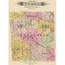


| Size | 23.00 x 37.44Historic State Map - Ohio Indiana - Johnson 1860 - 23 x 37.44 - Vintage Wall Art | 23.00 x 25.21Historic City Map - Hardy Ohio - Cring 1875 - 23 x 25.21 - Vintage Wall Art | 23.00 x 29.50Historic State Map - Oregon - USGLO 1866 - 23 x 29.50 - Vintage Wall Art | 23.00 x 33.07Historic State Map - New Mexico - Rand McNally 1897 - 23 x 33.07 - Vintage Wall Art | 23.00 x 31.14Historic City Map - Tuscarawas Ohio - Lawrence 1896 - 23 x 31.14 - Vintage Wall Art | 23 x 34.5Historic City Map - Middleport Hartford Brownsville Ohio West Virginia - Hayes 1877 - 23x34 - Vintage Wall Art | 23 x 27.06Historic State Map - Michigan - Greenleaf 1841 - 23 x 27.06 - Vintage Wall Art | 23 x 27.19Historic City Map - Bloomington Indiana - Sanborn 1887 - 23 x 27.19 - Vintage Wall Art | 23.00 x 24.91Historic State Map - Kentucky - Stockdale 1794 - 23 x 24.91 - Vintage Wall Art | 23.00 x 32.20Historic State Map - Rhode Island - Carey 1814 - 23 x 32.20 - Vintage Wall Art |
|---|---|---|---|---|---|---|---|---|---|---|
| Decor style | IndustrialHistoric State Map - Ohio Indiana - Johnson 1860 - 23 x 37.44 - Vintage Wall Art | VintageHistoric City Map - Hardy Ohio - Cring 1875 - 23 x 25.21 - Vintage Wall Art | VintageHistoric State Map - Oregon - USGLO 1866 - 23 x 29.50 - Vintage Wall Art | VintageHistoric State Map - New Mexico - Rand McNally 1897 - 23 x 33.07 - Vintage Wall Art | VintageHistoric City Map - Tuscarawas Ohio - Lawrence 1896 - 23 x 31.14 - Vintage Wall Art | -Historic City Map - Middleport Hartford Brownsville Ohio West Virginia - Hayes 1877 - 23x34 - Vintage Wall Art | VintageHistoric State Map - Michigan - Greenleaf 1841 - 23 x 27.06 - Vintage Wall Art | -Historic City Map - Bloomington Indiana - Sanborn 1887 - 23 x 27.19 - Vintage Wall Art | VintageHistoric State Map - Kentucky - Stockdale 1794 - 23 x 24.91 - Vintage Wall Art | VintageHistoric State Map - Rhode Island - Carey 1814 - 23 x 32.20 - Vintage Wall Art |
| Theme | Old State MapsHistoric State Map - Ohio Indiana - Johnson 1860 - 23 x 37.44 - Vintage Wall Art | Historical City MapsHistoric City Map - Hardy Ohio - Cring 1875 - 23 x 25.21 - Vintage Wall Art | Old State MapsHistoric State Map - Oregon - USGLO 1866 - 23 x 29.50 - Vintage Wall Art | Old State MapsHistoric State Map - New Mexico - Rand McNally 1897 - 23 x 33.07 - Vintage Wall Art | Historical City MapsHistoric City Map - Tuscarawas Ohio - Lawrence 1896 - 23 x 31.14 - Vintage Wall Art | Historical City MapsHistoric City Map - Middleport Hartford Brownsville Ohio West Virginia - Hayes 1877 - 23x34 - Vintage Wall Art | Old State MapsHistoric State Map - Michigan - Greenleaf 1841 - 23 x 27.06 - Vintage Wall Art | Historical City MapsHistoric City Map - Bloomington Indiana - Sanborn 1887 - 23 x 27.19 - Vintage Wall Art | Old State MapsHistoric State Map - Kentucky - Stockdale 1794 - 23 x 24.91 - Vintage Wall Art | Old State MapsHistoric State Map - Rhode Island - Carey 1814 - 23 x 32.20 - Vintage Wall Art |
| Shape | RectangleHistoric State Map - Ohio Indiana - Johnson 1860 - 23 x 37.44 - Vintage Wall Art | RectangleHistoric City Map - Hardy Ohio - Cring 1875 - 23 x 25.21 - Vintage Wall Art | RectangleHistoric State Map - Oregon - USGLO 1866 - 23 x 29.50 - Vintage Wall Art | RectangleHistoric State Map - New Mexico - Rand McNally 1897 - 23 x 33.07 - Vintage Wall Art | RectangleHistoric City Map - Tuscarawas Ohio - Lawrence 1896 - 23 x 31.14 - Vintage Wall Art | RectangleHistoric City Map - Middleport Hartford Brownsville Ohio West Virginia - Hayes 1877 - 23x34 - Vintage Wall Art | RectangleHistoric State Map - Michigan - Greenleaf 1841 - 23 x 27.06 - Vintage Wall Art | RectangleHistoric City Map - Bloomington Indiana - Sanborn 1887 - 23 x 27.19 - Vintage Wall Art | RectangleHistoric State Map - Kentucky - Stockdale 1794 - 23 x 24.91 - Vintage Wall Art | RectangleHistoric State Map - Rhode Island - Carey 1814 - 23 x 32.20 - Vintage Wall Art |
Now hiding additional rows in the Table
About this item


Customer ratings & reviews
0 ratings|0 reviews
This item does not have any reviews yet

Related pages
- North Alabama Maps
- Us State Flag Map
- Washington State Florida
- Maps Of Cincinnati Ohio
- Chicago World's Fair Map
- Ulm Map
- National Parks Posters
- Central America Travel Books, Maps & Guides
- Midwest United States Travel Books, Maps & Guides
- Northeast United States Travel Books, Maps & Guides
- Western United States Travel Books, Maps & Guides
- General South America Travel Books, Maps & Guides