Hero image 0 of Historic Map - Warwickshire County England - Cary 1792 - 23 x 34.76 - Vintage Wall Art, 0 of 5
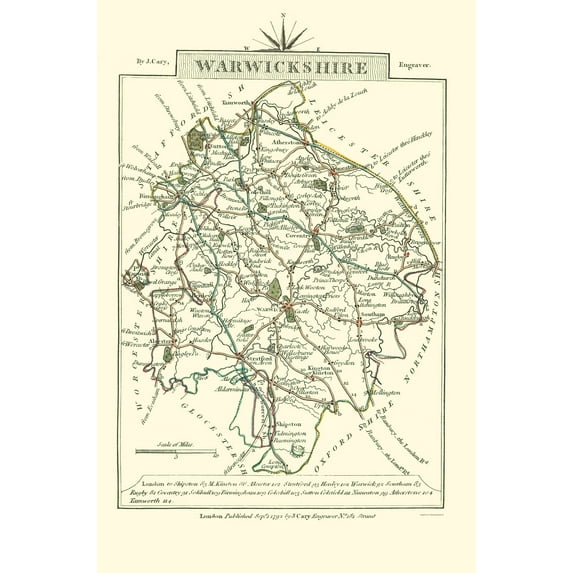
Historic Map - Warwickshire County England - Cary 1792 - 23 x 34.76 - Vintage Wall Art
(No ratings yet)
Current price is USDNow $45.95
You save $29.00
was $74.95
Price when purchased online
- Free shipping
- Free 30-day returns
How do you want your item?
Columbus, 43215
Arrives between Feb 23 - Feb 25
|Sold and shipped by Maps of the Past
4.3 stars out of 5, based on 10 seller reviews(4.3)
Free 30-day returns
| Product | Viewing this item |
|---|
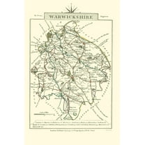

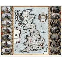

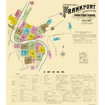


| Size | 23.00 x 34.76Historic Map - Warwickshire County England - Cary 1792 - 23 x 34.76 - Vintage Wall Art | 23.00 x 32.96Historic Map - Buckinghamshire County England - Cary 1792 - 23 x 32.96 - Vintage Wall Art | 27.75 x 23Historic Map - England Scotland Wales - Bleau 1645 - 27.75 x 23 - Vintage Wall Art | 23.00 x 30.05Historic Map - Louth County Ireland - Bartholomew 1882 - 23 x 30.05 - Vintage Wall Art | 23 x 26.13Historic City Map - Frankfort Kentucky - Sanborn 1907 - 23 x 26.13 - Vintage Wall Art | 23.00 x 41.47Historic State Map - Massachusetts Region - 1776 - 23 x 41.47 - Vintage Wall Art | 29.25 x 23Historic State Map - Virginia - Powhatan 1636 - 29.25 x 23 - Vintage Wall Art | 23.00 x 29.23Historic State Map - Maine - 1890 - 23 x 29.23 - Vintage Wall Art | 23.00 x 30.75Historic State Map - Oregon - Gousha 1935 - 23 x 30.75 - Vintage Wall Art | 23.00 x 30.31Historic State Map - Louisiana Surrounding Territories - Delifle 1718 - 23 x 30 - Vintage Wall Art |
|---|---|---|---|---|---|---|---|---|---|---|
| Material | Matte ArtHistoric Map - Warwickshire County England - Cary 1792 - 23 x 34.76 - Vintage Wall Art | Glossy Satin Photo QualityHistoric Map - Buckinghamshire County England - Cary 1792 - 23 x 32.96 - Vintage Wall Art | Glossy Satin Photo QualityHistoric Map - England Scotland Wales - Bleau 1645 - 27.75 x 23 - Vintage Wall Art | Glossy Satin Photo QualityHistoric Map - Louth County Ireland - Bartholomew 1882 - 23 x 30.05 - Vintage Wall Art | Glossy Satin Photo QualityHistoric City Map - Frankfort Kentucky - Sanborn 1907 - 23 x 26.13 - Vintage Wall Art | Glossy Satin Photo QualityHistoric State Map - Massachusetts Region - 1776 - 23 x 41.47 - Vintage Wall Art | Glossy Satin Photo QualityHistoric State Map - Virginia - Powhatan 1636 - 29.25 x 23 - Vintage Wall Art | Glossy Satin Photo QualityHistoric State Map - Maine - 1890 - 23 x 29.23 - Vintage Wall Art | Glossy Satin Photo QualityHistoric State Map - Oregon - Gousha 1935 - 23 x 30.75 - Vintage Wall Art | Glossy Satin Photo QualityHistoric State Map - Louisiana Surrounding Territories - Delifle 1718 - 23 x 30 - Vintage Wall Art |
| Decor style | VintageHistoric Map - Warwickshire County England - Cary 1792 - 23 x 34.76 - Vintage Wall Art | -Historic Map - Buckinghamshire County England - Cary 1792 - 23 x 32.96 - Vintage Wall Art | VintageHistoric Map - England Scotland Wales - Bleau 1645 - 27.75 x 23 - Vintage Wall Art | VintageHistoric Map - Louth County Ireland - Bartholomew 1882 - 23 x 30.05 - Vintage Wall Art | -Historic City Map - Frankfort Kentucky - Sanborn 1907 - 23 x 26.13 - Vintage Wall Art | VintageHistoric State Map - Massachusetts Region - 1776 - 23 x 41.47 - Vintage Wall Art | VintageHistoric State Map - Virginia - Powhatan 1636 - 29.25 x 23 - Vintage Wall Art | VintageHistoric State Map - Maine - 1890 - 23 x 29.23 - Vintage Wall Art | VintageHistoric State Map - Oregon - Gousha 1935 - 23 x 30.75 - Vintage Wall Art | -Historic State Map - Louisiana Surrounding Territories - Delifle 1718 - 23 x 30 - Vintage Wall Art |
| Shape | RectangleHistoric Map - Warwickshire County England - Cary 1792 - 23 x 34.76 - Vintage Wall Art | RectangleHistoric Map - Buckinghamshire County England - Cary 1792 - 23 x 32.96 - Vintage Wall Art | RectangleHistoric Map - England Scotland Wales - Bleau 1645 - 27.75 x 23 - Vintage Wall Art | RectangleHistoric Map - Louth County Ireland - Bartholomew 1882 - 23 x 30.05 - Vintage Wall Art | RectangleHistoric City Map - Frankfort Kentucky - Sanborn 1907 - 23 x 26.13 - Vintage Wall Art | RectangleHistoric State Map - Massachusetts Region - 1776 - 23 x 41.47 - Vintage Wall Art | RectangleHistoric State Map - Virginia - Powhatan 1636 - 29.25 x 23 - Vintage Wall Art | RectangleHistoric State Map - Maine - 1890 - 23 x 29.23 - Vintage Wall Art | RectangleHistoric State Map - Oregon - Gousha 1935 - 23 x 30.75 - Vintage Wall Art | RectangleHistoric State Map - Louisiana Surrounding Territories - Delifle 1718 - 23 x 30 - Vintage Wall Art |
Now hiding additional rows in the Table
About this item


Customer ratings & reviews
0 ratings|0 reviews
This item does not have any reviews yet

Related pages
- Virginia Occidental Mapa
- John Bassett Moore; United States Dept Of State; Francis Wharton
- Amc Theaters Columbus Ohio
- Oklahoma Indian Territory Map
- Washington City William Ogden Niles
- Tacoma Washington Seattle
- Central America Travel Books, Maps & Guides
- Western United States Travel Books, Maps & Guides
- Ontario Travel Books, Maps & Guides
- Midwest United States Travel Books, Maps & Guides
- General South America Travel Books, Maps & Guides
- Northeast United States Travel Books, Maps & Guides