
Hero image 0 of Historic Map - North America - Thomson 1814 - 23 x 28.05 - Vintage Wall Art, 0 of 5
Historic Map - North America - Thomson 1814 - 23 x 28.05 - Vintage Wall Art
(No ratings yet)
Historic Map - North America - Thomson 1814 - 23 x 28.05 - Vintage Wall ArtHistoric Map North America Thomson 1814 23 x 28 05 Vintage Wall ArtHistoric Map North America Thomson 1814 23 x 28 05 Vintage Wall ArtHistoric Map North America Thomson 1814 23 x 28 05 Vintage Wall Art
Material:Glossy Satin Photo Quality
Key item features
- BEAUTIFUL MAPS OF THE UNITED STATES - At Maps of the Past, we have all different types of US maps. From topographical to natural resources, we have exactly the type of US map you are looking for. Check out all of the different types of US maps that we have to offer. Easily find the one that is right for your needs.
- A UNITED STATES MAP FOR EVERY NEED - At Maps of the Past, we carry a variety of US maps. From exports and natural resources, to mines and railroads. We have maps of the US that cover any need. Check our wide selection of United States maps!
- ONLY ACCEPT THE BEST PRINT QUALITY FOR YOUR REPRODUCTIONS - There are many printers and print types available on the market, when purchasing a reproduction there is no finer quality reproduction than a reproduction using the Giclee Printing method. Giclee describes the technique or style of printing used, and it is revered as the highest quality printing because of the way it precisely sprays ink onto a surface. Trust nothing less than the best!
- GUARNANTEED TO GET EXACTLY WHAT YOU ORDERED - This map comes exactly to the specification of 23.00 x 28.05 inches/58.42 X 71.24 cm. All of our maps come rolled, wrapped, and shipped in a heavy gauge mailing tube to ensure it arrives intact.
- WHY CHOOSE MAPS OF THE PAST? - Maps of the Past is one of the single largest producers of different types of maps. They legally own the rights to the maps they sell, and provide them to you in clean, clear, and vibrant print. If you are looking for a high quality map print, then look no further than Maps of the Past!
Specs
- Size23.00 x 28.05
- MaterialGlossy Satin Photo Quality
- Decor styleVintage
- ShapeRectangle
- Rec. roomOffice
- BrandMAPS OF THE PAST
Current price is USD$36.95
Price when purchased online
- Free shipping
 Free 30-day returns
How do you want your item?
Columbus, 43215
Arrives between Feb 11 - Feb 13
|Sold and shipped by Maps of the Past
4.3 stars out of 5, based on 10 seller reviews(4.3)10 seller reviews
Free 30-day returns
Popular items in this category
Best selling items that customers love
Trademark Fine Art Masters Fine Art USA License Plate Map on Wood Canvas Wall Art - 14x19 $32.95
 4 optionsAvailable in additional 4 options$3295current price $32.95Options from $32.95 – $99.95
Trademark Fine Art Masters Fine Art USA License Plate Map on Wood Canvas Wall Art - 14x19
15 out of 5 Stars. 1 reviewsShipping, arrives in 3+ daysNorth Carolina Map - 11x14 Unframed Art Print - Great Vintage Gift and Decor for History Buffs and Old Map Enthusiasts Under $15 $14.99
 $1499current price $14.99
North Carolina Map - 11x14 Unframed Art Print - Great Vintage Gift and Decor for History Buffs and Old Map Enthusiasts Under $15
Shipping, arrives in 3+ daysNorthlight Patriotic “Proud to be an American” Wooden USA Map Wall Art - 15.75” x 12” $18.99
 $1899current price $18.99
Northlight Patriotic “Proud to be an American” Wooden USA Map Wall Art - 15.75” x 12”
Shipping, arrives in 3+ daysAmerican Art Decor Licensed Corona Brown Wood Tones Surfboard Plaque Wall Decor - 60"x15" $116.99 Was $129.99
 14 optionsAvailable in additional 14 optionsNow$11699current price Now $116.99, Was $129.99$129.99More options from $69.99
American Art Decor Licensed Corona Brown Wood Tones Surfboard Plaque Wall Decor - 60"x15"
74.6 out of 5 Stars. 7 reviewsShipping, arrives in 3+ daysHieng Large Canvas Wall Art, 3 Pcs, Living Room Vintage Landscape Decor, Nature Wall Art Bedroom Above Bed Decor, Country Retro Pictures, 16x24inch, Set of 3 $22.90


 $2290current price $22.90Options from $22.90 – $26.70
Hieng Large Canvas Wall Art, 3 Pcs, Living Room Vintage Landscape Decor, Nature Wall Art Bedroom Above Bed Decor, Country Retro Pictures, 16x24inch, Set of 3
Shipping, arrives in 3+ days48x78 Huge United States, USA Contemporary Elite Wall Map Laminated $44.00
 3 optionsAvailable in additional 3 options$4400current price $44.00More options from $18.90
48x78 Huge United States, USA Contemporary Elite Wall Map Laminated
114.1 out of 5 Stars. 11 reviewsShipping, arrives in 3+ days24x36 United States, USA Classic Elite Wall Map Mural Poster $21.90
 3 optionsAvailable in additional 3 options$2190current price $21.90More options from $12.99
24x36 United States, USA Classic Elite Wall Map Mural Poster
254.4 out of 5 Stars. 25 reviewsSave with Shipping, arrives in 2 days
New York Subway Map 1948 Art Print - 11x14 Unframed Art Print - Great Vintage Home Decor $14.99
 $1499current price $14.99
New York Subway Map 1948 Art Print - 11x14 Unframed Art Print - Great Vintage Home Decor
Shipping, arrives in 3+ daysBeach Pathway Canvas Wall Art - Ocean Theme Artwork Boardwalk Picture with Wood Toned Fence and Weeds Painting for Living Room (20 x 16in) $26.50
 2 optionsAvailable in additional 2 options$2650current price $26.50
Beach Pathway Canvas Wall Art - Ocean Theme Artwork Boardwalk Picture with Wood Toned Fence and Weeds Painting for Living Room (20 x 16in)
Shipping, arrives in 3+ daysMap of Florida 1855 Art Print - 11x14 Unframed Art Print - Great Vintage Home Decor $14.99
 $1499current price $14.99
Map of Florida 1855 Art Print - 11x14 Unframed Art Print - Great Vintage Home Decor
Shipping, arrives in 3+ daysVintage Wood Tree Rings Wall Art Set, Framed Canvas Paintings, Black and White Nature-Inspired Decorative for Modern Home Decor for Living Room, Bedroom, Dining Room, Office- 16"x24"x3 $77.39
 $7739current price $77.39
Vintage Wood Tree Rings Wall Art Set, Framed Canvas Paintings, Black and White Nature-Inspired Decorative for Modern Home Decor for Living Room, Bedroom, Dining Room, Office- 16"x24"x3
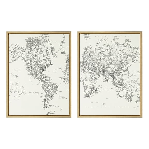
12 out of 5 Stars. 1 reviewsSave withShipping, arrives tomorrowKate and Laurel Sylvie Black and White Modern Retro World Map Framed Canvas Wall Art Set by The Creative Bunch Studio, 2 Piece 18x24 Gold, Vintage Map Art for Wall $84.99
 $8499current price $84.99
Kate and Laurel Sylvie Black and White Modern Retro World Map Framed Canvas Wall Art Set by The Creative Bunch Studio, 2 Piece 18x24 Gold, Vintage Map Art for Wall
25 out of 5 Stars. 2 reviewsSave withShipping, arrives in 2 daysHistory of the United States Marine - Framed 1", printed with a matte finish, 6" x 24" $39.95
 $3995current price $39.95
History of the United States Marine - Framed 1", printed with a matte finish, 6" x 24"
Shipping, arrives in 3+ daysUmbra Mappit Magnetic Map Wall Decor $60.80

 $6080current price $60.80
Umbra Mappit Magnetic Map Wall Decor
274.4 out of 5 Stars. 27 reviewsShipping, arrives in 3+ daysGallery Pops Pokémon - Blastoise Canvas Wall Art, Unframed Version, 12" x 12" $49.99
 $4999current price $49.99
Gallery Pops Pokémon - Blastoise Canvas Wall Art, Unframed Version, 12" x 12"
Shipping, arrives in 2 daysBest seller Country Floral Wall Art for Living Room, Blue and Yellow Flower with Green Botanical Canvas Wall Art, Retro Wood Boards Framed Wall Art for Bedroom Bathroom Wall Decor, 16X12 inch Ready to Hang $12.68
Best seller


 $1268current price $12.68More options from $10.79
Country Floral Wall Art for Living Room, Blue and Yellow Flower with Green Botanical Canvas Wall Art, Retro Wood Boards Framed Wall Art for Bedroom Bathroom Wall Decor, 16X12 inch Ready to Hang
194.8 out of 5 Stars. 19 reviewsSave withShipping, arrives in 2 days
About this item
Product details
Old North America Map - Thomson 1814 - This is an exquisite full-color Reproduction printed on high-quality gloss paper, art paper or canvas.
Print Size: 23.00 x 28.05 inches
58.42 X 71.24cm
The following towns are featured: a large format map of North America, with information from the Discoveries of Lewis & Clark, published by Thomson in 1814. West of the Rocky Mountains, the map shows pre-Lewis & Clark details, most notably the river running from Fort Vacouver northward into New Georgia and New Hanover, a strange pre-cursor to the course of the Columbia and Fraser Rivers. The fine details in western Canada are a reflection of the Hudson Bay Company and other fur trading networks which were then well known in the British Isles. To the east, a prominent note identifies the course of the Upper Missouri River, based upon sketches coming from early reports back from William Clark in the outbound portion of the Lewis & Clark Expedition, but pre-dating the release of the final expedition information which would occur in the official report of the expedition, published for the first time in Philadelphia in 1814. The missions in California are named. The Trans
SKU: ITAM0005
Original Maps are often difficult to find and usually have fold lines, identifying stamps or markings, tears, ragged edges, and assorted other natural signs of age that detract from their beauty. All of our maps have been professionally restored to depict their original beauty, while keeping all historical data intact.
These maps are fabulous pieces of history full of information useful to Historians, Genealogists, Cartographers, Relic Hunters, & Others. They make fascinating conversation pieces and splendid works of art for the home or office.
- BEAUTIFUL MAPS OF THE UNITED STATES - At Maps of the Past, we have all different types of US maps. From topographical to natural resources, we have exactly the type of US map you are looking for. Check out all of the different types of US maps that we have to offer. Easily find the one that is right for your needs.
- A UNITED STATES MAP FOR EVERY NEED - At Maps of the Past, we carry a variety of US maps. From exports and natural resources, to mines and railroads. We have maps of the US that cover any need. Check our wide selection of United States maps!
- ONLY ACCEPT THE BEST PRINT QUALITY FOR YOUR REPRODUCTIONS - There are many printers and print types available on the market, when purchasing a reproduction there is no finer quality reproduction than a reproduction using the Giclee Printing method. Giclee describes the technique or style of printing used, and it is revered as the highest quality printing because of the way it precisely sprays ink onto a surface. Trust nothing less than the best!
- GUARNANTEED TO GET EXACTLY WHAT YOU ORDERED - This map comes exactly to the specification of 23.00 x 28.05 inches/58.42 X 71.24 cm. All of our maps come rolled, wrapped, and shipped in a heavy gauge mailing tube to ensure it arrives intact.
- WHY CHOOSE MAPS OF THE PAST? - Maps of the Past is one of the single largest producers of different types of maps. They legally own the rights to the maps they sell, and provide them to you in clean, clear, and vibrant print. If you are looking for a high quality map print, then look no further than Maps of the Past!
info:
We aim to show you accurate product information. Manufacturers, suppliers and others provide what you see here, and we have not verified it.
Specifications
Size
23.00 x 28.05
Material
Glossy Satin Photo Quality
Decor style
Vintage
Theme
Historical International Maps
Warranty
Warranty information
Please be aware that the warranty terms on items offered for sale by third party Marketplace sellers may differ from those displayed in this section (if any). To confirm warranty terms on an item offered for sale by a third party Marketplace seller, please use the 'Contact seller' feature on the third party Marketplace seller's information page and request the item's warranty terms prior to purchase.
Customer ratings & reviews
0 ratings|0 reviews
This item does not have any reviews yet
