
Hero image 0 of Railroad Map - Grand Trunk System Louisville Nashville Railroads- Reynold 1921 - 23 x 32.79 - Vintage Wall Art, 0 of 5
Railroad Map - Grand Trunk System Louisville Nashville Railroads- Reynold 1921 - 23 x 32.79 - Vintage Wall Art
(No ratings yet)
Railroad Map - Grand Trunk System Louisville Nashville Railroads- Reynold 1921 - 23 x 32.79 - Vintage Wall ArtRailroad Map Grand Trunk System Louisville Nashville Railroads Reynold 1921 23 x 32 79 Vintage Wall ArtRailroad Map Grand Trunk System Louisville Nashville Railroads Reynold 1921 23 x 32 79 Vintage Wall Art
Material:Matte Art
Key item features
- WHAT IS A RAILROAD SYSTEM? - Railroad systems were the original means of transporting both goods and people across the US, and many other countries across the globe. Railroads were built beginning in the 1800's and grew rapidly. They span coast to coast and are still heavily used today in many countries.
- ARE YOU A RAILROAD ENTHUSIAST? - If so, then add to your collection with prints of the original mappings of the railroad systems. Compare it against what is present today and see how much or how little it has changed since it's inceptions likely more than 100 years ago.
- ONLY ACCEPT THE BEST PRINT QUALITY FOR YOUR REPRODUCTIONS - There are many printers and print types available on the market, when purchasing a reproduction there is no finer quality reproduction than a reproduction using the Giclee Printing method. Giclee describes the technique or style of printing used, and it is revered as the highest quality printing because of the way it precisely sprays ink onto a surface. Trust nothing less than the best!
- GUARNANTEED TO GET EXACTLY WHAT YOU ORDERED - This map comes exactly to the specification of 23.00 x 32.79 inches/58.42 X 83.28 cm. All of our maps come rolled, wrapped, and shipped in a heavy gauge mailing tube to ensure it arrives intact.
- WHY CHOOSE MAPS OF THE PAST? - Maps of the Past is one of the single largest producers of different types of maps. They legally own the rights to the maps they sell, and provide them to you in clean, clear, and vibrant print. If you are looking for a high quality map print, then look no further than Maps of the Past!
Specs
- Color1
- Size23.00 x 32.79
- MaterialMatte Art
- Decor styleVintage
- ThemeOld Railroad Maps
- ShapeRectangle
Current price is USDNow $45.95
You save $29.00
was $74.95$74.95
You save$29.00
Price when purchased online
- Free shipping
 Free 30-day returns
How do you want your item?
Columbus, 43215
Arrives between Feb 28 - Mar 3
|Sold and shipped by Maps of the Past
4.3 stars out of 5, based on 10 seller reviews(4.3)10 seller reviews
Free 30-day returns
Check out these related products
Railroad Map - Illinois Central Railroad - Reynold 1921 - 23 x 31.69 - Vintage Wall Art $40.95 $40.95/count
 3 optionsAvailable in additional 3 options$4095current price $40.95$40.95/count
Railroad Map - Illinois Central Railroad - Reynold 1921 - 23 x 31.69 - Vintage Wall Art
Railroad Map - Northern Pacific Pennsylvania Railroad - Reynold 1921 - 31.79 x 23 - Vintage Wall Art $40.95
 3 optionsAvailable in additional 3 options$4095current price $40.95
Railroad Map - Northern Pacific Pennsylvania Railroad - Reynold 1921 - 31.79 x 23 - Vintage Wall Art
Historic Map - Gallia France - Spruner 1865 - 29.02 x 23 - Vintage Wall Art $40.95
 3 optionsAvailable in additional 3 options$4095current price $40.95
Historic Map - Gallia France - Spruner 1865 - 29.02 x 23 - Vintage Wall Art
Railroad Map - Salt Lake Route New York New Haven Hartford Railroad - Reynold 1921 - 23 x 31.80 - Vintage Wall Art $40.95 $40.95/count
 $4095current price $40.95$40.95/count
Railroad Map - Salt Lake Route New York New Haven Hartford Railroad - Reynold 1921 - 23 x 31.80 - Vintage Wall Art
Railroad Map - Colorado Delaware and Lackawanna Railroad - Reynold 1921 - 23 x 32.15 - Vintage Wall Art $40.95 $40.95/count
 3 optionsAvailable in additional 3 options$4095current price $40.95$40.95/count
Railroad Map - Colorado Delaware and Lackawanna Railroad - Reynold 1921 - 23 x 32.15 - Vintage Wall Art
Historic Map - Abydos Egypt - Baedeker 1913 - 32.70 x 23 - Vintage Wall Art $40.95 $40.95/count
 $4095current price $40.95$40.95/count
Historic Map - Abydos Egypt - Baedeker 1913 - 32.70 x 23 - Vintage Wall Art
Historic County Map - Montgomery County Virginia - Gilmer 1864 - 27.59 x 23 - Vintage Wall Art $40.95 $40.95/count
 3 optionsAvailable in additional 3 options$4095current price $40.95$40.95/count
Historic County Map - Montgomery County Virginia - Gilmer 1864 - 27.59 x 23 - Vintage Wall Art
Historic Map - Egypt Arabia - Oxford 1828 - 23 x 29.84 - Vintage Wall Art $40.95
 $4095current price $40.95
Historic Map - Egypt Arabia - Oxford 1828 - 23 x 29.84 - Vintage Wall Art
Historic State Map - Missouri - Alden 1886 - 23 x 35.40 - Vintage Wall Art $40.95
 3 optionsAvailable in additional 3 options$4095current price $40.95
Historic State Map - Missouri - Alden 1886 - 23 x 35.40 - Vintage Wall Art
Historic Map - Africa - Alden 1886 - 23 x 35.35 - Vintage Wall Art $40.95
 $4095current price $40.95
Historic Map - Africa - Alden 1886 - 23 x 35.35 - Vintage Wall Art
Historic County Map - Pulaski County Virginia - Boyd 1890 - 37.65 x 23 - Vintage Wall Art $40.95
 $4095current price $40.95
Historic County Map - Pulaski County Virginia - Boyd 1890 - 37.65 x 23 - Vintage Wall Art
Historic Map - Egypt - Perthes 1896 - 23 x 26.04 - Vintage Wall Art $40.95
 $4095current price $40.95
Historic Map - Egypt - Perthes 1896 - 23 x 26.04 - Vintage Wall Art
Historic Map - Brussels Belgium Central - Baedeker 1910 - 23 x 29.93 - Vintage Wall Art $40.95
 $4095current price $40.95
Historic Map - Brussels Belgium Central - Baedeker 1910 - 23 x 29.93 - Vintage Wall Art
Historic Map - Netherlands Northern - Baedeker 1910 - 25.08 x 23 - Vintage Wall Art $40.95 $40.95/count
 $4095current price $40.95$40.95/count
Historic Map - Netherlands Northern - Baedeker 1910 - 25.08 x 23 - Vintage Wall Art
Historic County Map - Venango County Pennsylvania - Irwin 1857 - 29.77 x 23 - Vintage Wall Art $40.95
 $4095current price $40.95
Historic County Map - Venango County Pennsylvania - Irwin 1857 - 29.77 x 23 - Vintage Wall Art
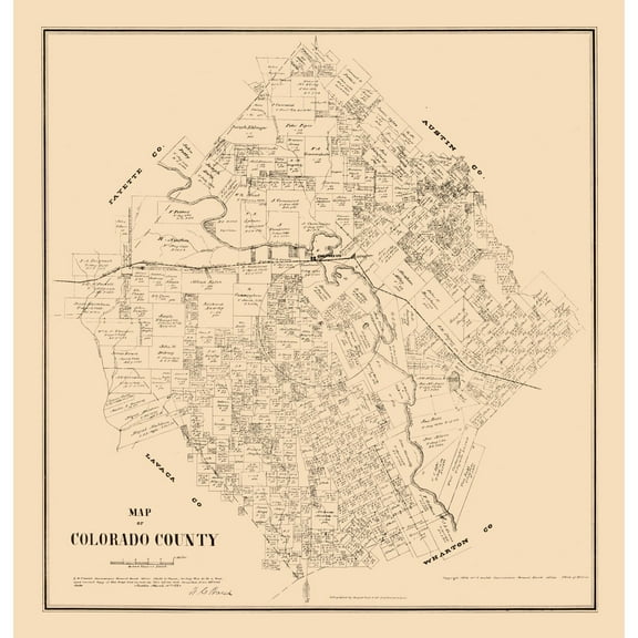
Historic County Map - Colorado County Texas - Walsh 1880 - 23 x 24.01 - Vintage Wall Art $40.95
 3 optionsAvailable in additional 3 options$4095current price $40.95
Historic County Map - Colorado County Texas - Walsh 1880 - 23 x 24.01 - Vintage Wall Art
Historic Map - Mechelen Belgium - Baedeker 1910 - 23 x 31.98 - Vintage Wall Art $40.95 $40.95/count
 3 optionsAvailable in additional 3 options$4095current price $40.95$40.95/count
Historic Map - Mechelen Belgium - Baedeker 1910 - 23 x 31.98 - Vintage Wall Art
Historic Map - Trieste Italy - Baedeker 1910 - 23 x 30.22 - Vintage Wall Art $40.95 $40.95/count
 $4095current price $40.95$40.95/count
Historic Map - Trieste Italy - Baedeker 1910 - 23 x 30.22 - Vintage Wall Art
Historic County Map - Brazoria County Texas - West 1860 - 23 x 32.73 - Vintage Wall Art $40.95 $40.95/count
 3 optionsAvailable in additional 3 options$4095current price $40.95$40.95/count
Historic County Map - Brazoria County Texas - West 1860 - 23 x 32.73 - Vintage Wall Art
Historic Map - Salzburg Austria - Baedeker 1910 - 30.30 x 23 - Vintage Wall Art $40.95
 3 optionsAvailable in additional 3 options$4095current price $40.95
Historic Map - Salzburg Austria - Baedeker 1910 - 30.30 x 23 - Vintage Wall Art
About this item
Product details
Old Transportation Maps - Grand Trunk System, Louisville, Nashville - Reynold 1921 - This is an exquisite full-color Reproduction printed on high-quality gloss paper, art paper or canvas.
Print Size: 23.00 x 32.79 inches
58.42 X 83.28cm
The following towns are featured: New York, Cleveland, Quebec, Toronto, Buffalo, Atlanta, Nashville, Memphis, Louisville, Cincinnati.
This Map is Situated in: North America.
SKU: ITRR0008
Original Maps are often difficult to find and usually have fold lines, identifying stamps or markings, tears, ragged edges, and assorted other natural signs of age that detract from their beauty. All of our maps have been professionally restored to depict their original beauty, while keeping all historical data intact.
These maps are fabulous pieces of history full of information useful to Historians, Genealogists, Cartographers, Relic Hunters, & Others. They make fascinating conversation pieces and splendid works of art for the home or office.
- WHAT IS A RAILROAD SYSTEM? - Railroad systems were the original means of transporting both goods and people across the US, and many other countries across the globe. Railroads were built beginning in the 1800's and grew rapidly. They span coast to coast and are still heavily used today in many countries.
- ARE YOU A RAILROAD ENTHUSIAST? - If so, then add to your collection with prints of the original mappings of the railroad systems. Compare it against what is present today and see how much or how little it has changed since it's inceptions likely more than 100 years ago.
- ONLY ACCEPT THE BEST PRINT QUALITY FOR YOUR REPRODUCTIONS - There are many printers and print types available on the market, when purchasing a reproduction there is no finer quality reproduction than a reproduction using the Giclee Printing method. Giclee describes the technique or style of printing used, and it is revered as the highest quality printing because of the way it precisely sprays ink onto a surface. Trust nothing less than the best!
- GUARNANTEED TO GET EXACTLY WHAT YOU ORDERED - This map comes exactly to the specification of 23.00 x 32.79 inches/58.42 X 83.28 cm. All of our maps come rolled, wrapped, and shipped in a heavy gauge mailing tube to ensure it arrives intact.
- WHY CHOOSE MAPS OF THE PAST? - Maps of the Past is one of the single largest producers of different types of maps. They legally own the rights to the maps they sell, and provide them to you in clean, clear, and vibrant print. If you are looking for a high quality map print, then look no further than Maps of the Past!
info:
We aim to show you accurate product information. Manufacturers, suppliers and others provide what you see here, and we have not verified it.
Specifications
Color
1
Size
23.00 x 32.79
Material
Matte Art
Decor style
Vintage
Warranty
Warranty information
Please be aware that the warranty terms on items offered for sale by third party Marketplace sellers may differ from those displayed in this section (if any). To confirm warranty terms on an item offered for sale by a third party Marketplace seller, please use the 'Contact seller' feature on the third party Marketplace seller's information page and request the item's warranty terms prior to purchase.
Customer ratings & reviews
0 ratings|0 reviews
This item does not have any reviews yet
