
Hero image 0 of Map of Minneapolis 36x54 with Neighborhoods, Streets, Roads, Highways and Parks - Glossy Photo Paper Wall Map Poster Print - Vivid Imagery with Bright Colors, 0 of 5
Map of Minneapolis 36x54 with Neighborhoods, Streets, Roads, Highways and Parks - Glossy Photo Paper Wall Map Poster Print - Vivid Imagery with Bright Colors
(No ratings yet)
Map of Minneapolis 36x54 with Neighborhoods, Streets, Roads, Highways and Parks - Glossy Photo Paper Wall Map Poster Print - Vivid Imagery with Bright ColorsMap Minneapolis 36x54 Neighborhoods Streets Roads Highways Parks Glossy Photo Paper Wall Map Poster Print Vivid Imagery Bright ColorsMap of Minneapolis 18x24 with Neighborhoods Streets Roads Highways and Parks Laminated Wall Map Poster Print Vivid Imagery with Bright ColorsMap of Minneapolis 24x36 with Neighborhoods Streets Roads Highways and Parks Laminated Wall Map Poster Print Vivid Imagery with Bright ColorsMap of Minneapolis 20x30 with Neighborhoods Streets Roads Highways and Parks Laminated Wall Map Poster Print Vivid Imagery with Bright Colors
Size:36" x 54"
Key item features
- Expertly Designed Cartography: Crafted by professional cartographers, this 36x54 glossy photo paper poster of Minneapolis showcases detailed neighborhoods, streets, roads, highways, and parks with vivid imagery and bright colors.
- Educational and Decorative: Perfect for both educational and decorative purposes, this poster adds a vibrant touch to classrooms and homes, serving as a useful tool for learning about Minneapolis's layout and geography.
- Durable and Interactive: This poster provides a write-on, wipe-off surface suitable for dry erase markers, allowing for easy updates and interactive use.
Specs
 Size36" x 54"
 BrandCompliance Assistance
Current price is USD$29.99
Price when purchased online
 Free 30-day returns
How do you want your item?
Columbus, 43215
Arrives between Feb 23 - Feb 26
|Shipping fee $4.99
Sold and shipped by Compliance Assistance
2.8947368421052633 stars out of 5, based on 19 seller reviews(2.9)19 seller reviews
Free 30-day returns
About this item
Product details
This high-quality glossy photo paper map is both an educational and decorative piece, designed by professional cartographers. It highlights neighborhoods, streets, roads, highways and parks with vivid imagery and bright colors. The glossy photo paper allows for interactive use with dry erase markers. The map is delivered rolled in a tube to ensure it arrives in perfect, creaseless condition. Attribution and acknowledgements go to openstreetmaps. The maps are used with their permissions. Copyright is included on the printed material.
- Expertly Designed Cartography: Crafted by professional cartographers, this 36x54 glossy photo paper poster of Minneapolis showcases detailed neighborhoods, streets, roads, highways, and parks with vivid imagery and bright colors.
- Educational and Decorative: Perfect for both educational and decorative purposes, this poster adds a vibrant touch to classrooms and homes, serving as a useful tool for learning about Minneapolis's layout and geography.
- Durable and Interactive: This poster provides a write-on, wipe-off surface suitable for dry erase markers, allowing for easy updates and interactive use.
info:
We aim to show you accurate product information. Manufacturers, suppliers and others provide what you see here, and we have not verified it.
Specifications
Size
36" x 54"
Brand
Compliance Assistance
Warranty
Warranty information
Please be aware that the warranty terms on items offered for sale by third party Marketplace sellers may differ from those displayed in this section (if any). To confirm warranty terms on an item offered for sale by a third party Marketplace seller, please use the 'Contact seller' feature on the third party Marketplace seller's information page and request the item's warranty terms prior to purchase.
Similar items you might like
Based on what customers bought
Map of Milwakee 18x24 with Neighborhoods, Streets, Roads, Highways and Parks - Laminated Wall Map Poster Print - Vivid Imagery with Bright Colors $14.99 Was $16.99
 4 optionsAvailable in additional 4 optionsNow$1499current price Now $14.99, Was $16.99$16.99+$4.99 shippingYou save $2.00You save$2.00Options from $14.99 – $29.99
Map of Milwakee 18x24 with Neighborhoods, Streets, Roads, Highways and Parks - Laminated Wall Map Poster Print - Vivid Imagery with Bright Colors
Shipping, arrives in 3+ daysMap of Brooklyn 18x24 with Neighborhoods, Streets, Roads, Highways and Parks - Laminated Wall Map Poster Print - Vivid Imagery with Bright Colors $14.99 Was $16.99
 4 optionsAvailable in additional 4 optionsNow$1499current price Now $14.99, Was $16.99$16.99+$4.99 shippingYou save $2.00You save$2.00Options from $14.99 – $29.99
Map of Brooklyn 18x24 with Neighborhoods, Streets, Roads, Highways and Parks - Laminated Wall Map Poster Print - Vivid Imagery with Bright Colors
Shipping, arrives in 3+ daysMap of Philadelphia 18x24 with Neighborhoods, Streets, Roads, Highways and Parks - Laminated Wall Map Poster Print - Vivid Imagery with Bright Colors $14.99 Was $16.99
 4 optionsAvailable in additional 4 optionsNow$1499current price Now $14.99, Was $16.99$16.99+$4.99 shippingYou save $2.00You save$2.00Options from $14.99 – $29.99
Map of Philadelphia 18x24 with Neighborhoods, Streets, Roads, Highways and Parks - Laminated Wall Map Poster Print - Vivid Imagery with Bright Colors
Shipping, arrives in 3+ daysMap of Detroit 18x24 with Neighborhoods, Streets, Roads, Highways and Parks - Laminated Wall Map Poster Print - Vivid Imagery with Bright Colors $14.99
 4 optionsAvailable in additional 4 options$1499current price $14.99Options from $14.99 – $29.99
Map of Detroit 18x24 with Neighborhoods, Streets, Roads, Highways and Parks - Laminated Wall Map Poster Print - Vivid Imagery with Bright Colors
Shipping, arrives in 3+ daysMap of Phoenix 18x24 with Neighborhoods, Streets, Roads, Highways and Parks - Laminated Wall Map Poster Print - Vivid Imagery with Bright Colors $14.99 Was $16.99
 4 optionsAvailable in additional 4 optionsNow$1499current price Now $14.99, Was $16.99$16.99+$4.99 shippingYou save $2.00You save$2.00Options from $14.99 – $29.99
Map of Phoenix 18x24 with Neighborhoods, Streets, Roads, Highways and Parks - Laminated Wall Map Poster Print - Vivid Imagery with Bright Colors
Shipping, arrives in 3+ daysMap of Memphis 18x24 with Neighborhoods, Streets, Roads, Highways and Parks - Laminated Wall Map Poster Print - Vivid Imagery with Bright Colors $14.99 Was $16.99
 4 optionsAvailable in additional 4 optionsNow$1499current price Now $14.99, Was $16.99$16.99+$4.99 shippingYou save $2.00You save$2.00Options from $14.99 – $29.99
Map of Memphis 18x24 with Neighborhoods, Streets, Roads, Highways and Parks - Laminated Wall Map Poster Print - Vivid Imagery with Bright Colors
Shipping, arrives in 3+ daysMap of Baltimore 18x24 with Neighborhoods, Streets, Roads, Highways and Parks - Laminated Wall Map Poster Print - Vivid Imagery with Bright Colors $14.99 Was $16.99
 4 optionsAvailable in additional 4 optionsNow$1499current price Now $14.99, Was $16.99$16.99+$4.99 shippingYou save $2.00You save$2.00Options from $14.99 – $29.99
Map of Baltimore 18x24 with Neighborhoods, Streets, Roads, Highways and Parks - Laminated Wall Map Poster Print - Vivid Imagery with Bright Colors
12 out of 5 Stars. 1 reviewsShipping, arrives in 3+ daysMap of Dallas 18x24 with Neighborhoods, Streets, Roads, Highways and Parks - Laminated Wall Map Poster Print - Vivid Imagery with Bright Colors $14.99 Was $16.99
 4 optionsAvailable in additional 4 optionsNow$1499current price Now $14.99, Was $16.99$16.99+$4.99 shippingYou save $2.00You save$2.00Options from $14.99 – $29.99
Map of Dallas 18x24 with Neighborhoods, Streets, Roads, Highways and Parks - Laminated Wall Map Poster Print - Vivid Imagery with Bright Colors
Shipping, arrives in 3+ daysMap of San Diego 18x24 with Neighborhoods, Streets, Roads, Highways and Parks - Laminated Wall Map Poster Print - Vivid Imagery with Bright Colors $14.99 Was $16.99
 4 optionsAvailable in additional 4 optionsNow$1499current price Now $14.99, Was $16.99$16.99+$4.99 shippingYou save $2.00You save$2.00Options from $14.99 – $29.99
Map of San Diego 18x24 with Neighborhoods, Streets, Roads, Highways and Parks - Laminated Wall Map Poster Print - Vivid Imagery with Bright Colors
Shipping, arrives in 3+ daysMap of Houston 18x24 with Neighborhoods, Streets, Roads, Highways and Parks - Laminated Wall Map Poster Print - Vivid Imagery with Bright Colors $14.99 Was $16.99
 4 optionsAvailable in additional 4 optionsNow$1499current price Now $14.99, Was $16.99$16.99+$4.99 shippingYou save $2.00You save$2.00Options from $14.99 – $29.99
Map of Houston 18x24 with Neighborhoods, Streets, Roads, Highways and Parks - Laminated Wall Map Poster Print - Vivid Imagery with Bright Colors
Shipping, arrives in 3+ daysMap of Indianapolis 18x24 with Neighborhoods, Streets, Roads, Highways and Parks - Laminated Wall Map Poster Print - Vivid Imagery with Bright Colors $14.99 Was $16.99
 4 optionsAvailable in additional 4 optionsNow$1499current price Now $14.99, Was $16.99$16.99+$4.99 shippingYou save $2.00You save$2.00Options from $14.99 – $29.99
Map of Indianapolis 18x24 with Neighborhoods, Streets, Roads, Highways and Parks - Laminated Wall Map Poster Print - Vivid Imagery with Bright Colors
Map of Albuquerque 18x24 with Neighborhoods, Streets, Roads, Highways and Parks - Laminated Wall Map Poster Print - Vivid Imagery with Bright Colors $14.99 Was $16.99
 4 optionsAvailable in additional 4 optionsNow$1499current price Now $14.99, Was $16.99$16.99+$4.99 shippingYou save $2.00You save$2.00Options from $14.99 – $29.99
Map of Albuquerque 18x24 with Neighborhoods, Streets, Roads, Highways and Parks - Laminated Wall Map Poster Print - Vivid Imagery with Bright Colors
Shipping, arrives in 3+ daysMap of Nashville 18x24 with Neighborhoods, Streets, Roads, Highways and Parks - Laminated Wall Map Poster Print - Vivid Imagery with Bright Colors $14.99
 4 optionsAvailable in additional 4 options$1499current price $14.99+$4.99 shippingOptions from $14.99 – $29.99
Map of Nashville 18x24 with Neighborhoods, Streets, Roads, Highways and Parks - Laminated Wall Map Poster Print - Vivid Imagery with Bright Colors
Shipping, arrives in 3+ daysMap of Atlanta 18x24 with Neighborhoods, Streets, Roads, Highways and Parks - Laminated Wall Map Poster Print - Vivid Imagery with Bright Colors $14.99 Was $16.99
 4 optionsAvailable in additional 4 optionsNow$1499current price Now $14.99, Was $16.99$16.99+$4.99 shippingYou save $2.00You save$2.00Options from $14.99 – $29.99
Map of Atlanta 18x24 with Neighborhoods, Streets, Roads, Highways and Parks - Laminated Wall Map Poster Print - Vivid Imagery with Bright Colors
Shipping, arrives in 3+ daysMap of Los Angeles 18x24 with Neighborhoods, Streets, Roads, Highways and Parks - Laminated Wall Map Poster Print - Vivid Imagery with Bright Colors $14.99 Was $16.99
 4 optionsAvailable in additional 4 optionsNow$1499current price Now $14.99, Was $16.99$16.99+$4.99 shippingYou save $2.00You save$2.00Options from $14.99 – $29.99
Map of Los Angeles 18x24 with Neighborhoods, Streets, Roads, Highways and Parks - Laminated Wall Map Poster Print - Vivid Imagery with Bright Colors
Shipping, arrives in 3+ daysMap of Manhattan 18x24 with Neighborhoods, Streets, Roads, Highways and Parks - Laminated Wall Map Poster Print - Vivid Imagery with Bright Colors $14.99 Was $16.99
 4 optionsAvailable in additional 4 optionsNow$1499current price Now $14.99, Was $16.99$16.99+$4.99 shippingYou save $2.00You save$2.00Options from $14.99 – $29.99
Map of Manhattan 18x24 with Neighborhoods, Streets, Roads, Highways and Parks - Laminated Wall Map Poster Print - Vivid Imagery with Bright Colors
Shipping, arrives in 3+ daysMap of Seattle 18x24 with Neighborhoods, Streets, Roads, Highways and Parks - Laminated Wall Map Poster Print - Vivid Imagery with Bright Colors $14.99 Was $16.99
 4 optionsAvailable in additional 4 optionsNow$1499current price Now $14.99, Was $16.99$16.99+$4.99 shippingYou save $2.00You save$2.00Options from $14.99 – $29.99
Map of Seattle 18x24 with Neighborhoods, Streets, Roads, Highways and Parks - Laminated Wall Map Poster Print - Vivid Imagery with Bright Colors
Shipping, arrives in 3+ daysMap of Miami 18x24 with Neighborhoods, Streets, Roads, Highways and Parks - Laminated Wall Map Poster Print - Vivid Imagery with Bright Colors $14.99 Was $16.99
 4 optionsAvailable in additional 4 optionsNow$1499current price Now $14.99, Was $16.99$16.99+$4.99 shippingYou save $2.00You save$2.00Options from $14.99 – $29.99
Map of Miami 18x24 with Neighborhoods, Streets, Roads, Highways and Parks - Laminated Wall Map Poster Print - Vivid Imagery with Bright Colors
Shipping, arrives in 3+ daysMap of Colorado - Laminated Wall Map Poster Print Perfect for Classrooms and Homes - Vivid Imagery with Bright Colors - 18x24 $10.99 Was $12.99
 4 optionsAvailable in additional 4 optionsNow$1099current price Now $10.99, Was $12.99$12.99+$4.99 shippingYou save $2.00You save$2.00Options from $10.99 – $29.99
Map of Colorado - Laminated Wall Map Poster Print Perfect for Classrooms and Homes - Vivid Imagery with Bright Colors - 18x24
Shipping, arrives in 3+ daysMap of Ohio Style C - Laminated Wall Map Poster Print Perfect for Classrooms and Homes - Vivid Imagery with Bright Colors - 18x24 $10.99 Was $12.99
 4 optionsAvailable in additional 4 optionsNow$1099current price Now $10.99, Was $12.99$12.99+$4.99 shippingYou save $2.00You save$2.00Options from $10.99 – $29.99
Map of Ohio Style C - Laminated Wall Map Poster Print Perfect for Classrooms and Homes - Vivid Imagery with Bright Colors - 18x24
Popular items in this category
Best selling items that customers love
18x24 Map of Middle East - Laminated Wall Map Poster Print Perfect for Classrooms and Homes - Vivid Imagery with Bright Colors $10.99 Was $14.99
 4 optionsAvailable in additional 4 optionsNow$1099current price Now $10.99, Was $14.99$14.99+$4.99 shippingYou save $4.00You save$4.00Options from $10.99 – $29.99
18x24 Map of Middle East - Laminated Wall Map Poster Print Perfect for Classrooms and Homes - Vivid Imagery with Bright Colors
Shipping, arrives in 3+ daysMap of Florida Style E - Laminated Wall Map Poster Print Perfect for Classrooms and Homes - Vivid Imagery with Bright Colors - 18x24 $10.99 Was $12.99
 3 optionsAvailable in additional 3 optionsNow$1099current price Now $10.99, Was $12.99$12.99+$4.99 shippingYou save $2.00You save$2.00Options from $10.99 – $14.99
Map of Florida Style E - Laminated Wall Map Poster Print Perfect for Classrooms and Homes - Vivid Imagery with Bright Colors - 18x24
13 out of 5 Stars. 1 reviewsShipping, arrives in 3+ daysNorth Carolina Map Poster - Laminated Wall Map - Style A - 18x24 - Ideal for Classrooms and Homes – Features Bright Colors and Vivid Imagery $10.99 Was $12.99
 4 optionsAvailable in additional 4 optionsNow$1099current price Now $10.99, Was $12.99$12.99+$4.99 shippingYou save $2.00You save$2.00Options from $10.99 – $29.99
North Carolina Map Poster - Laminated Wall Map - Style A - 18x24 - Ideal for Classrooms and Homes – Features Bright Colors and Vivid Imagery
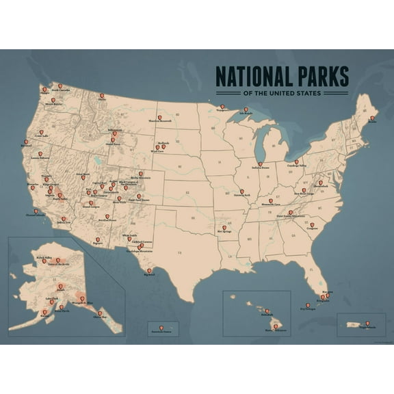
Shipping, arrives in 3+ daysBest Maps Ever US National Parks Map 18” x 24” Poster $23.95
 $2395current price $23.95
Best Maps Ever US National Parks Map 18” x 24” Poster
Shipping, arrives in 3+ daysUSA National Parks, Monuments & Forests Map 24x36 Poster $32.00
 $3200current price $32.00
USA National Parks, Monuments & Forests Map 24x36 Poster
15 out of 5 Stars. 1 reviewsShipping, arrives in 3+ daysPalmetto Posters 24x31 Laminated Poster: Large detailed political and administrative map of kenya with roads railroads national parks cities and airports $22.00
 $2200current price $22.00
Palmetto Posters 24x31 Laminated Poster: Large detailed political and administrative map of kenya with roads railroads national parks cities and airports
Shipping, arrives in 3+ daysUS National Parks Map 11x14 Print $16.70
 $1670current price $16.70
US National Parks Map 11x14 Print
Shipping, arrives in 3+ daysUnited States Map - USA Poster, US Educational Map - with State Capital - for Ages Kids to Adults- Home School Office - Printed on 12pt. Glossy Card Stock | Bulk Pack of 10 | 8.5 x 11 inches $14.69
 $1469current price $14.69
United States Map - USA Poster, US Educational Map - with State Capital - for Ages Kids to Adults- Home School Office - Printed on 12pt. Glossy Card Stock | Bulk Pack of 10 | 8.5 x 11 inches
14 out of 5 Stars. 1 reviewsShipping, arrives in 3+ daysPalmetto Posters 24x31 Laminated Poster: Large detailed political and administrative map of zambia with roads railroads cities and airports $22.00
 $2200current price $22.00
Palmetto Posters 24x31 Laminated Poster: Large detailed political and administrative map of zambia with roads railroads cities and airports
Shipping, arrives in 3+ daysPalmetto Posters 24x31 Laminated Poster: Large detailed political and administrative map of somalia with roads railroads cities and airports $22.00
 $2200current price $22.00
Palmetto Posters 24x31 Laminated Poster: Large detailed political and administrative map of somalia with roads railroads cities and airports
Shipping, arrives in 3+ daysPalmetto Posters 24x31 Laminated Poster: Large scale political and administrative map of india with roads railroads and major cities $22.00
 $2200current price $22.00
Palmetto Posters 24x31 Laminated Poster: Large scale political and administrative map of india with roads railroads and major cities
Palmetto Posters 24x31 Laminated Poster: Large detailed political and administrative map of afghanistan with roads cities and airports $22.00
 $2200current price $22.00
Palmetto Posters 24x31 Laminated Poster: Large detailed political and administrative map of afghanistan with roads cities and airports
Shipping, arrives in 3+ daysPalmetto Posters 24x31 Laminated Poster: Large detailed political and administrative map of eritrea with roads railroads cities and airports $22.00
 $2200current price $22.00
Palmetto Posters 24x31 Laminated Poster: Large detailed political and administrative map of eritrea with roads railroads cities and airports
Palmetto Posters 20x24 Laminated Poster: Large political and administrative map of costa rica with roads cities national parks and airports $22.00
 $2200current price $22.00
Palmetto Posters 20x24 Laminated Poster: Large political and administrative map of costa rica with roads cities national parks and airports
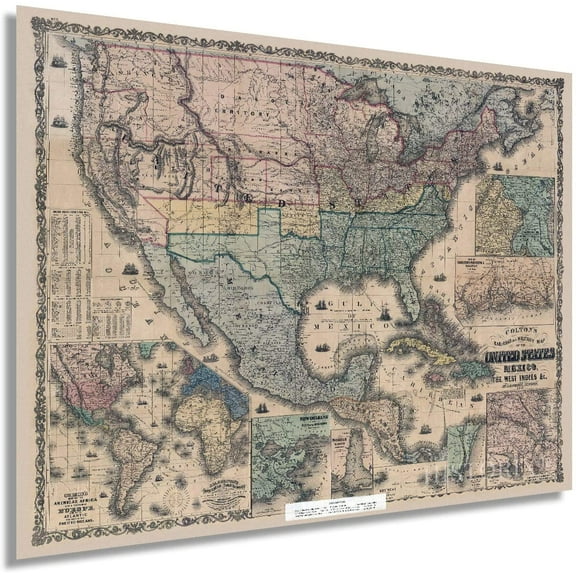
15 out of 5 Stars. 1 reviewsShipping, arrives in 3+ daysHISTORIX 1862 United States Railroad and Military Map Vintage Poster Wall Art Print, 18 x 24 Inch $39.99
 2 optionsAvailable in additional 2 options$3999current price $39.99Options from $39.99 – $59.99
HISTORIX 1862 United States Railroad and Military Map Vintage Poster Wall Art Print, 18 x 24 Inch
Shipping, arrives in 3+ daysPALMETTO POSTERS Large Political And Administrative Map of Dominican Republic with Roads Railroads And Major Cities Laminated 20" x 24" Poster $22.00
 $2200current price $22.00
PALMETTO POSTERS Large Political And Administrative Map of Dominican Republic with Roads Railroads And Major Cities Laminated 20" x 24" Poster
Shipping, arrives in 3+ daysPalmetto Posters 22x29 Laminated Poster: Large detailed political and administrative map of saudi arabia with relief roads railroads and major cities $22.00
 $2200current price $22.00
Palmetto Posters 22x29 Laminated Poster: Large detailed political and administrative map of saudi arabia with relief roads railroads and major cities
Shipping, arrives in 3+ daysPalmetto Posters 24x31 Laminated Poster: Large detailed political and administrative map of djibouti with roads railroads cities and airports $22.00
 $2200current price $22.00
Palmetto Posters 24x31 Laminated Poster: Large detailed political and administrative map of djibouti with roads railroads cities and airports
Shipping, arrives in 3+ days
Customer ratings & reviews
0 ratings|0 reviews
This item does not have any reviews yet

Related pages
- North Alabama Maps
- Midwest United States Travel Books, Maps & Guides
- North Georgia Map
- Northeast United States Travel Books, Maps & Guides
- Interstate Highways Map
- Central America Travel Books, Maps & Guides
- Michigan State Map
- Southern United States Travel Books, Maps & Guides
- Georgia Atlanta Map
- General South America Travel Books, Maps & Guides
- Map Illinois Highways
- National Parks Posters