Hero image 0 of Historic Map - Cisalpine Gaul Rhaetia Noricum Corsica Italy - Oxford 1828 - 33.10 x 23 - Vintage Wall Art, 0 of 5
Historic Map - Cisalpine Gaul Rhaetia Noricum Corsica Italy - Oxford 1828 - 33.10 x 23 - Vintage Wall Art
(No ratings yet)
Historic Map - Cisalpine Gaul Rhaetia Noricum Corsica Italy - Oxford 1828 - 33.10 x 23 - Vintage Wall ArtHistoric Map Cisalpine Gaul Rhaetia Noricum Corsica Italy Oxford 1828 33 10 x 23 Vintage Wall ArtHistoric Map Cisalpine Gaul Rhaetia Noricum Corsica Italy Oxford 1828 33 10 x 23 Vintage Wall ArtHistoric Map Cisalpine Gaul Rhaetia Noricum Corsica Italy Oxford 1828 33 10 x 23 Vintage Wall Art
Key item features
- OWN A PIECE OF YOUR HOME COUNTRY - Looking for something that reminds you of the country you or your ancestors originate from? Well now you can own a piece of your heritage with a beautiful map of your home country. Maps of the Past has maps for every need!
- INTERNATIONAL MAPS PROVIDE IMPORTANT INFORMATION - International maps not only show you how the different countries, cities, counties, and territories are divided and where the borders can be found, but it also highlights rivers, mountains, and other natural elements of the land. International maps can also show you natural resources and exports of a country.
- ONLY ACCEPT THE BEST PRINT QUALITY FOR YOUR REPRODUCTIONS - There are many printers and print types available on the market, when purchasing a reproduction there is no finer quality reproduction than a reproduction using the Giclee Printing method. Giclee describes the technique or style of printing used, and it is revered as the highest quality printing because of the way it precisely sprays ink onto a surface. Trust nothing less than the best!
- GUARNANTEED TO GET EXACTLY WHAT YOU ORDERED - This map comes exactly to the specification of 23.00 x 33.10 inches/58.42 X 84.07 cm. All of our maps come rolled, wrapped, and shipped in a heavy gauge mailing tube to ensure it arrives intact.
- WHY CHOOSE MAPS OF THE PAST? - Maps of the Past is one of the single largest producers of different types of maps. They legally own the rights to the maps they sell, and provide them to you in clean, clear, and vibrant print. If you are looking for a high quality map print, then look no further than Maps of the Past!
Specs
- Color1
- Size23.00 x 33.10
- MaterialMatte Canvas
- Decor styleVintage
- ShapeRectangle
- Art typePainting
Price when purchased online
Not Available
How do you want your item?
Not available
Check out these related products
Historic War Map - Cannae Italy Battle - Oxford 1828 - 23 x 29.28 - Vintage Wall Art $40.95
 $4095current price $40.95
Historic War Map - Cannae Italy Battle - Oxford 1828 - 23 x 29.28 - Vintage Wall Art
Historic Map - Asia Minor Armenia Mesopotamia Syria - Oxford 1828 - 32.77 x 23 - Vintage Wall Art $40.95
 $4095current price $40.95
Historic Map - Asia Minor Armenia Mesopotamia Syria - Oxford 1828 - 32.77 x 23 - Vintage Wall Art
Historic Map - Greece Turkey Aegaean Sea Coasts Islands - Oxford 1828 - 23 x 32.83 - Vintage Wall Art $40.95
 $4095current price $40.95
Historic Map - Greece Turkey Aegaean Sea Coasts Islands - Oxford 1828 - 23 x 32.83 - Vintage Wall Art
Historic Map - Central Asia - Oxford 1828 - 31.83 x 23 - Vintage Wall Art $40.95 $40.95/count
 $4095current price $40.95$40.95/count
Historic Map - Central Asia - Oxford 1828 - 31.83 x 23 - Vintage Wall Art
Historic Map - Middle East Countries Sardis Susa - Oxford 1828 - 28.63 x 23 - Vintage Wall Art $40.95 $40.95/count
 $4095current price $40.95$40.95/count
Historic Map - Middle East Countries Sardis Susa - Oxford 1828 - 28.63 x 23 - Vintage Wall Art
Historic War Map - Syvota Greece - Oxford 1828 - 32.04 x 23 - Vintage Wall Art $40.95 $40.95/count
 $4095current price $40.95$40.95/count
Historic War Map - Syvota Greece - Oxford 1828 - 32.04 x 23 - Vintage Wall Art
Historic Map - Asia - Oxford 1828 - 29.53 x 23 - Vintage Wall Art $40.95 $40.95/count
 3 optionsAvailable in additional 3 options$4095current price $40.95$40.95/count
Historic Map - Asia - Oxford 1828 - 29.53 x 23 - Vintage Wall Art
Historic Map - Samos Mycale Greece - Oxford 1828 - 29.88 x 23 - Vintage Wall Art $40.95
 $4095current price $40.95
Historic Map - Samos Mycale Greece - Oxford 1828 - 29.88 x 23 - Vintage Wall Art
Historic Map - Thrace Dacia Macedonia Greece - Oxford 1828 - 32.03 x 23 - Vintage Wall Art $40.95
 $4095current price $40.95
Historic Map - Thrace Dacia Macedonia Greece - Oxford 1828 - 32.03 x 23 - Vintage Wall Art
Historic City Map - New Glarus Twin Grove Stewart Wisconsin - Ogle 1918 - 26.30 x 23 - Vintage Wall Art $40.95 $40.95/count
 $4095current price $40.95$40.95/count
Historic City Map - New Glarus Twin Grove Stewart Wisconsin - Ogle 1918 - 26.30 x 23 - Vintage Wall Art
Historic Map - Aetolia Acarnania Greece - Oxford 1828 - 27.12 x 23 - Vintage Wall Art $40.95 $40.95/count
 3 optionsAvailable in additional 3 options$4095current price $40.95$40.95/count
Historic Map - Aetolia Acarnania Greece - Oxford 1828 - 27.12 x 23 - Vintage Wall Art
Historic Map - Armenia Colchis Albania Iberia Asia - Oxford 1828 - 30.04 x 23 - Vintage Wall Art $40.95
 3 optionsAvailable in additional 3 options$4095current price $40.95
Historic Map - Armenia Colchis Albania Iberia Asia - Oxford 1828 - 30.04 x 23 - Vintage Wall Art
Topographical Map - Burleson Texas Quad - USGS 1955 - 23 x 28.45 - Vintage Wall Art $40.95 $40.95/count
 $4095current price $40.95$40.95/count
Topographical Map - Burleson Texas Quad - USGS 1955 - 23 x 28.45 - Vintage Wall Art
Topographical Map - Amarillo Texas West Quad - USGS 1960 - 23 x 29.11 - Vintage Wall Art $40.95 $40.95/count
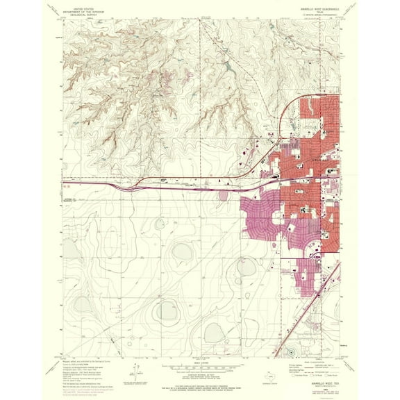 3 optionsAvailable in additional 3 options$4095current price $40.95$40.95/count
Topographical Map - Amarillo Texas West Quad - USGS 1960 - 23 x 29.11 - Vintage Wall Art
Historic Map - Salamis Island Greece - Oxford 1828 - 31.01 x 23 - Vintage Wall Art $40.95
 3 optionsAvailable in additional 3 options$4095current price $40.95
Historic Map - Salamis Island Greece - Oxford 1828 - 31.01 x 23 - Vintage Wall Art
Historic Map - Italy Central - Oxford 1828 - 33.10 x 23 - Vintage Wall Art $40.95 $40.95/count
 $4095current price $40.95$40.95/count
Historic Map - Italy Central - Oxford 1828 - 33.10 x 23 - Vintage Wall Art
Topographical Map - Abilene Texas West Quad - USGS 1957 - 23 x 28.66 - Vintage Wall Art $40.95 $40.95/count
 $4095current price $40.95$40.95/count
Topographical Map - Abilene Texas West Quad - USGS 1957 - 23 x 28.66 - Vintage Wall Art
Topographical Map - Tallahassee Florida Quad - USGS 1954 - 33.98 x 23 - Vintage Wall Art $40.95 $40.95/count
 $4095current price $40.95$40.95/count
Topographical Map - Tallahassee Florida Quad - USGS 1954 - 33.98 x 23 - Vintage Wall Art
Historic Map - Europe Ancient - D'Anville 1799 - 23 x 28.37 - Vintage Wall Art $40.95 $40.95/count
 $4095current price $40.95$40.95/count
Historic Map - Europe Ancient - D'Anville 1799 - 23 x 28.37 - Vintage Wall Art
Historic City Map - Paris Northern Illinois - Ogle 1910 - 40.56 x 23 - Vintage Wall Art $40.95 $40.95/count
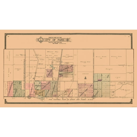 3 optionsAvailable in additional 3 options$4095current price $40.95$40.95/count
Historic City Map - Paris Northern Illinois - Ogle 1910 - 40.56 x 23 - Vintage Wall Art
About this item
Product details
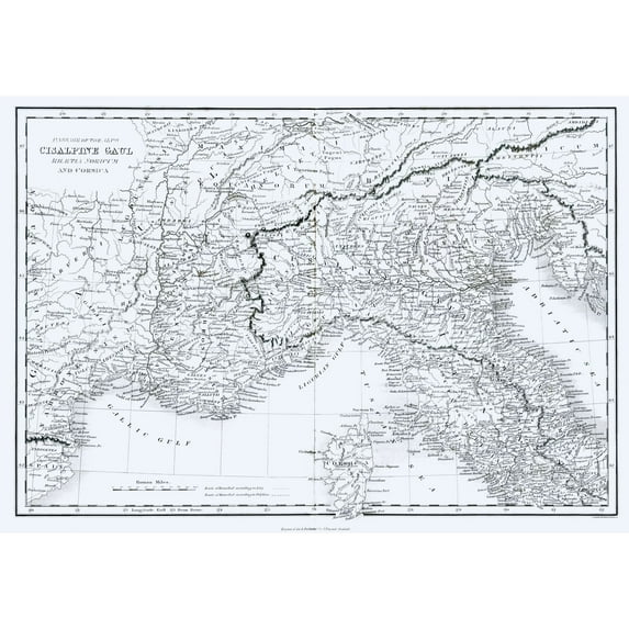
Old International Maps - Cisalpine Gaul - Rhaetia Noricum - Corsica - Oxford 1828 - This is an exquisite full-color Reproduction printed on high-quality gloss paper, art paper or canvas.
Print Size: 23.00 x 33.10 inches
58.42 X 84.07cm
The following towns are featured: Cabillonum, Paulini, Batiana, Maletum, Virunum, Anesica, Port of Venice, Cortona, Florentia, Bercetum, Dinia.
This Map is Situated in: Cisalpine Gaul, Rhaetia Noricum, Corsica.
SKU: ITIT0066
Original Maps are often difficult to find and usually have fold lines, identifying stamps or markings, tears, ragged edges, and assorted other natural signs of age that detract from their beauty. All of our maps have been professionally restored to depict their original beauty, while keeping all historical data intact.
These maps are fabulous pieces of history full of information useful to Historians, Genealogists, Cartographers, Relic Hunters, & Others. They make fascinating conversation pieces and splendid works of art for the home or office.
- OWN A PIECE OF YOUR HOME COUNTRY - Looking for something that reminds you of the country you or your ancestors originate from? Well now you can own a piece of your heritage with a beautiful map of your home country. Maps of the Past has maps for every need!
- INTERNATIONAL MAPS PROVIDE IMPORTANT INFORMATION - International maps not only show you how the different countries, cities, counties, and territories are divided and where the borders can be found, but it also highlights rivers, mountains, and other natural elements of the land. International maps can also show you natural resources and exports of a country.
- ONLY ACCEPT THE BEST PRINT QUALITY FOR YOUR REPRODUCTIONS - There are many printers and print types available on the market, when purchasing a reproduction there is no finer quality reproduction than a reproduction using the Giclee Printing method. Giclee describes the technique or style of printing used, and it is revered as the highest quality printing because of the way it precisely sprays ink onto a surface. Trust nothing less than the best!
- GUARNANTEED TO GET EXACTLY WHAT YOU ORDERED - This map comes exactly to the specification of 23.00 x 33.10 inches/58.42 X 84.07 cm. All of our maps come rolled, wrapped, and shipped in a heavy gauge mailing tube to ensure it arrives intact.
- WHY CHOOSE MAPS OF THE PAST? - Maps of the Past is one of the single largest producers of different types of maps. They legally own the rights to the maps they sell, and provide them to you in clean, clear, and vibrant print. If you are looking for a high quality map print, then look no further than Maps of the Past!
info:
We aim to show you accurate product information. Manufacturers, suppliers and others provide what you see here, and we have not verified it.
Specifications
Color
1
Size
23.00 x 33.10
Material
Matte Canvas
Decor style
Vintage
Customer ratings & reviews
0 ratings|0 reviews
This item does not have any reviews yet
