
1896 Map of Louisiana - Vintage Map of Louisiana Wall Art - Old Louisiana Wall Map Indexed Showing Cities Towns and Railroads - Louisiana Wall Decor
Key item features
- Size: 18 x 24 Inch
- Museum-quality giclee print
- Printed using archival ink on premium heavyweight acid-free matte paper
- Shipped in a sturdy cardboard tube
- Makes a perfect gift
Specs
 Size18" x 24"
 BrandHISTORIX
 MaterialPaper
- Free shipping
 Free 30-day returns
How do you want your item?
About this item
Product details
Feature Points
- VINTAGE MAP REPRODUCTION: You’ll love this high quality historic reproduction of 1896 Map of Louisiana. Our museum quality maps are archival grade, which means it will look great and last without fading for over 100 years. Our print to order maps are made in the USA and each map is inspected for quality. This beautiful artwork is a perfect addition to your themed decor. Vintage maps look great in the home, study or office. They make a perfect gift as well.
- MUSEUM QUALITY: This high quality map print will be a great addition to your vintage-themed wall. Don't waste money on cheap-looking, thin paper posters. We use thick, fine art print quality matte paper. Our professional’s choice matte paper displays artwork in high detail without glare. The color is vibrant and text is easy to read. When framed, this map looks absolutely stunning.
- A LOOK BACK AT HISTORY: This is an impressive, historic reproduction of 1896 Map of Louisiana. This print is from an original found in the maps and geography division of the US Library of Congress. A true piece of history. See our product description section for more fascinating information about this historic map and its significance.
- READY TO FRAME: This print includes a 0.2 inch border for a perfect frame fit and look. Our maps are designed to fit easy-to-find standard frame sizes, saving you money from having to pay for a custom frame. Each map is inspected for quality and shipped in a rigid tube.
- HISTORIX: We love history and art. Sometimes old maps have tears, folds, separations and other blemishes. We digitally restore and enhance maps while keeping its historical character. All our maps are proudly made in the USA. Customers all over the world love our vintage maps and we know you will too.
Additional Information
Produced by the prolific mapmaker Rand Mcnally, this railroad and transportation map of Louisiana in 1895 depicts the state in a time of great transition as reconstruction and the turn of the century approached. The Mississippi River had long been a crucial trade route for getting goods into the midwest. The main entry at New Orleans had kept the iconic American city thriving, and the 1890s were no different. People from across the globe came through the city, and its French roots mixed with local Creole culture had developed into a distinct melting pot found nowhere else.
During the Civil War, the capture of the Mississippi by Union forces marked a turning point in the war, and Union victory became apparent due to the significant importance of the river to Confederate forces. The late 20th century saw significant advances in shipbuilding, and the proliferation of locks, levees, and dams along the river started. Much of this engineering occurred to keep the river from shifting into the Atchafalaya River, thus bypassing New Orleans.
The acquisition of Louisiana, as negotiated in 1803, included a vast amount of North American territory. France was engaged in multiple conflicts and needed capital to finance these clashes, allowing the new nation to acquire 828,000 sq mi of land for fifteen million dollars. The purchase would become a pivotal part of the American notion of Manifest Destiny and redefine the geography and geopolitical landscape of America. This map is truly an authentic piece of cartographical history.
Our museum quality giclee print comes printed with archival ink on premium heavyweight matte paper. Shipped in a sturdy cardboard tube your print will arrive ready to be framed. This eye-catching vintage map print makes the perfect gift for anyone that loves history and imagery.
- Size: 18 x 24 Inch
- Museum-quality giclee print
- Printed using archival ink on premium heavyweight acid-free matte paper
- Shipped in a sturdy cardboard tube
- Makes a perfect gift
Specifications
Size
Brand
Material
Warranty
Warranty information
Similar items you might like
Based on what customers bought
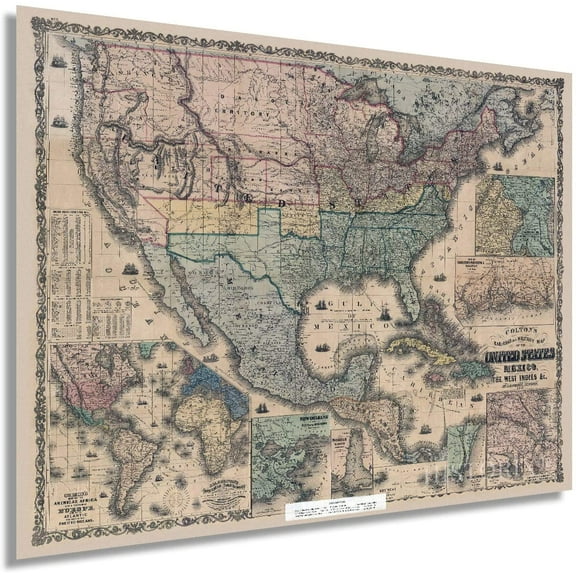
HISTORIX 1862 United States Railroad and Military Map Vintage Poster Wall Art Print, 18 x 24 Inch $42.99
 2 optionsAvailable in additional 2 options$4299current price $42.99Options from $42.99 – $64.99
HISTORIX 1862 United States Railroad and Military Map Vintage Poster Wall Art Print, 18 x 24 Inch
Shipping, arrives in 3+ days1856 United States Political Map - Pre Civil War Map Displaying Free and Slave States and Territory Open to Slavery or Freedom with Statistics - US History Map $39.99
 2 optionsAvailable in additional 2 options$3999current price $39.99Options from $39.99 – $54.99
1856 United States Political Map - Pre Civil War Map Displaying Free and Slave States and Territory Open to Slavery or Freedom with Statistics - US History Map
Shipping, arrives in 3+ daysBest Paved Roads in New Mexico and Arizona G1 Series Map Bundle $39.95
 $3995current price $39.95+$6.99 shipping
Best Paved Roads in New Mexico and Arizona G1 Series Map Bundle
Shipping, arrives in 3+ days1862 Military Map of the United States - Vintage Map of the United States - American Civil War Map showing forts and fortifications - US Civil War Map $39.99
 2 optionsAvailable in additional 2 options$3999current price $39.99Options from $39.99 – $59.99
1862 Military Map of the United States - Vintage Map of the United States - American Civil War Map showing forts and fortifications - US Civil War Map
Shipping, arrives in 3+ daysHISTORIX Vintage 1952 Puerto Rico Map Poster - Vintage Wall Map of Puerto Rico E Islas Limitrofes - Old Puerto Rico Map Wall Art Print $37.99
 2 optionsAvailable in additional 2 options$3799current price $37.99Options from $37.99 – $59.99
HISTORIX Vintage 1952 Puerto Rico Map Poster - Vintage Wall Map of Puerto Rico E Islas Limitrofes - Old Puerto Rico Map Wall Art Print
Shipping, arrives in 3+ daysHISTORIX Vintage 1963 South Africa Map Print - Vintage Map of South Africa Wall Art - Old Map of The Republic of South Africa Poster $39.99
 2 optionsAvailable in additional 2 options$3999current price $39.99Options from $39.99 – $54.99
HISTORIX Vintage 1963 South Africa Map Print - Vintage Map of South Africa Wall Art - Old Map of The Republic of South Africa Poster
Shipping, arrives in 3+ daysTopographical Map - Ashland Texas Quad - USGS 1962 - 23 x 28.79 - Vintage Wall Art $40.95
 3 optionsAvailable in additional 3 options$4095current price $40.95Options from $40.95 – $45.95
Topographical Map - Ashland Texas Quad - USGS 1962 - 23 x 28.79 - Vintage Wall Art
Shipping, arrives in 3+ daysColorado State Hand-Drawn Map Poster 24x18", Vintage-Style Wall Art, Lithographic Print with Soy-Based Inks, Gift for History Buffs, Travelers, Teachers, Made in USA $37.26
 $3726current price $37.26
Colorado State Hand-Drawn Map Poster 24x18", Vintage-Style Wall Art, Lithographic Print with Soy-Based Inks, Gift for History Buffs, Travelers, Teachers, Made in USA
Shipping, arrives in 3+ daysTopographical Map - Marse Wyoming Quad - USGS 1967 - 23 x 31.50 - Vintage Wall Art $40.95
 3 optionsAvailable in additional 3 options$4095current price $40.95Options from $40.95 – $45.95
Topographical Map - Marse Wyoming Quad - USGS 1967 - 23 x 31.50 - Vintage Wall Art
Shipping, arrives in 3+ daysTopographical Map - White City Florida Quad- USGS 1943 - 23 x 27.04 - Vintage Wall Art $40.95
 3 optionsAvailable in additional 3 options$4095current price $40.95Options from $40.95 – $45.95
Topographical Map - White City Florida Quad- USGS 1943 - 23 x 27.04 - Vintage Wall Art
Shipping, arrives in 3+ daysTopographical Map - Pathfinder Reservoir Wyoming Quad - USGS 1951 - 23 x 31.67 - Vintage Wall Art $40.95
 3 optionsAvailable in additional 3 options$4095current price $40.95Options from $40.95 – $45.95
Topographical Map - Pathfinder Reservoir Wyoming Quad - USGS 1951 - 23 x 31.67 - Vintage Wall Art
Shipping, arrives in 3+ daysHistorical Civil War Map - Beaufort South Carolina - Schelten 1861 - 34.81 x 23 - Vintage Wall Art $40.95
 3 optionsAvailable in additional 3 options$4095current price $40.95Options from $40.95 – $45.95
Historical Civil War Map - Beaufort South Carolina - Schelten 1861 - 34.81 x 23 - Vintage Wall Art
Shipping, arrives in 3+ daysXplorer Maps MAP_UT Utah State Hand-Drawn Map $37.26
 $3726current price $37.26
Xplorer Maps MAP_UT Utah State Hand-Drawn Map
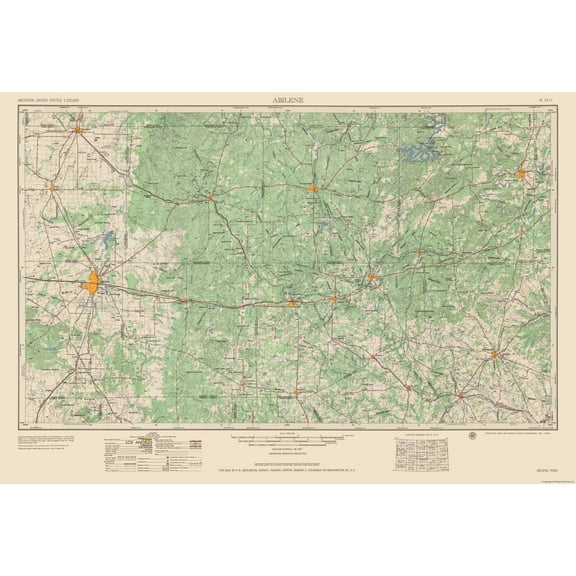
Shipping, arrives in 3+ daysTopographical Map - Abilene Texas Quad - USGS 1954 - 33.79 x 23 - Vintage Wall Art $40.95
 3 optionsAvailable in additional 3 options$4095current price $40.95Options from $40.95 – $45.95
Topographical Map - Abilene Texas Quad - USGS 1954 - 33.79 x 23 - Vintage Wall Art
Shipping, arrives in 3+ daysXplorer Maps Pennsylvania State Hand-Drawn Map Poster - Authentic 24x18 Inch Vintage-Style Wall Art - Lithographic Print with Soy-Based Inks - Made In USA - Neutral Colors $32.99
 $3299current price $32.99
Xplorer Maps Pennsylvania State Hand-Drawn Map Poster - Authentic 24x18 Inch Vintage-Style Wall Art - Lithographic Print with Soy-Based Inks - Made In USA - Neutral Colors
Shipping, arrives in 3+ daysCalifornia State Hand-Drawn Map Poster 18x24", Vintage-Style Wall Art, Lithographic Print with Soy-Based Inks, Gift for History Buffs, Travelers, Teachers, Made in USA $32.99 Was $37.26
 Now$3299current price Now $32.99, Was $37.26$37.26You save $4.27You save$4.27
California State Hand-Drawn Map Poster 18x24", Vintage-Style Wall Art, Lithographic Print with Soy-Based Inks, Gift for History Buffs, Travelers, Teachers, Made in USA
Shipping, arrives in 3+ daysXplorer Maps New Hampshire State Hand-Drawn Map Poster - Authentic 18x24 Inch Vintage-Style Wall Art - Lithographic Print with Soy-Based Inks - Made In USA $32.99
 $3299current price $32.99
Xplorer Maps New Hampshire State Hand-Drawn Map Poster - Authentic 18x24 Inch Vintage-Style Wall Art - Lithographic Print with Soy-Based Inks - Made In USA
Shipping, arrives in 3+ daysClearance Hovmgk 2025 USA Color Map Art Print Poster, Vintage Updated USA Map with Mount McKinley, Geographical Wall Art for Home & Office, Educational Map for Geography Lovers & Collectors $9.64 Was $10.87
Clearance
 Now$964current price Now $9.64, Was $10.87$10.87+$1.99 shippingYou save $1.23You save$1.23
Hovmgk 2025 USA Color Map Art Print Poster, Vintage Updated USA Map with Mount McKinley, Geographical Wall Art for Home & Office, Educational Map for Geography Lovers & Collectors
Shipping, arrives in 3+ days1856 Kentucky and Tennessee $35.00
 5 optionsAvailable in additional 5 options$3500current price $35.00Options from $35.00 – $100.00
1856 Kentucky and Tennessee
Shipping, arrives in 3+ daysHistoric State Map - Vermont - Carey 1795 - 23 x 27.81 - Vintage Wall Art $40.95
 3 optionsAvailable in additional 3 options$4095current price $40.95Options from $40.95 – $45.95
Historic State Map - Vermont - Carey 1795 - 23 x 27.81 - Vintage Wall Art
Shipping, arrives in 3+ days
Popular items in this category
Best selling items that customers love
Michelin Streetwise Maps Streetwise New Orleans Map- Laminated City Center Street Map of New Orleans, Louisiana, (Paperback) $12.18
 $1218current price $12.18
Michelin Streetwise Maps Streetwise New Orleans Map- Laminated City Center Street Map of New Orleans, Louisiana, (Paperback)
15 out of 5 Stars. 1 reviewsShipping, arrives in 3+ days1886 Columbus Georgia Map - Vintage Columbus Georgia Map - Old Map of Columbus GA - Bird's Eye View History Map of Muscogee County Columbus GA Wall Art Poster $59.99
 2 optionsAvailable in additional 2 options$5999current price $59.99More options from $39.99
1886 Columbus Georgia Map - Vintage Columbus Georgia Map - Old Map of Columbus GA - Bird's Eye View History Map of Muscogee County Columbus GA Wall Art Poster
Shipping, arrives in 3+ daysGeoJango USA Wall Map Poster - Black & White (24x16 Inches) $39.00
 3 optionsAvailable in additional 3 options$3900current price $39.00Options from $39.00 – $59.00
GeoJango USA Wall Map Poster - Black & White (24x16 Inches)
15 out of 5 Stars. 1 reviewsShipping, arrives in 3+ daysCruisin' the Fossil Freeway Map: The Ultimate Prehistoric Road Map to the Best of the American West (Other) $18.28
 $1828current price $18.28
Cruisin' the Fossil Freeway Map: The Ultimate Prehistoric Road Map to the Best of the American West (Other)
Shipping, arrives in 3+ daysBest seller RMC Signature United States USA and World Wall Map Set - Laminated $29.90
Best seller 2 optionsAvailable in additional 2 options$2990current price $29.90
RMC Signature United States USA and World Wall Map Set - Laminated
294.6 out of 5 Stars. 29 reviewsSave with Shipping, arrives in 2 days
GeoJango United States Wall Map Poster - Lite Terrain (24x16 Inches) $39.00
 3 optionsAvailable in additional 3 options$3900current price $39.00Options from $39.00 – $59.00
GeoJango United States Wall Map Poster - Lite Terrain (24x16 Inches)
Shipping, arrives in 3+ daysI LOVE BATON ROUGE LOUISIANA Street Sign la city state us wall road décor gift $21.99
 4 optionsAvailable in additional 4 options$2199current price $21.99More options from $10.99
I LOVE BATON ROUGE LOUISIANA Street Sign la city state us wall road décor gift
Shipping, arrives in 3+ daysBest seller America's Natural Wonders National Parks Quarters Collection Map $5.99 Was $11.99
Best seller Now$599current price Now $5.99, Was $11.99$11.99+$6.24 shippingYou save $6.00You save$6.00
America's Natural Wonders National Parks Quarters Collection Map
244.8 out of 5 Stars. 24 reviewsShipping, arrives in 3+ daysNational geographic adventure map: united states, southeast - folded map: 9781566957205 $13.34
 $1334current price $13.34
National geographic adventure map: united states, southeast - folded map: 9781566957205
Save withShipping, arrives in 3+ days2006 Latin America Map Poster - Central and South America Map - Latin American Poster - South America Map Poster - South America Wall Map $39.99
 2 optionsAvailable in additional 2 options$3999current price $39.99Options from $39.99 – $54.99
2006 Latin America Map Poster - Central and South America Map - Latin American Poster - South America Map Poster - South America Wall Map
Shipping, arrives in 3+ daysBest Paved Roads in Southern California - Southern California G1 Series Map $21.95
 $2195current price $21.95+$4.99 shipping
Best Paved Roads in Southern California - Southern California G1 Series Map
Shipping, arrives in 3+ daysC-MAP Reveal US Lakes South East $169.99
 $16999current price $169.99
C-MAP Reveal US Lakes South East
Shipping, arrives in 3+ daysNational geographic adventure map: united states, rocky mountains - folded map: 9781566957144 $14.95
$1495current price $14.95National geographic adventure map: united states, rocky mountains - folded map: 9781566957144
Save withShipping, arrives in 3+ daysGeoJango USA Map Poster With Travel Destinations - Gold (24x16 Inches) $39.00
 3 optionsAvailable in additional 3 options$3900current price $39.00Options from $39.00 – $59.00
GeoJango USA Map Poster With Travel Destinations - Gold (24x16 Inches)
Shipping, arrives in 3+ daysColorfullWorlds Cork World Map Push Pin Travel Map Wall Art Decor Educational Office and Home Decor (Black, Medium) $116.90
 $11690current price $116.90
ColorfullWorlds Cork World Map Push Pin Travel Map Wall Art Decor Educational Office and Home Decor (Black, Medium)
Shipping, arrives in 3+ daysCity scratch-off map: washington, d.c.: a sightseeing scavenger hunt: 9781452149974 $15.03
 $1503current price $15.03
City scratch-off map: washington, d.c.: a sightseeing scavenger hunt: 9781452149974
Shipping, arrives in 3+ daysNational Geographic Destination City Map Paris Map, (Paperback) $9.25
 $925current price $9.25
National Geographic Destination City Map Paris Map, (Paperback)
15 out of 5 Stars. 1 reviewsSave withShipping, arrives in 2 daysDiscover North America Lakes US Canada $129.00
 $12900current price $129.00
Discover North America Lakes US Canada
Shipping, arrives in 3+ daysNational geographic adventure map: united states, southwest - folded map: 9781566957151 $13.93
 $1393current price $13.93
National geographic adventure map: united states, southwest - folded map: 9781566957151
Save withShipping, arrives in 3+ daysLandmass - Scratch Off Map Of The United States - USA Poster - US National Parks - State Capitals - America Print - Travel Wall Art - Decor - Gifts for Travelers - Unique Gift Ideas $23.99
 $2399current price $23.99
Landmass - Scratch Off Map Of The United States - USA Poster - US National Parks - State Capitals - America Print - Travel Wall Art - Decor - Gifts for Travelers - Unique Gift Ideas
64.3 out of 5 Stars. 6 reviewsShipping, arrives in 3+ days
Customer ratings & reviews

Related pages
- Mississippi Maps Decor
- Framed Colorado Map
- Kansas City Map Art
- Oregon Map Decor
- Framed Map Florida
- Austin Map Print
- National Parks Posters
- Central America Travel Books, Maps & Guides
- South America Travel Books, Maps & Guides
- General South America Travel Books, Maps & Guides
- Northeast United States Travel Books, Maps & Guides
- Midwest United States Travel Books, Maps & Guides