
Hero image 0 of Historic City Map - Frankton Elwood Pendleton Anderson Indiana - Baskin 1876 - 23 x 29.10 - Vintage Wall Art, 0 of 5
Historic City Map - Frankton Elwood Pendleton Anderson Indiana - Baskin 1876 - 23 x 29.10 - Vintage Wall Art
(No ratings yet)
Historic City Map - Frankton Elwood Pendleton Anderson Indiana - Baskin 1876 - 23 x 29.10 - Vintage Wall ArtHistoric City Map Frankton Elwood Pendleton Anderson Indiana Baskin 1876 23 x 29 10 Vintage Wall ArtHistoric City Map Frankton Elwood Pendleton Anderson Indiana Baskin 1876 23 x 29 10 Vintage Wall Art
Material:Glossy Satin Photo Quality
Current price is USD$40.95
Price when purchased online
- Free shipping
- Free 30-day returns
How do you want your item?
Columbus, 43215
Arrives between Feb 23 - Feb 25
|Sold and shipped by Maps of the Past
4.3 stars out of 5, based on 10 seller reviews(4.3)
Free 30-day returns
| Product | Viewing this item |
|---|
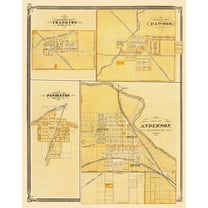

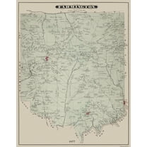
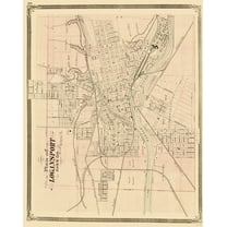


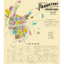
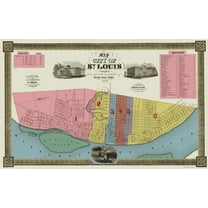

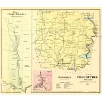
| Size | 23.00 x 29.10Historic City Map - Frankton Elwood Pendleton Anderson Indiana - Baskin 1876 - 23 x 29.10 - Vintage Wall Art | 28.31 x 23Historic County Map - Blackford County Indiana - Andreas 1876 - 28.31 x 23 - Vintage Wall Art | 23 x 29.5Historic City Map - Farmington Pennsylvania - Caldwell 1877 - 23 x 29.5 - Vintage Wall Art | 23.00 x 28.99Historic City Map - Logansport Indiana - Baskin 1876 - 23 x 28.99 - Vintage Wall Art | 28.88 x 23Historic City Map - Waseca Wilton East Janesville Minnesota - Andreas 1874 - 28.88 x 23 - Vintage Wall Art | 23.00 x 34.85Historic State Map - Arizona - Rand McNally 1879 - 23 x 34.85 - Vintage Wall Art | 23 x 26.13Historic City Map - Frankfort Kentucky - Sanborn 1907 - 23 x 26.13 - Vintage Wall Art | 23.00 x 36.78Historic City Map - St Louis Missouri - Twichel 1844 - 23 x 3678 - Vintage Wall Art | 23.00 x 30.51Historic City Map - Denver Colorado - Thayer 1879 - 23 x 30.51 - Vintage Wall Art | 26.63 x 23Historic City Map - Cherry Tree Pennsylvania - Beers 1865 - 26.63 x 23 - Vintage Wall Art |
|---|---|---|---|---|---|---|---|---|---|---|
| Material | Glossy Satin Photo QualityHistoric City Map - Frankton Elwood Pendleton Anderson Indiana - Baskin 1876 - 23 x 29.10 - Vintage Wall Art | Glossy Satin Photo QualityHistoric County Map - Blackford County Indiana - Andreas 1876 - 28.31 x 23 - Vintage Wall Art | Glossy Satin Photo QualityHistoric City Map - Farmington Pennsylvania - Caldwell 1877 - 23 x 29.5 - Vintage Wall Art | Glossy Satin Photo QualityHistoric City Map - Logansport Indiana - Baskin 1876 - 23 x 28.99 - Vintage Wall Art | Glossy Satin Photo QualityHistoric City Map - Waseca Wilton East Janesville Minnesota - Andreas 1874 - 28.88 x 23 - Vintage Wall Art | Glossy Satin Photo QualityHistoric State Map - Arizona - Rand McNally 1879 - 23 x 34.85 - Vintage Wall Art | Glossy Satin Photo QualityHistoric City Map - Frankfort Kentucky - Sanborn 1907 - 23 x 26.13 - Vintage Wall Art | Glossy Satin Photo QualityHistoric City Map - St Louis Missouri - Twichel 1844 - 23 x 3678 - Vintage Wall Art | Glossy Satin Photo QualityHistoric City Map - Denver Colorado - Thayer 1879 - 23 x 30.51 - Vintage Wall Art | Glossy Satin Photo QualityHistoric City Map - Cherry Tree Pennsylvania - Beers 1865 - 26.63 x 23 - Vintage Wall Art |
| Theme | Historical City MapsHistoric City Map - Frankton Elwood Pendleton Anderson Indiana - Baskin 1876 - 23 x 29.10 - Vintage Wall Art | Historical County MapsHistoric County Map - Blackford County Indiana - Andreas 1876 - 28.31 x 23 - Vintage Wall Art | Historical City MapsHistoric City Map - Farmington Pennsylvania - Caldwell 1877 - 23 x 29.5 - Vintage Wall Art | Historical City MapsHistoric City Map - Logansport Indiana - Baskin 1876 - 23 x 28.99 - Vintage Wall Art | Historical City MapsHistoric City Map - Waseca Wilton East Janesville Minnesota - Andreas 1874 - 28.88 x 23 - Vintage Wall Art | Old State MapsHistoric State Map - Arizona - Rand McNally 1879 - 23 x 34.85 - Vintage Wall Art | Historical City MapsHistoric City Map - Frankfort Kentucky - Sanborn 1907 - 23 x 26.13 - Vintage Wall Art | Historical City MapsHistoric City Map - St Louis Missouri - Twichel 1844 - 23 x 3678 - Vintage Wall Art | Historical City MapsHistoric City Map - Denver Colorado - Thayer 1879 - 23 x 30.51 - Vintage Wall Art | Historical City MapsHistoric City Map - Cherry Tree Pennsylvania - Beers 1865 - 26.63 x 23 - Vintage Wall Art |
| Framed | NHistoric City Map - Frankton Elwood Pendleton Anderson Indiana - Baskin 1876 - 23 x 29.10 - Vintage Wall Art | NHistoric County Map - Blackford County Indiana - Andreas 1876 - 28.31 x 23 - Vintage Wall Art | -Historic City Map - Farmington Pennsylvania - Caldwell 1877 - 23 x 29.5 - Vintage Wall Art | NHistoric City Map - Logansport Indiana - Baskin 1876 - 23 x 28.99 - Vintage Wall Art | NHistoric City Map - Waseca Wilton East Janesville Minnesota - Andreas 1874 - 28.88 x 23 - Vintage Wall Art | -Historic State Map - Arizona - Rand McNally 1879 - 23 x 34.85 - Vintage Wall Art | NHistoric City Map - Frankfort Kentucky - Sanborn 1907 - 23 x 26.13 - Vintage Wall Art | NHistoric City Map - St Louis Missouri - Twichel 1844 - 23 x 3678 - Vintage Wall Art | NHistoric City Map - Denver Colorado - Thayer 1879 - 23 x 30.51 - Vintage Wall Art | -Historic City Map - Cherry Tree Pennsylvania - Beers 1865 - 26.63 x 23 - Vintage Wall Art |
Now hiding additional rows in the Table
About this item


Customer ratings & reviews
0 ratings|0 reviews
This item does not have any reviews yet

Related pages
- Cincinnati Landmarks
- Aerial America South Dakota
- Northampton County Pa Map
- Council Bluffs Iowa Map
- Fort Worth Map
- Huntsville Alabama Map
- National Parks Posters
- Central America Travel Books, Maps & Guides
- Western United States Travel Books, Maps & Guides
- Ontario Travel Books, Maps & Guides
- General South America Travel Books, Maps & Guides
- Midwest United States Travel Books, Maps & Guides