
Hero image 0 of Historic State Map - Alaska Southern Portion No 6 - Vancouver 1800 - 23 x 27.60 - Vintage Wall Art, 0 of 5
Historic State Map - Alaska Southern Portion No 6 - Vancouver 1800 - 23 x 27.60 - Vintage Wall Art
(No ratings yet)
Historic State Map - Alaska Southern Portion No 6 - Vancouver 1800 - 23 x 27.60 - Vintage Wall ArtHistoric State Map Alaska Southern Portion No 6 Vancouver 1800 23 x 27 60 Vintage Wall ArtHistoric State Map Alaska Southern Portion No 6 Vancouver 1800 23 x 27 60 Vintage Wall ArtHistoric State Map Alaska Southern Portion No 6 Vancouver 1800 23 x 27 60 Vintage Wall Art
Material:Glossy Satin Photo Quality
Key item features
- OWN A STATE MAP TODAY - If you are looking for a map of your state, or another specific state, to frame and hang on your wall, then look no further! Our state maps are also great for school projects. Our maps have a variety of uses, and they come in a variety of styles. We have every state map you could need!
- STATE MAPS PROVIDE IMPORTANT INFORMATION - State maps not only show you how the different counties and/or cities are divided up and where the borders can be found within a state, but it also highlights rivers, mountains, and other natural elements. Some of them may also provide
- ONLY ACCEPT THE BEST PRINT QUALITY FOR YOUR REPRODUCTIONS - There are many printers and print types available on the market, when purchasing a reproduction there is no finer quality reproduction than a reproduction using the Giclee Printing method. Giclee describes the technique or style of printing used, and it is revered as the highest quality printing because of the way it precisely sprays ink onto a surface. Trust nothing less than the best!
- GUARNANTEED TO GET EXACTLY WHAT YOU ORDERED - This map comes exactly to the specification of 23.00 x 27.60 inches/58.42 X 70.10 cm. All of our maps come rolled, wrapped, and shipped in a heavy gauge mailing tube to ensure it arrives intact.
- WHY CHOOSE MAPS OF THE PAST? - Maps of the Past is one of the single largest producers of different types of maps. They legally own the rights to the maps they sell, and provide them to you in clean, clear, and vibrant print. If you are looking for a high quality map print, then look no further than Maps of the Past!
Specs
- Size23.00 x 27.60
- MaterialGlossy Satin Photo Quality
- Decor styleVintage
- ThemeOld State Maps
- ShapeRectangle
- Rec. roomOffice
Current price is USD$36.95$36.95/count
Price when purchased online
- Free shipping
 Free 30-day returns
How do you want your item?
Columbus, 43215
Arrives between Feb 17 - Feb 19
|Sold and shipped by Maps of the Past
4.3 stars out of 5, based on 10 seller reviews(4.3)10 seller reviews
Free 30-day returns
Popular items in this category
Best selling items that customers love
Trademark Fine Art Masters Fine Art USA License Plate Map on Wood Canvas Wall Art - 14x19 $32.95
 4 optionsAvailable in additional 4 options$3295current price $32.95Options from $32.95 – $99.95
Trademark Fine Art Masters Fine Art USA License Plate Map on Wood Canvas Wall Art - 14x19
15 out of 5 Stars. 1 reviewsShipping, arrives in 3+ daysNorth Carolina Map - 11x14 Unframed Art Print - Great Vintage Gift and Decor for History Buffs and Old Map Enthusiasts Under $15 $14.99
 $1499current price $14.99
North Carolina Map - 11x14 Unframed Art Print - Great Vintage Gift and Decor for History Buffs and Old Map Enthusiasts Under $15
Shipping, arrives in 3+ daysNew York Subway Map 1948 Art Print - 11x14 Unframed Art Print - Great Vintage Home Decor $14.99
 $1499current price $14.99
New York Subway Map 1948 Art Print - 11x14 Unframed Art Print - Great Vintage Home Decor
Shipping, arrives in 3+ daysMap of Florida 1855 Art Print - 11x14 Unframed Art Print - Great Vintage Home Decor $14.99
 $1499current price $14.99
Map of Florida 1855 Art Print - 11x14 Unframed Art Print - Great Vintage Home Decor
Shipping, arrives in 3+ daysNorthlight Patriotic “Proud to be an American” Wooden USA Map Wall Art - 15.75” x 12” $18.99
 $1899current price $18.99
Northlight Patriotic “Proud to be an American” Wooden USA Map Wall Art - 15.75” x 12”
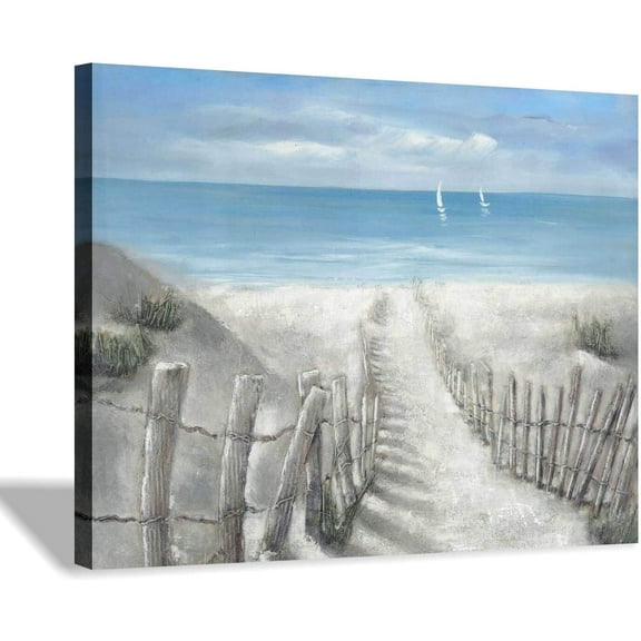
Shipping, arrives in 3+ daysBeach Pathway Canvas Print Artwork: Coastal Ocean Picture Canvas Wall Art Small Size for Bathroom (16x 12x 1 Panel) $19.99

 $1999current price $19.99+$1.00 shipping
Beach Pathway Canvas Print Artwork: Coastal Ocean Picture Canvas Wall Art Small Size for Bathroom (16x 12x 1 Panel)
Shipping, arrives in 3+ daysBoat on the shore of the beach wall art on sunrise time set of 3 12x12inch each panel canvas stretched on wood frame $20.00
 2 optionsAvailable in additional 2 options$2000current price $20.00Options from $20.00 – $45.00
Boat on the shore of the beach wall art on sunrise time set of 3 12x12inch each panel canvas stretched on wood frame
Save with Shipping, arrives in 2 days
1845 Map of Maine Art Print - 11x14 Unframed Art Print - Great Vintage Home Decor $14.99
 $1499current price $14.99
1845 Map of Maine Art Print - 11x14 Unframed Art Print - Great Vintage Home Decor
Shipping, arrives in 3+ daysTrademark Art 'Map of South America, 1700' Canvas Art by Guillaume Delisle $70.79
 4 optionsAvailable in additional 4 options$7079current price $70.79More options from $36.35
Trademark Art 'Map of South America, 1700' Canvas Art by Guillaume Delisle
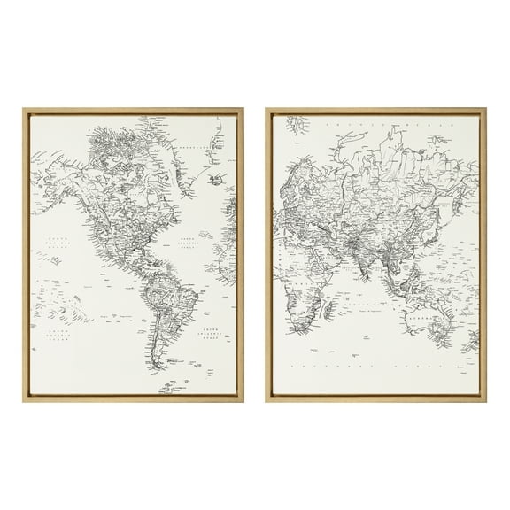
Save withShipping, arrives tomorrowKate and Laurel Sylvie Black and White Modern Retro World Map Framed Canvas Wall Art Set by The Creative Bunch Studio, 2 Piece 18x24 Gold, Vintage Map Art for Wall $84.99
 $8499current price $84.99
Kate and Laurel Sylvie Black and White Modern Retro World Map Framed Canvas Wall Art Set by The Creative Bunch Studio, 2 Piece 18x24 Gold, Vintage Map Art for Wall
25 out of 5 Stars. 2 reviewsSave with1818 Map of Washington DC Art Print - 11x14 Unframed Art Print - Great Vintage Home Decor $14.99
 $1499current price $14.99
1818 Map of Washington DC Art Print - 11x14 Unframed Art Print - Great Vintage Home Decor
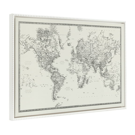
Shipping, arrives in 3+ daysKate and Laurel Sylvie Vintage World Map Framed Canvas Wall Art by Corinna Buchholz of Piddix 23x33 Gray Decorative Map Art for Wall $76.99
 $7699current price $76.99
Kate and Laurel Sylvie Vintage World Map Framed Canvas Wall Art by Corinna Buchholz of Piddix 23x33 Gray Decorative Map Art for Wall
Save withShipping, arrives in 2 daysKate and Laurel Sylvie Beaded Vintage Black and White World Map Vintage Framed Canvas Wall Art by The Creative Bunch Studio, 28x38 White, Modern Geographical Map Decor $109.99
 4 optionsAvailable in additional 4 options$10999current price $109.99More options from $89.99
Kate and Laurel Sylvie Beaded Vintage Black and White World Map Vintage Framed Canvas Wall Art by The Creative Bunch Studio, 28x38 White, Modern Geographical Map Decor
Shipping, arrives in 3+ daysDesignart 'Adirondack Beach Chairs ' Seashore Photo Canvas Art Print $29.87
 4 optionsAvailable in additional 4 options$2987current price $29.87Options from $29.87 – $100.42
Designart 'Adirondack Beach Chairs ' Seashore Photo Canvas Art Print
15 out of 5 Stars. 1 reviewsSave withShipping, arrives in 2 daysTrademark Fine Art Ethan Harper Back Study I Canvas Wall Art - 24x32 $59.95
 4 optionsAvailable in additional 4 options$5995current price $59.95More options from $32.95
Trademark Fine Art Ethan Harper Back Study I Canvas Wall Art - 24x32
Shipping, arrives in 3+ days
About this item
Product details
Old State Map - Alaska Southern Portion No 6 - Vancouver 1800 - This is an exquisite full-color Reproduction printed on high-quality gloss paper, art paper or canvas.
Print Size: 23.00 x 27.60 inches
58.42 X 70.10cm
The following towns are featured: French map detailing the most southern portion of Alaska. Notable features include: Mt. St. Elie, Baie de Beeuing, Port Mulgrave, Mt. Fairweather, Archipel du Roi George III, Detriot de Chatham, Passage de Stephens, Canal de Seymour, Canal de Lynn, Ile de Amiraute, Norfolk Sound, Prince Fredrick Sound, Christian Sound, Cross Sound and exploration routes with dates indicated. On the top part of the map are expanded views of plans for Port Conclusion, Port Protection and Cross Sound.
This Map is Situated in: State of Alaska (AK).
SKU: AKZZ0025
Original Maps are often difficult to find and usually have fold lines, identifying stamps or markings, tears, ragged edges, and assorted other natural signs of age that detract from their beauty. All of our maps have been professionally restored to depict their original beauty, while keeping all historical data intact.
These maps are fabulous pieces of history full of information useful to Historians, Genealogists, Cartographers, Relic Hunters, & Others. They make fascinating conversation pieces and splendid works of art for the home or office.
- OWN A STATE MAP TODAY - If you are looking for a map of your state, or another specific state, to frame and hang on your wall, then look no further! Our state maps are also great for school projects. Our maps have a variety of uses, and they come in a variety of styles. We have every state map you could need!
- STATE MAPS PROVIDE IMPORTANT INFORMATION - State maps not only show you how the different counties and/or cities are divided up and where the borders can be found within a state, but it also highlights rivers, mountains, and other natural elements. Some of them may also provide
- ONLY ACCEPT THE BEST PRINT QUALITY FOR YOUR REPRODUCTIONS - There are many printers and print types available on the market, when purchasing a reproduction there is no finer quality reproduction than a reproduction using the Giclee Printing method. Giclee describes the technique or style of printing used, and it is revered as the highest quality printing because of the way it precisely sprays ink onto a surface. Trust nothing less than the best!
- GUARNANTEED TO GET EXACTLY WHAT YOU ORDERED - This map comes exactly to the specification of 23.00 x 27.60 inches/58.42 X 70.10 cm. All of our maps come rolled, wrapped, and shipped in a heavy gauge mailing tube to ensure it arrives intact.
- WHY CHOOSE MAPS OF THE PAST? - Maps of the Past is one of the single largest producers of different types of maps. They legally own the rights to the maps they sell, and provide them to you in clean, clear, and vibrant print. If you are looking for a high quality map print, then look no further than Maps of the Past!
info:
We aim to show you accurate product information. Manufacturers, suppliers and others provide what you see here, and we have not verified it.
Specifications
Size
23.00 x 27.60
Material
Glossy Satin Photo Quality
Decor style
Vintage
Theme
Old State Maps
Warranty
Warranty information
Please be aware that the warranty terms on items offered for sale by third party Marketplace sellers may differ from those displayed in this section (if any). To confirm warranty terms on an item offered for sale by a third party Marketplace seller, please use the 'Contact seller' feature on the third party Marketplace seller's information page and request the item's warranty terms prior to purchase.
Customer ratings & reviews
0 ratings|0 reviews
This item does not have any reviews yet

Related pages
- Map Bonita Springs Fl
- Fort Collins Co Map
- Harpers Ferry Map
- Southern Calif Map
- Milford Sound Map
- San Francisco Area Code
- National Parks Posters
- Central America Travel Books, Maps & Guides
- Cyprus Travel Books
- Iceland & Greenland Travel Books
- Caribbean & West Indies Travel Books, Maps & Guides
- Greece Travel Books