
1769 Map of Boston Massachusetts - Vintage Map Wall Art - Vintage Boston Map Art Showing Buildings and Streets in 1769 - Boston Map Wall Art - Boston Map Poster
Key item features
- Size: 24 x 36 Inches
- Museum-quality giclee print
- Printed using archival ink on premium heavyweight acid-free matte paper
- Shipped in a sturdy cardboard tube
- Makes a perfect gift
Specs
 Size24" x 36"
 BrandHISTORIX
- Free shipping
 Free 30-day returns
How do you want your item?
About this item
Product details
Feature Points
- VINTAGE MAP REPRODUCTION: You’ll love this high quality historic reproduction of 1769 Map of Boston Massachusetts. Our museum quality maps are archival grade, which means it will look great and last without fading for over 100 years. Our print to order maps are made in the USA and each map is inspected for quality. This beautiful artwork is a perfect addition to your themed decor. Vintage maps look great in the home, study or office. They make a perfect gift as well.
- MUSEUM QUALITY: This high quality map print will be a great addition to your vintage-themed wall. Don't waste money on cheap-looking, thin paper posters. We use thick, fine art print quality matte paper. Our professional’s choice matte paper displays artwork in high detail without glare. The color is vibrant and text is easy to read. When framed, this map looks absolutely stunning.
- A LOOK BACK AT HISTORY: This is an impressive, historic reproduction of 1769 Map of Boston Massachusetts. This print is from an original found in the maps and geography division of the US Library of Congress. A true piece of history. See our product description section for more fascinating information about this historic map and its significance.
- READY TO FRAME: This print includes a 0.2 inch border for a perfect frame fit and look. Our maps are designed to fit easy-to-find standard frame sizes, saving you money from having to pay for a custom frame. Each map is inspected for quality and shipped in a rigid tube.
- HISTORIX: We love history and art. Sometimes old maps have tears, folds, separations and other blemishes. We digitally restore and enhance maps while keeping its historical character. All our maps are proudly made in the USA. Customers all over the world love our vintage maps and we know you will too.
Additional Information
Published in 1769, this map of Boston was produced at a time of great tumult for the iconic American city. Though the Revolutionary war had yet to break out, tensions were high between the colonists and Great Britain. The passage of the Townsend Acts in 1767 had further angered colonists, and Boston was a hotbed for patriot speech and action. Boston’s role in the Revolution was crucial, and this depiction in 1769 paints a unique picture of the city in a time of transition and just one year before the famous Boston Massacre. British troops that had been stationed in the city since 1868 opened fire on a group of pro-independence protestors, and the incident served as fuel for the growing Patriotic movement.
Some of the interesting features of this illustration include the details regarding the dates of significant fires as well as outbreaks of smallpox. It also features landmarks that have been filled and re-purposed like Mill Pond as well as prominent features that remain to this day like Boston Common.
William Price, the producer of this map, owned the rights to this map, which was initially printed in 1726. Price would amend and update the map re-printing for the following forty years. Street names were added or changed, and new buildings were depicted by shading rather than perspective drawing. The details, additions, and cartouche make this map the best visual record of pre-Revolutionary Boston and an authentic piece of both American and cartographical history.
Our museum quality giclee print comes printed with archival ink on premium heavyweight matte paper. Shipped in a sturdy cardboard tube your print will arrive ready to be framed. This eye-catching vintage map print makes the perfect gift for anyone that loves history and imagery.
- Size: 24 x 36 Inches
- Museum-quality giclee print
- Printed using archival ink on premium heavyweight acid-free matte paper
- Shipped in a sturdy cardboard tube
- Makes a perfect gift
Specifications
Size
Brand
Warranty
Warranty information
Similar items you might like
Vintage 1954 New York City Subway Map Poster Vintage Map Wall Art - NYC Subway Poster $17.51
 2 optionsAvailable in additional 2 options$1751current price $17.51
Vintage 1954 New York City Subway Map Poster Vintage Map Wall Art - NYC Subway Poster
12 out of 5 Stars. 1 reviewsRetro Denver City Poster Vintage U.S. City Tourism Art for Walls Print Poster $20.00
 5 optionsAvailable in additional 5 options$2000current price $20.00
Retro Denver City Poster Vintage U.S. City Tourism Art for Walls Print Poster
Best seller Swiftmaps Laminated RMC Classic Edition World Wall Map Poster, 50" x 32" $19.99
Best seller $1999current price $19.99
Swiftmaps Laminated RMC Classic Edition World Wall Map Poster, 50" x 32"
394.5 out of 5 Stars. 39 reviews1pc, Room Decor Vintage Valentine'S Day Metal Tin Sign, 8x12 Inches, Iron Rectangular Wall Art, Love-Themed Decor for Home, Kitchen, Bathroom - Art Deco Style Poster $11.99
 $1199current price $11.99
1pc, Room Decor Vintage Valentine'S Day Metal Tin Sign, 8x12 Inches, Iron Rectangular Wall Art, Love-Themed Decor for Home, Kitchen, Bathroom - Art Deco Style Poster
Clearance USA Map Poster under $5! CQCYD 2025 USA Color Map Poster, Updated United States Art Print with Gulf and Mountains, 12x18 Inch Vintage Wall Chart, Geography Education Decor $7.19 Was $8.99
Clearance $719current price $7.19, Was $8.99$8.99
USA Map Poster under $5! CQCYD 2025 USA Color Map Poster, Updated United States Art Print with Gulf and Mountains, 12x18 Inch Vintage Wall Chart, Geography Education Decor
15 out of 5 Stars. 1 reviewsHISTORIX Vintage 1869 Kankakee Illinois Map Poster - 18x24 Inch Old Map of Kankakee Illinois Wall Art - Bird's Eye View History Map of Illinois Poster $39.99
 2 optionsAvailable in additional 2 options$3999current price $39.99
HISTORIX Vintage 1869 Kankakee Illinois Map Poster - 18x24 Inch Old Map of Kankakee Illinois Wall Art - Bird's Eye View History Map of Illinois Poster
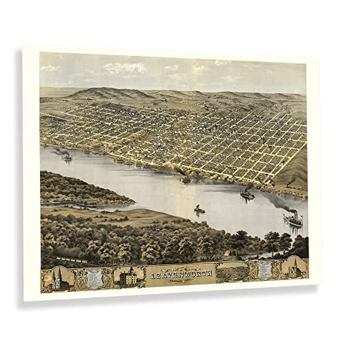
HISTORIX Vintage 1869 Leavenworth Kansas Map Print - 18x24 Inch Vintage Bird's Eye View of Leavenworth City Map of Kansas State Wall Art Poster $39.99
 3 optionsAvailable in additional 3 options$3999current price $39.99
HISTORIX Vintage 1869 Leavenworth Kansas Map Print - 18x24 Inch Vintage Bird's Eye View of Leavenworth City Map of Kansas State Wall Art Poster
HISTORIX Vintage 1652 North America Map Poster - Old Map Print of America Septentrionalis - Vintage Map of North America Wall Art Print $39.99
 2 optionsAvailable in additional 2 options$3999current price $39.99
HISTORIX Vintage 1652 North America Map Poster - Old Map Print of America Septentrionalis - Vintage Map of North America Wall Art Print
HISTORIX 1881 Troy New York Map Vintage Poster Wall Art Print, 18 x 24 Inch $39.99
 2 optionsAvailable in additional 2 options$3999current price $39.99
HISTORIX 1881 Troy New York Map Vintage Poster Wall Art Print, 18 x 24 Inch
SSZMDLB under $5 USA Map Poster, 2025 USA Color Map, Vintage Style Art Print Poster, Updated Geography Chart with Mount McKinley, 12x18 Inch Wall Decor Educational Display $9.99
 $999current price $9.99
SSZMDLB under $5 USA Map Poster, 2025 USA Color Map, Vintage Style Art Print Poster, Updated Geography Chart with Mount McKinley, 12x18 Inch Wall Decor Educational Display
HISTORIX 1776 Map of Southern British Colonies in America Vintage Poster Wall Art Print, 18 x 24 Inch $39.99
 2 optionsAvailable in additional 2 options$3999current price $39.99
HISTORIX 1776 Map of Southern British Colonies in America Vintage Poster Wall Art Print, 18 x 24 Inch
HISTORIX Vintage 1912 Palestine Map Print - Vintage Map of Palestine in the Time of Jesus Christ - Historic Holy Land Map Poster Wall Art $39.99
 2 optionsAvailable in additional 2 options$3999current price $39.99
HISTORIX Vintage 1912 Palestine Map Print - Vintage Map of Palestine in the Time of Jesus Christ - Historic Holy Land Map Poster Wall Art
1856 Florida State Wall Map - Vintage Map Wall Art - Vintage Florida Map Poster Showing Cities, Towns, Roads, Trails and Railroad Lines - Vintage Florida Poster $37.99
 2 optionsAvailable in additional 2 options$3799current price $37.99
1856 Florida State Wall Map - Vintage Map Wall Art - Vintage Florida Map Poster Showing Cities, Towns, Roads, Trails and Railroad Lines - Vintage Florida Poster
HISTORIX Vintage 1941 Underground Railroad Map of the United States - Vintage Underground Railroad Map of United States Wall Art Poster $39.99
 2 optionsAvailable in additional 2 options$3999current price $39.99
HISTORIX Vintage 1941 Underground Railroad Map of the United States - Vintage Underground Railroad Map of United States Wall Art Poster
Vintage London Street Scene Poster European Rainy Day, Reflections On Sidewalk Wall Art, Victorian Storefront Illustration, Unframed Poster Size 8x12 $39.99
 11 optionsAvailable in additional 11 options$3999current price $39.99
Vintage London Street Scene Poster European Rainy Day, Reflections On Sidewalk Wall Art, Victorian Storefront Illustration, Unframed Poster Size 8x12
1886 Map of New York City Poster - NYC Vintage Map Wall Art - Panoramic Birds Eye View of New York City Map Art - New York City Map Print - NYC Vintage Poster $39.99
 2 optionsAvailable in additional 2 options$3999current price $39.99
1886 Map of New York City Poster - NYC Vintage Map Wall Art - Panoramic Birds Eye View of New York City Map Art - New York City Map Print - NYC Vintage Poster
Staron 2025 Color Map of United States Art Print Poster, Updated USA Chart with Gulf and Mount McKinley, 12x18 Inch Vintage Style Wall Decor $9.99
$999current price $9.99Staron 2025 Color Map of United States Art Print Poster, Updated USA Chart with Gulf and Mount McKinley, 12x18 Inch Vintage Style Wall Decor
11 out of 5 Stars. 1 reviewsRainy European Street Wall Art Poster Moody Alley At Night, Dark Academia Vintage Wall Decor, City Lights Reflection, Unframed Poster Size 8x12 $34.99
 11 optionsAvailable in additional 11 options$3499current price $34.99
Rainy European Street Wall Art Poster Moody Alley At Night, Dark Academia Vintage Wall Decor, City Lights Reflection, Unframed Poster Size 8x12
Vintage 1781 Cape Fear River Region Map Vintage Map of Wilmington and Brunswick County North Carolina - New Hanover NC Vintage Map Wall Art - American Revolution Map $16.99
 3 optionsAvailable in additional 3 options$1699current price $16.99
Vintage 1781 Cape Fear River Region Map Vintage Map of Wilmington and Brunswick County North Carolina - New Hanover NC Vintage Map Wall Art - American Revolution Map
1888 Map of Alabama - Vintage Map of Alabama Wall Art - Railroad Map of Alabama History Poster $39.99
 2 optionsAvailable in additional 2 options$3999current price $39.99
1888 Map of Alabama - Vintage Map of Alabama Wall Art - Railroad Map of Alabama History Poster
Customer ratings & reviews

Related pages
- Interstate Highways Map
- Gatlinburg Map
- Alabama County Map Roads
- Map Illinois Highways
- State Park Map
- Colorado Gold Map
- National Parks Posters
- Central America Travel Books, Maps & Guides
- Midwest United States Travel Books, Maps & Guides
- Southern United States Travel Books, Maps & Guides
- General United States Travel Books, Maps & Guides
- Northeast United States Travel Books, Maps & Guides