
Hero image 0 of Historic Nautical Map - Atlantic Ocean Islands - Cram 1892 - Vintage Wall Art, 0 of 4
Historic Nautical Map - Atlantic Ocean Islands - Cram 1892 - Vintage Wall Art
(No ratings yet)
Historic Nautical Map - Atlantic Ocean Islands - Cram 1892 - Vintage Wall ArtAtlantic Ocean Islands Cram 1892 23 00 x 27 50 Matte Art PaperHistoric Nautical Map Atlantic Ocean Islands Cram 1892 Vintage Wall ArtHistoric Nautical Map Atlantic Ocean Islands Cram 1892 Vintage Wall ArtAtlantic Ocean Islands Cram 1892 23 00 x 27 50 Glossy Satin Paper
Material:Matte Art
Size:23.00 x 27.50
Key item features
- CHECK OUT OUR BEAUTIFUL NAUTICAL MAPS - Water covers three quarters of the planet and waterways are vital for getting goods from one part of the globe to another. Nautical maps show you exactly what routes are most commonly used between various ports and how those goods are moved.
- NAUTICAL MAPS MAKE GREAT WALL ART - Are you looking for something new to add to a beach house? Are you a boating enthusiast who collects nautical memorabilia? Nautical maps are a wonderful compliment to any room.
- ONLY ACCEPT THE BEST PRINT QUALITY FOR YOUR REPRODUCTIONS - There are many printers and print types available on the market, when purchasing a reproduction there is no finer quality reproduction than a reproduction using the Giclee Printing method. Giclee describes the technique or style of printing used, and it is revered as the highest quality printing because of the way it precisely sprays ink onto a surface. Trust nothing less than the best!
- GUARANTEED TO GET EXACTLY WHAT YOU ORDERED - All of our maps come rolled, wrapped, and shipped in a heavy gauge mailing tube to ensure it arrives intact.
- WHY CHOOSE MAPS OF THE PAST? - Maps of the Past is one of the single largest producers of different types of maps. They legally own the rights to the maps they sell, and provide them to you in clean, clear, and vibrant print. If you are looking for a high quality map print, then look no further than Maps of the Past!
Specs
- ColorMulticolor
- Decor styleIndustrial
- FramedN
- ShapeRectangle
- Art typePhotography
- Rec. roomOffice
Current price is USD$45.95
Price when purchased online
- Free shipping
 Free 30-day returns
How do you want your item?
Columbus, 43215
Arrives between Apr 27 - Apr 29
|Sold and shipped by Maps of the Past
4.363636363636363 stars out of 5, based on 11 seller reviews(4.4)11 seller reviews
Free 30-day returns
About this item
Product details
Old International Maps - Islands of Atlantic Ocean - Cram 1892 - This is an exquisite full-color Reproduction printed on gloss paper or art paper.
The following towns are featured: Lagens, Velas, Horta, Praya, Agulo, Gulmat, Bartovento, Texina, Villages, Pinosa, Salvado.
This Map is Situated in: Islands of Atlantic Ocean.
SKU: ITAO0007
Original Maps are often difficult to find and usually have fold lines, identifying stamps or markings, tears, ragged edges, and assorted other natural signs of age that detract from their beauty. All of our maps have been professionally restored to depict their original beauty, while keeping all historical data intact.
These maps are fabulous pieces of history full of information useful to Historians, Genealogists, Cartographers, Relic Hunters, & Others. They make fascinating conversation pieces and splendid works of art for the home or office.
- CHECK OUT OUR BEAUTIFUL NAUTICAL MAPS - Water covers three quarters of the planet and waterways are vital for getting goods from one part of the globe to another. Nautical maps show you exactly what routes are most commonly used between various ports and how those goods are moved.
- NAUTICAL MAPS MAKE GREAT WALL ART - Are you looking for something new to add to a beach house? Are you a boating enthusiast who collects nautical memorabilia? Nautical maps are a wonderful compliment to any room.
- ONLY ACCEPT THE BEST PRINT QUALITY FOR YOUR REPRODUCTIONS - There are many printers and print types available on the market, when purchasing a reproduction there is no finer quality reproduction than a reproduction using the Giclee Printing method. Giclee describes the technique or style of printing used, and it is revered as the highest quality printing because of the way it precisely sprays ink onto a surface. Trust nothing less than the best!
- GUARANTEED TO GET EXACTLY WHAT YOU ORDERED - All of our maps come rolled, wrapped, and shipped in a heavy gauge mailing tube to ensure it arrives intact.
- WHY CHOOSE MAPS OF THE PAST? - Maps of the Past is one of the single largest producers of different types of maps. They legally own the rights to the maps they sell, and provide them to you in clean, clear, and vibrant print. If you are looking for a high quality map print, then look no further than Maps of the Past!
info:
We aim to show you accurate product information. Manufacturers, suppliers and others provide what you see here, and we have not verified it.
Specifications
Color
Multicolor
Decor style
Industrial
Theme
Historical International Maps
Framed
N
Warranty
Warranty information
Please be aware that the warranty terms on items offered for sale by third party Marketplace sellers may differ from those displayed in this section (if any). To confirm warranty terms on an item offered for sale by a third party Marketplace seller, please use the 'Contact seller' feature on the third party Marketplace seller's information page and request the item's warranty terms prior to purchase.
Similar items you might like
Based on what customers bought
Historic Map - Africa - Mitchell 1869 - Vintage Wall Art $36.95
 4 optionsAvailable in additional 4 options$3695current price $36.95
Historic Map - Africa - Mitchell 1869 - Vintage Wall Art
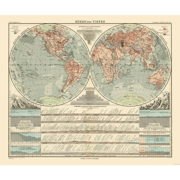
Historic Map - World - Perthes 1891 - 27.56 x 23 - Vintage Wall Art $40.95 $40.95/count
 $4095current price $40.95$40.95/count
Historic Map - World - Perthes 1891 - 27.56 x 23 - Vintage Wall Art
Historic Map - Geographical Systems Ancient - Cortambert 1880 - Vintage Wall Art $36.95
 $3695current price $36.95
Historic Map - Geographical Systems Ancient - Cortambert 1880 - Vintage Wall Art
Historic City Map - Pensacola Florida - Bellin 1764 - Vintage Wall Art $36.95
 4 optionsAvailable in additional 4 options$3695current price $36.95
Historic City Map - Pensacola Florida - Bellin 1764 - Vintage Wall Art
Historic State Map - Louisiana French Colony - Jefferys 1767 - Vintage Wall Art $36.95
 4 optionsAvailable in additional 4 options$3695current price $36.95
Historic State Map - Louisiana French Colony - Jefferys 1767 - Vintage Wall Art
Historic State Map - United States Northeast Coast - Moll 1711 - 23 x 38.28 - Vintage Wall Art $45.95
 $4595current price $45.95
Historic State Map - United States Northeast Coast - Moll 1711 - 23 x 38.28 - Vintage Wall Art
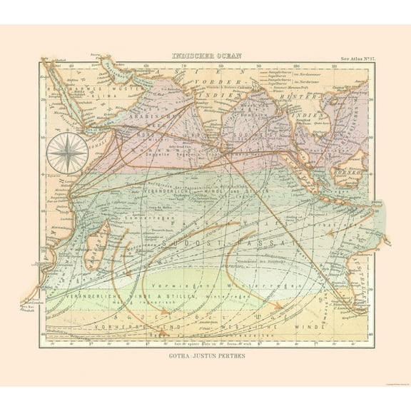
Historic Nautical Map - Indian Ocean - Perthes 1914 - 26.03 x 23 - Vintage Wall Art $40.95
 4 optionsAvailable in additional 4 options$4095current price $40.95
Historic Nautical Map - Indian Ocean - Perthes 1914 - 26.03 x 23 - Vintage Wall Art
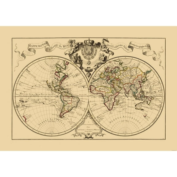
Historic Map - World - De l'isle - Vintage Wall Art $36.95
 $3695current price $36.95
Historic Map - World - De l'isle - Vintage Wall Art
Historic State Map - New Hampshire - Carter 1878 - Vintage Wall Art $36.95
 4 optionsAvailable in additional 4 options$3695current price $36.95
Historic State Map - New Hampshire - Carter 1878 - Vintage Wall Art
Historic City Map - Pensacola Florida - 1780 - Vintage Wall Art $36.95
 4 optionsAvailable in additional 4 options$3695current price $36.95
Historic City Map - Pensacola Florida - 1780 - Vintage Wall Art
Historic State Map - Massachusetts - Reynold 1921 - 31.73 x 23 - Vintage Wall Art $40.95
 4 optionsAvailable in additional 4 options$4095current price $40.95
Historic State Map - Massachusetts - Reynold 1921 - 31.73 x 23 - Vintage Wall Art
Historic State Map - Nevada - Reynold 1921 - Vintage Wall Art $36.95
 3 optionsAvailable in additional 3 options$3695current price $36.95
Historic State Map - Nevada - Reynold 1921 - Vintage Wall Art
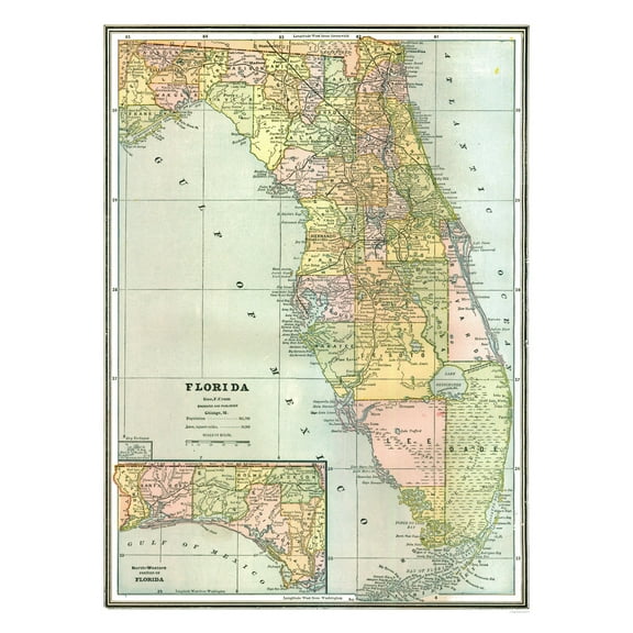
Historic State Map - Florida - Johnson 1888 - Vintage Wall Art $36.95
 4 optionsAvailable in additional 4 options$3695current price $36.95
Historic State Map - Florida - Johnson 1888 - Vintage Wall Art
Historic State Map - Maine - Cram 1892 - 23 x 29.86 - Vintage Wall Art $45.95 $45.95/count
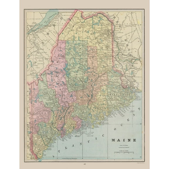 4 optionsAvailable in additional 4 options$4595current price $45.95$45.95/count
Historic State Map - Maine - Cram 1892 - 23 x 29.86 - Vintage Wall Art
Historic Map - Africa - Monteith 1882 - Vintage Wall Art $36.95
 $3695current price $36.95
Historic Map - Africa - Monteith 1882 - Vintage Wall Art
Historic Map - Tartary Russia - Tanner 1835 - Vintage Wall Art $36.95
 $3695current price $36.95
Historic Map - Tartary Russia - Tanner 1835 - Vintage Wall Art
Historic Map - Scotland Old Regions - 23 x 31.03 - Vintage Wall Art $40.95 $40.95/count
 4 optionsAvailable in additional 4 options$4095current price $40.95$40.95/count
Historic Map - Scotland Old Regions - 23 x 31.03 - Vintage Wall Art
Historic State Map - New Mexico - Hoen 1896 - Vintage Wall Art $36.95
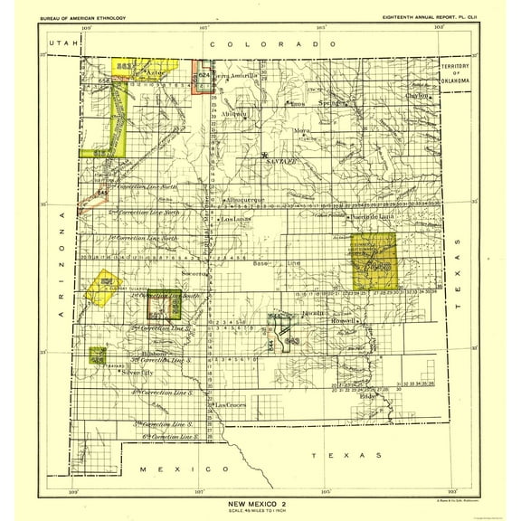 4 optionsAvailable in additional 4 options$3695current price $36.95
Historic State Map - New Mexico - Hoen 1896 - Vintage Wall Art
Topographical Map - Goldstone Sheet - US Army 1948 - Vintage Wall Art $36.95
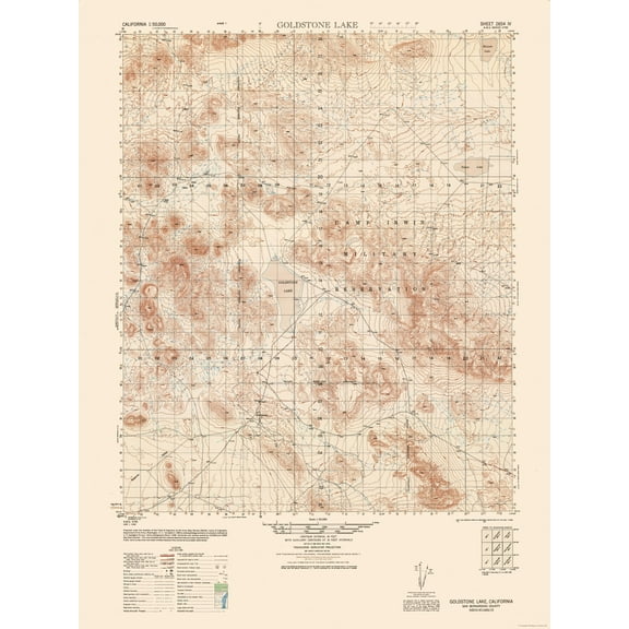 $3695current price $36.95
Topographical Map - Goldstone Sheet - US Army 1948 - Vintage Wall Art
Historic Map - Russia Baltic Sea - Radefeld 1855 - 28.14 x 23 - Vintage Wall Art $45.95 $45.95/count
 4 optionsAvailable in additional 4 options$4595current price $45.95$45.95/count
Historic Map - Russia Baltic Sea - Radefeld 1855 - 28.14 x 23 - Vintage Wall Art
Check out these related products
Historic Nautical Map - Atlantic Ocean - Stieler 1885 - Vintage Wall Art $36.95
 $3695current price $36.95
Historic Nautical Map - Atlantic Ocean - Stieler 1885 - Vintage Wall Art
Historic Nautical Map - Atlantic Ocean - Perthes 1914 - Vintage Wall Art $36.95
 $3695current price $36.95
Historic Nautical Map - Atlantic Ocean - Perthes 1914 - Vintage Wall Art
Historic Nautical Map - Pacific Ocean - Perthes 1914 - Vintage Wall Art $36.95
 $3695current price $36.95
Historic Nautical Map - Pacific Ocean - Perthes 1914 - Vintage Wall Art
Historic Nautical Map - Atlantic Ocean Europe - Roy 1666 - Vintage Wall Art $36.95
 $3695current price $36.95
Historic Nautical Map - Atlantic Ocean Europe - Roy 1666 - Vintage Wall Art
Historic Nautical Map - Antarctic Ocean - Perthes 1914 - Vintage Wall Art $36.95
 4 optionsAvailable in additional 4 options$3695current price $36.95
Historic Nautical Map - Antarctic Ocean - Perthes 1914 - Vintage Wall Art
Historic Nautical Map - Pacific Ocean - Cassini 1790 - Vintage Wall Art $36.95
 $3695current price $36.95
Historic Nautical Map - Pacific Ocean - Cassini 1790 - Vintage Wall Art
Historic Nautical Map - Arctic Ocean - Perthes 1914 - 26.07 x 23 - Vintage Wall Art $40.95
 4 optionsAvailable in additional 4 options$4095current price $40.95
Historic Nautical Map - Arctic Ocean - Perthes 1914 - 26.07 x 23 - Vintage Wall Art
Historic Nautical Map - Mediterranean Sea Indian Ocean Ports - Perthes 1914 $36.95
 4 optionsAvailable in additional 4 options$3695current price $36.95
Historic Nautical Map - Mediterranean Sea Indian Ocean Ports - Perthes 1914
Historic Nautical Map - British Isles German Sea British Ocean - Vintage Wall Art $36.95
 $3695current price $36.95
Historic Nautical Map - British Isles German Sea British Ocean - Vintage Wall Art
Historic Nautical Map - Pacific Ocean Major Port Cities - Perthes 1914 - Vintage Wall Art $36.95
 $3695current price $36.95
Historic Nautical Map - Pacific Ocean Major Port Cities - Perthes 1914 - Vintage Wall Art
Historic Nautical Map - Danube River Grein Vienna Austria - Baedeker 1896 - Vintage Wall Art $36.95
 4 optionsAvailable in additional 4 options$3695current price $36.95
Historic Nautical Map - Danube River Grein Vienna Austria - Baedeker 1896 - Vintage Wall Art
Historic Nautical Map - Austria Hungary Danube River - Baedeker 1896 - Vintage Wall Art $36.95
 $3695current price $36.95
Historic Nautical Map - Austria Hungary Danube River - Baedeker 1896 - Vintage Wall Art
Historic State Map - Texas Colorado River - Konen 1835 - Vintage Wall Art $36.95
 $3695current price $36.95
Historic State Map - Texas Colorado River - Konen 1835 - Vintage Wall Art
Historic Map - Paul Journeys Middle East - Ortelius 1570 - Vintage Wall Art $36.95
 4 optionsAvailable in additional 4 options$3695current price $36.95
Historic Map - Paul Journeys Middle East - Ortelius 1570 - Vintage Wall Art
Historic Map - Judea Israel - Ortelius 1570 - Vintage Wall Art $36.95
 4 optionsAvailable in additional 4 options$3695current price $36.95
Historic Map - Judea Israel - Ortelius 1570 - Vintage Wall Art
Historic Map - Upper Austria - Baedeker 1896 - Vintage Wall Art $36.95
 4 optionsAvailable in additional 4 options$3695current price $36.95
Historic Map - Upper Austria - Baedeker 1896 - Vintage Wall Art
Historic Map - Val Roseg Switzerland - Baedeker 1921 - Vintage Wall Art $36.95
 $3695current price $36.95
Historic Map - Val Roseg Switzerland - Baedeker 1921 - Vintage Wall Art
Historic Map - Philippine Islands - Reynold 1921 - Vintage Wall Art $36.95
 $3695current price $36.95
Historic Map - Philippine Islands - Reynold 1921 - Vintage Wall Art
Historic Map - Islands Japan - Boussole 1787 - Vintage Wall Art $36.95
 4 optionsAvailable in additional 4 options$3695current price $36.95
Historic Map - Islands Japan - Boussole 1787 - Vintage Wall Art
Historic Map - Kuril Islands Japan - La Perouse 1799 - Vintage Wall Art $36.95
 4 optionsAvailable in additional 4 options$3695current price $36.95
Historic Map - Kuril Islands Japan - La Perouse 1799 - Vintage Wall Art
Customer ratings & reviews
0 ratings|0 reviews
This item does not have any reviews yet
