
Navionics Platinum+ NPSA004L - Mexico, Caribbean to Brazil
Key item features
- Nautical Chart – Comprehensive charts are derived from multiple officials, government, and private sources, displayed in a familiar look and feel
- SonarChart HD Bathymetry - Innovative 1' (0.5 m) bathymetry charts are created by using Navionics proprietary systems that augment existing content with sonar data contributed by the boating community
- Community Edits - Get useful local knowledge from edits made by users of the Navionics Boating app on your compatible smart device.
- SonarChart Live Mapping Feature - Watch new HD depth maps develop in real-time as your boat moves through the water.
- Advanced Map Options - Customize your view to focus on the details that matter most
- Relief Shading - Get an easy-to-interpret, clearer view of bottom structure.
- Satellite Imagery with SonarChart Shading Overlay - Experience an enhanced awareness above and below the waterline.
- Sonar Imagery - View bottom hardness clearly and in contrasting color.
- 3D View - Adjust the perspective of your chart view to highlight key features and enhance awareness
- Aerial Photos - Get a better sense of your surroundings.
- Check the compatibility of Platinum+ content and features with your GPS chartplotter.
- Format - SD/MSD Card
- SD/MSD Card
- SKU : 0821245991713
- Condition : NEW
- MPN : 010C136440
Specs
- BrandNavionics
- SeriesPlatinum Plus
- AccessoriesSD/MSD Card
- Has written warrantyNo
- Free shipping
 Free 30-day returns
How do you want your item?
More seller options (5)
Try 30 days of Walmart+ for just $1!
About this item
Product details
NPSA004L - Mexico, Caribbean to Brazil
Get the world’s No. 1 choice in marine mapping - with the best, most up-to-date Navionics Platinum+ cartography on your compatible chartplotter.
For offshore or inland waters, this all-in-one solution offers detail-rich integrated mapping of coastal waters, lakes, rivers and more. Get SonarChart™ 1’ (0.5 meter) HD bathymetry maps, advanced features such as dock-to-dock route guidance technology, live mapping and Plotter Sync to provide wireless access to daily updates.
The Navionics Chart Installer software also ensures the freshest chart data every time out. Navionics dock-to-dock route guidance solutions give you a suggested path to follow through channels, inlets, marina entrances and more. Multiple shading options aid in shallow water navigation and make it easy to highlight a target depth range for the best fishing spots.
Navionics Platinum+™ charts include all the content of Navionics®+ cartography, with integrated offshore and inland mapping, 42,000+ lakes and additional viewing options for relief shading, satellite imagery with SonarChart shading overlay, 3D perspective view, aerial photos, and more.
Chart Code - NPSA0004L
Coverage Area:
Coverage of Mexico, Central America and Brazil. Coverage includes the US Gulf Coast and the eastern US coast to Savannah, GA; Bermuda; the Bahamas; Cuba; Hispaniola; Puerto Rico and the Virgin Islands; the Windward and Leeward Islands; Jamaica; the Panama Canal, the western coast of South America to Arica, Chile; the Galapagos Islands; the Revillagigedo Islands; the Ilha Fernando de Noronha; the Saint Peter and Saint Paul Archipelago and the Rocas Atoll.
Features:
- Nautical Chart – Comprehensive charts are derived from multiple officials, government, and private sources, displayed in a familiar look and feel
- SonarChart HD Bathymetry - Innovative 1' (0.5 m) bathymetry charts are created by using Navionics proprietary systems that augment existing content with sonar data contributed by the boating community
- Community Edits - Get useful local knowledge from edits made by users of the Navionics Boating app on your compatible smart device.
- Daily Updates - Up to 5,000 daily updates to our charts give you the most accurate, most current Navionics data available.1
- Dock-to-dock Route Guidance2 - Start your trip with a suggested path.
- SonarChart Live Mapping Feature - Watch new HD depth maps develop in real-time as your boat moves through the water.
- Advanced Map Options - Customize your view to focus on the details that matter most
- Plotter Sync1 - Transfer routes and markers, update chart layers, and more - between your compatible chartplotter and the Boating app.
- Relief Shading - Get an easy-to-interpret, clearer view of bottom structure.
- Satellite Imagery with SonarChart Shading Overlay - Experience an enhanced awareness above and below the waterline.
- Sonar Imagery - View bottom hardness clearly and in contrasting color.
- 3D View - Adjust the perspective of your chart view to highlight key features and enhance awareness
- Aerial Photos - Get a better sense of your surroundings.
Compatibility:
- Check the compatibility of Platinum+ content and features with your GPS chartplotter.
Technical Specifications:
- Format - SD/MSD Card
In the Box:
- SD/MSD Card
1Subscription not required for SonarChart Live mapping feature on some chartplotter models; requires latest chartplotter firmware release.
2Dock-to-dock Route Guidance is for planning purposes only and does not replace safe navigation operations.
*Navionics+ and Platinum+ cards are not compatible with Garmin chartplotters.
*Sold as an Individual
This product may not be returned to the original point of purchase. Please contact the manufacturer directly with any issues or concerns.- Nautical Chart – Comprehensive charts are derived from multiple officials, government, and private sources, displayed in a familiar look and feel
- SonarChart HD Bathymetry - Innovative 1' (0.5 m) bathymetry charts are created by using Navionics proprietary systems that augment existing content with sonar data contributed by the boating community
- Community Edits - Get useful local knowledge from edits made by users of the Navionics Boating app on your compatible smart device.
- SonarChart Live Mapping Feature - Watch new HD depth maps develop in real-time as your boat moves through the water.
- Advanced Map Options - Customize your view to focus on the details that matter most
- Relief Shading - Get an easy-to-interpret, clearer view of bottom structure.
- Satellite Imagery with SonarChart Shading Overlay - Experience an enhanced awareness above and below the waterline.
- Sonar Imagery - View bottom hardness clearly and in contrasting color.
- 3D View - Adjust the perspective of your chart view to highlight key features and enhance awareness
- Aerial Photos - Get a better sense of your surroundings.
- Check the compatibility of Platinum+ content and features with your GPS chartplotter.
- Format - SD/MSD Card
- SD/MSD Card
- SKU : 0821245991713
- Condition : NEW
- MPN : 010C136440
Specifications
Brand
Series
Model name
Accessories
Warranty
Warranty information
Please be aware that the warranty terms on items offered for sale by third party Marketplace sellers may differ from those displayed in this section (if any). To confirm warranty terms on an item offered for sale by a third party Marketplace seller, please use the 'Contact seller' feature on the third party Marketplace seller's information page and request the item's warranty terms prior to purchase.
Similar items you might like
Garmin Navionics NSSA004L - Mexico, the Caribbean to Brazil - Inland Coastal Marine Chart [010-C1285-20] $190.58
![Garmin Navionics NSSA004L - Mexico, the Caribbean to Brazil - Inland Coastal Marine Chart [010-C1285-20]](https://i5.walmartimages.com/asr/b7e440dc-fc26-406e-a446-29db81571ad4.68f19c5af5a8621386b122f1265e2438.jpeg?odnHeight=576&odnWidth=576&odnBg=FFFFFF) $19058current price $190.58
$19058current price $190.58Garmin Navionics NSSA004L - Mexico, the Caribbean to Brazil - Inland Coastal Marine Chart [010-C1285-20]
Garmin 010C128500 Navionics Vision Mexico Caribbean to Brazil Marine Charts $405.95
 $40595current price $405.95
Garmin 010C128500 Navionics Vision Mexico Caribbean to Brazil Marine Charts
Garmin 010C125100 Norway Sognefjord - Svefjorden Gar $259.99
 $25999current price $259.99
Garmin 010C125100 Norway Sognefjord - Svefjorden Gar
Navionics NASA010R - Central America Caribbean - Navionics [010-C1459-30] $141.60
![Navionics NASA010R - Central America Caribbean - Navionics [010-C1459-30]](https://i5.walmartimages.com/asr/5565750c-7675-45d5-8eb6-de4f1359c019.31185999a2182e1824c87b09dd9dc4f7.jpeg?odnHeight=576&odnWidth=576&odnBg=FFFFFF) $14160current price $141.60
$14160current price $141.60Navionics NASA010R - Central America Caribbean - Navionics [010-C1459-30]
Garmin 010C122500 Navionics Vision NVAF002R - Africa $238.09
 $23809current price $238.09
Garmin 010C122500 Navionics Vision NVAF002R - Africa
Garmin 010C125200 Navionics Vision NVEU053R - Norway $259.99
 $25999current price $259.99
Garmin 010C125200 Navionics Vision NVEU053R - Norway
Navionics Platinum NPSA012R - Brazil $237.72
 $23772current price $237.72
Navionics Platinum NPSA012R - Brazil
Garmin 010C126800 Navionics Vision NVEU073R - Italy $238.09
 $23809current price $238.09
Garmin 010C126800 Navionics Vision NVEU073R - Italy
Navionics 010C146440 Platinum Australia East $316.94
 $31694current price $316.94
Navionics 010C146440 Platinum Australia East
Garmin 010C126400 Caspian Sea & Lower Volga River Gar $259.94
 $25994current price $259.94
Garmin 010C126400 Caspian Sea & Lower Volga River Gar
Garmin 010-C0733-00 Bluechart g2 vision VUS032R Southern Gulf of Mexico New $351.99
 $35199current price $351.99
Garmin 010-C0733-00 Bluechart g2 vision VUS032R Southern Gulf of Mexico New
Garmin 010C125300 Norway Vestfjden To Svalbard Garmi $259.99
 $25999current price $259.99
Garmin 010C125300 Norway Vestfjden To Svalbard Garmi
Garmin Navionics Vision Nvus007r U.S. East $265.99
 $26599current price $265.99
Garmin Navionics Vision Nvus007r U.S. East
Garmin 010C122900 The Gulf & Red Sea Garmin Navionics $259.99
 $25999current price $259.99
Garmin 010C122900 The Gulf & Red Sea Garmin Navionics
Garmin BlueChart® g3 Vision® HD - VUS027R - Hawaiian Islands - Mariana Islands - microSD™/SD™ $351.99
 $35199current price $351.99
Garmin BlueChart® g3 Vision® HD - VUS027R - Hawaiian Islands - Mariana Islands - microSD™/SD™
Garmin Navionics Vision NVUS013R Canada, West Alaska [010-C1485-00] $234.03
![Garmin Navionics Vision NVUS013R Canada, West Alaska [010-C1485-00]](https://i5.walmartimages.com/asr/e5cde664-9858-45a5-8b24-58f38d65d5c2.1a148b122aa976d6d6a20c1d0391ba9d.jpeg?odnHeight=576&odnWidth=576&odnBg=FFFFFF) $23403current price $234.03
$23403current price $234.03Garmin Navionics Vision NVUS013R Canada, West Alaska [010-C1485-00]
Garmin 010C123700 Spain Mediterranean Coast Garmin N $238.09
 $23809current price $238.09
Garmin 010C123700 Spain Mediterranean Coast Garmin N
Europe Central & West Garmin Navio $234.69
 $23469current price $234.69
Europe Central & West Garmin Navio
Garmin 010C124600 Navionics Vision NVEU043R - Iceland to Orkney $234.69
 $23469current price $234.69
Garmin 010C124600 Navionics Vision NVEU043R - Iceland to Orkney
Garmin BlueChart g3 Vision VCA019R - Hecate Strait Navigational Software $351.99
 $35199current price $351.99
Garmin BlueChart g3 Vision VCA019R - Hecate Strait Navigational Software
Check out these related products
Navionics Plus NASA004L Mexico, Caribbean to Brazil microSD $189.88
 $18988current price $189.88
Navionics Plus NASA004L Mexico, Caribbean to Brazil microSD
Navionics Platinum NPSA010R - Central America Caribbean [010-C1459-40] $230.00 Was $343.09
![Navionics Platinum NPSA010R - Central America Caribbean [010-C1459-40]](https://i5.walmartimages.com/asr/5c6a6c35-c0be-4a03-9be2-b49259085489.6c779198883cabf7df8f00104c7eadd8.jpeg?odnHeight=576&odnWidth=576&odnBg=FFFFFF) $23000current price $230.00, Was $343.09$343.09
$23000current price $230.00, Was $343.09$343.09Navionics Platinum NPSA010R - Central America Caribbean [010-C1459-40]
Navionics NASA012R - Brazil - Navionics $145.12
 $14512current price $145.12
Navionics NASA012R - Brazil - Navionics
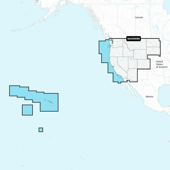
Navionics Plus NAUS008R U.S. West microSD $148.46
 $14846current price $148.46
Navionics Plus NAUS008R U.S. West microSD
14 out of 5 Stars. 1 reviewsNavionics Plus NAUS001L US and Coastal Canada microSD $180.99
 $18099current price $180.99
Navionics Plus NAUS001L US and Coastal Canada microSD
Navionics Platinum NPUS006R U.S. South microSD $245.30
 $24530current price $245.30
Navionics Platinum NPUS006R U.S. South microSD
11 out of 5 Stars. 1 reviews


