
Navionics Platinum+ NPUS006R U.S. South microSD
Key item features
- Integrated Mapping: Combines Garmin and Navionics content for detailed coverage, clarity, and a familiar user experience across coastal waters, lakes, and rivers.
- Advanced Guidance: Features dock-to-dock route guidance technology that calculates suggested paths based on boat settings, chart data, and frequently traveled routes.
- Enhanced Visuals: Offers high-resolution relief shading, satellite imagery with SonarChart Shading overlay, and unique 3D views for improved situational awareness.
- Detailed Bathymetry: Provides SonarChart HD bathymetry maps with up to 1-foot (0.5 meter) contours for a more precise depiction of bottom structure.
- Real-time Updates: Allows easy access to daily chart updates via Navionics Chart Installer software or wirelessly through the Plotter Sync feature with the Navionics Boating app.
- Targeted Fishing: Includes a fishing range advanced feature to highlight user-defined target depth ranges for optimal fishing spots.
Specs
- Map typeNautical Chart
- SubjectU.S. South Fishing Map
- FeaturesWater-Resistant
- SizeOne Size
- BrandNavionics
- MaterialAs Specified
- Free shipping
 Free 30-day returns
How do you want your item?
Try 30 days of Walmart+ for just $1!
About this item
Product details
Navionics Platinum+ NPUS006R U.S. South microSD
Model: 010-C1369-40- Integrated Garmin and Navionics® content provides exceptional coverage, clarity and detail in a familiar look and feel
- Easy access to daily chart updates is via the Navionics® Chart Installer software or wirelessly via the Plotter Sync feature with the Navionics Boating app (The Plotter Sync feature requires use of the Navionics Boating app on your compatible smart device with an active subscription of the same area.)
- Navionics® advanced dock-to-dock route guidance technology uses your boat settings, along with chart data and frequently traveled routes, to calculate a suggested path to follow (Route guidance is for planning purposes only and does not replace safe navigation operations.)
- High-resolution relief shading feature combines color and shadow to give you an easy-to-interpret, clearer view of bottom structure than contour lines alone
- High-resolution satellite imagery combined with SonarChart™ Shading overlay give you a realistic view of your surroundings — ideal for entering unfamiliar harbors or ports
- Sonar imagery is a downloadable image overlay that shows bottom hardness in contrasting color so you can easily identify transition areas on select U.S. lakes
- Aerial and surface photography of ports, marinas, bridges, docks, boat ramps, dams and navigational landmarks offers superior situational awareness
- Unique 3D views provide additional perspective both above and below the water
- Download the Community Edits content layer to any Navionics® card, and view this valuable, local information — contributed by Navionics Boating app users — on your compatible chartplotter
- For improved fishing and navigation, SonarChart™ HD bathymetry maps display up to 1’ (0.5 meter) contours, providing a more detailed depiction of bottom structure
- Fishing range advanced feature lets you highlight a user-defined target depth range
- To aid in navigation, the shallow water shading advanced feature highlights depths up to a user-defined level
- SonarChart™ Live mapping feature allows boaters to create new personal 1’ HD bathymetry maps that display in real time on the screens of their compatible plotters while navigating
Detailed coverage of the lakes, rivers and coasts of Alabama, Arkansas, Florida, Georgia, Kansas, Louisiana, Mississippi, Missouri, Nebraska, New Mexico, Oklahoma, Tennessee, and Texas. Coastal coverage of the Gulf of Mexico, the Atlantic coasts of Florida and Georgia, the Bahamas and the Florida Keys are also included.
Get the world’s No. 1 choice in marine mapping (based on 2020 reported sales) — with the best, most up-to-date Navionics Platinum+™ premium marine cartography on your compatible chartplotter. For offshore or inland waters, this all-in-one solution offers detail-rich integrated mapping of coastal waters, lakes, rivers and more. Get 1’ (0.5 meter) HD contours, premier-grade chart features (depending on chartplotter model), including high-resolution relief shading, satellite imagery with SonarChart™ Shading overlay and 3D views, plus dock-to-dock route guidance technology, live mapping and Plotter Sync to provide wireless access to daily updates. The Navionics® Chart Installer software also ensures access to the freshest chart data every time out. Navionics route guidance solutions give you a suggested path to follow through channels, inlets, marina entrances and more. (Route guidance is for planning purposes only and does not replace safe navigation operations.) Multiple shading options aid in shallow water navigation and make it easy to highlight a target depth range for the best fishing spots.
- Model NO : NVN010C136940
- Brand : Navionics
- Navionics Platinum+ NPUS006R U.S. South microSD
Specifications
Map type
Subject
Features
Size
Warranty
Warranty information
Please be aware that the warranty terms on items offered for sale by third party Marketplace sellers may differ from those displayed in this section (if any). To confirm warranty terms on an item offered for sale by a third party Marketplace seller, please use the 'Contact seller' feature on the third party Marketplace seller's information page and request the item's warranty terms prior to purchase.
Similar items you might like
C-MAP Reveal US Lakes South East $179.00
 $17900current price $179.00
C-MAP Reveal US Lakes South East
15 out of 5 Stars. 1 reviewsMyanmar - 24" x 36" Laminated Wall Map $71.26
 $7126current price $71.26
Myanmar - 24" x 36" Laminated Wall Map
Minnetonka Lake - 37.25" x 27.75" Matte Plastic Wall Map $80.83
 $8083current price $80.83
Minnetonka Lake - 37.25" x 27.75" Matte Plastic Wall Map
4 Foot United States Map with Flags [72116] $22.99
![4 Foot United States Map with Flags [72116]](https://i5.walmartimages.com/asr/8833907b-671e-4608-ba73-103c8f1379da.18e29dae1be105a1542fd65296dfc579.jpeg?odnHeight=576&odnWidth=576&odnBg=FFFFFF) $2299current price $22.99
$2299current price $22.994 Foot United States Map with Flags [72116]
Grand Canyon Raised Relief Map, Rubberized Foam Backing - Souvenir Size $20.67
 $2067current price $20.67
Grand Canyon Raised Relief Map, Rubberized Foam Backing - Souvenir Size
Upper Neuse River, NC $19.95
 $1995current price $19.95
Upper Neuse River, NC
Benchmark Maps: Baja California Peninsula Wall Map - 25 x 39 inches - Front Lamination $65.25 Was $86.04
 $6525current price $65.25, Was $86.04$86.04
Benchmark Maps: Baja California Peninsula Wall Map - 25 x 39 inches - Front Lamination
Franko Maps - Coronados Islands (Mexico) Fish ID $9.98
 $998current price $9.98
Franko Maps - Coronados Islands (Mexico) Fish ID
Bartram Trail, Geogia Map $14.88
 $1488current price $14.88
Bartram Trail, Geogia Map
TestPlay 3381 San Francisco Raised Relief Map, Framed - Souvenir Size $21.15
 $2115current price $21.15
TestPlay 3381 San Francisco Raised Relief Map, Framed - Souvenir Size
Benchmark Maps: Baja California Peninsula Wall Map - 25 x 39 inches - Rolled Canvas $80.95
$8095current price $80.95Benchmark Maps: Baja California Peninsula Wall Map - 25 x 39 inches - Rolled Canvas
TestPlay 3320 New York State Raised Relief Map, Unframed - Souvenir Size $17.71
 $1771current price $17.71
TestPlay 3320 New York State Raised Relief Map, Unframed - Souvenir Size
G3C9601LIdaho State Wall Map - 14.75" x 17.75" Laminated $48.28
 $4828current price $48.28
G3C9601LIdaho State Wall Map - 14.75" x 17.75" Laminated
1926 Bootlegger's Map of the United States $65.00
 3 optionsAvailable in additional 3 options$6500current price $65.00
1926 Bootlegger's Map of the United States
Pymatuning Lake Fishing Map $29.47
 $2947current price $29.47
Pymatuning Lake Fishing Map
Benchmark Maps: California Recreation Wall Map - 26 x 34 inches - Front Lamination $65.48
 $6548current price $65.48
Benchmark Maps: California Recreation Wall Map - 26 x 34 inches - Front Lamination
Great South Bay, NY $19.95
 $1995current price $19.95
Great South Bay, NY
Topographical Map - Morenci Michigan Quad - USGS 1960 - Vintage Wall Art $36.95
 4 optionsAvailable in additional 4 options$3695current price $36.95
Topographical Map - Morenci Michigan Quad - USGS 1960 - Vintage Wall Art
Topographical Map - Tracy Missouri Quad - USGS 1961 - Vintage Wall Art $36.95
 4 optionsAvailable in additional 4 options$3695current price $36.95
Topographical Map - Tracy Missouri Quad - USGS 1961 - Vintage Wall Art

Check out these related products
Navionics Plus NAUS001L US and Coastal Canada microSD $180.99
 $18099current price $180.99
Navionics Plus NAUS001L US and Coastal Canada microSD
Navionics Plus NAUS008R U.S. West microSD $148.46
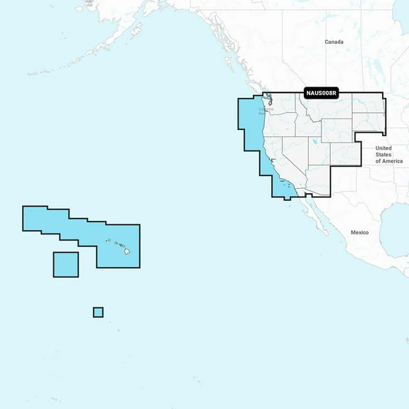 $14846current price $148.46
Navionics Plus NAUS008R U.S. West microSD
14 out of 5 Stars. 1 reviewsNavionics Plus NASA004L Mexico, Caribbean to Brazil microSD $189.88
 $18988current price $189.88
Navionics Plus NASA004L Mexico, Caribbean to Brazil microSD
Navionics Platinum NPUS007R - U.S. East $224.17
 $22417current price $224.17
Navionics Platinum NPUS007R - U.S. East
Navionics Platinum NPSA004L - Mexico, Caribbean to Brazil $349.99
 $34999current price $349.99
Navionics Platinum NPSA004L - Mexico, Caribbean to Brazil
Garmin 010-C1290-00 Navionics Vision Nvus006r U.s. South $246.80
 $24680current price $246.80
Garmin 010-C1290-00 Navionics Vision Nvus006r U.s. South
Best seller Humminbird LakeMaster Premium - Western States V1 $151.92
Best seller $15192current price $151.92
Humminbird LakeMaster Premium - Western States V1
94.4 out of 5 Stars. 9 reviewsGarmin New OEM U.K. & Ireland Lakes & Rivers - Inland Marine Charts Garmin Navionics Vision ™ | NVEU072R | microSD™/SD™ and One-year Subscription, 010-C1267-00 $259.99
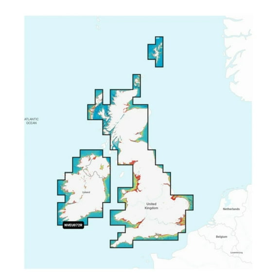 $25999current price $259.99
Garmin New OEM U.K. & Ireland Lakes & Rivers - Inland Marine Charts Garmin Navionics Vision ™ | NVEU072R | microSD™/SD™ and One-year Subscription, 010-C1267-00
Humminbird LakeMaster - Ontario V1 $109.29
 $10929current price $109.29
Humminbird LakeMaster - Ontario V1
43 out of 5 Stars. 4 reviewsGarmin 010C145420 Canada North - Garmin Navionics N $165.99
 $16599current price $165.99
Garmin 010C145420 Canada North - Garmin Navionics N
Garmin Navionics Vision NVUS007R U.S. East [010-C1291-00] $256.41 Was $351.74
![Garmin Navionics Vision NVUS007R U.S. East [010-C1291-00]](https://i5.walmartimages.com/asr/21df24cd-c46f-4baa-a5d4-71bd57e57623.44784c80dd99fea4746c99046a5b67a5.jpeg?odnHeight=576&odnWidth=576&odnBg=FFFFFF) $25641current price $256.41, Was $351.74$351.74
$25641current price $256.41, Was $351.74$351.74Garmin Navionics Vision NVUS007R U.S. East [010-C1291-00]
Garmin New OEM U.S. North & Great Lakes - Lakes, Rivers and Coastal Marine Charts, 010-C1289-20 $142.46
 $14246current price $142.46
Garmin New OEM U.S. North & Great Lakes - Lakes, Rivers and Coastal Marine Charts, 010-C1289-20
Garmin 010C129020 Navionics Plus Chart for US South $153.05
 $15305current price $153.05
Garmin 010C129020 Navionics Plus Chart for US South


Customer ratings & reviews
- 5 stars0% (0)0 ratings are rated 5 stars, 0% of all ratings
- 4 stars0% (0)0 ratings are rated 4 stars, 0% of all ratings
- 3 stars0% (0)0 ratings are rated 3 stars, 0% of all ratings
- 2 stars0% (0)0 ratings are rated 2 stars, 0% of all ratings
- 1 star100% (1)1 rating are rated 1 star, 100% of all ratings
Filtered and sorted results would be available on the new 'Customer ratings & reviews' page.
