
1889 Puget Sound Map - Vintage Map of Puget Sound Washington Wall Art - Includes Vintage Nautical Charts and Washington Lighthouses
Key item features
- Size: 16 x 24 Inches
- Museum-quality giclee print
- Printed using archival ink on premium heavyweight acid-free matte paper
- Shipped in a sturdy cardboard tube
- Makes a perfect gift
Specs
 Size16" x 24"
 BrandHISTORIX
- Free shipping
 Free 30-day returns
How do you want your item?
About this item
Product details
Feature Points
- VINTAGE MAP REPRODUCTION: You’ll love this high quality historic reproduction of 1889 Puget Sound Map . Our museum quality maps are archival grade, which means it will look great and last without fading for over 100 years. Our print to order maps are made in the USA and each map is inspected for quality. This beautiful artwork is a perfect addition to your themed decor. Vintage maps look great in the home, study or office. They make a perfect gift as well.
- MUSEUM QUALITY: This high quality map print will be a great addition to your vintage-themed wall. Don't waste money on cheap-looking, thin paper posters. We use thick, fine art print quality matte paper. Our professional’s choice matte paper displays artwork in high detail without glare. The color is vibrant and text is easy to read. When framed, this map looks absolutely stunning.
- A LOOK BACK AT HISTORY: This is an impressive, historic reproduction of 1889 Puget Sound Map. This print is from an original found in the maps and geography division of the US Library of Congress. A true piece of history. See our product description section for more fascinating information about this historic map and its significance.
- READY TO FRAME: This print includes a 0.2 inch border for a perfect frame fit and look. Our maps are designed to fit easy-to-find standard frame sizes, saving you money from having to pay for a custom frame. Each map is inspected for quality and shipped in a rigid tube.
- HISTORIX: We love history and art. Sometimes old maps have tears, folds, separations and other blemishes. We digitally restore and enhance maps while keeping its historical character. All our maps are proudly made in the USA. Customers all over the world love our vintage maps and we know you will too.
Additional Information
Created in 1889 and depicting relief heights and nautical charts, this map of Puget Sound is a historical document of a region rich with history and culture. Named in 1792 after Huguenot Lieutenant Peter Puget, the Puget Sound refers to both the waters and surrounding land. This map followed the completion of the Northern Pacific railroad line in 1888 which connected the entire region to the eastern United States. Active trading and the rich waters provided ample opportunity for commercial fishing, and these made up the primary economic drivers. The diverse flora and fauna of the area have drawn recreational fisherman here for decades as well in hunt of steelhead trout and sockeye salmon.
Digitally restored and enhanced to correct colors, alignment and with minor blemishes removed, this unique piece of nautical history is sure to interest any lover of American or nautical history. The map also details the many lighthouses of the region as well as the safe channels for vessels to navigate, tides and buoy locations. This is an uncommon piece of cartographical history and would make the perfect gift for anyone that appreciates the rich history of the region, or maritime antiquities.
Prominent islands within Puget Sound today include Anderson Island, Bainbridge Island, Blake Island, Camano Island, Fidalgo Island, Fox Island, Harstine Island, Herron Island, Indian Island, Marrowstone Island, Maury Island, McNeil Island, Squaxin Island, Vashon Island, and Whidbey Island.
This striking reproduction is printed on heavy matte stock with museum quality archival ink, your print will come shipped in a sturdy cardboard tube to ensure 100% satisfaction. Our reproductions make an ideal piece of decor for any study, classroom, office or home.
- Size: 16 x 24 Inches
- Museum-quality giclee print
- Printed using archival ink on premium heavyweight acid-free matte paper
- Shipped in a sturdy cardboard tube
- Makes a perfect gift
Specifications
Size
Brand
Warranty
Warranty information
Similar items you might like
Based on what customers bought
Topographical Map - Keyser West Virginia Maryland Quad - USGS 1920 - Vintage Wall Art $36.95
 $3695current price $36.95
Topographical Map - Keyser West Virginia Maryland Quad - USGS 1920 - Vintage Wall Art
California State Hand-Drawn Map Poster 18x24", Vintage-Style Wall Art, Lithographic Print with Soy-Based Inks, Gift for History Buffs, Travelers, Teachers, Made in USA $32.99 Was $37.26
 $3299current price $32.99, Was $37.26$37.26
California State Hand-Drawn Map Poster 18x24", Vintage-Style Wall Art, Lithographic Print with Soy-Based Inks, Gift for History Buffs, Travelers, Teachers, Made in USA
Clearance Lksixu 12x18 United States Map, Classic USA Wall Map with Gulf of America and Mount McKinley, Laminated United States Scholar Map Poster Geography Learning USA Map for Home Office School $6.99 Was $14.99
Clearance
 $699current price $6.99, Was $14.99$14.99
Lksixu 12x18 United States Map, Classic USA Wall Map with Gulf of America and Mount McKinley, Laminated United States Scholar Map Poster Geography Learning USA Map for Home Office School
Colorado State Hand-Drawn Map Poster 24x18", Vintage-Style Wall Art, Lithographic Print with Soy-Based Inks, Gift for History Buffs, Travelers, Teachers, Made in USA $37.26
 $3726current price $37.26
Colorado State Hand-Drawn Map Poster 24x18", Vintage-Style Wall Art, Lithographic Print with Soy-Based Inks, Gift for History Buffs, Travelers, Teachers, Made in USA
Historic State Map - Nebraska Kansas - Colton 1855 - Vintage Wall Art $36.95
 4 optionsAvailable in additional 4 options$3695current price $36.95
Historic State Map - Nebraska Kansas - Colton 1855 - Vintage Wall Art
HISTORIX Vintage 1932 Oregon Trail Map Poster - Vintage Map of The Oregon Trail Wall Art Print - Oregon Trail History Map $39.99
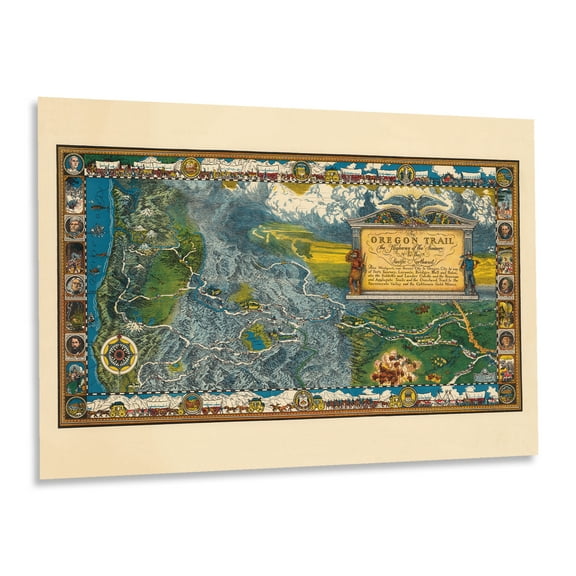 2 optionsAvailable in additional 2 options$3999current price $39.99
HISTORIX Vintage 1932 Oregon Trail Map Poster - Vintage Map of The Oregon Trail Wall Art Print - Oregon Trail History Map
Xplorer Maps New Hampshire State Hand-Drawn Map Poster - Authentic 18x24 Inch Vintage-Style Wall Art - Lithographic Print with Soy-Based Inks - Made In USA $32.99
 $3299current price $32.99
Xplorer Maps New Hampshire State Hand-Drawn Map Poster - Authentic 18x24 Inch Vintage-Style Wall Art - Lithographic Print with Soy-Based Inks - Made In USA
Historic State Map - South Carolina - Mitchell 1849 - Vintage Wall Art $36.95
 $3695current price $36.95
Historic State Map - South Carolina - Mitchell 1849 - Vintage Wall Art
Cape Cod Hand-Drawn Map Poster - Authentic 24x18 Inch Vintage-Style Wall Art - Lithographic Print with Soy-Based Inks - Made In USA $43.08
 $4308current price $43.08
Cape Cod Hand-Drawn Map Poster - Authentic 24x18 Inch Vintage-Style Wall Art - Lithographic Print with Soy-Based Inks - Made In USA
Washington DC 3D Raised Relief Map $39.99
 $3999current price $39.99
Washington DC 3D Raised Relief Map
Railroad Map - Frisco Lines - South Texas Land 1911 - Vintage Wall Art $36.95
 4 optionsAvailable in additional 4 options$3695current price $36.95
Railroad Map - Frisco Lines - South Texas Land 1911 - Vintage Wall Art
1715 Map of West Indies Islands of America - Vintage Map Wall Art - Shows what belongs to Spain, England, France and Holland - Old West Indies Art - Carribean Art $39.99
 2 optionsAvailable in additional 2 options$3999current price $39.99
1715 Map of West Indies Islands of America - Vintage Map Wall Art - Shows what belongs to Spain, England, France and Holland - Old West Indies Art - Carribean Art
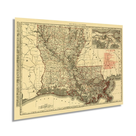
Historic State Map - Louisiana - Melish 1820 - Vintage Wall Art $36.95
 4 optionsAvailable in additional 4 options$3695current price $36.95
Historic State Map - Louisiana - Melish 1820 - Vintage Wall Art
National Geographic Northwest Map Set: Mt. Jefferson & Mt. Washington #819 - Oregon Northwest $22.89 $2.41/in
 $2289current price $22.89$2.41/in
National Geographic Northwest Map Set: Mt. Jefferson & Mt. Washington #819 - Oregon Northwest
1896 Map of Louisiana - Vintage Map of Louisiana Wall Art - Old Louisiana Wall Map Indexed Showing Cities Towns and Railroads - Louisiana Wall Decor $39.99
 2 optionsAvailable in additional 2 options$3999current price $39.99
1896 Map of Louisiana - Vintage Map of Louisiana Wall Art - Old Louisiana Wall Map Indexed Showing Cities Towns and Railroads - Louisiana Wall Decor
Railroad Map - United States Railway Map - Bartholomew 1892 - Vintage Wall Art $36.95
 4 optionsAvailable in additional 4 options$3695current price $36.95
Railroad Map - United States Railway Map - Bartholomew 1892 - Vintage Wall Art
1755 Caribbean Map - Vintage Map of the Caribbean - Old Caribbean Poster - History Gulf of Mexico and Islands of America Maritime Map Wall Art Poster $39.99
 2 optionsAvailable in additional 2 options$3999current price $39.99
1755 Caribbean Map - Vintage Map of the Caribbean - Old Caribbean Poster - History Gulf of Mexico and Islands of America Maritime Map Wall Art Poster
Xplorer Maps Pennsylvania State Hand-Drawn Map Poster - Authentic 24x18 Inch Vintage-Style Wall Art - Lithographic Print with Soy-Based Inks - Made In USA - Neutral Colors $37.26
 $3726current price $37.26
Xplorer Maps Pennsylvania State Hand-Drawn Map Poster - Authentic 24x18 Inch Vintage-Style Wall Art - Lithographic Print with Soy-Based Inks - Made In USA - Neutral Colors
Clearance 2025 Vintage Color Map, United States Geography Poster, Mount McKinley Location, Educational Tool for Home or Office Décor, Highly Detailed Collectible Map $6.41 Was $7.13
Clearance$641current price $6.41, Was $7.13$7.132025 Vintage Color Map, United States Geography Poster, Mount McKinley Location, Educational Tool for Home or Office Décor, Highly Detailed Collectible Map
RXMEKW United States Map 2,025 Map Update, Including U.S. Bay and Mckinley Mountain 12In*18In $7.00
 $700current price $7.00
RXMEKW United States Map 2,025 Map Update, Including U.S. Bay and Mckinley Mountain 12In*18In
Check out these related products
1784 North America Map of United States - Vintage United States Map - History Map of North America - Vereinigte Staaten von Nord- Old Map of America Wall Art Poster $39.99
 2 optionsAvailable in additional 2 options$3999current price $39.99
1784 North America Map of United States - Vintage United States Map - History Map of North America - Vereinigte Staaten von Nord- Old Map of America Wall Art Poster
1894 New Hampshire Map - Vintage Map of New Hampshire - History Railroad Map of New Hampshire - Old New Hampshire Wall Art Poster $39.99
 2 optionsAvailable in additional 2 options$3999current price $39.99
1894 New Hampshire Map - Vintage Map of New Hampshire - History Railroad Map of New Hampshire - Old New Hampshire Wall Art Poster
1864 Richmond Virginia Map - Vintage Richmond Map - Old Richmond VA Map - History Map of Richmond VA and Surrounding Country Wall Art Poster $37.99
 2 optionsAvailable in additional 2 options$3799current price $37.99
1864 Richmond Virginia Map - Vintage Richmond Map - Old Richmond VA Map - History Map of Richmond VA and Surrounding Country Wall Art Poster
HISTORIX 1878 Map of Rutherford County Tennessee Vintage Poster Wall Art Print, 18 x 24 Inch $39.99
 2 optionsAvailable in additional 2 options$3999current price $39.99
HISTORIX 1878 Map of Rutherford County Tennessee Vintage Poster Wall Art Print, 18 x 24 Inch
HISTORIX 1862 United States Railroad and Military Map Vintage Poster Wall Art Print, 24 x 36 Inch $46.99
 $4699current price $46.99
HISTORIX 1862 United States Railroad and Military Map Vintage Poster Wall Art Print, 24 x 36 Inch
HISTORIX 1875 Green River Wyoming Map Vintage Poster Wall Art Print, 18 x 24 Inch $39.99
 2 optionsAvailable in additional 2 options$3999current price $39.99
HISTORIX 1875 Green River Wyoming Map Vintage Poster Wall Art Print, 18 x 24 Inch
HISTORIX 1849 Map of Havana Cuba Vintage Poster Wall Art Print, 24 x 30 Inch $39.99
 2 optionsAvailable in additional 2 options$3999current price $39.99
HISTORIX 1849 Map of Havana Cuba Vintage Poster Wall Art Print, 24 x 30 Inch
HISTORIX 1889 Moline Illinois Map Vintage Poster Wall Art Print, 24 x 36 Inch $39.99
 2 optionsAvailable in additional 2 options$3999current price $39.99
HISTORIX 1889 Moline Illinois Map Vintage Poster Wall Art Print, 24 x 36 Inch
HISTORIX 1892 Lancaster New York Vintage Map Poster Wall Art Print, 24 x 36 Inch $39.99
 2 optionsAvailable in additional 2 options$3999current price $39.99
HISTORIX 1892 Lancaster New York Vintage Map Poster Wall Art Print, 24 x 36 Inch
HISTORIX 1786 Old World Eastern Hemisphere Vintage Map Poster Wall Art Print, 24 x 24 Inch $37.99
 2 optionsAvailable in additional 2 options$3799current price $37.99
HISTORIX 1786 Old World Eastern Hemisphere Vintage Map Poster Wall Art Print, 24 x 24 Inch
15 out of 5 Stars. 1 reviewsHISTORIX 1879 Olympia Washington Vintage Map Poster Wall Art Print, 18 x 24 Inch $39.99
 2 optionsAvailable in additional 2 options$3999current price $39.99
HISTORIX 1879 Olympia Washington Vintage Map Poster Wall Art Print, 18 x 24 Inch
HISTORIX 1786 Old World Western Hemisphere Vintage Map Poster Wall Art Print, 16 x 16 Inch $37.99
 2 optionsAvailable in additional 2 options$3799current price $37.99
HISTORIX 1786 Old World Western Hemisphere Vintage Map Poster Wall Art Print, 16 x 16 Inch
15 out of 5 Stars. 1 reviewsHISTORIX 1890 Helena Montana Lewis & Clarke County Vintage Map Poster Wall Art Print, 18 x 24 Inch $39.99
 2 optionsAvailable in additional 2 options$3999current price $39.99
HISTORIX 1890 Helena Montana Lewis & Clarke County Vintage Map Poster Wall Art Print, 18 x 24 Inch
HISTORIX 1883 Superior Wisconsin Vintage Map Poster Wall Art Print, 12 x 24 Inch $39.99
 2 optionsAvailable in additional 2 options$3999current price $39.99
HISTORIX 1883 Superior Wisconsin Vintage Map Poster Wall Art Print, 12 x 24 Inch
HISTORIX 1879 Montana State Vintage Map Poster Wall Art Print, 24 x 36 Inch $39.99
 $3999current price $39.99
HISTORIX 1879 Montana State Vintage Map Poster Wall Art Print, 24 x 36 Inch
HISTORIX 1903 Middlesex Fells Massachusetts Vintage Map Poster Wall Art Print, 18 x 24 Inch $39.99
 2 optionsAvailable in additional 2 options$3999current price $39.99
HISTORIX 1903 Middlesex Fells Massachusetts Vintage Map Poster Wall Art Print, 18 x 24 Inch
HISTORIX 1867 Madison Wisconsin Vintage Map Poster Wall Art Print, 24 x 36 Inch $39.99
 2 optionsAvailable in additional 2 options$3999current price $39.99
HISTORIX 1867 Madison Wisconsin Vintage Map Poster Wall Art Print, 24 x 36 Inch
HISTORIX 2021 South America Map Poster Wall Art Print, 18 x 24 Inch $39.99
 2 optionsAvailable in additional 2 options$3999current price $39.99
HISTORIX 2021 South America Map Poster Wall Art Print, 18 x 24 Inch
National Geographic Maps RE00622092 World Executive Wall Map - Mural $112.83
 $11283current price $112.83
National Geographic Maps RE00622092 World Executive Wall Map - Mural
15 out of 5 Stars. 1 reviewsHISTORIX 2006 World Map of Volcanoes Poster Wall Art Print, 18 x 24 Inch $39.99
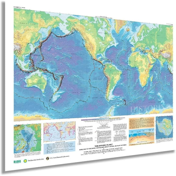 2 optionsAvailable in additional 2 options$3999current price $39.99
HISTORIX 2006 World Map of Volcanoes Poster Wall Art Print, 18 x 24 Inch
Customer ratings & reviews

Related pages
- Lighthouses Oregon Map
- Maps Salt Lake City
- Ontario Travel Books, Maps & Guides
- Lighthouses Florida Map
- Central America Travel Books, Maps & Guides
- Caribbean & West Indies Travel Books, Maps & Guides
- Iceland & Greenland Travel Books
- Cape Cod Massachusetts Map
- Puget Sound Nautical Map
- Cyprus Travel Books
- Bethany Beach Map
- National Parks Posters